Due to the increasing volume of long-distance auto traffic in the 1920's, the city designated the block between Hill & Queen's Avenues and 9th & 10th streets as a "Tourist Camp" with a few basic facilities. After the demise of the Brandon Municipal Railway, several of the old car bodies were placed in the Tourist Camp to be used as cooking & eating shelters. Some may have had sleeping accommodations. Later (ca. 1938?) several were placed in a row along the south side of Victoria Avenue, approximately 28th or 29th St, and were used as the city's first drive-in hamburger place, "The Train Drive-in". This, I believe, only lasted one or two summer seasons. LAS.
Custodial History
For custodial history see the collection level description of the Lawrence Stuckey collection.
For custodial history see the collection level description of the Lawrence Stuckey collection.
Scope and Content
1000 block of Rosser Ave., north side. Showing (left to right): Public Library (ex. Merchants Bank of Canada) built 1906; [Smith's Tobacco Shop,]; A.C. Fraser Block built 1890; Scotia Towers built 1970's.
For custodial history see the collection level description of the Lawrence Stuckey collection.
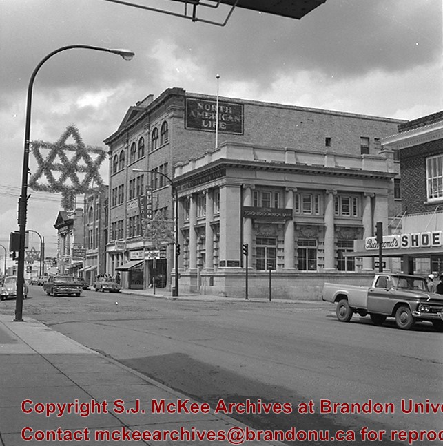
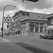
Scope and Content
1000 block of Rosser Ave., north side. Showing (left to right): Public Library (ex. Merchants Bank of Canada) built 1906; [Smith's Tobacco Shop,]; A.C. Fraser Block built 1890; Scotia Towers built 1970's.
Photograph shows the Kresge store on the southwest corner of 10th Street and Rosser Avenue. Other 10th Street businesses that are visible on the west side of the street include: James Richardson & Son Investments, Beneficial Finance and Loans, Bass' Storkland, Brandon News & Record Shop, Recreation Bowling and Billiards, and Bottomley's. The Welcome Brandon sign can be seen in the top right corner of the photograph.
Image submitted to Fred McGuinness by T. Horobin of Brandon
Scope and Content
Photograph shows a man, perhaps an engineer standing next to a Brandon Municipal Railway car covered in snow. A Brandon Municipal Railway token/tag is affixed to the image.
Photograph shows the intersection of 10th Street and Princess Avenue, Brandon, Manitoba. View is facing northwest along west side of the 100-block of 10th Street. A stationary policeman/divider is at the centre of the intersection. Visible businesses include: Doig's, Plaza Shoe Shop, and Cambridge Clothes Shop. A horse-drawn sled is parked in front of Doig's store. The Olympia Block, Cecil Hotel, and CPR Station are visible in the background.


.jpg?width=1200&404=no-img.jpg&watermark=wmk)
.jpg?width=180&404=no-img.jpg)
.jpg?width=1200&404=no-img.jpg&watermark=wmk)
.jpg?width=180&404=no-img.jpg)


.jpg%3fmaxheight%3d1000%26maxwidth%3d1000%26watermark%3dwmk&description=1000+block+of+Rosser+Avenue)
.jpg%3fmaxheight%3d1000%26maxwidth%3d1000%26watermark%3dwmk&description=1000+block+of+Rosser+Avenue)