Skip header and navigation

Revise Search

20 records – page 1 of 1.

Education Building

http://archives.brandonu.ca/en/permalink/descriptions679
Part Of
Education building
Description Level
Item
GMD
graphic
Date Range
c. 1967
Part Of
Education building
Description Level
Item
Series Number
2.7
Item Number
2.7.1
GMD
graphic
Date Range
c. 1967
Physical Description
3.5" x 5.5" (colour)
Scope and Content
Postcard of the Education Building. Shows the east side of the building and the main entrance.
Images
Show Less

Education Building

http://archives.brandonu.ca/en/permalink/descriptions682
Part Of
Education building
Description Level
Item
GMD
graphic
Date Range
c. 1967
Part Of
Education building
Description Level
Item
Series Number
2.7
Item Number
2.7.2
GMD
graphic
Date Range
c. 1967
Physical Description
4.75" x 3.5" (b/w)
Scope and Content
Photograph is looking northwest from the front lawn and shows parked cars and the Education Building, particularly the south side of the building.
Images
Show Less

Education Building

http://archives.brandonu.ca/en/permalink/descriptions865
Part Of
Education building
Description Level
Item
GMD
graphic
Date Range
c. early 1970s
Part Of
Education building
Description Level
Item
Series Number
2.7
Item Number
2.7.3
GMD
graphic
Date Range
c. early 1970s
Physical Description
5" x 2.25" (b/w)
Scope and Content
Photograph is looking west from the driveway and shows the east side of the Education Building, including the main entrance.
Images
Show Less

Education Building

http://archives.brandonu.ca/en/permalink/descriptions868
Part Of
Education building
Description Level
Item
GMD
graphic
Date Range
c. 1970s
Part Of
Education building
Description Level
Item
Series Number
2.7
Item Number
2.7.5
GMD
graphic
Date Range
c. 1970s
Physical Description
3.25" x 4.5" (b/w)
Scope and Content
Photograph is looking northwest from the front lawn and shows the south east corner of the Education Building.
Notes
Similar to BUPC 2.7.2 but without the cars and people in the foreground.
Images
Show Less

Education Building

http://archives.brandonu.ca/en/permalink/descriptions870
Part Of
Education building
Description Level
Item
GMD
graphic
Date Range
c. late 1960s/early 1970s
Part Of
Education building
Description Level
Item
Series Number
2.7
Item Number
2.7.6
GMD
graphic
Date Range
c. late 1960s/early 1970s
Physical Description
3.25" x 4" (b/w)
Scope and Content
Photograph is looking northwest from the front lawn and shows the south and east sides of the Education Building.
Notes
Similar to BUPC 2.7.5.
Images
Show Less

Education Building

http://archives.brandonu.ca/en/permalink/descriptions3023
Part Of
Education building
Description Level
Item
GMD
graphic
Date Range
May, 1978
Part Of
Education building
Description Level
Item
Series Number
2.7
Item Number
2.7.8
GMD
graphic
Date Range
May, 1978
Physical Description
3.5" x 5" (colour)
Scope and Content
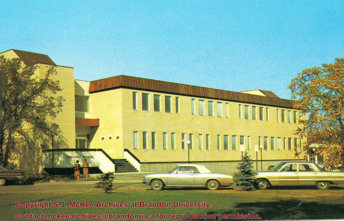
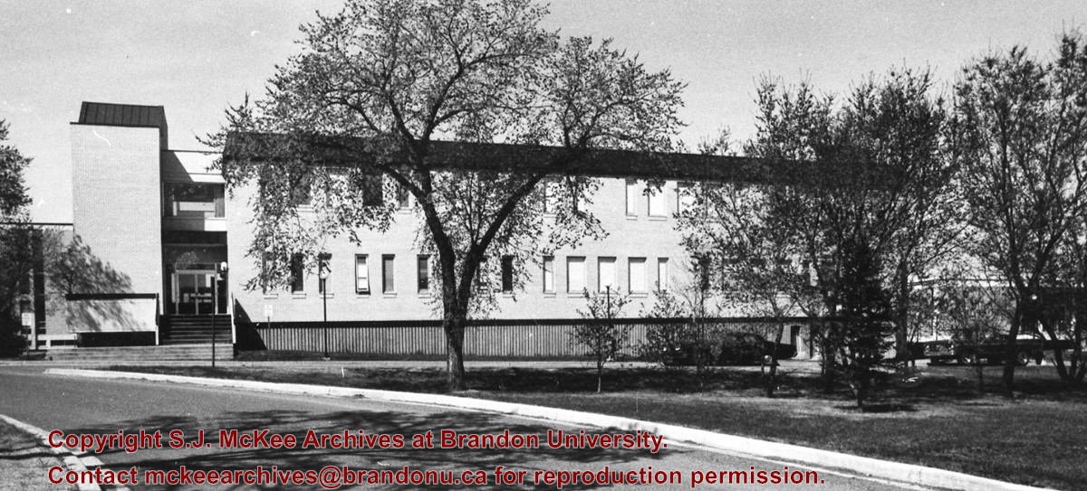
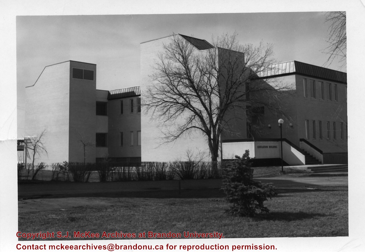
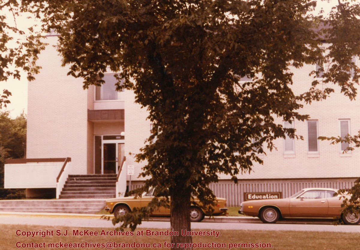
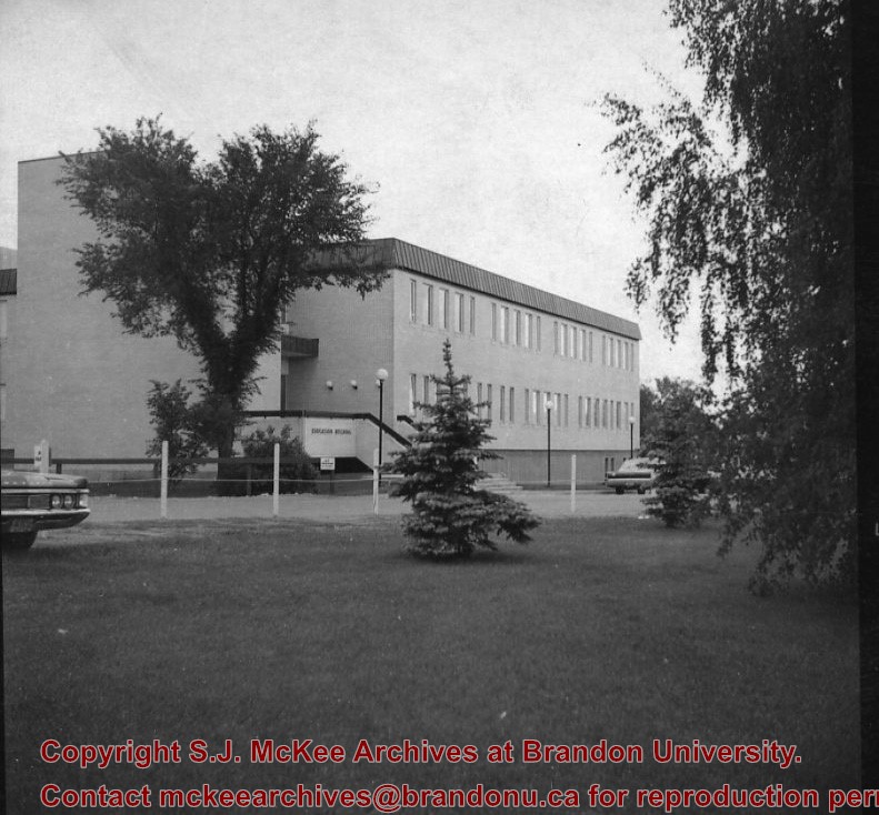
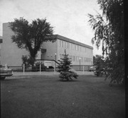
Photograph is looking west southwest and shows the Education Building, including the main entrance. Photograph was taken before the construction of the wheelchair ramp (built in the mid 1980s).
Images
Show Less

Education Building

http://archives.brandonu.ca/en/permalink/descriptions8210
Part Of
Education building
Description Level
Item
GMD
graphic
Date Range
c. 1971
Part Of
Education building
Description Level
Item
Series Number
2.7
Item Number
2.7.9
GMD
graphic
Date Range
c. 1971
Physical Description
2.5" x 2.5" (b/w)
Scope and Content
Contact print is looking northwest from the front lawn and shows the east side and southeast corner of the Education Building.
Images
Show Less

Brandon University campus construction

http://archives.brandonu.ca/en/permalink/descriptions8016
Part Of
Brandon University Photograph collection
Description Level
Item
GMD
graphic
Date Range
c. 1996
Part Of
Brandon University Photograph collection
Creator
Photographer: Sandy Black
Description Level
Item
Series Number
2.1
Item Number
BUPC 2.1.82
GMD
graphic
Date Range
c. 1996
Physical Description
4" x 6" (colour)
Scope and Content
View is northeast from the Brandon College Building. Photograph shows the inside of the Brandon College Building after it had been gutted and then partially rebuilt. The exterior fascade of the west side of the building can be clearly seen in this photograph. A number of houses on the east side of 200 block of 18th Street are also visible, as is the stone fence on Princess Avenue and the flag pole on the front lawn.
Subject Access
campus photographs
campus construction
Brandon streets
Images
Show Less

A.E. McKenzie Building

http://archives.brandonu.ca/en/permalink/descriptions860
Part Of
Brandon University Photograph collection
Description Level
Item
GMD
graphic
Date Range
c. mid 1980s
Part Of
Brandon University Photograph collection
Description Level
Item
Series Number
2.4
Item Number
BUPC 2.4.2
GMD
graphic
Date Range
c. mid 1980s
Physical Description
3.5" x 5" (colour)
Scope and Content
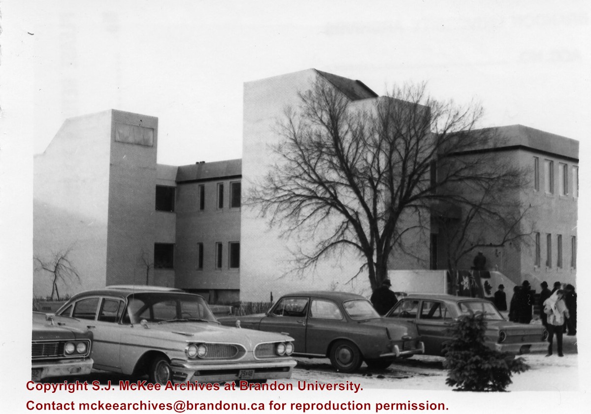
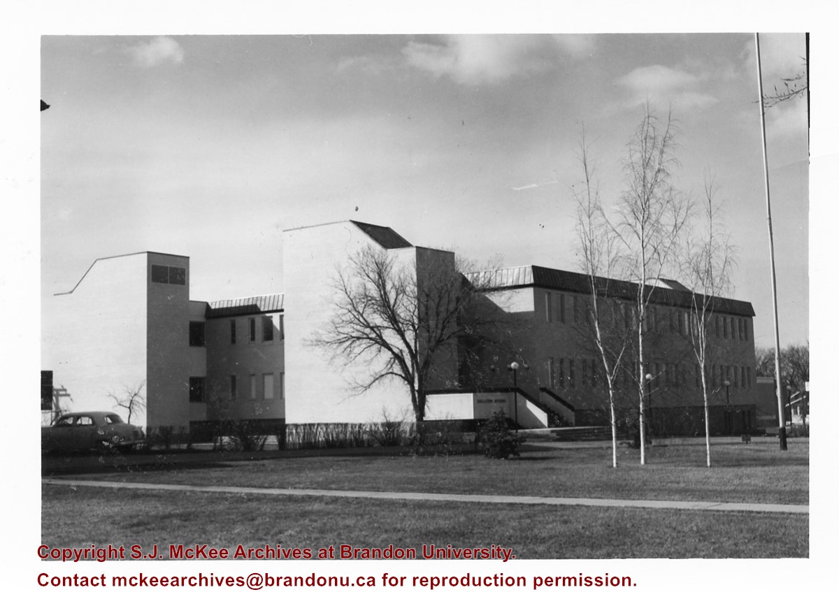
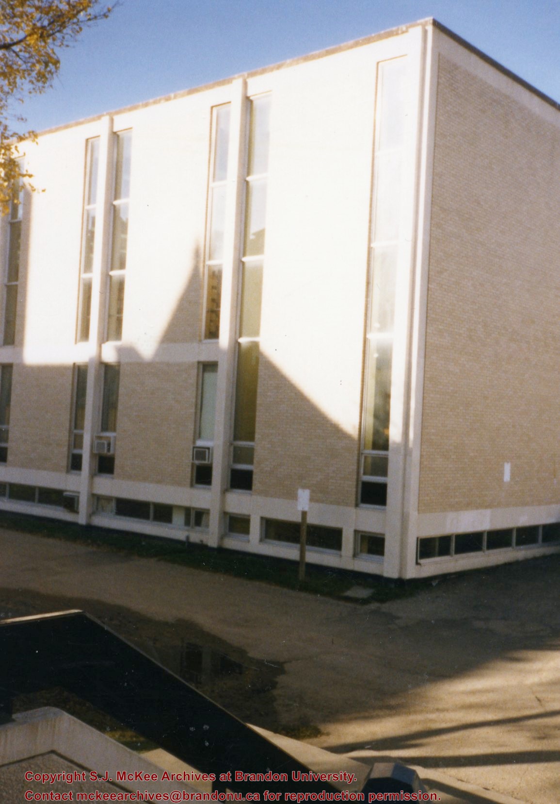
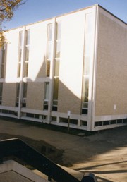
Photograph is looking southwest from the back steps of the Education Building and shows the northeast corner of the A.E. McKenzie Building, which housed the Library and Faculty of Arts.
Images
Show Less

Education Building construction

http://archives.brandonu.ca/en/permalink/descriptions8598
Part Of
Education building
Description Level
Item
GMD
graphic
Date Range
c. 1966
Part Of
Education building
Description Level
Item
Series Number
2.7
Item Number Range
2.7.11 to 2.7.87
GMD
graphic
Date Range
c. 1966
Physical Description
4.25" x 3.25" (b/w)
Physical Condition
Some of the photographs have discolored lines through them.
History / Biographical
Donkersloot began working at Brandon University in 1971 as the Clerk of Works. From 1973 until his retirement, he was the Director of Physical Plant.
Custodial History
Photographs were taken by Tom Donkersloot during construction and stored in albums in the Physical Plant H-Hut until they were transfered to the McKee Archives by Doug Duncalf in May 2008.
Scope and Content
Seventy seven photographs of the construction of the Education Building.
Notes
Donkersloot recorded the date and time each photograph was taken on the back of the photos.
Show Less

Aerial view: Brandon College

http://archives.brandonu.ca/en/permalink/descriptions594
Part Of
Brandon University Photograph collection
Description Level
Item
GMD
graphic
Date Range
[fall 1964?]
Part Of
Brandon University Photograph collection
Description Level
Item
Series Number
2.1
Item Number
BUPC 2.1.2
GMD
graphic
Date Range
[fall 1964?]
Physical Description
5" x 4" (b/w)
Scope and Content
Brandon College looking south from 19th Street. Photograph was taken after Flora Cowan Hall was built but before construction of the Education Building.
Subject Access
aerial photographs
campus photographs
campus buildings
Brandon streets
Images
Show Less

Brandon University campus construction

http://archives.brandonu.ca/en/permalink/descriptions8005
Part Of
Brandon University Photograph collection
Description Level
Item
GMD
graphic
Date Range
c. 1996
Part Of
Brandon University Photograph collection
Creator
Photographer: Sandy Black
Description Level
Item
Series Number
2.1
Item Number
BUPC 2.1.71
GMD
graphic
Date Range
c. 1996
Physical Description
4" x 6" (colour)
Scope and Content
View is northeast probably from the roof of McMaster Hall. Photograph shows the construction of the new roof on Clark Hall and the Brandon College Building. A portion of the east side of the 000 and 100 blocks of 18th Street, as well as the corner of 18th Street and Rosser Avenue are visible in the upper left hand corner. This includes the "Downtown Brandon" sign.
Subject Access
campus photographs
campus buildings
campus construction
Brandon streets
Images
Show Less

Brandon University campus construction

http://archives.brandonu.ca/en/permalink/descriptions8006
Part Of
Brandon University Photograph collection
Description Level
Item
GMD
graphic
Date Range
c. 1996
Part Of
Brandon University Photograph collection
Creator
Photographer: Sandy Black
Description Level
Item
Series Number
2.1
Item Number
BUPC 2.1.72
GMD
graphic
Date Range
c. 1996
Physical Description
6" x 4" (colour)
Scope and Content
View is north northeast probably from the roof of McMaster Hall. Photograph shows the construction of the new roof on Clark Hall and the Brandon College Building, as well as the construction of the extension to Clark Hall and the skywalk. Portions of the city as far north as the Assiniboine River are also visible.
Subject Access
campus photographs
campus buildings
campus construction
Brandon streets
Images
Show Less

Brandon University campus construction

http://archives.brandonu.ca/en/permalink/descriptions8018
Part Of
Brandon University Photograph collection
Description Level
Item
GMD
graphic
Date Range
c. 1996
Part Of
Brandon University Photograph collection
Description Level
Item
Series Number
2.1
Item Number
BUPC 2.1.84
GMD
graphic
Date Range
c. 1996
Physical Description
6" x 4" (colour)
Scope and Content
View is north northeast from the roof of McMaster Hall. Photograph shows the campus under construction during the renovation of the Brandon College Building and Clark Hall. The photograph was taken in late fall after the roof had been removed from the buildings but before the construction of the extension of Clark Hall. Construction materials litter the courtyard and driveway. The view looking north extends to The North Hill - a number of residential blocks, particularly to the northeast of 18th Street are visible. Buildings include the International Harvester Building and Kin Village.
Subject Access
campus photographs
campus buildings
campus construction
Brandon streets
Images
Show Less

Brandon University campus construction

http://archives.brandonu.ca/en/permalink/descriptions8020
Part Of
Brandon University Photograph collection
Description Level
Item
GMD
graphic
Date Range
c. 1996
Part Of
Brandon University Photograph collection
Creator
Photographer: Sandy Black
Description Level
Item
Series Number
2.1
Item Number
BUPC 2.1.86
GMD
graphic
Date Range
c. 1996
Physical Description
6" x 4" (colour)
Scope and Content
View is north northeast probably from the roof of McMaster Hall. Photograph shows the construction of the new roof on Clark Hall and the Brandon College Building, as well as the construction of the extension to Clark Hall and the skywalk. The view looking north extends to The North Hill - a number of residential blocks, particularly to the northeast of 18th Street are visible. Buildings include the International Harvester Building and Kin Village.
Subject Access
campus photographs
campus buildings
campus construction
Brandon streets
Images
Show Less

Aerial view - Brandon University campus

http://archives.brandonu.ca/en/permalink/descriptions7989
Part Of
Brandon University Photograph collection
Description Level
Item
GMD
graphic
Date Range
c. 2000
Part Of
Brandon University Photograph collection
Creator
Photograph commissioned by Brandon University and taken by Yourview Aerial Scenics Ltd.
Description Level
Item
Series Number
2.1
Item Number
BUPC 2.1.55
GMD
graphic
Date Range
c. 2000
Physical Description
6" x 4" (colour)
Scope and Content
View is southwest from approximatley 16th Street between Princess and Rosser Avenues. Photograph shows the Brandon University campus, as well as surrounding residential blocks, including Flemming, J.R. Reid and Vincent Massey schools.
Subject Access
aerial photographs
campus photographs
campus buildings
Brandon streets
Images
Show Less

Aerial view - Brandon University campus

http://archives.brandonu.ca/en/permalink/descriptions7990
Part Of
Brandon University Photograph collection
Description Level
Item
GMD
graphic
Date Range
c. 2000
Part Of
Brandon University Photograph collection
Creator
Photograph commissioned by Brandon University and taken by Yourview Aerial Scenics Ltd.
Description Level
Item
Series Number
2.1
Item Number
BUPC 2.1.56
GMD
graphic
Date Range
c. 2000
Physical Description
6" x 4" (colour)
Scope and Content
View is west southwest from approximatley 16th Street between Princess and Lorne Avenues. Photograph shows the Brandon University campus, as well as surrounding residential blocks between 16th and 23rd Streets, Princess and Louise Avenues..
Subject Access
aerial photographs
campus photographs
campus buildings
Brandon streets
Images
Show Less

Aerial view - Brandon University campus

http://archives.brandonu.ca/en/permalink/descriptions7991
Part Of
Brandon University Photograph collection
Description Level
Item
GMD
graphic
Date Range
c. 2000
Part Of
Brandon University Photograph collection
Creator
Photograph commissioned by Brandon University and taken by Yourview Aerial Scenics Ltd.
Description Level
Item
Series Number
2.1
Item Number
BUPC 2.1.57
GMD
graphic
Date Range
c. 2000
Physical Description
6" x 4" (colour)
Scope and Content
View is west from approximatley 17th Street between Lorne and Louise Avenues. Photograph shows a portion of the Brandon University campus (excluding the Education Building and anything north of it), as well as surrounding residential blocks from approximatley 17th Street to 22nd Street.
Subject Access
aerial photographs
campus photographs
campus buildings
Brandon streets
Images
Show Less

Aerial view - Brandon University campus

http://archives.brandonu.ca/en/permalink/descriptions7992
Part Of
Brandon University Photograph collection
Description Level
Item
GMD
graphic
Date Range
c. 1990
Part Of
Brandon University Photograph collection
Description Level
Item
Series Number
2.1
Item Number
BUPC 2.1.58
GMD
graphic
Date Range
c. 1990
Physical Description
5" x 3.5" (colour)
Scope and Content
View is west northwest from approximatley 16th Street and Louise Avenue. Photograph shows the Brandon University campus, prior to the Library Extension, and a large portion of the city to the west of the campus.
Subject Access
aerial photographs
campus photographs
campus buildings
Brandon streets
Images
Show Less

Aerial view - Brandon University campus

http://archives.brandonu.ca/en/permalink/descriptions7993
Part Of
Brandon University Photograph collection
Description Level
Item
GMD
graphic
Date Range
c. 1990
Part Of
Brandon University Photograph collection
Description Level
Item
Series Number
2.1
Item Number
BUPC 2.1.59
GMD
graphic
Date Range
c. 1990
Physical Description
5" x 3.5" (colour)
Scope and Content
View is northwest from approximatley 16th Street and Louise Avenue. Photograph shows the Brandon University campus, prior to the Library Extension, and a large portion of the city to the west of the campus.
Subject Access
aerial photographs
campus photographs
campus buildings
Brandon streets
Show Less

20 records – page 1 of 1.