Skip header and navigation

Revise Search

20 records – page 10 of 1.

CPR 18th Street crossing & signal tower

http://archives.brandonu.ca/en/permalink/descriptions9943
Part Of
RG 11 Lawrence Stuckey fonds
Description Level
Item
GMD
graphic
Date Range
1962
Accession Number
1-2002
Part Of
RG 11 Lawrence Stuckey fonds
Creator
L.A. Stuckey
Description Level
Item
Series Number
3.1
Item Number
1-2002.3.1P20(1)
Accession Number
1-2002
GMD
graphic
Date Range
1962
Physical Description
2 1/2" x 2 1/2"
Material Details
Negative
History / Biographical
The Towerman controlled the crossing gates, [as well as] switches and signals for all routes into and out of the station and freight yards. [Mr. Stuckey's] grandfather, Samuel Gilmour, operated the previous tower for many years (which only operated the crossing gates), and continued to operate the new tower for several years after it was built (ca. 1929). This tower was made obsolete with the installation of Centralized Traffic Control in 1965.
Custodial History
For custodial history see the collection level description of the Lawrence Stuckey collection.
Scope and Content
Canadian Pacific Railway's18th Street crossing & signal tower.
Notes
Photo taken just before construction started on overpass
For a better picture of this tower see photo No. 53 (engine 2911) in CPR steam trains file
Name Access
CPR crossing & signal towers
Subject Access
crossing towers
signal towers
railroads
railways
Canadian Pacific Railway in Brandon
Repro Restriction
The McKee Archives is the copyright holder for the Stuckey materials.
Location Copy
1-2002.3.9.163
Storage Location
Lawrence Stuckey collection
Arrangement
[Mr. Stuckey numbered two envelopes P20. We have kept the same number but designated the first envelope P20(1) and the contents of the second envelope P20(2) and P20(3).]
Images
Show Less

East side 10th Street facing north from Princess Avenue, Brandon, Manitoba

http://archives.brandonu.ca/en/permalink/descriptions8376
Part Of
Joseph H. Hughes collection
Description Level
Item
GMD
graphic
Date Range
1962
Accession Number
3-1997
Part Of
Joseph H. Hughes collection
Description Level
Item
Series Number
3-1997.1
Item Number
3-1997.1.6
Accession Number
3-1997
GMD
graphic
Date Range
1962
Physical Description
8"x 10" (b/w)
Physical Condition
good
Scope and Content
Photograph of an east side of 10th Street facing north from Princess Avenue. Visible businesses include: Thunderbird Bowl, Canadian Pacific Telegraphs, Pittsburgh Paint & Glass, Strand Theatre, Trans Canada Credit Loans, Ted Heming Jewellers, Carlton Cafe, McKenzie Seeds, Clement Block, Mitrou's Cafe and Tea Room, and Brandon Musical Supply Ltd. Vehicles parked on 10th Street are facing north.
Notes
Photograph dated from "Tara's Bulba," the movie playing at the Strand Theatre and similiar vehicles captured in the photograph.
Name Access
Thunderbird Bowl
Canadian Pacific Telegraphs
Pittsburgh Paint & Glass
Strand Theatre
Trans Canada Credit Loans
Ted Heming Jewellers
Carlton Cafe
McKenzie Seeds
Clement Block
Mitrou Building
Brandon Musical Supply Ltd.
10th Street
Subject Access
downtowns
street scenes
Brandon business buildings & facilities after 1940
Storage Location
RG 5 photograph storage drawer
Images
Show Less

Town Hall, Dauphin, Manitoba

http://archives.brandonu.ca/en/permalink/descriptions10494
Part Of
RG 11 Lawrence Stuckey fonds
Description Level
Item
GMD
graphic
Date Range
September 16, 1989
Accession Number
1-2002
Part Of
RG 11 Lawrence Stuckey fonds
Creator
L.A. Stuckey
Description Level
Item
Series Number
3.3
Item Number
1-2002.3.3.CNR[167]
Accession Number
1-2002
GMD
graphic
Date Range
September 16, 1989
Physical Description
2.25" x 2.25" (b/w)
Material Details
Negative
History / Biographical
Stuckey's notes: During World War II dances were held nightly on the second floor, well patronized by the boys from RCAF No. 10 Service Flying Training School (SFTS) Dauphin and RCAF No. 7 Bombing & Gunnery School (B&G) Paulson. While on course at No. 7 B&G I attended often - great times!
Custodial History
For custodial history see the collection level description of the Lawrence Stuckey collection.
Scope and Content
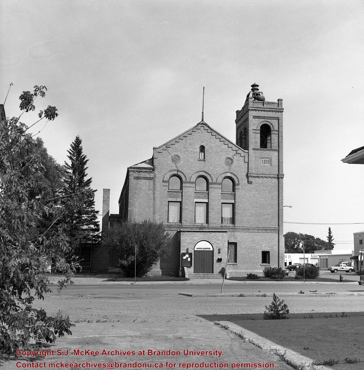
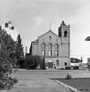
Image of the town hall at Dauphin, Manitoba, taken along the CNR line, Gladstone substation.
Name Access
CNR
Dauphin, Manitoba
Subject Access
railways
public buildings
Repro Restriction
The McKee Archives is the copyright holder of the Stuckey materials.
Storage Location
Lawrence Stuckey collection
Images
Show Less

Brandon College - H-Huts

http://archives.brandonu.ca/en/permalink/descriptions11625
Part Of
CKX fonds
Description Level
Item
GMD
graphic
Date Range
c. 1955
Accession Number
11-2010
Part Of
CKX fonds
Creator
CKX
Description Level
Item
Item Number
11-2010.B129a
Accession Number
11-2010
GMD
graphic
Date Range
c. 1955
Physical Description
5" x 4" (b/w)
Material Details
Negative
Custodial History
See fonds level of the CKX records for custodial history.
Scope and Content
Image of the H-Huts under construction. Kinsmen Stadium is visible in the background.
Name Access
CKX Television
Brandon College
Subject Access
public buildings
colleges
Storage Location
CKX fonds - 2010 accessions
Images
Show Less

Brandon College dining room

http://archives.brandonu.ca/en/permalink/descriptions11667
Part Of
CKX fonds
Description Level
Item
GMD
graphic
Date Range
c. 1960
Accession Number
11-2010
Part Of
CKX fonds
Creator
CKX
Description Level
Item
Item Number
11-2010.B129z
Accession Number
11-2010
GMD
graphic
Date Range
c. 1960
Physical Description
5" x 4" (b/w)
Material Details
Negative
Custodial History
See fonds level of the CKX records for custodial history.
Scope and Content
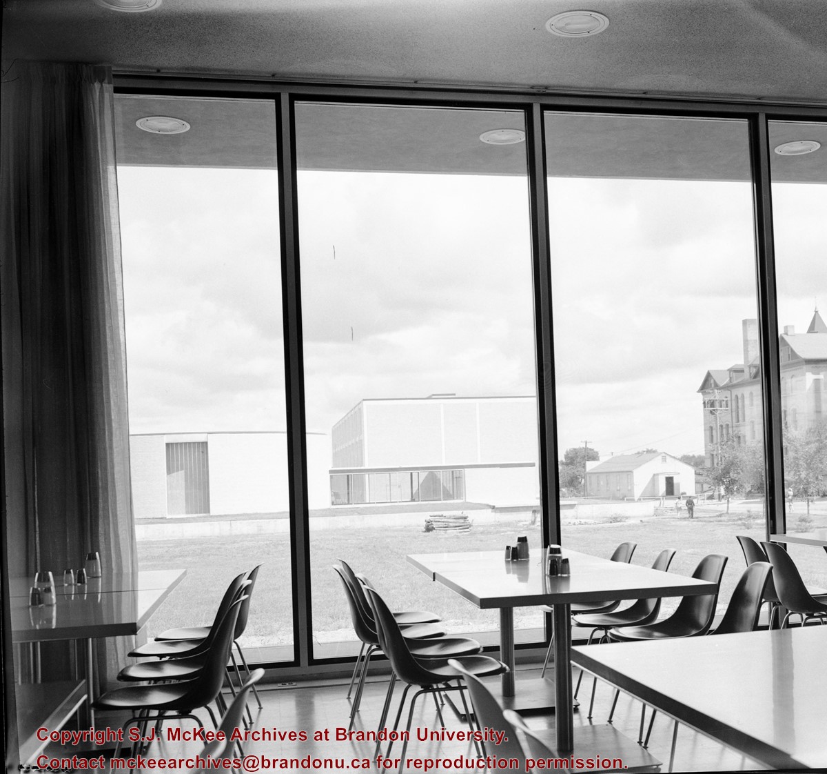
Image was taken from inside the Dining Room looking out through the windows across campus. Portiosn of the J.R.C. Evans Lecture Theatre, the A.E. McKenzie Building and Clark Hall are visible.
Name Access
CKX Television
Brandon College
Dining Room
Subject Access
public buildings
colleges
Storage Location
CKX fonds - 2010 accessions
Images
Show Less

Bank of Montreal - 10th Street and Rosser, Brandon, Manitoba

http://archives.brandonu.ca/en/permalink/descriptions8384
Part Of
Joseph H. Hughes collection
Description Level
Item
GMD
graphic
Date Range
c. 1959
Accession Number
3-1997
Part Of
Joseph H. Hughes collection
Description Level
Item
Series Number
3-1997.1
Item Number
3-1997.1.12
Accession Number
3-1997
GMD
graphic
Date Range
c. 1959
Physical Description
8" x 10" (b/w)
Physical Condition
good
Scope and Content
Photograph shows the southeast corner of 10th Street and Rosser Avenue, Brandon, Manitoba. The Bank of Montreal is situated on the corner. Visible businesses along the east side of 10th Street include: Barclay's Shoe Store, Carlton Cafe, and Ted Heming Jewellers.
Name Access
Bank of Montreal
Barclay's Shoe Store
Carlton Cafe
Ted Heming Jewellers
Subject Access
downtowns
street scenes
Brandon business buildings & facilities after 1940
building exteriors
banks
Storage Location
RG 5 photograph storage drawer
Images
Show Less

Corner of 10th Street and Princess Avenue, Brandon, Manitoba

http://archives.brandonu.ca/en/permalink/descriptions8387
Part Of
Joseph H. Hughes collection
Description Level
Item
GMD
graphic
Date Range
c. 1930
Accession Number
3-1997
Part Of
Joseph H. Hughes collection
Description Level
Item
Series Number
3-1997.1
Item Number
3-1997.1.14
Accession Number
3-1997
GMD
graphic
Date Range
c. 1930
Physical Description
8 " x 10" (b/w)
Physical Condition
good
Scope and Content
Photograph shows the intersection of 10th Street and Princess Avenue, Brandon, Manitoba. View is facing northwest along west side of the 100-block of 10th Street. A stationary policeman/divider is at the centre of the intersection. Visible businesses include: Doig's, Plaza Shoe Shop, and Cambridge Clothes Shop. A horse-drawn sled is parked in front of Doig's store. The Olympia Block, Cecil Hotel, and CPR Station are visible in the background.
Name Access
Doig's
Plaza Shoe Shop
Cambridge Clothes Shop
Alexandra Block
Strathcona Block
10th Street
Princess Avenue
Subject Access
downtowns
street scenes
Brandon business buildings & facilities before 1940
building exteriors
Transportation
Storage Location
RG 5 photograph storage drawer
Images
Show Less

Aerial view: Brandon College

http://archives.brandonu.ca/en/permalink/descriptions594
Part Of
Brandon University Photograph collection
Description Level
Item
GMD
graphic
Date Range
[fall 1964?]
Part Of
Brandon University Photograph collection
Description Level
Item
Series Number
2.1
Item Number
BUPC 2.1.2
GMD
graphic
Date Range
[fall 1964?]
Physical Description
5" x 4" (b/w)
Scope and Content
Brandon College looking south from 19th Street. Photograph was taken after Flora Cowan Hall was built but before construction of the Education Building.
Subject Access
aerial photographs
campus photographs
campus buildings
Brandon streets
Images
Show Less

Brandon University campus construction

http://archives.brandonu.ca/en/permalink/descriptions8005
Part Of
Brandon University Photograph collection
Description Level
Item
GMD
graphic
Date Range
c. 1996
Part Of
Brandon University Photograph collection
Creator
Photographer: Sandy Black
Description Level
Item
Series Number
2.1
Item Number
BUPC 2.1.71
GMD
graphic
Date Range
c. 1996
Physical Description
4" x 6" (colour)
Scope and Content
View is northeast probably from the roof of McMaster Hall. Photograph shows the construction of the new roof on Clark Hall and the Brandon College Building. A portion of the east side of the 000 and 100 blocks of 18th Street, as well as the corner of 18th Street and Rosser Avenue are visible in the upper left hand corner. This includes the "Downtown Brandon" sign.
Subject Access
campus photographs
campus buildings
campus construction
Brandon streets
Images
Show Less

Brandon University campus construction

http://archives.brandonu.ca/en/permalink/descriptions8006
Part Of
Brandon University Photograph collection
Description Level
Item
GMD
graphic
Date Range
c. 1996
Part Of
Brandon University Photograph collection
Creator
Photographer: Sandy Black
Description Level
Item
Series Number
2.1
Item Number
BUPC 2.1.72
GMD
graphic
Date Range
c. 1996
Physical Description
6" x 4" (colour)
Scope and Content
View is north northeast probably from the roof of McMaster Hall. Photograph shows the construction of the new roof on Clark Hall and the Brandon College Building, as well as the construction of the extension to Clark Hall and the skywalk. Portions of the city as far north as the Assiniboine River are also visible.
Subject Access
campus photographs
campus buildings
campus construction
Brandon streets
Images
Show Less

Brandon University campus construction

http://archives.brandonu.ca/en/permalink/descriptions8018
Part Of
Brandon University Photograph collection
Description Level
Item
GMD
graphic
Date Range
c. 1996
Part Of
Brandon University Photograph collection
Description Level
Item
Series Number
2.1
Item Number
BUPC 2.1.84
GMD
graphic
Date Range
c. 1996
Physical Description
6" x 4" (colour)
Scope and Content
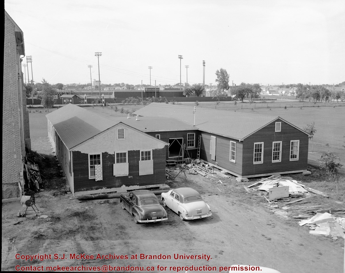
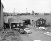
View is north northeast from the roof of McMaster Hall. Photograph shows the campus under construction during the renovation of the Brandon College Building and Clark Hall. The photograph was taken in late fall after the roof had been removed from the buildings but before the construction of the extension of Clark Hall. Construction materials litter the courtyard and driveway. The view looking north extends to The North Hill - a number of residential blocks, particularly to the northeast of 18th Street are visible. Buildings include the International Harvester Building and Kin Village.
Subject Access
campus photographs
campus buildings
campus construction
Brandon streets
Images
Show Less

Brandon University campus construction

http://archives.brandonu.ca/en/permalink/descriptions8020
Part Of
Brandon University Photograph collection
Description Level
Item
GMD
graphic
Date Range
c. 1996
Part Of
Brandon University Photograph collection
Creator
Photographer: Sandy Black
Description Level
Item
Series Number
2.1
Item Number
BUPC 2.1.86
GMD
graphic
Date Range
c. 1996
Physical Description
6" x 4" (colour)
Scope and Content
View is north northeast probably from the roof of McMaster Hall. Photograph shows the construction of the new roof on Clark Hall and the Brandon College Building, as well as the construction of the extension to Clark Hall and the skywalk. The view looking north extends to The North Hill - a number of residential blocks, particularly to the northeast of 18th Street are visible. Buildings include the International Harvester Building and Kin Village.
Subject Access
campus photographs
campus buildings
campus construction
Brandon streets
Images
Show Less

West side of 10th Street from Princess Avenue, Brandon, Manitoba

http://archives.brandonu.ca/en/permalink/descriptions8401
Part Of
Joseph H. Hughes collection
Description Level
Item
GMD
graphic
Date Range
c. 1955
Accession Number
3-1997
Part Of
Joseph H. Hughes collection
Description Level
Item
Series Number
3-1997.1
Item Number
3-1997.1.23
Accession Number
3-1997
GMD
graphic
Date Range
c. 1955
Physical Description
8" x 10" (b/w)
Physical Condition
good
Scope and Content
Photograph of west side of 10th Street, Brandon, Manitoba, facing northwest. Visible businesses in the Alexandra Block include Doig's, Box Brothers Hardware and Allied Hardware Stores, followed by Simpsons-Sears and Barry Neill Men's Wear in the Strathcona Block. The Johnny Smith Block is visible in the background.
Name Access
Strathcona Block
Alexandra Block
Doig's
Box Brothers Hardware
Simpsons-Sears Ltd.
Barry Neill Men's Wear
10th Street
Subject Access
downtowns
street scenes
Brandon business buildings & facilities after 1940
building exteriors
Storage Location
RG 5 photograph storage drawer
Images
Show Less

Brandon College - classroom in H-Huts

http://archives.brandonu.ca/en/permalink/descriptions11626
Part Of
CKX fonds
Description Level
Item
GMD
graphic
Date Range
c. 1955
Accession Number
11-2010
Part Of
CKX fonds
Creator
CKX
Description Level
Item
Item Number
11-2010.B129b
Accession Number
11-2010
GMD
graphic
Date Range
c. 1955
Physical Description
5" x 4" (b/w)
Material Details
Negative
Custodial History
See fonds level of the CKX records for custodial history.
Scope and Content
Image of a classroom located in the H-Huts.
Name Access
CKX Television
Brandon College
Subject Access
public buildings
colleges
Storage Location
CKX fonds - 2010 accessions
Images
Show Less

Brandon College - McKenzie building groundbreaking

http://archives.brandonu.ca/en/permalink/descriptions11636
Part Of
CKX fonds
Description Level
Item
GMD
graphic
Date Range
September 9, 1959
Accession Number
11-2010
Part Of
CKX fonds
Creator
CKX
Description Level
Item
Item Number
11-2010.B129i
Accession Number
11-2010
GMD
graphic
Date Range
September 9, 1959
Physical Description
5" x 4" (b/w)
Material Details
Negative
Custodial History
See fonds level of the CKX records for custodial history.
Scope and Content
Image taken at the groundbreaking ceremony for the A.E. McKenzie Building.
Name Access
CKX Television
Brandon College
Subject Access
public buildings
colleges
Storage Location
CKX fonds - 2010 accessions
Images
Show Less
Part Of
RG 11 Lawrence Stuckey fonds
Description Level
Item
GMD
graphic
Date Range
[18-]
Accession Number
1-2002
Part Of
RG 11 Lawrence Stuckey fonds
Description Level
Item
Series Number
3.1
Item Number
1-2002.3.1P1
Accession Number
1-2002
GMD
graphic
Date Range
[18-]
Physical Description
3" x 5"
Material Details
Negative
History / Biographical
Chief Engineer of the Northern Pacific Railroad 1870-1882
Chief Engineer of the Canadian Pacific Railway 1881; [worked from] Winnipeg to Oak Lake, Manitoba
Selected [the site that would become] Brandon as the first division point west of Winnipeg.
Custodial History
For custodial history see the collection level description of the Lawrence Stuckey collection.
Scope and Content
Major General Thomas Lafayette Rosser
Name Access
Thomas L. Rosser
Subject Access
military personnel
surveyors
engineers
Canadian Pacific Railway in Brandon
Repro Restriction
The McKee Archives is the copyright holder for the Stuckey materials.
Location Copy
1-2002.3.9.146
Storage Location
Lawrence Stuckey collection
Images
Show Less

Aerial view - Brandon University campus

http://archives.brandonu.ca/en/permalink/descriptions7989
Part Of
Brandon University Photograph collection
Description Level
Item
GMD
graphic
Date Range
c. 2000
Part Of
Brandon University Photograph collection
Creator
Photograph commissioned by Brandon University and taken by Yourview Aerial Scenics Ltd.
Description Level
Item
Series Number
2.1
Item Number
BUPC 2.1.55
GMD
graphic
Date Range
c. 2000
Physical Description
6" x 4" (colour)
Scope and Content
View is southwest from approximatley 16th Street between Princess and Rosser Avenues. Photograph shows the Brandon University campus, as well as surrounding residential blocks, including Flemming, J.R. Reid and Vincent Massey schools.
Subject Access
aerial photographs
campus photographs
campus buildings
Brandon streets
Images
Show Less

Aerial view - Brandon University campus

http://archives.brandonu.ca/en/permalink/descriptions7990
Part Of
Brandon University Photograph collection
Description Level
Item
GMD
graphic
Date Range
c. 2000
Part Of
Brandon University Photograph collection
Creator
Photograph commissioned by Brandon University and taken by Yourview Aerial Scenics Ltd.
Description Level
Item
Series Number
2.1
Item Number
BUPC 2.1.56
GMD
graphic
Date Range
c. 2000
Physical Description
6" x 4" (colour)
Scope and Content
View is west southwest from approximatley 16th Street between Princess and Lorne Avenues. Photograph shows the Brandon University campus, as well as surrounding residential blocks between 16th and 23rd Streets, Princess and Louise Avenues..
Subject Access
aerial photographs
campus photographs
campus buildings
Brandon streets
Images
Show Less

Aerial view - Brandon University campus

http://archives.brandonu.ca/en/permalink/descriptions7991
Part Of
Brandon University Photograph collection
Description Level
Item
GMD
graphic
Date Range
c. 2000
Part Of
Brandon University Photograph collection
Creator
Photograph commissioned by Brandon University and taken by Yourview Aerial Scenics Ltd.
Description Level
Item
Series Number
2.1
Item Number
BUPC 2.1.57
GMD
graphic
Date Range
c. 2000
Physical Description
6" x 4" (colour)
Scope and Content
View is west from approximatley 17th Street between Lorne and Louise Avenues. Photograph shows a portion of the Brandon University campus (excluding the Education Building and anything north of it), as well as surrounding residential blocks from approximatley 17th Street to 22nd Street.
Subject Access
aerial photographs
campus photographs
campus buildings
Brandon streets
Images
Show Less

Aerial view - Brandon University campus

http://archives.brandonu.ca/en/permalink/descriptions7992
Part Of
Brandon University Photograph collection
Description Level
Item
GMD
graphic
Date Range
c. 1990
Part Of
Brandon University Photograph collection
Description Level
Item
Series Number
2.1
Item Number
BUPC 2.1.58
GMD
graphic
Date Range
c. 1990
Physical Description
5" x 3.5" (colour)
Scope and Content
View is west northwest from approximatley 16th Street and Louise Avenue. Photograph shows the Brandon University campus, prior to the Library Extension, and a large portion of the city to the west of the campus.
Subject Access
aerial photographs
campus photographs
campus buildings
Brandon streets
Images
Show Less

20 records – page 10 of 1.