Materials were in the possession of Harvey Young until their donation to the McKee Archives in 2008.
Scope and Content
Fonds consists of one file containing a copy of the history of the Geology Department and a drawing of its layout when it was located in the H-Huts. Both were created by Harvey Young.
View is southwest from approximatley 16th Street between Princess and Rosser Avenues. Photograph shows the Brandon University campus, as well as surrounding residential blocks, including Flemming, J.R. Reid and Vincent Massey schools.
View is west southwest from approximatley 16th Street between Princess and Lorne Avenues. Photograph shows the Brandon University campus, as well as surrounding residential blocks between 16th and 23rd Streets, Princess and Louise Avenues..
View is west from approximatley 17th Street between Lorne and Louise Avenues. Photograph shows a portion of the Brandon University campus (excluding the Education Building and anything north of it), as well as surrounding residential blocks from approximatley 17th Street to 22nd Street.
View is west northwest from approximatley 16th Street and Louise Avenue. Photograph shows the Brandon University campus, prior to the Library Extension, and a large portion of the city to the west of the campus.
View is northwest from approximatley 16th Street and Louise Avenue. Photograph shows the Brandon University campus, prior to the Library Extension, and a large portion of the city to the west of the campus.
For custodial history see the collection level description of the Lawrence Stuckey collection.
Scope and Content
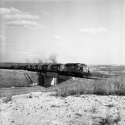
Image of CPR Highway 10 bridge (town in background) and XW 5693-5703-5918-5960-5947-3036, Minnedosa, Manitoba. Image was taken along the CPR Minnedosa & Bredenbury subdivision (ex. Manitoba & N.W. Railway).
Mr. Stuckey's notes: On bridge mile 87.2, Bredenbury Sub[division]. Has permanent 10 MPH slow order [on] account [of] footings in shale.
Custodial History
For custodial history see the collection level description of the Lawrence Stuckey collection.
Scope and Content
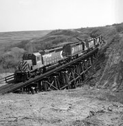
Image of CP XW 6015-5701-5929-5747-QNS&L 215-6037, Harrowby, Manitoba. Image was taken along the CPR Minnedosa & Bredenbury subdivision (ex. Manitoba & N.W. Railway).
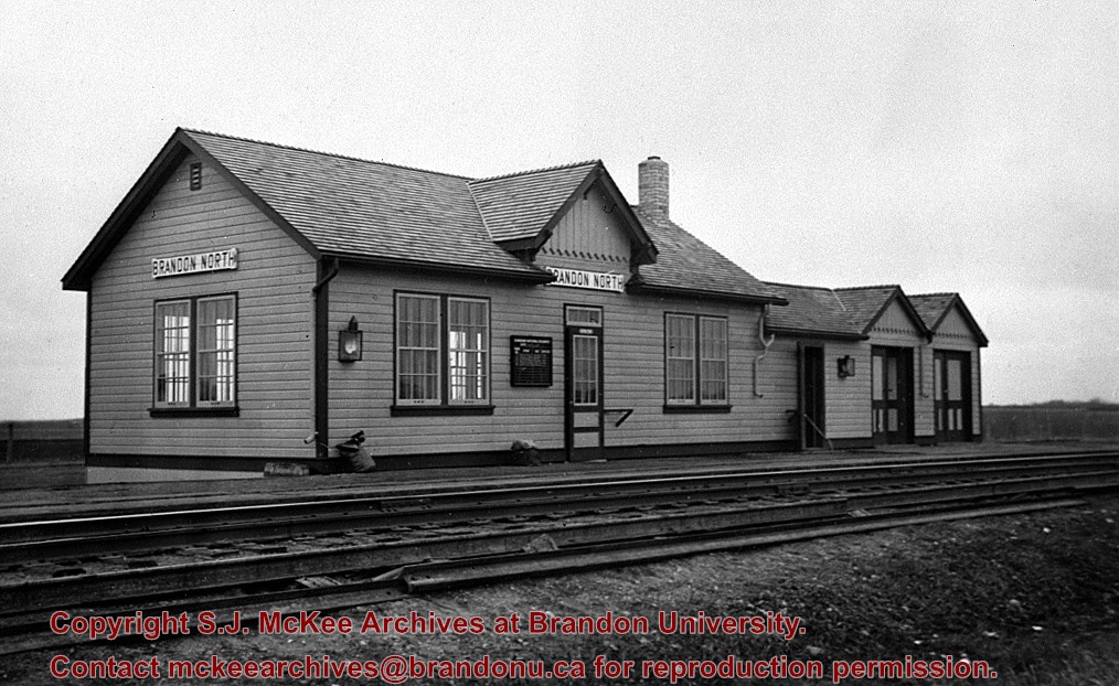
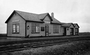
[This station, located 13 km north of Brandon on the east side of PTH 10, was] built in the early 1930s to replace Knox as the CNR’s mainline station for Brandon. All passenger trains stopped and buses operated between the CNR’s Brandon station and Brandon North to meet all trains. It was enlarged as shown here in late 1930s, and at peak operation in the 1940s & 1950s saw six daily passenger trains 1 - 2 & 3 - 4 “Continental Limited” and 11 - 12 locals. VIA trains 3 and 4 "Supercontinental" ceased operation Nov. 15, 1981 leaving no passenger service on the former Grand Trunk Pacific mainline of CNR [at that time]. This station was demolished in the fall of 1982.
Custodial History
For custodial history see the collection level description of the Lawrence Stuckey collection.
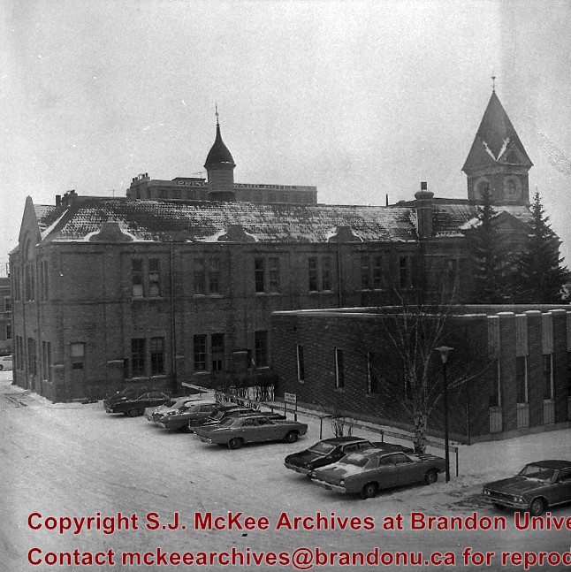
Image shows the Brandon College campus from 17th Street looking southwest. The photo was taken after the completion of the original Music Building in 1963, but construction of the Education Building. Also visible are a number of properties on the 200 block of 18th Street and the 200 block of 20th Street.
Image is looking east northeast from approximately the 300 block of 23rd Street between Lorne and Louise Avenues. Photograph shows the Brandon College campus after the opening of the original Music Building in 1963, but before the construction of the Education Building in 1966. A number of house on the 300 blocks of 22nd and 21st Streets are visible in the foreground, with the A.E. McKenzie Seed Co., the Prince Edward Hotel and various grain elevators on the horizon.
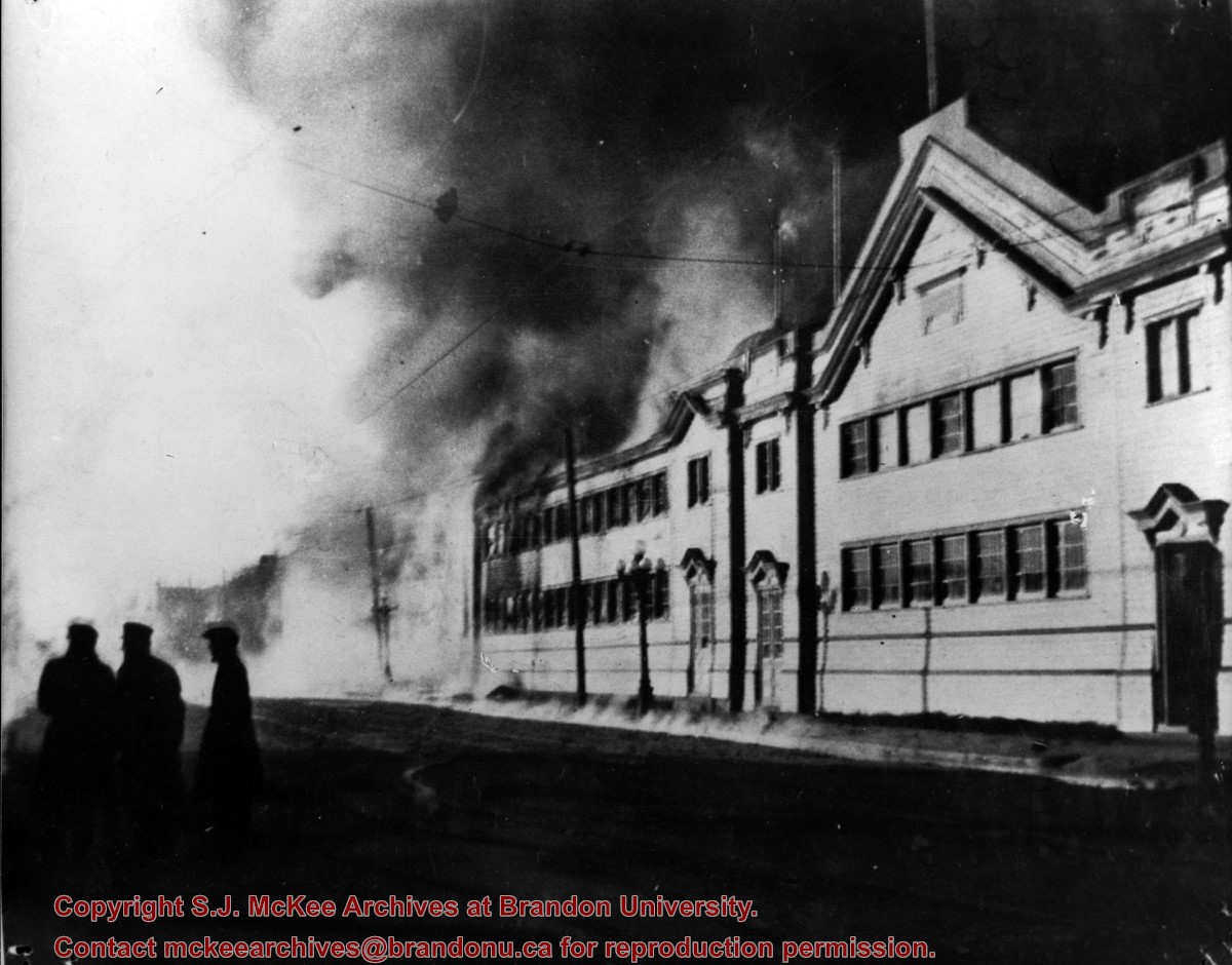
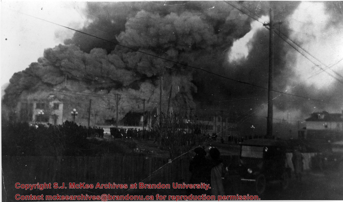
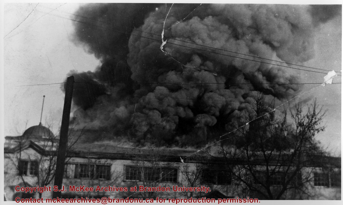
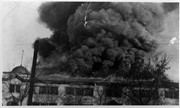
Photograph of spectators gathered to watch the Royal North-West Mounted Police (RNWMP) horse barns on fire. The barns were located in the Winter Fair Building on the Fair Grounds.


+and+XW+5693-5703-5918-5960-5947-3036%2c+Minnedosa%2c+Manitoba.)