View is south southeast from approsimatley Rosser Avenue and 21st Street. Photograph shows the Brandon University campus, Kinsmen Stadium, Earl Oxford School, the Fair Grounds (including the Grand Stand and Race Track), and a number of residential blocks.
View is south southwest from approximatley the southwest corner of 18th Street and Princess Avenue. Photograph shows the University campus, Kinsmen Stadium, Earl Oxford School and residential blocks.
View is west from 17th Street between Louise and Princess Avenues to approximalety 25th Street. Photograph shows the University campus, Fleming School, Coronation Park and residential blocks.
View is southeast from north of the corner of Princess Avenue and 22nd Street to approximatley Brandon Avenue. Photograph shows the University campus, Kinsmen Stadium, Earl Oxford School, and residential blocks. Brandon Collegiate Institute (BCI) is visible in the upper left corner.
View is west southwest from approximatley the northside of Princess Avenue just east of 18th Street. Photograph shows the University campus, part of Kinsmen Stadium and residential blocks.
View is northwest from approximatley the southeast corner of 18th Street and Louise Avenue. Photograph shows the University campus and residential blocks.
View is southwest from approximatley the corner of 17th Street and Princess Avenue to McDiarmid Drive. Photograph shows the Brandon University campus, Kinsmen Stadium, Fleming School, Coronation Park and residential blocks.
View is west northwest from aproximatley 15th Street and Louise Avenue to 34th Street. Photograph shows the Brandon University campus, part of Kinsmen Stadium, Fleming School, Coronoation Park, Valleyview Centennial School, Sacred Heart School ?, and residential blocks.
View is west northwest from aproximatley 16th Street and Louise Avenue to west of 34th Street. Photograph shows the Brandon University campus, part of Kinsmen Stadium, Coronoation Park, Valleyview Centennial School, part of the Assiniboine River and residential blocks.
View is southwest from approximatley 16th Street and Princess Avenue to McDiarmid Drive. Photograph shows the Brandon University campus, Kinsmen Stadium, Fleming School, Coronation Park, J.R. Ried School and residential blocks.
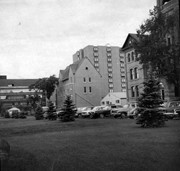
View is southwest and shows a portion of the Brandon College Building, an H-Hut, the Citizens' Science Building, McMaster Hall and the John R. Brodie Science Centre, as well as a number of parked cars. Photograph was taken on the lawn in front of Clark Hall.
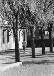
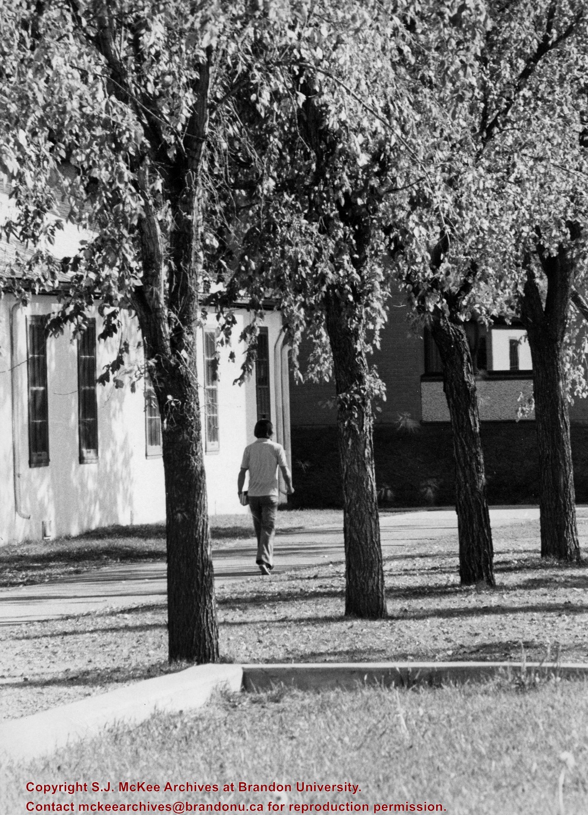
Photograph shows a student walking south along the sidewalk in front of Clark Hall and the Brandon College Building. Education Building in the background.
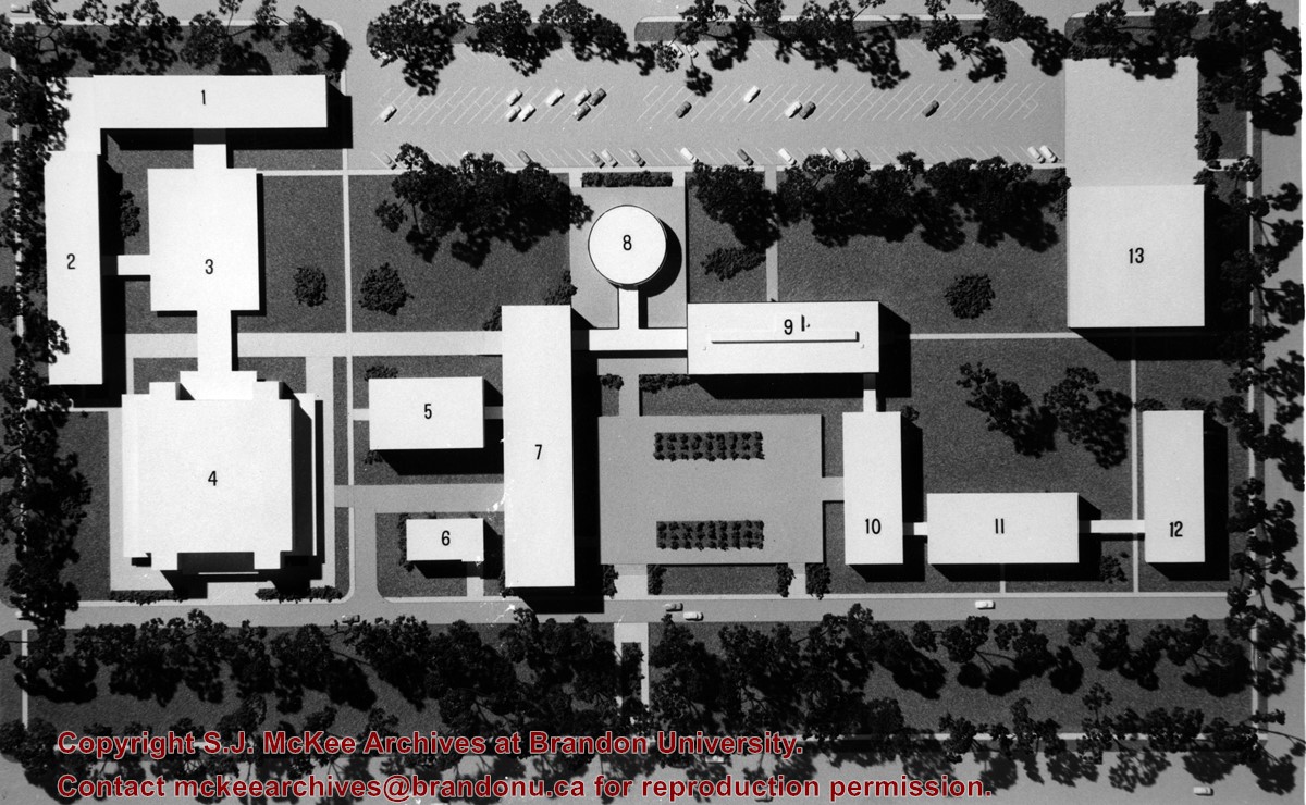
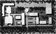
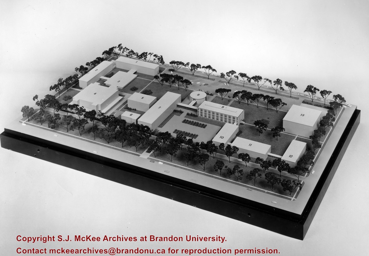
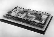
The idea behind the new proposed campus was to tear down the Brandon College Building and Clark Hall and either move the entire campus west on Victoria Avenue to land owned by Fotheringham or to rebuild the campus on the existing grounds.
Scope and Content
Photograph shows a model of a proposed new campus for Brandon University. In the model the Brandon College Building and Clark Hall have been removed.
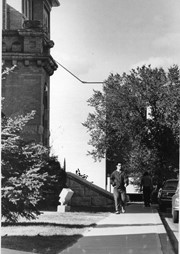
View is north northwest from the John R. Brodie Science Center (?). Photograph shows: Citizens' Science Building, Brandon College Building and Clark Hall, the Education Building and the driveway running in front of the buildings.
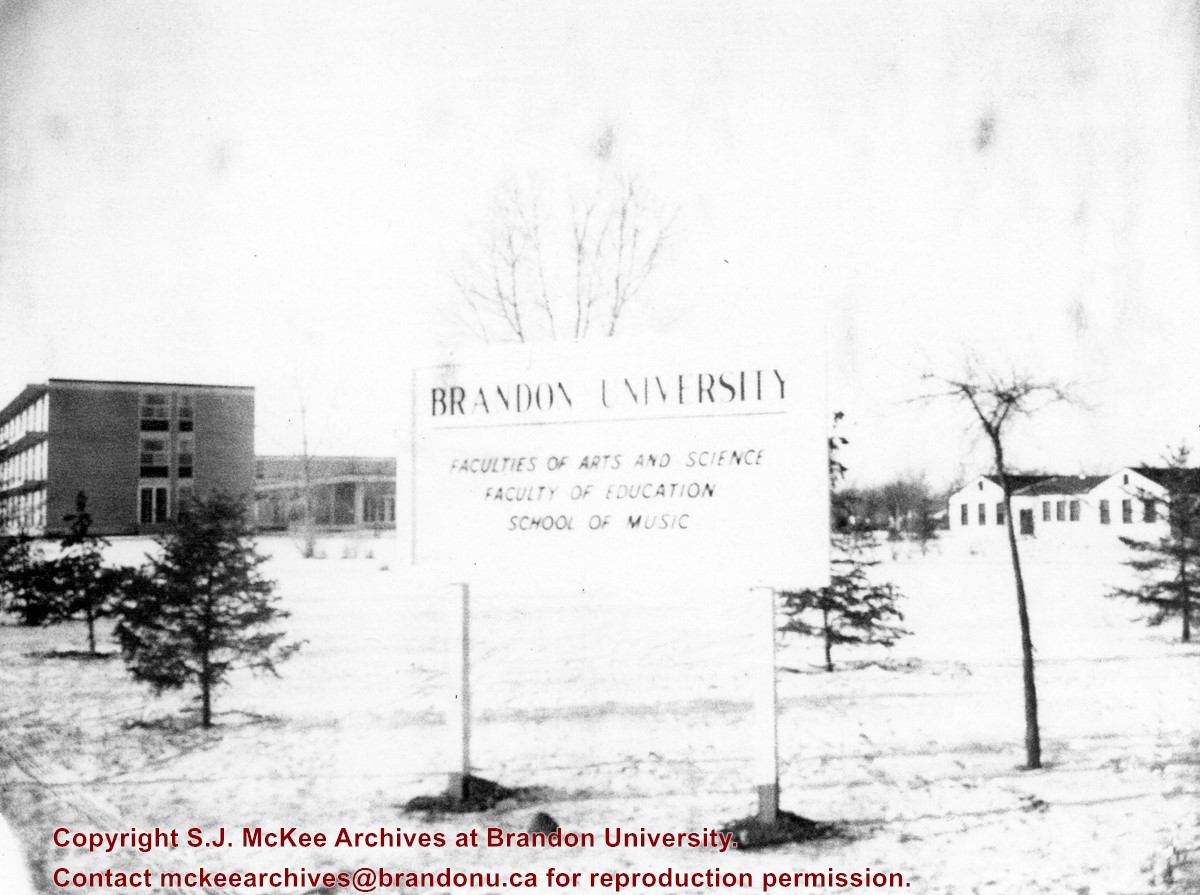
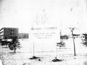
View is northwest from approximatley the corner of 18th Street and Louise Avenue. Photograph shows a Brandon University sign post listing the faculties and schools on campus. In the background is Flora Cowan Hall, the Dining Hall, Darrach Hall and the H-Huts.
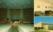
The Steinway Concert Grand piano on the stage in the Evans Theatre photograph was donated to Brandon College from the Vining estate.
Scope and Content
Item consists of images of the interior of the J. R. C. Evans Lecture Theatre, the Dining Room lounge (top right), and the entrance to the Gymnasium (bottom right).
View is north northeast. Photograph shows the Brandon College Building in the foreground with the Education Building and North Hill in the background. Photo was taken from the roof of McMaster Hall.


