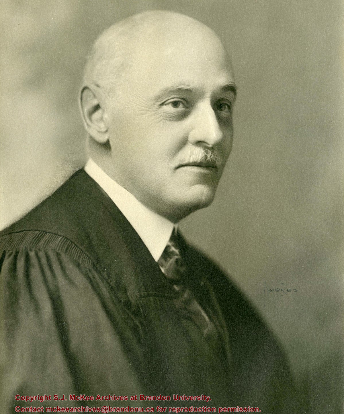
Bertha Miriam Clark was born on Prince Edward Island but attended public and high school in Brandon, MB. She was a member of the Class of 1929 and served as Lady Stick in her final year at Brandon College.
Clark married J. Scott Leith, Brandon College Class of 1928. Scott and Bertha Leith's son James Clark Leith is in the Canadian Who's Who.
Custodial History
Album was sent to Pat Britton, Brandon University Director of Alumni Relations, by Bertha Leith in April 1991. Britton then transferred it to the McKee Archives.
Scope and Content
Fonds consists of a small accordian style photograph album (7 x 10.5 x 3.5 cm) created by Bertha Clark during her years at Brandon College. The photographs, which measure 4" x 2.75", depict numerous people and events.
Notes
History/Bio information taken from the 1928-1929 Sickle.
Item is a pen and ink drawing of the Brandon College Building and Clark Hall by Brandon artist Doug Brolund to be used by the University in its "Building for Strength" campaign. A card attached to the print said: "Building from Strength compliments of John R. Mallea and L.D. Whitehead."
Storage Location
RG 6 Brandon University fonds
Series16: Brandon University/College artifacts
16.3 Artifacts - other
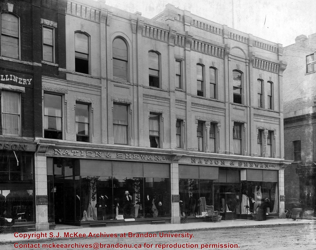
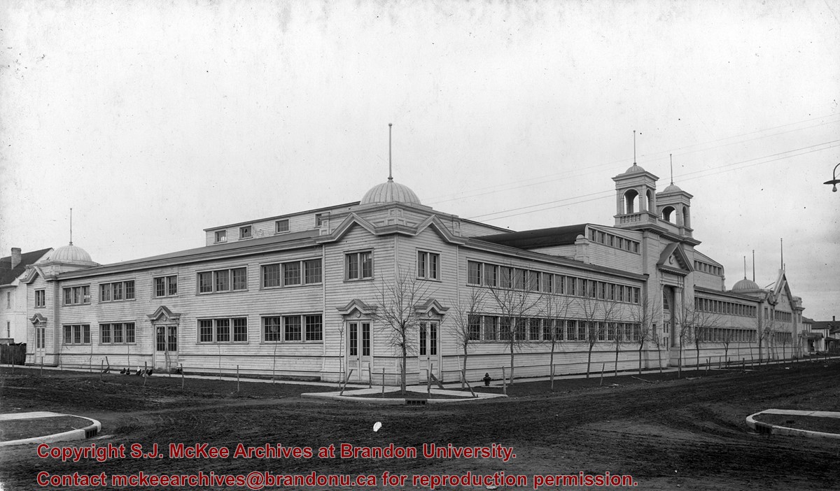
Erected in 1889, at 806 Rosser Avenue (the southeast corner of Rosser Avenue and 7th Street), the building was designed by Brandon architect W.H. Shillinglaw. At the time of its construction the structure housed the Nation Department Store, which became Nation & Shewan Department Store in 1894. One of Brandon’s largest and most successful drygoods businesses, the venture was owned and operated by Fred Nation and Alexander Shewan.
Built adjacent to an existing three storey brick building known as the A.D. Rankin Block (built sometime between 1885 and 1888), this smaller building was eventually absorbed by the Nation and Shewan Block after 1897, when Rankin Drygoods moved into the newly constructed Syndicate Block located farther east down Rosser Ave. Later, the Rankin Block became known as Nation Chambers. These two structures comprised what was known as the Nation and Shewan Block.
Major improvements were made to the store and an annex was added in 1910. Some of the renovation additions included, but were not limited to: an updated frontage with new copper sash windows and prismatic glass tops, plate glass windows, new fixtures and carpet. With the renovations the floor space of the business was almost doubled. The stock of the business also increased, with the Brandon Weekly Sun reporting that when finished, Nation & Shewan would be a “store of which the citizens of Brandon will be justly proud.”
The drygoods firm operated until Nation’s death 1926, when it became known as A. Shewan Limited. From 1933 to 1944, the business was known as Shewan and Son. Shortly thereafter, the Metropolitan Stores Ltd began operating out of the Nation & Shewan Block.
In 2000, the Town Centre prepared to knock down what was then known as the Red Apple Building, the former Nation & Shewan Block. The demolition was to make way for the new atrium and entrance for the mall, and begin a new period of redevelopment at the downtown shopping centre.
Custodial History
See fonds level description of the Alf Fowler collection for custodial history.
Scope and Content
Photo shows the front of the Nation & Shewan Block, which was located in the 800 block of Rosser Avenue on the southside.
Storage Range
RG 5 Western Manitoba Manuscript collection - photograph storage drawer
View is southwest from approximatley 16th Street between Princess and Rosser Avenues. Photograph shows the Brandon University campus, as well as surrounding residential blocks, including Flemming, J.R. Reid and Vincent Massey schools.
View is west southwest from approximatley 16th Street between Princess and Lorne Avenues. Photograph shows the Brandon University campus, as well as surrounding residential blocks between 16th and 23rd Streets, Princess and Louise Avenues..
View is west from approximatley 17th Street between Lorne and Louise Avenues. Photograph shows a portion of the Brandon University campus (excluding the Education Building and anything north of it), as well as surrounding residential blocks from approximatley 17th Street to 22nd Street.
View is west northwest from approximatley 16th Street and Louise Avenue. Photograph shows the Brandon University campus, prior to the Library Extension, and a large portion of the city to the west of the campus.
View is northwest from approximatley 16th Street and Louise Avenue. Photograph shows the Brandon University campus, prior to the Library Extension, and a large portion of the city to the west of the campus.
Photograph shows the removal of one of the houses formerly located on 20th Street between Louise and Princess Avenues. The houses on those blocks were removed to create parking lots for the University. A Fed Zavislak Ltd. Well Drilling & Trucking pickup truck is visible at the curb.
Photograph shows the removal of one of the houses formerly located on 20th Street between Louise and Princess Avenues. The houses on those blocks were removed to create parking lots for the University.
View is northeast probably from the roof of McMaster Hall. Photograph shows the construction of the new roof on Clark Hall and the Brandon College Building. A portion of the east side of the 000 and 100 blocks of 18th Street, as well as the corner of 18th Street and Rosser Avenue are visible in the upper left hand corner. This includes the "Downtown Brandon" sign.
View is north northeast probably from the roof of McMaster Hall. Photograph shows the construction of the new roof on Clark Hall and the Brandon College Building, as well as the construction of the extension to Clark Hall and the skywalk. Portions of the city as far north as the Assiniboine River are also visible.
View is northeast from the Brandon College Building. Photograph shows the inside of the Brandon College Building after it had been gutted and then partially rebuilt. The exterior fascade of the west side of the building can be clearly seen in this photograph. A number of houses on the east side of 200 block of 18th Street are also visible, as is the stone fence on Princess Avenue and the flag pole on the front lawn.
View is north northeast from the roof of McMaster Hall. Photograph shows the campus under construction during the renovation of the Brandon College Building and Clark Hall. The photograph was taken in late fall after the roof had been removed from the buildings but before the construction of the extension of Clark Hall. Construction materials litter the courtyard and driveway. The view looking north extends to The North Hill - a number of residential blocks, particularly to the northeast of 18th Street are visible. Buildings include the International Harvester Building and Kin Village.
View is north northeast probably from the roof of McMaster Hall. Photograph shows the construction of the new roof on Clark Hall and the Brandon College Building, as well as the construction of the extension to Clark Hall and the skywalk. The view looking north extends to The North Hill - a number of residential blocks, particularly to the northeast of 18th Street are visible. Buildings include the International Harvester Building and Kin Village.
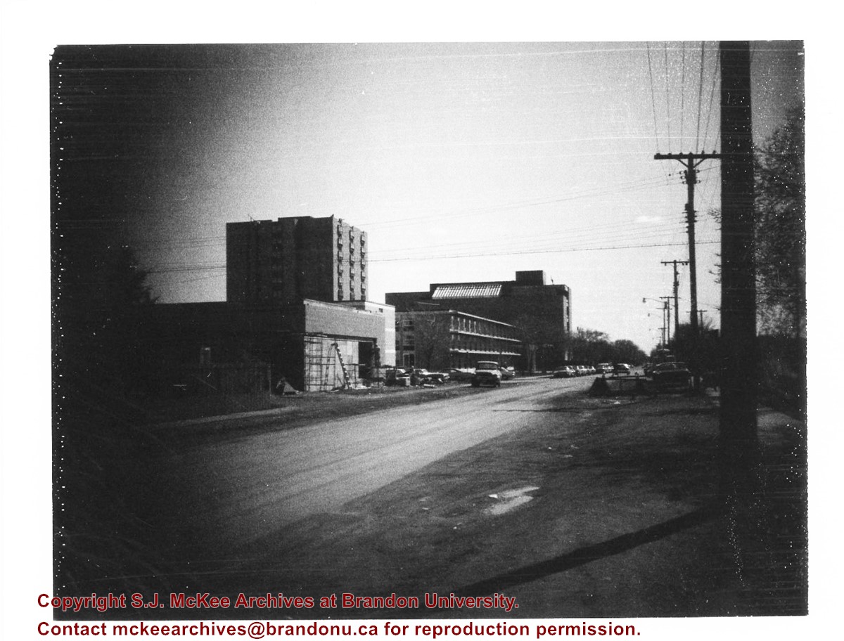
Donkersloot began working at Brandon University in 1970/1971 as the Clerk of Works. From 1973 until his retirement, he was the Director of Physical Plant.
The Site Services building was built in 1971.
Custodial History
Photograph was taken by Tom Donkersloot during construction and stored in albums in the Physical Plant H-Hut until they were transfered to the McKee Archives by Doug Duncalf in May 2008.
Scope and Content
Photograph shows construction of Brandon University's Site Services Building located on Louise Avenue at the corner of 20th Street. Also visible are McMaster Hall, Flora Cowan Women's Residence and the John R. Brodie Science Centre. Photograph is looking east/northeast from approximately 21st Street.
Notes
Donkersloot recorded the date and time each photograph was taken on the back of the photos.
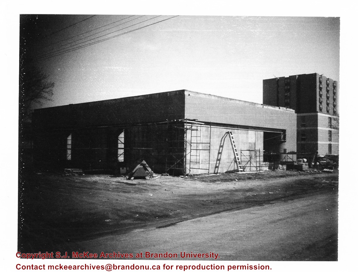
Donkersloot began working at Brandon University in 1970/1971 as the Clerk of Works. From 1973 until his retirement, he was the Director of Physical Plant.
The Site Services Building was built in 1971.
Custodial History
Photograph was taken by Tom Donkersloot during construction and stored in albums in the Physical Plant H-Hut until they were transfered to the McKee Archives by Doug Duncalf in May 2008.
Scope and Content
Photograph shows construction of Brandon University's Site Services Building located on Louise Avenue at the corner of 20th Street. Also visible are McMaster Hall and part of Darrach Hall. Photograph is looking northeast.
Notes
Donkersloot recorded the date and time each photograph was taken on the back of the photos.


