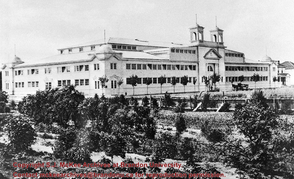
A series of thirteen blueprints was prepared for the proposed new lecture building and theatre. Blueprints four and eleven are missing from this collection. Those included provide a plot plan for the buildings within the general campus and individual schedules showing various features of the new buildings.
Storage Location
RG 6 Brandon University fonds
Series 2: Board of Governors
2.1 Documents
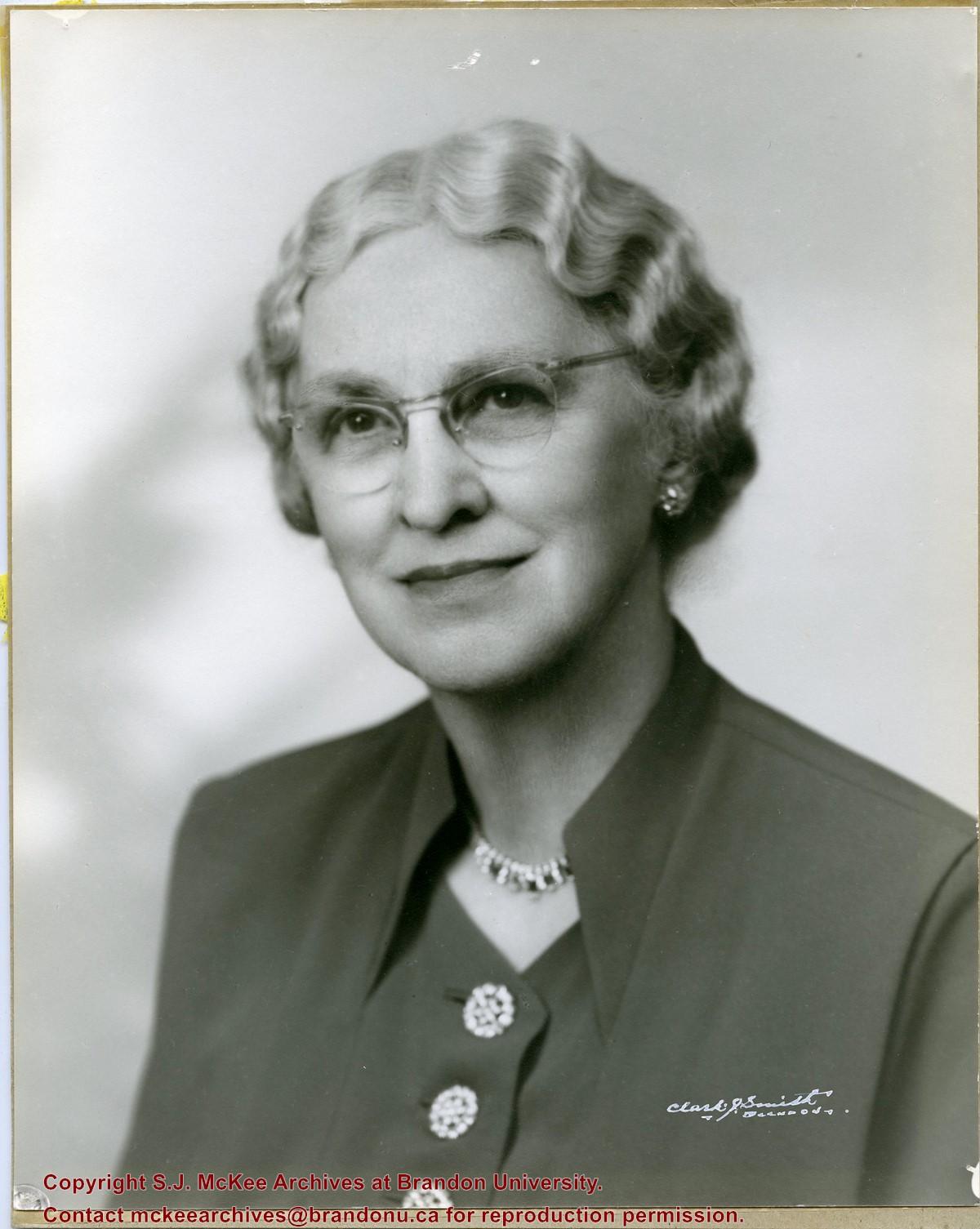
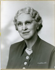
Photograph shows a portrait of an elderly woman with crimped hair and wearing classes. The woman has been identified as Elma Hughes, wife of Willard J. Hughes.
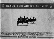
Published by Western News Agency Ltd., Winnipeg, (46 pp.)
Physical Description
9.25" x 6.75" (b/w)
Material Details
Small pamphlet containing photo essay
History / Biographical
Established as Sewell Camp in 1909, it was renamed after Major-General Sir Sam Hughes, Canada's Minister of Militia and Defence, in 1915. During World War I (1914–1918), more than 38,000 troops of the Canadian Expeditionary Force trained there. Many of the soldiers later distinguished themselves at the battle of Vimy Ridge, in April 1917.
Extensive trench systems, grenade and rifle ranges, and military structures were built in 1915 and 1916. A variety of retail stores on a double-avenued area close to the main camp formed a lively commercial midway. Camp Hughes was dismantled in the 1930s as part of an unemployment relief project.
The Camp Hughes Military Training Site, located at NE 34-10-16 W, 10 kms west of Carberry,
R.M. of North Cypress, was designated Manitoba Provincial Heritage Site No. 82 on April 18, 1994.
Custodial History
Donated by Earl Johnson, publisher of the Baldur Gazette, through the "good offices" of Fred McGuinness.
Scope and Content
Item is a small pamphlet containing 50 black & white photographs in a photo essay entitled: Ready for Active Service, Camp Hughes Manitoba.
Notes
McGuinness wrote about Camp Hughes and how he acquired the pamphlet in a Viewpoint column in the November 1, 2001 edition of the Brandon Sun. A copy of the article is with the pamphlet. History/Bio information taken from the Manitoba Government Exlpore Our Heritage Website at: http://www.gov.mb.ca/chc/hrb/prov/p082.html (December 14, 2009).
Photograph shows a southwest view of the Prince Edward Hotel and train station.
Notes
Part of "Souvenir of Brandon, Manitoba, Canada [viewbook], Printed by Photogelatine Engraving Co. Limited, Ottawa." Dates obtained from the Burchill's Music Store Henderson's Brandon City Directory listings (1927-1929). Writing on the front of the photograph reads: Prince Edward Hotel, Brandon, Man.
Red ink stain is on the front right corner of postcard
Scope and Content
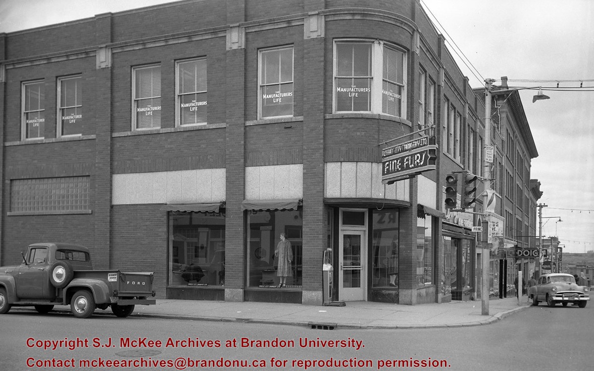
Photograph shows 10th Street facing south from Princess Avenue. Visible landmarks and businesses include: Manitoba Power Commission (MPC)'s power sub-station, First Baptist Church, Wheat City Arena, and the grand stand at the Exhibition Grounds.
The partial sign visible at the bottom of the photograph on the east side of 10th Street reads Yates and Neale, which refers to a plumbing and heating company that dissolved in 1943 to be replaced by Neale, Stothard and Chapman.
Businesses on the west side of 10th Street include: Dominion Tire & Radio Co., Bolts Barber Shop, Elviss T.E. Co. Stables.
Notes
Information concerning Yates and Neale courtesy Jack Stothard. Writing on the front of the postcard reads: Brandon, Looking S.W., Jerrett Photo. This photograph shows a rare view of the 200-block of 10th Street.
[Display Building II, the last surviving building of those constructed for the Dominion Fair held in Brandon in 1913, has been named one of the 10 most endangered historic buildings in the country by the Heritage Canada Foundation. P.E. 10/07/09.]
Custodial History
For custodial history see the collection level description of the Lawrence Stuckey collection.
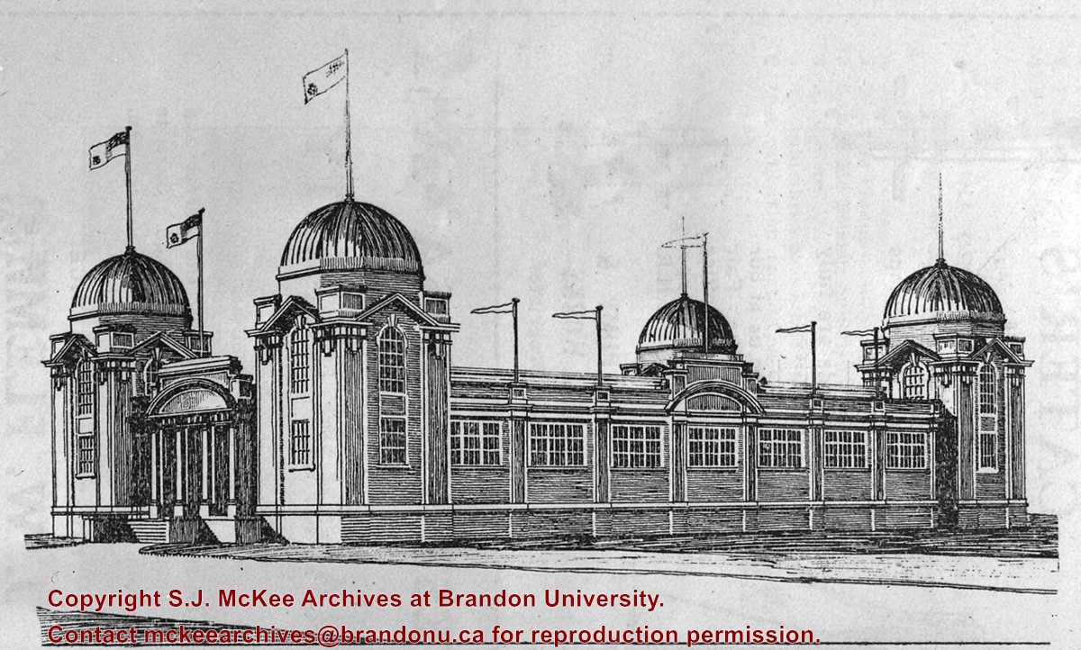
Scope and Content
Dominion Exhibition Display Building II at Brandon fairgrounds
Also known as the Mercantile Display Building
Notes
Architect's drawing
Built for the Dominion Fair of 1913 with some alterations from the proposed design shown.
Photograph shows the Brandon Wheat Market along Pacific Avenue on November 30, 1885. Farmers can be seen driving wagon teams loaded with bags of grain in line on Pacific Avenue from 10 Street to at least 7th Street. On the north side of Pacific Avenue the CPR Land Office and grain elevators are pictured. On the south side of Pacific Avenue, the general merchant/hardware store Bower, Blackburn, Mundell & Porter is situated on the corner of Pacific Avenue and 10th Street. A 10th Street sign is affixed to the merchants' store. On the east side of the general store, Edie House, the Grand View Hotel, and a Farmers' boarding and lodging house can be seen. Most of the buildings appear to be woodframed except for the Grand View, which is constructed of brick. Sidewalks appear to be in place on the south side of Pacific and snow dusts the streets. A baby swathed in winter clothing sits in a pram/baby carriage in front of the general store.
Notes
Writing on the front of the photograph reads: Novemeber 30th, 1885, Brandon Wheat Market
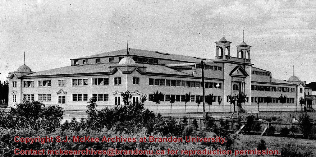
Built in 1908 (Barker p. 119); All but the northeast corner of the building was destroyed by fire on October 29, 1920, with the loss of many R.C.M.P. horses.
Custodial History
For custodial history see the collection level description of the Lawrence Stuckey collection.
Scope and Content
Winter Fair Building
Notes
View is from the southeast; Located on the 500 block of 10th Street
[Mr. Stuckey put two negatives in same envelope, numbering them M4 and M4a. We have separated them.]
This photo was taken by C.J. Smith for Bryant Studio. Bryant Studio (I believe) was opened in 1907 by Smith for Bryant. Smith later bought the studio when Bryant planned to close it. The same studio was subsequently purchased by L.A. Stuckey on January 1, 1958. LAS.
Custodial History
For custodial history see the collection level description of the Lawrence Stuckey collection.
Scope and Content
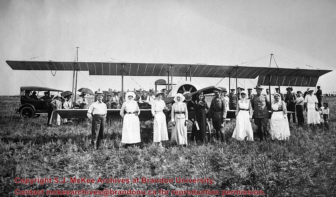
Photo of Katherine Stinson and her aircraft at Camp Hughes, including Army officers and nurses.
Notes
See Lawrence Stuckey file (Finding Aids) for biography of Katherine Stinson.
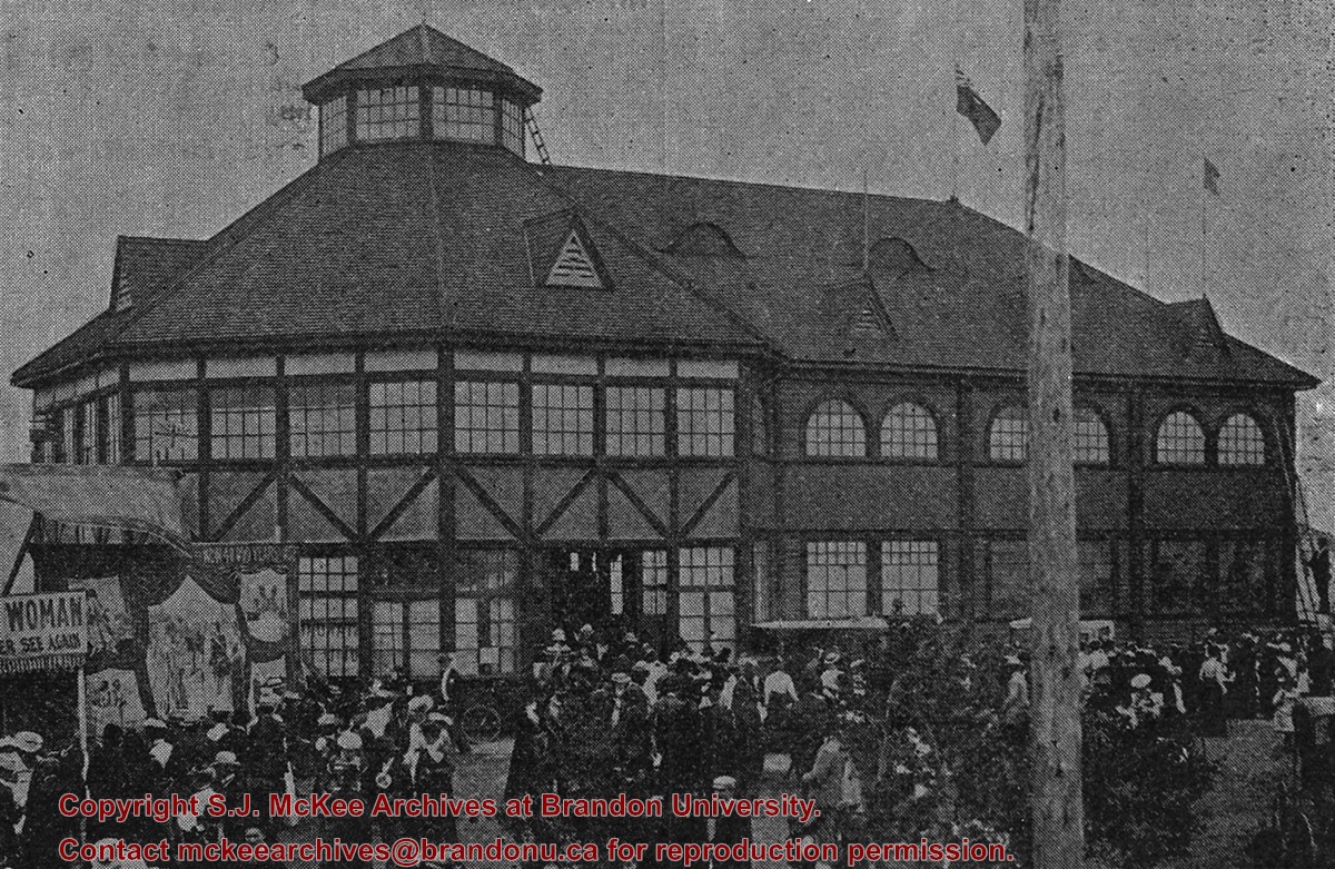
Opened 1903. Closed 1923. Building became the Oak Theatre ca. 1930. Reopened as Towne Cinema ca. 1980 after being closed for many years. The building has since been demolished.
Scope and Content
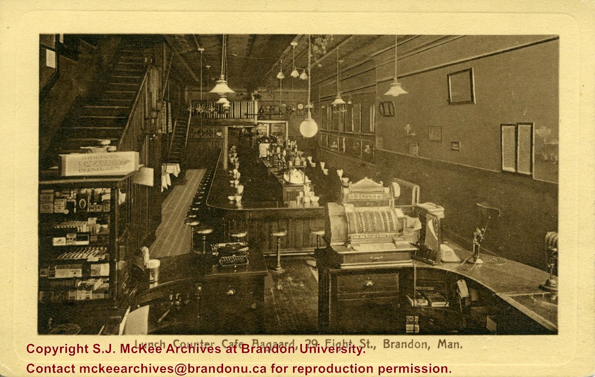
Postcard shows the interior of the lunch counter and cashier register at Cafe Aagaard located at 29-8th Street Brandon.
Notes
Writing on the front of the postcard reads: Lunch Counter Cafe Aagaard, 29 Eigth St., Brandon, Man. The back of the postcard reads: Cafe Aagaard, Largest, Oldest and Best in Brandon. The postcard is addressed to Mrs. K.L. McGregor, 157-4th St.


 and (2).jpg?width=1200&404=no-img.jpg&watermark=wmk)
 and (2).jpg?width=180&404=no-img.jpg)


+-+Rawlings+Hardware)
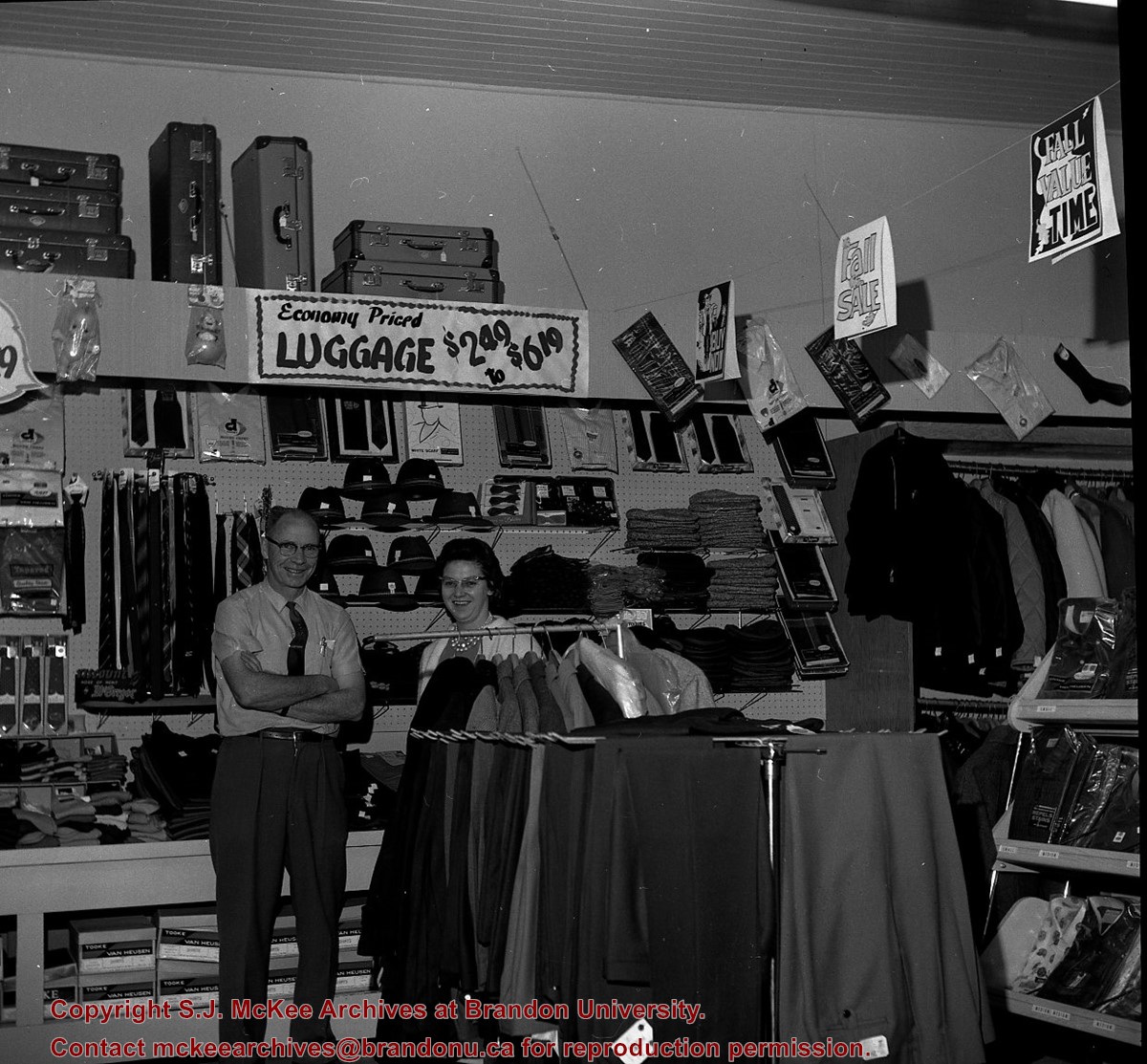
%2520and%2520(2).jpg%3fmaxheight%3d1000%26maxwidth%3d1000%26watermark%3dwmk&description=Brown%27s+Clothing+Store+(Virden))
)