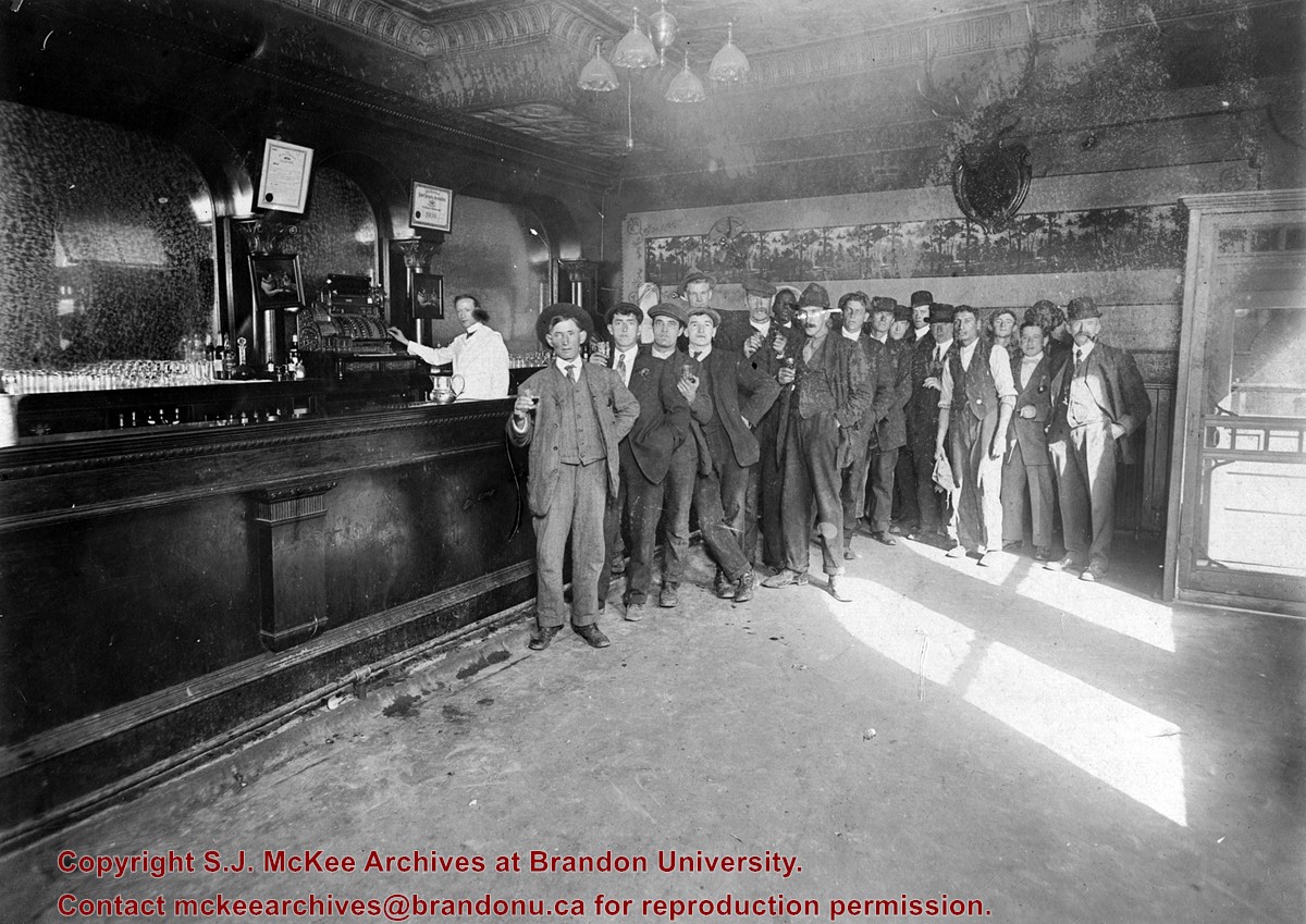
Photograph shows the interior of a bar with a group of 18 patrons and staff standing to the right of the counter. Two framed photographs of dogs playing poker hang above the bar. Date ascertained from certificate hanging above the cash register.
Notes
William Henderson is listed as the bartender for the Grand Union Hotel in the 1909 Henderson's Brandon City Directory.
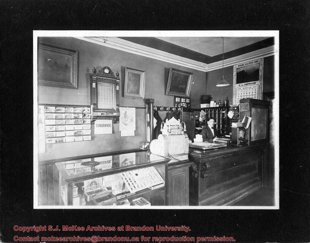
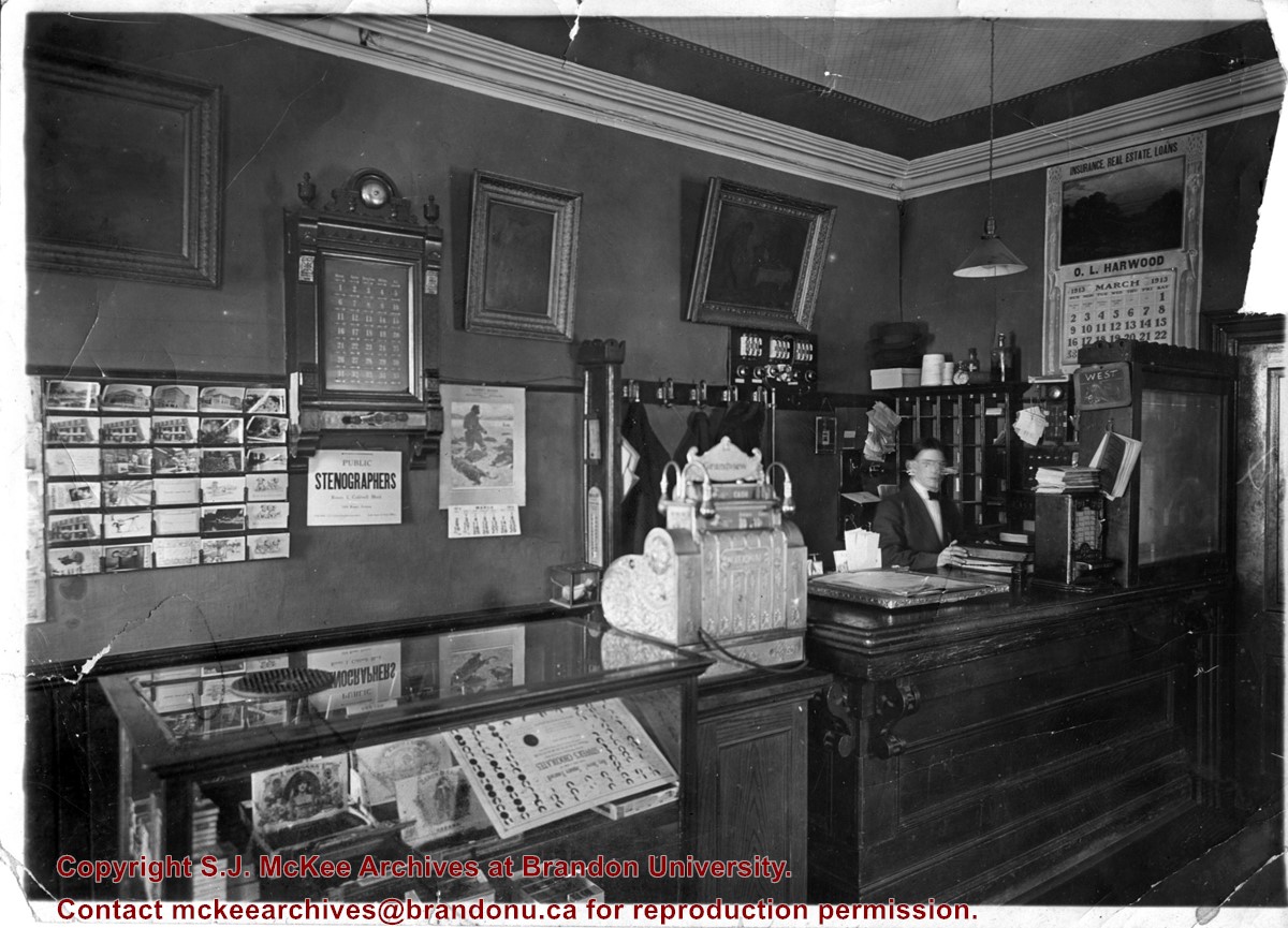
Photograph shows the possible interior of the Grandview Hotel. A young man is working behind the counter that holds a cash register and tobacco display case. A calendar for March 1913 advertises O.L. Harwood's Insurance, Real Estate, and Loans. Below the hotel's 35-room call box is an advertisement for the Public Stenographers Company. A postcard stand holds cards of Brandon's courthouse and other prominent buildings.
Photograph shows the possible interior of the Grandview Hotel. A young man is working behind the counter that holds a cash register and tobacco display case. A calendar for March 1913 advertises O.L. Harwood's Insurance, Real Estate, and Loans. Below the hotel's 35-room call box is an advertisement for the Public Stenographers Company. A postcard stand holds cards of Brandon's courthouse and other prominent buildings.
Notes
Date ascertained from calendar above counter. This photograph is a duplicate of 20-2009.23 but is in sharper focus. Grand View is written in pencil on the back of the photograph.
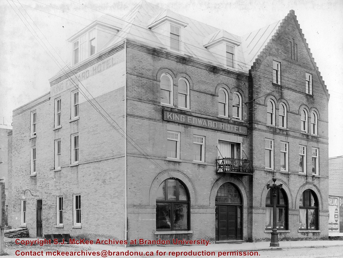
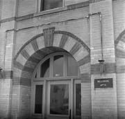
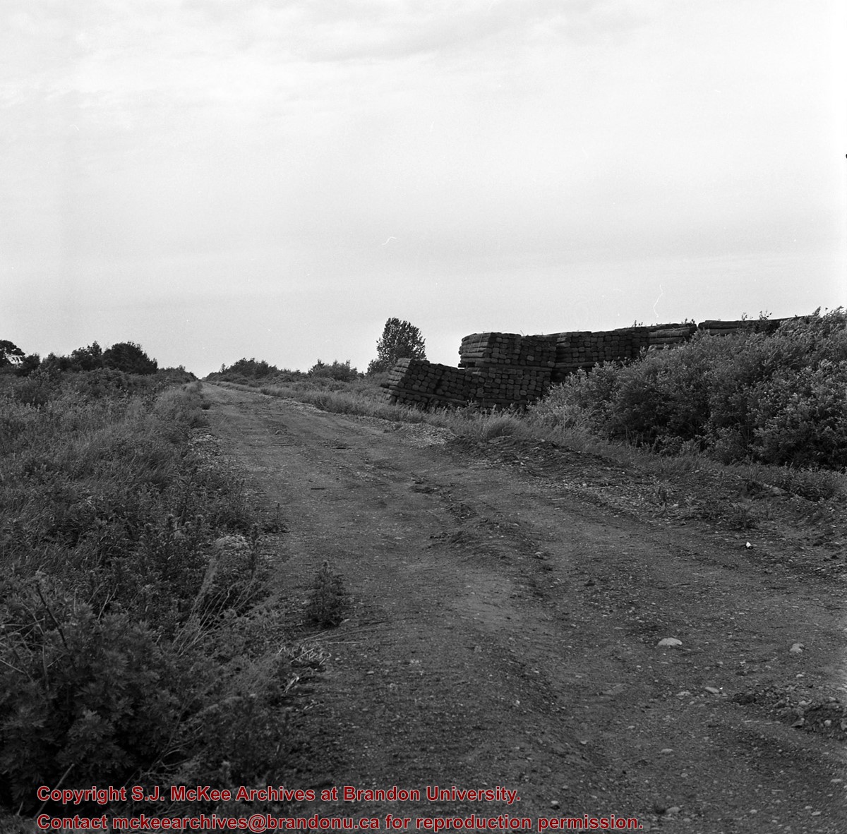
Building was built as the Reno Hotel in 1910, the city's best; was soon overshadowed by Canadian Northern Railway's Prince Edward Hotel in 1912; Became Belvidere Apts. 1918
This is the only building, apart from houses, completely faced with "Samson's" brick from Brandon Sand & Brick Co. (plant at 30th St. & Princess Ave - presently playground of Valleyview School) to survive into the 1980's. Ornamentation around door and windows is the only surviving example of their red dyed brick, known.
Custodial History
For custodial history see the collection level description of the Lawrence Stuckey collection.
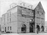
Scope and Content
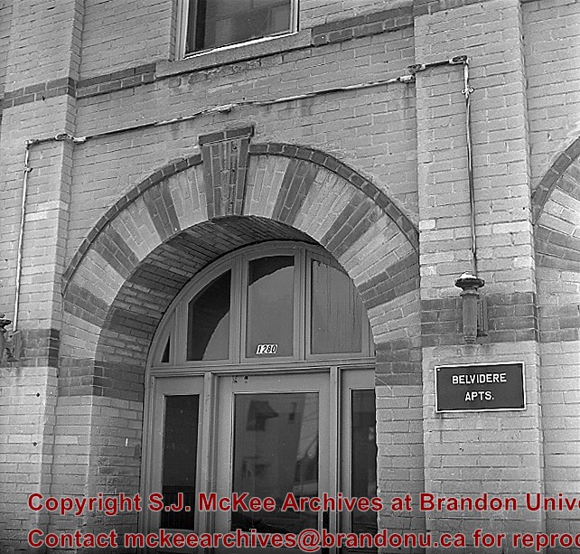
Front entrance of Belvidere Apartments (ex. Reno Hotel), 1280 Rosser Ave.
Notes
[Mr. Stuckey put two negatives (DC5 and DC5a) in same envelope, which we have separated, along with a print we numbered DC5(b).]
Building was built as the Reno Hotel in 1910, the city's best; was soon overshadowed by Canadian Northern Railway's Prince Edward Hotel in 1912; Became Belvidere Apts. 1918
This is the only building, apart from houses, completely faced with "Samson's" brick from Brandon Sand & Brick Co. (plant at 30th St. & Princess Ave - presently playground of Valleyview School) to survive into the 1980's. Ornamentation around door and windows is the only surviving example of their red dyed brick, known.
Custodial History
For custodial history see the collection level description of the Lawrence Stuckey collection.
Left hand corner of mat is bent. Mock-up instructions are written in pencil at the bottom right hand corner. Portions of the photograph itself are marked with pen.
History / Biographical
The Queen's Hotel was located on the corner of Rosser Avenue and Tenth Street (Steen & Boyce, 1882. Brandon, Manitoba, Canada and Her Industries. Steen & Boyce Publishers Printers & Binders, 81.). Therefore this photo appears to display Rosser Avenue looking east. P.E. 11/06/09
Scope and Content
Photograph shows early Rosser Avenue under construction between 9th Street and 10th Street in the 1880s. Buildings that line the avenue are wood framed and there are wooden boardwalks in front of a few structures. On the north side of Rosser Avenue signs for Fortier & Bucke Commision Agents and Transit House (Hotel) can be seen. On the south side of Rosser Avenue, the Queen's Hotel and Robinson Brothers and Company groceries and dry goods store are open for business. A family appears to be standing on the stoop at the dry goods store. A boy is lounging in the entryway of the Queen's Hotel. A man is standing on a wooden plank that extends across the dirt road of Rosser Avenue between the dry goods store and the commission agents' shop.
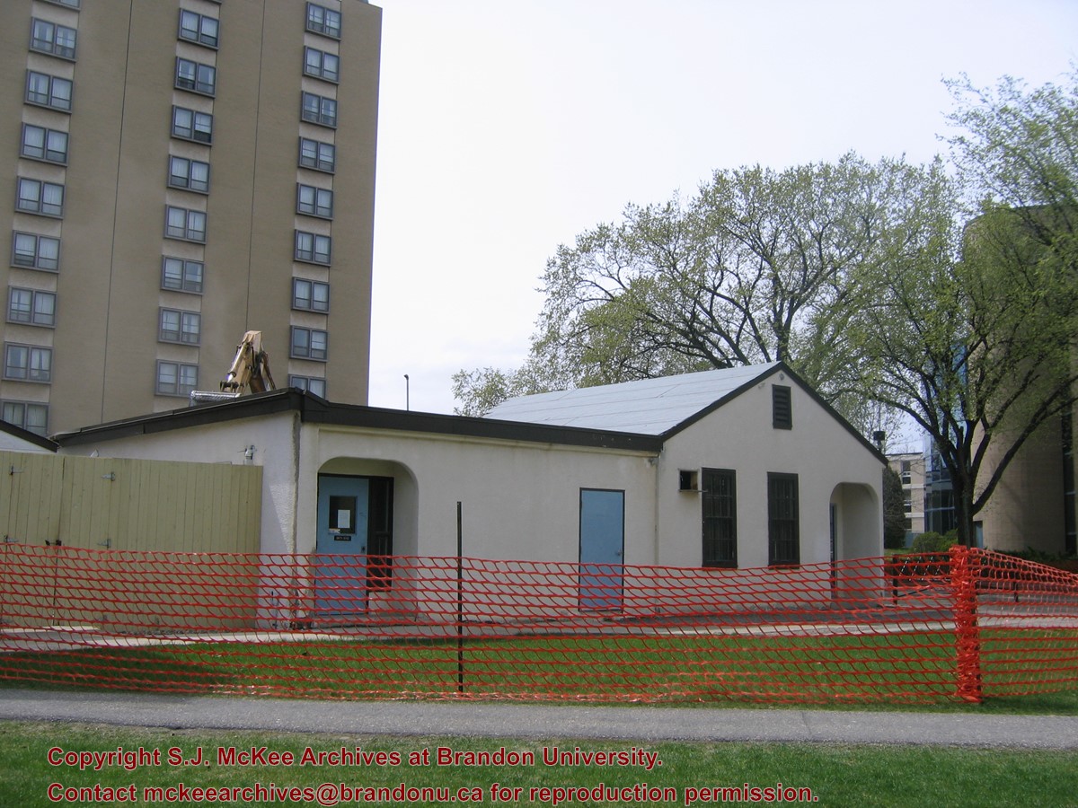
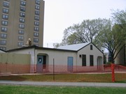
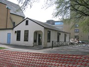
Located at the centre of the Brandon University campus, the Physical Plant H-Hut was destroyed following the opening of the new $3.9M, 13,600 square-foot physical plant on 07 April 2010.
Custodial History
Photograph was taken by McKee Archives project archivist Jill Sutherland.
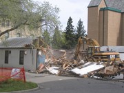
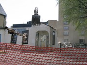
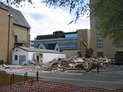
Scope and Content
Photograph shows the demolition of the Physical Plant H-Hut.
Located at the centre of the Brandon University campus, the Physical Plant H-Hut was destroyed following the opening of the new $3.9M, 13,600 square-foot physical plant on 07 April 2010.
Custodial History
Photograph was taken by McKee Archives project archivist Jill Sutherland.
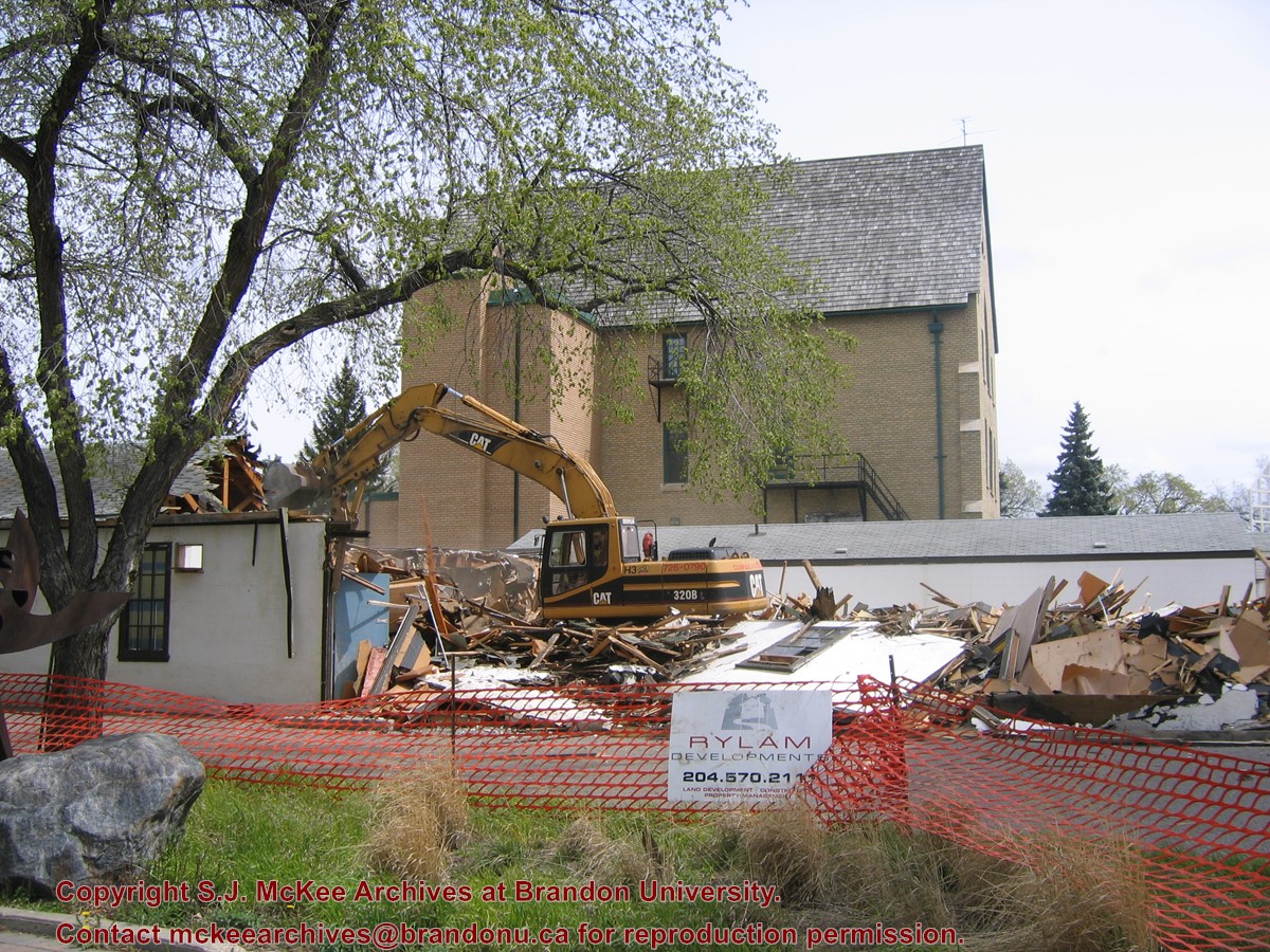
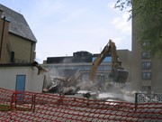
Scope and Content
Photograph shows the demolition of the Physical Plant H-Hut. A sign for Rylam Development is visible on the snow fence fencing off the demolition site.
Located at the centre of the Brandon University campus, the Physical Plant H-Hut was destroyed following the opening of the new $3.9M, 13,600 square-foot physical plant on 07 April 2010.
Custodial History
Photograph was taken by McKee Archives project archivist Jill Sutherland.
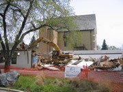
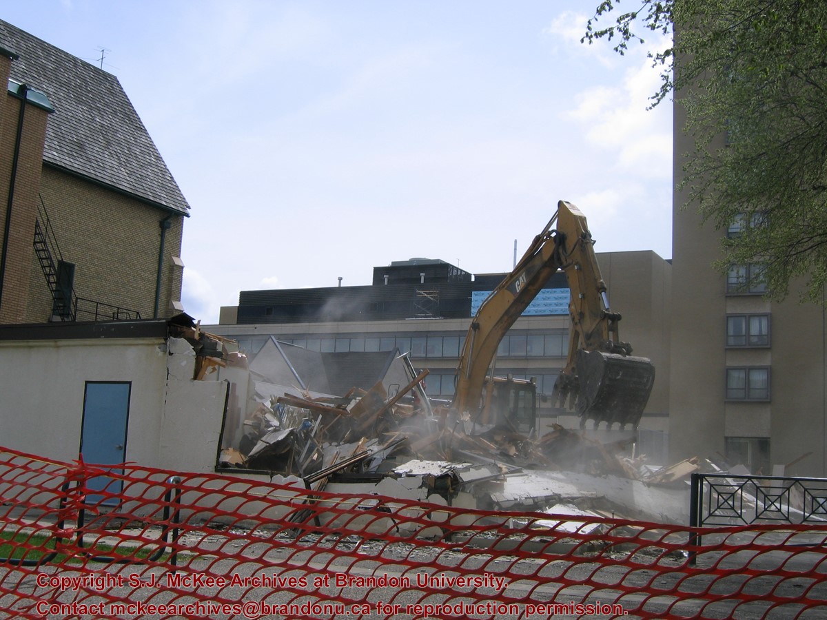
Scope and Content
Photograph shows the demolition of the Physical Plant H-Hut. The photograph is looking northeast from the steps of Harvest Hall. The Citizens' Science Centre (BUSU Building) is visible in the background.
Located at the centre of the Brandon University campus, the Physical Plant H-Hut was destroyed following the opening of the new $3.9M, 13,600 square-foot physical plant on 07 April 2010.
Custodial History
Photograph was taken by McKee Archives project archivist Jill Sutherland.
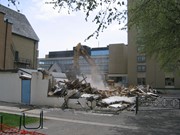
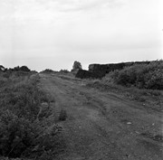
Scope and Content
Photograph shows the demolition of the Physical Plant H-Hut. The photograph is looking northeast.
Located at the centre of the Brandon University campus, the Physical Plant H-Hut was destroyed following the opening of the new $3.9M, 13,600 square-foot physical plant on 07 April 2010.
Custodial History
Photograph was taken by McKee Archives project archivist Jill Sutherland.
Scope and Content
Photograph shows the demolition of the Physical Plant H-Hut. The photograph is looking south/southeast.
Located at the centre of the Brandon University campus, the Physical Plant H-Hut was destroyed following the opening of the new $3.9M, 13,600 square-foot physical plant on 07 April 2010.
Custodial History
Photograph was taken by McKee Archives project archivist Jill Sutherland.
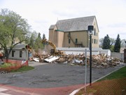
Scope and Content
Photograph shows the demolition of the Physical Plant H-Hut. The photograph is looking southeast. The John R. Brodie Science Centre, the Geology H-Hut, and portions of the Citizens' Science Building (BUSU Building), Knowles-Douglas expansion (KDC) and McMaster Hall are visible in the background.
Modern school geography and atlas : authorized by the councils of Public Instruction for the provinces of Ontario, Quebec, New Brunswick and Prince Edward Island

.jpg?width=1200&404=no-img.jpg&watermark=wmk)
.jpg?width=180&404=no-img.jpg)


.jpg%3fmaxheight%3d1000%26maxwidth%3d1000%26watermark%3dwmk&description=Belvidere+Apartments)