Brandon College looking south from 19th Street. Photograph was taken after Flora Cowan Hall was built but before construction of the Education Building.
Photograph was in possession of Mrs. Ruby Miles, who passed the image on to Fred McGuinness. McGuinness makes reference to Mrs. Miles and this photograph in his Sunbeams column (Source: F.A. Rosser, "Another interesting chat with a daughter of the plains," Brandon Sun 18 Aug 1981).
Scope and Content
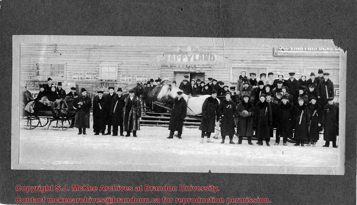
Photograph allegedly shows the Wheat City Business College graduating class standing outside a woodframed building in the winter. Affixed to the building are posters/advertisements that read: Happyland, Monday July 30 [1906?]. A banner spelling Happyland in large block letters hangs above the building's door that is numbered 209. Surrounding the banner are the red ensign/Dominion of Canada flags.
The students are wearing long wintercoats with fur collars, some are wearing fur hats. The men appear to have ribbons pinned to their lapels. On the left of the photograph, a group of three female students are sitting in a horse-drawn sleigh and have fur robes on their laps. On the right, a number of students are standing on a horse-drawn sled. Two individuals can be seen holding megaphones, another student is holding a basketball.
Notes
Writing on the back of the photograph reads: 1909, Tenth Street and Princess. Two yellow labels are affixed to the back of the photograph. one reads: graduating class, Wheat City Business College. The other reads Mrs. K.L. McGregor, 157-4th St.
View is southwest from approximatley 16th Street between Princess and Rosser Avenues. Photograph shows the Brandon University campus, as well as surrounding residential blocks, including Flemming, J.R. Reid and Vincent Massey schools.
View is west southwest from approximatley 16th Street between Princess and Lorne Avenues. Photograph shows the Brandon University campus, as well as surrounding residential blocks between 16th and 23rd Streets, Princess and Louise Avenues..
View is west from approximatley 17th Street between Lorne and Louise Avenues. Photograph shows a portion of the Brandon University campus (excluding the Education Building and anything north of it), as well as surrounding residential blocks from approximatley 17th Street to 22nd Street.
View is west northwest from approximatley 16th Street and Louise Avenue. Photograph shows the Brandon University campus, prior to the Library Extension, and a large portion of the city to the west of the campus.
View is northwest from approximatley 16th Street and Louise Avenue. Photograph shows the Brandon University campus, prior to the Library Extension, and a large portion of the city to the west of the campus.
Image shows the Brandon College campus from 17th Street looking southwest. The photo was taken after the completion of the original Music Building in 1963, but construction of the Education Building. Also visible are a number of properties on the 200 block of 18th Street and the 200 block of 20th Street.
Image is looking east northeast from approximately the 300 block of 23rd Street between Lorne and Louise Avenues. Photograph shows the Brandon College campus after the opening of the original Music Building in 1963, but before the construction of the Education Building in 1966. A number of house on the 300 blocks of 22nd and 21st Streets are visible in the foreground, with the A.E. McKenzie Seed Co., the Prince Edward Hotel and various grain elevators on the horizon.
The Royal Bank moved to this location on 26 October 1929. An existing building was renovated to accomodate the bank. On 28 May 1976 fire destroyed the buildings from the lane west to the Royal Bank.
Scope and Content
Photograph shows the south side of Rosser Avenue between 7th and 8th Streets, west of the Eaton's building. Visible shops include: Vogue [Ladies Wear], Smith's Drugs, Sobie's Tailored Undergarnments, Household Finance Loans, and The Royal Bank of Canada.
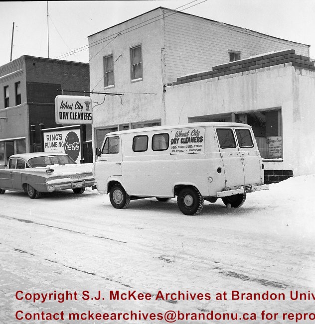
Photograph shows Western Motors Ltd. on the southwest corner of 10th Street and Princess Avenue. To the west of the car dealership/garage is the Greyhound Bus Station and its Maxwell House Cafe as well as the court house.
Photograph shows the west side of the 200-block on 10th Street. Visible businesses include: Chamber of Commerce Tourist Information, Dominion Tire & Radio Co., Bonnie's Bonnet Shop, Steve's Grill, Wally's Taxi, and Western Motors Ltd. The painted advertisement for Doig, Rankin and Robertson is visible on the Alexandra Block. Christmas ornaments are displayed from light standards and include Santa Claus and a Christmas elf.
Photograph shows the west side of the 200-block on 10th Street. Visible businesses include: Chamber of Commerce Tourist Information, Dominion Tire & Radio Co., Steve's Grill, Wally's Taxi, and the garage entrances to Western Motors Ltd. A Santa Claus Christmas ornament is displayed from a light standard.
View is northwest from Clark Hall. Photograph shows construction materials in the area between Clark Hall and the A.E. McKenzie Building during winter. The Western Manitoba Centennial Auditorium is visible in the upper right hand corner.
View is south southeast from the skywalk. Photograph shows the courtyard in winter full of vehicles, machines and building materials. Also visible are the Development and Physical Plant H-Huts, the Citizens' Science Building, the John R. Brodie Science Centre and McMaster Hall.
View is northwest from the roof of the Brandon College Building. Photograph was taken through wire fencing and shows construction on the roof of the Brandon College Building during winter. The original Clark Hall entrance to the roof is clearly visible. Portions of the A.E. McKenzie Building, Clark Hall and the Western Manitoba Centennial Auditorium are visible in the background.
Photograph was taken from the skywalk and shows students leaving the George T. Richardson Centre during winter. The courtyard contains construction materials. The Physical Plant H-Hut and McMaster Hall are partially visible in the background.
The photograph was taken for the Centennial of Brandon College/University.
Scope and Content
Aerial photograph taken looking southwest from approximately the northeast corner of Princess Avenue and 17th Street. The entire campus, as well as a number of residential streets are visible.


