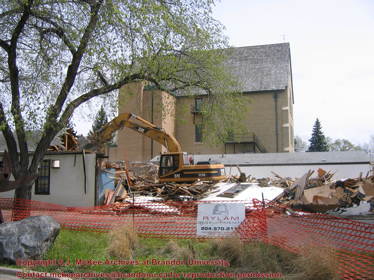
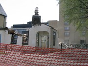
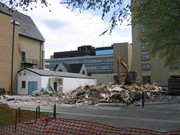
Located at the centre of the Brandon University campus, the Physical Plant H-Hut was destroyed following the opening of the new $3.9M, 13,600 square-foot physical plant on 07 April 2010.
Custodial History
Photograph was taken by McKee Archives project archivist Jill Sutherland.
Scope and Content
Photograph shows the demolition of the Physical Plant H-Hut. A sign for Rylam Development is visible on the snow fence fencing off the demolition site.
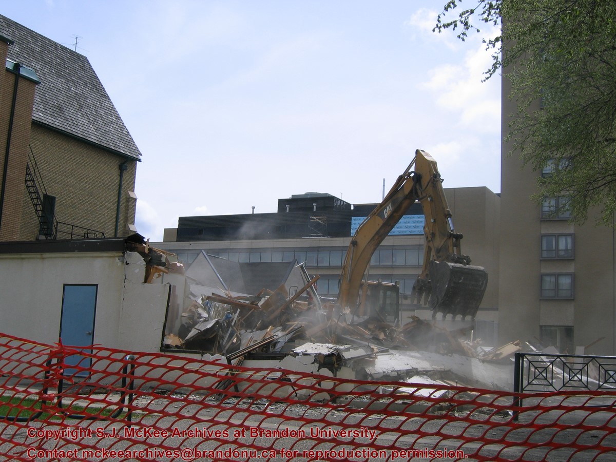
Located at the centre of the Brandon University campus, the Physical Plant H-Hut was destroyed following the opening of the new $3.9M, 13,600 square-foot physical plant on 07 April 2010.
Custodial History
Photograph was taken by McKee Archives project archivist Jill Sutherland.
Scope and Content
Photograph shows the demolition of the Physical Plant H-Hut. The photograph is looking northeast from the steps of Harvest Hall. The Citizens' Science Centre (BUSU Building) is visible in the background.
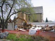
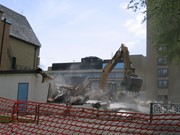
Located at the centre of the Brandon University campus, the Physical Plant H-Hut was destroyed following the opening of the new $3.9M, 13,600 square-foot physical plant on 07 April 2010.
Custodial History
Photograph was taken by McKee Archives project archivist Jill Sutherland.
Scope and Content
Photograph shows the demolition of the Physical Plant H-Hut. The photograph is looking northeast.
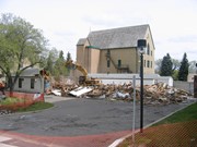
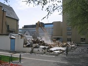
Located at the centre of the Brandon University campus, the Physical Plant H-Hut was destroyed following the opening of the new $3.9M, 13,600 square-foot physical plant on 07 April 2010.
Custodial History
Photograph was taken by McKee Archives project archivist Jill Sutherland.
Scope and Content
Photograph shows the demolition of the Physical Plant H-Hut. The photograph is looking south/southeast.
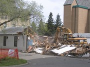
Located at the centre of the Brandon University campus, the Physical Plant H-Hut was destroyed following the opening of the new $3.9M, 13,600 square-foot physical plant on 07 April 2010.
Custodial History
Photograph was taken by McKee Archives project archivist Jill Sutherland.
Scope and Content
Photograph shows the demolition of the Physical Plant H-Hut. The photograph is looking southeast. The John R. Brodie Science Centre, the Geology H-Hut, and portions of the Citizens' Science Building (BUSU Building), Knowles-Douglas expansion (KDC) and McMaster Hall are visible in the background.
The McKee Archives is the copyright holder for the Stuckey materials.
Storage Location
Lawrence Stuckey collection
Arrangement
[Mr. Stuckey put two negatives in one envelope and taped the prints to the outside of the envelope. We have separated them and numbered the negatives CA16(1) and CA16(2) and the prints CA16(1a) and CA16(2a).]
After demise of the streetcars, a transit system was started by MacArthur Transportation Co. with three routes, an east end loop, a south end loop, and a west end loop, with terminal at 8th St. & Rosser Ave. The E & W was operated as a continuous route with two locally built coach bodies on new Maple Leaf trucks. A secondhand, larger, Leland coach was acquired for the S. end, which was replaced by a large GMC about 1938.
Custodial History
For custodial history see the collection level description of the Lawrence Stuckey collection.
For custodial history see the collection level description of the Lawrence Stuckey collection.
Scope and Content
[View of Prince Edward Hotel under construction.]
Notes
[Mr. Stuckey put six negatives (3 combined negatives) in one envelope. We have separated them and numbered them DC6f(1) through DC6f(6). From a combined negative.]
For custodial history see the collection level description of the Lawrence Stuckey collection.
Scope and Content
West side of Sixth Street, north of Rosser Avenue; looking north
Notes
Businesses displayed (S to N) include: Winter & O'Neill - general store; James A. Smart - hardware; Grand Central Hotel - built 1882, razed 1890; American House - hotel; Brandon House (far end) - hotel


.jpg?width=1200&404=no-img.jpg&watermark=wmk)
.jpg?width=180&404=no-img.jpg)
.jpg?width=1200&404=no-img.jpg&watermark=wmk)
.jpg?width=180&404=no-img.jpg)
.jpg?width=1200&404=no-img.jpg&watermark=wmk)
.jpg?width=180&404=no-img.jpg)
.jpg?width=1200&404=no-img.jpg&watermark=wmk)
.jpg?width=180&404=no-img.jpg)


.jpg?width=1200&404=no-img.jpg&watermark=wmk)
.jpg?width=180&404=no-img.jpg)
.jpg?width=1200&404=no-img.jpg&watermark=wmk)
.jpg?width=180&404=no-img.jpg)
.jpg?width=1200&404=no-img.jpg&watermark=wmk)
.jpg?width=180&404=no-img.jpg)
.jpg?width=1200&404=no-img.jpg&watermark=wmk)
.jpg?width=180&404=no-img.jpg)


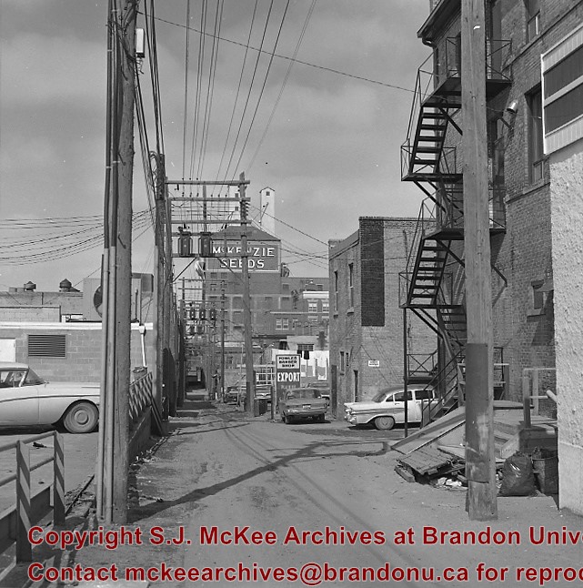
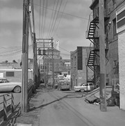
.jpg%3fmaxheight%3d1000%26maxwidth%3d1000%26watermark%3dwmk&description=Back+lane+between+Eighth+Street+and+Ninth+Street)
.jpg%3fmaxheight%3d1000%26maxwidth%3d1000%26watermark%3dwmk&description=Back+lane+between+Eighth+Street+and+Ninth+Street)
.jpg%3fmaxheight%3d1000%26maxwidth%3d1000%26watermark%3dwmk&description=Back+lane+between+Eighth+Street+and+Ninth+Street)
.jpg%3fmaxheight%3d1000%26maxwidth%3d1000%26watermark%3dwmk&description=Back+lane+between+Eighth+Street+and+Ninth+Street)
.jpg%3fmaxheight%3d1000%26maxwidth%3d1000%26watermark%3dwmk&description=Prince+Edward+Hotel+Construction)
.jpg%3fmaxheight%3d1000%26maxwidth%3d1000%26watermark%3dwmk&description=200+block+of+Tenth+Street)
.jpg%3fmaxheight%3d1000%26maxwidth%3d1000%26watermark%3dwmk&description=200+block+of+Tenth+Street)
.jpg%3fmaxheight%3d1000%26maxwidth%3d1000%26watermark%3dwmk&description=100+block+of+Tenth+Street)