These blocks of ice were used to fill the ice houses of the Wheat City Ice Co. (located north of Rosser Avenue on the west side of 15th Street, and south of Princess Avenue on the east side of 17th Street), the CPR icehouses (at the station and 3rd St. & Assiniboine Ave), and the CNR icehouse (at Forth Street and McTavish Avenue). In addition, large quantities of ice were shipped to smaller towns in railcars (usually old refrigerator cars).
Custodial History
For custodial history see the collection level description of the Lawrence Stuckey collection.
Scope and Content
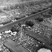
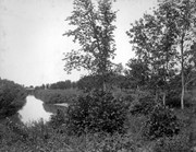
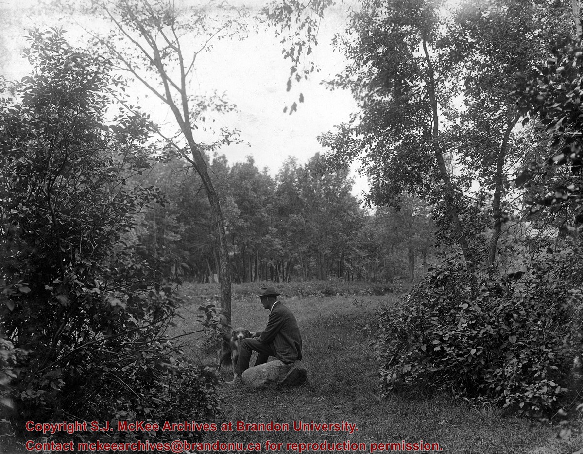
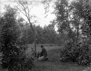
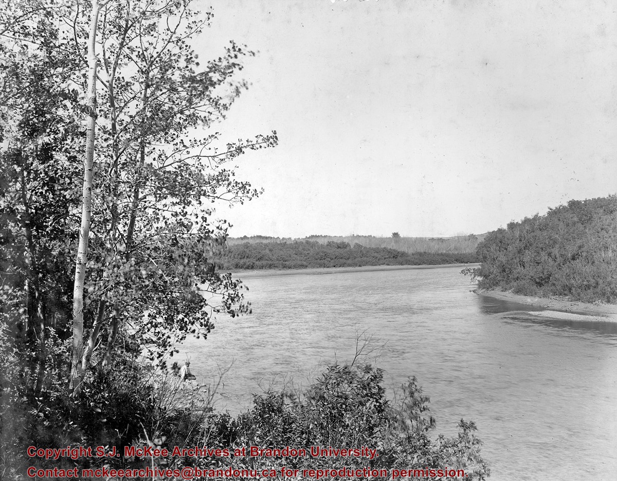
Cutting ice from the Assiniboine River
Notes
This is one of five images that show the method in which ice is cut into blocks and loaded onto sleighs or trucks. Note the large draft horses still in use at this date.
[Mr. Stuckey put five negatives into the same envelope. We have separated them and numbered them H12(1) to H12(5).]
Additional information provided by the Fred McGuinness collection (20-2009).
These blocks of ice were used to fill the ice houses of the Wheat City Ice Co. (located north of Rosser Avenue on the west side of 15th Street, and south of Princess Avenue on the east side of 17th Street), the CPR icehouses (at the station and 3rd St. & Assiniboine Ave), and the CNR icehouse (at Forth Street and McTavish Avenue). In addition, large quantities of ice were shipped to smaller towns in railcars (usually old refrigerator cars).
Custodial History
For custodial history see the collection level description of the Lawrence Stuckey collection.
Scope and Content
Cutting ice from the Assiniboine River
Notes
This is one of five images that show the method in which ice is cut into blocks and loaded onto sleighs or trucks. Note the large draft horses still in use at this date.
[Mr. Stuckey put five negatives into the same envelope. We have separated them and numbered them H12(1) to H12(5).]
Additional information provided by the Fred McGuinness collection (20-2009).
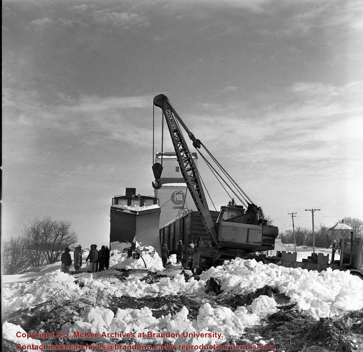
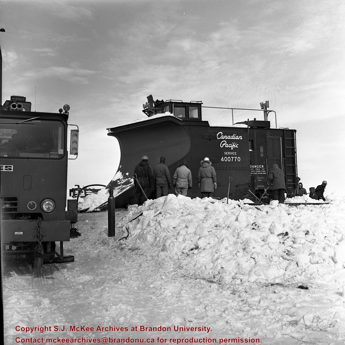
Photographs have been glued to a backing board that has warped over time
History / Biographical
Photograph of possible Dakota from Sioux Valley in Brandon for the summer fair.
Scope and Content
Photograph shows street view of north side of Rosser Avenue, primarily the 700 block. Businesses visible in the Fleming Block include: Lowes Brothers Clothing, Robert Hall [Insurance Broker], Manitoba Farmers Hedge and Wire Fence Company. Businesses visible in the Beaubier Block include the Empire Hotel. Businesses east of the Empire Hotel are grocer A.M. Percival and the Brandon Hardware Company. A number of Aboriginal peoples are driving horse and carriages west along Rosser Avenue as spectators look on.
Notes
Writing on the front of the photograph matting reads: 295 July 1906. One photograph (20-2009.11) is glued above and two others are glued on the reverse side. Page appears to be from a photo album.
Photographs have been glued to a backing board that has warped over time
History / Biographical
Photograph of possible Dakota from Sioux Valley in Brandon for the summer fair.
Scope and Content
Photograph shows street view of north side of Rosser Avenue, primarily the 700 block. Businesses visible in the Fleming Block include: Lowes Brothers Clothing, Robert Hall [Insurance Broker], Manitoba Farmers Hedge and Wire Fence Company. Businesses visible in the Beaubier Block include the Empire Hotel. Businesses east of the Empire Hotel are grocer A.M. Percival and the Brandon Hardware Company. A number of Aboriginal peoples are driving horse and buggies west along Rosser Avenue as spectators look on.
Notes
Writing on the front of the photograph matting reads: 294 July 1906. One photograph (20-2009.10) is glued below and two others are glued on the reverse side. Page appears to be from a photo album.

.jpg?width=1200&404=no-img.jpg&watermark=wmk)
.jpg?width=180&404=no-img.jpg)
.jpg?width=1200&404=no-img.jpg&watermark=wmk)
.jpg?width=180&404=no-img.jpg)
.jpg?width=1200&404=no-img.jpg&watermark=wmk)
.jpg?width=180&404=no-img.jpg)
.jpg?width=1200&404=no-img.jpg&watermark=wmk)
.jpg?width=180&404=no-img.jpg)
.jpg?width=1200&404=no-img.jpg&watermark=wmk)
.jpg?width=180&404=no-img.jpg)


.jpg%3fmaxheight%3d1000%26maxwidth%3d1000%26watermark%3dwmk&description=Cutting+Ice+from+the+Assiniboine+River)
.jpg%3fmaxheight%3d1000%26maxwidth%3d1000%26watermark%3dwmk&description=Cutting+Ice+from+the+Assiniboine+River)
.jpg%3fmaxheight%3d1000%26maxwidth%3d1000%26watermark%3dwmk&description=Cutting+Ice+from+the+Assiniboine+River)
.jpg%3fmaxheight%3d1000%26maxwidth%3d1000%26watermark%3dwmk&description=Cutting+Ice+from+the+Assiniboine+River)
.jpg%3fmaxheight%3d1000%26maxwidth%3d1000%26watermark%3dwmk&description=Cutting+Ice+from+the+Assiniboine+River)
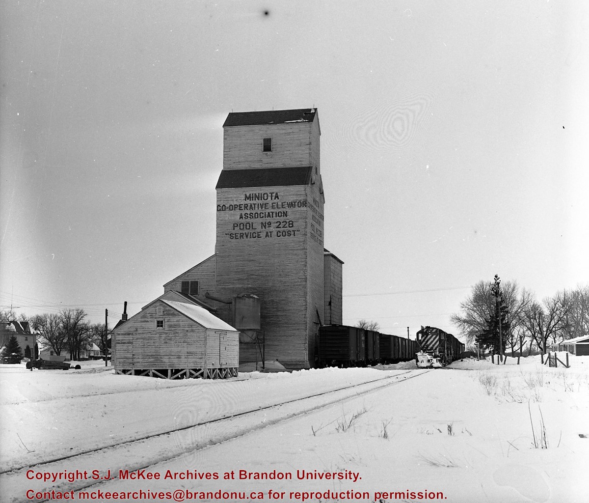
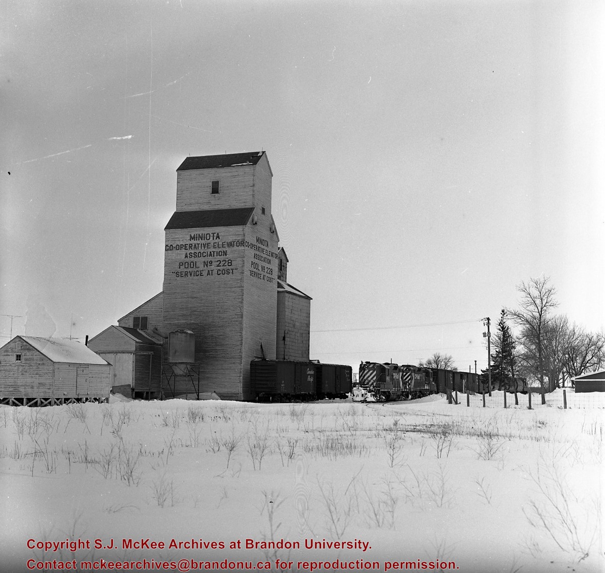
+-+Miniota%2c+Manitoba)
+-+Miniota%2c+Manitoba)
+-+Miniota%2c+Manitoba)