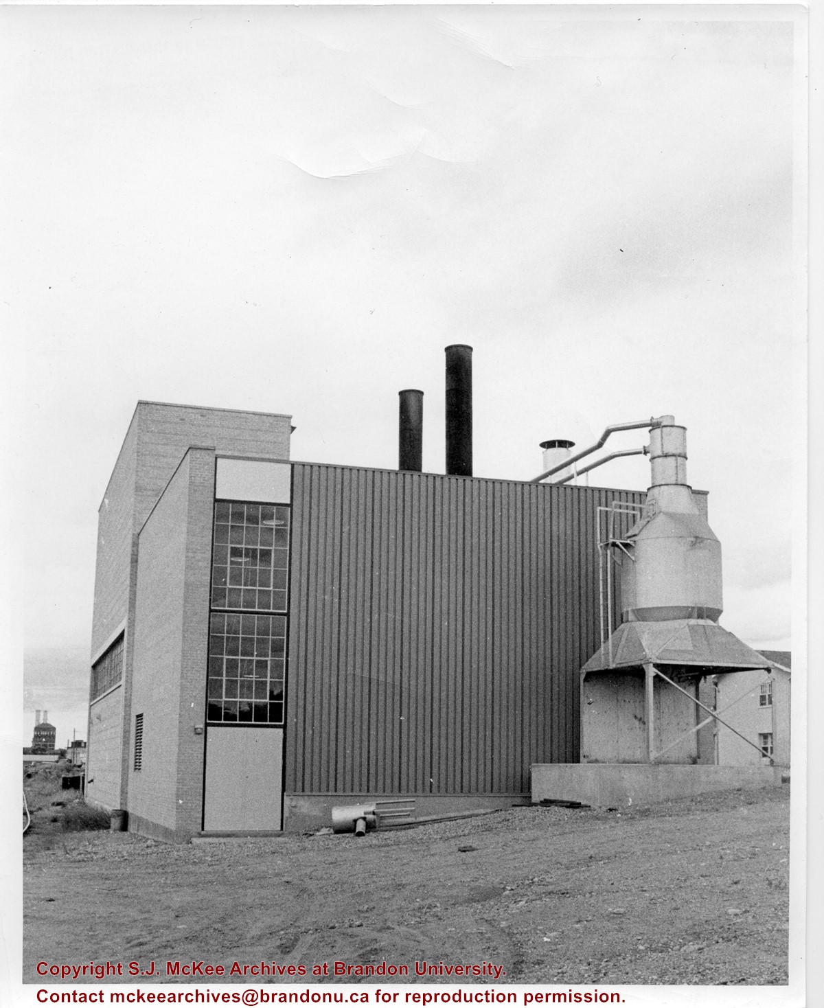
The 1960s campus expansion necessitated a large, updated heat source so a central steam plant fueled by coal was built north of the campus adjacent to the CPR rail lines on Pacific Avenue. A 25-year agreement was made between the University and John R. Brodie of the Great West Coal Company, which guaranteed BU lower coal prices tendered by the Canadian National and Canadian Pacific Railways on an annual basis. Brandon College Engineer John Kasiurak officially opened the Heating Plant on 24 January 1962. An extension and/or upgrade of the steam plant appears to have occurred in 1970.
Until the 1990s, heat was piped underground to the campus from the Pacific Avenue Heating Plant but inspection standards were outpacing the maintenance and repairs required to keep the plant operating smoothly. Consequently, a new steam plant was built immediately adjacent to the University to the west of Darrach Hall on 20th Street. This building was essential to handling additional loads from the proposed library expansion. The original steam plant was subsequently sold.
Scope and Content
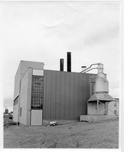
Photograph is looking east and shows the exterior of Brandon University's steam generating plant located at 20th Street and Pacific Avenue beside the railroad tracks. McKenzie Seeds is visible in the background.
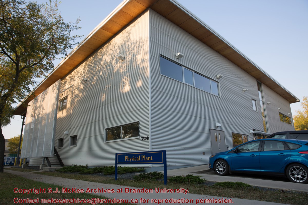
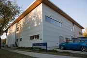
A $3.9M, 13,600 square-foot physical plant was opened on 07 April 2010. Located south of the steam plant on 20th Street by Darrach Hall, the building replaced the old Physical Plant occupying the World War II H-Huts. The new building serves as the hub for many campus operations, providing services from security and technical support, to building maintenance, deliveries, grounds keeping, cleaning, and capital project management.
Custodial History
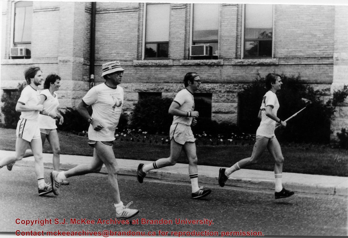
Photograph is part of a series of campus images commissioned by the McKee Archives and Communications in the lead up to Brandon University's 50th Anniversary celebration.
Scope and Content
Photograph shows the new Physical Plant building located on the west side of 20th Street, just north of Louise Avenue. The photograph is looking southwest and shows the exterior of the building, as well as part of the parking lot.
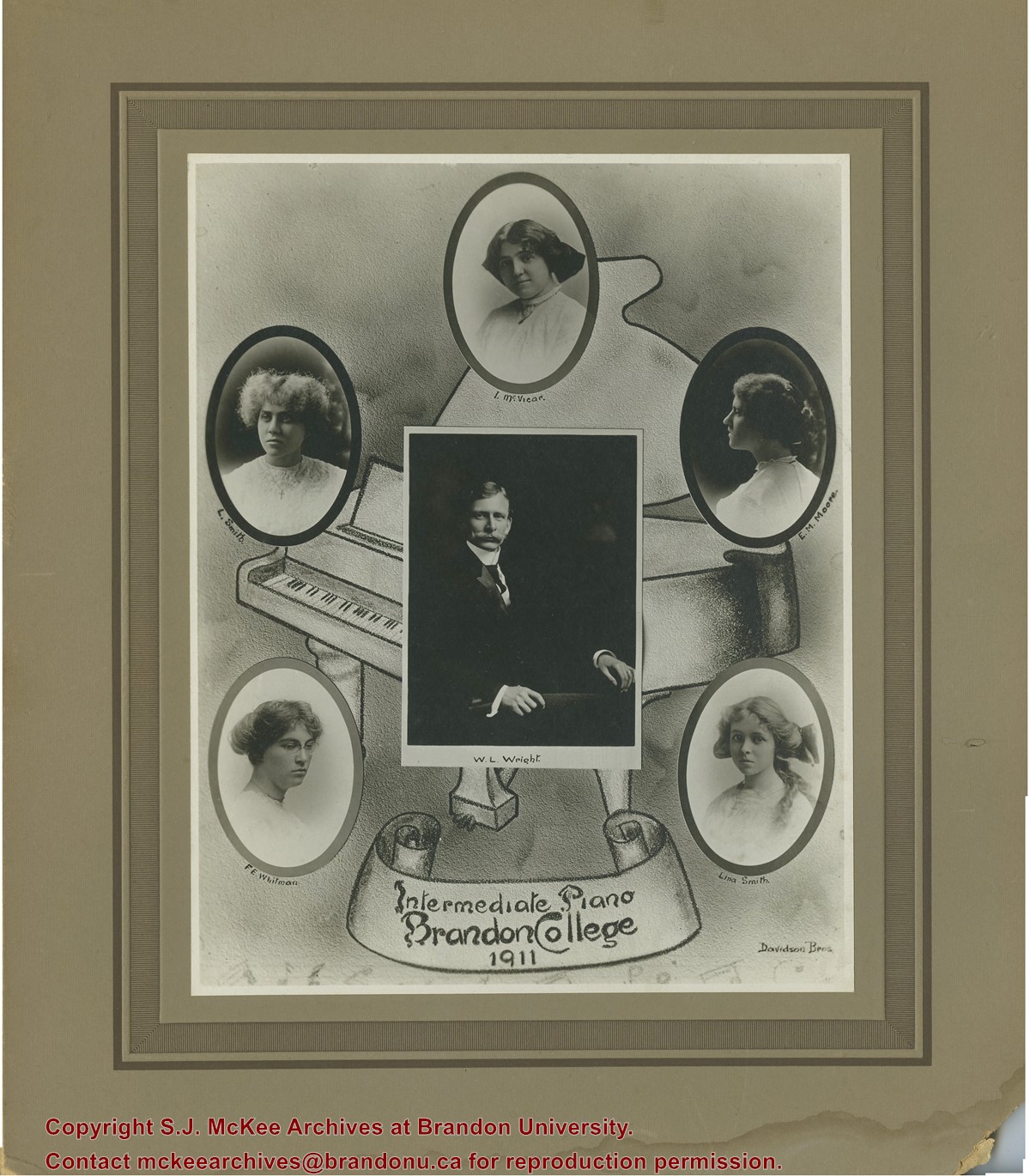
Donated by John G. Townsend of Seal Rock, Oregon (husband of the late I. McVicar) in December 1963.
Scope and Content
Item consists of portraits of members of Brandon College's Intermediate Piano class, 1911, with a photograph of W.L. Wright (Instructor) in the middle. Students include: L. Smith; I. McVicar; E.M. Moore; F.E. Whitman; and Lina Smith.
Photograph shows the removal of one of the houses formerly located on 20th Street between Louise and Princess Avenues. The houses on those blocks were removed to create parking lots for the University. A Fed Zavislak Ltd. Well Drilling & Trucking pickup truck is visible at the curb.
Photograph shows the removal of one of the houses formerly located on 20th Street between Louise and Princess Avenues. The houses on those blocks were removed to create parking lots for the University.
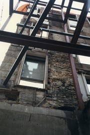
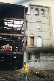
View is northeast from the Brandon College Building. Photograph shows the inside of the Brandon College Building after it had been gutted and then partially rebuilt. The exterior fascade of the west side of the building can be clearly seen in this photograph. A number of houses on the east side of 200 block of 18th Street are also visible, as is the stone fence on Princess Avenue and the flag pole on the front lawn.
Brandon College looking south from 19th Street. Photograph was taken after Flora Cowan Hall was built but before construction of the Education Building.
Image shows the Brandon College campus from 17th Street looking southwest. The photo was taken after the completion of the original Music Building in 1963, but construction of the Education Building. Also visible are a number of properties on the 200 block of 18th Street and the 200 block of 20th Street.
View is southwest from approximatley 16th Street between Princess and Rosser Avenues. Photograph shows the Brandon University campus, as well as surrounding residential blocks, including Flemming, J.R. Reid and Vincent Massey schools.
View is west southwest from approximatley 16th Street between Princess and Lorne Avenues. Photograph shows the Brandon University campus, as well as surrounding residential blocks between 16th and 23rd Streets, Princess and Louise Avenues..
View is west from approximatley 17th Street between Lorne and Louise Avenues. Photograph shows a portion of the Brandon University campus (excluding the Education Building and anything north of it), as well as surrounding residential blocks from approximatley 17th Street to 22nd Street.
View is west northwest from approximatley 16th Street and Louise Avenue. Photograph shows the Brandon University campus, prior to the Library Extension, and a large portion of the city to the west of the campus.
View is northwest from approximatley 16th Street and Louise Avenue. Photograph shows the Brandon University campus, prior to the Library Extension, and a large portion of the city to the west of the campus.


