Image is looking east northeast from approximately the 300 block of 23rd Street between Lorne and Louise Avenues. Photograph shows the Brandon College campus after the opening of the original Music Building in 1963, but before the construction of the Education Building in 1966. A number of house on the 300 blocks of 22nd and 21st Streets are visible in the foreground, with the A.E. McKenzie Seed Co., the Prince Edward Hotel and various grain elevators on the horizon.
View is north, taken from approximatley 19th Street and Rosser Avenue. Photograph shows: Clark Hall, the A.E. McKenzie Building, the J.R.C. Evans Lecture Theatre, H-Huts, Darrach Hall and Flora Cowan Hall, as well as a number of homes in the area.
Some damage to matting, especially on the back. Photograph is good. There are two brads in the matting (one on the left edge, one on the right edge). The brads are connected to a (broken) red ribbon likely used to hang the photograph.
Custodial History
Kay Sullivan gave the photograph to Fred McGuinness in August 2007.
Scope and Content
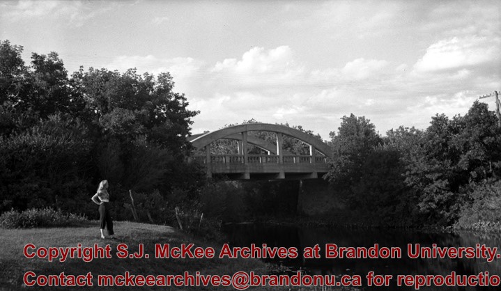
Photograph was taken from the riverbank and shows the steel bridge in Souris, MB. A second wooden bridge is visible behind the steel bridge. The residence of Dr. W.A. Sherrin can be seen to the right of the bridges.
Notes
Dr. Sherrin's residence was identified using the Illustrated Souvenir of Souris, Manitoba (p. 38).
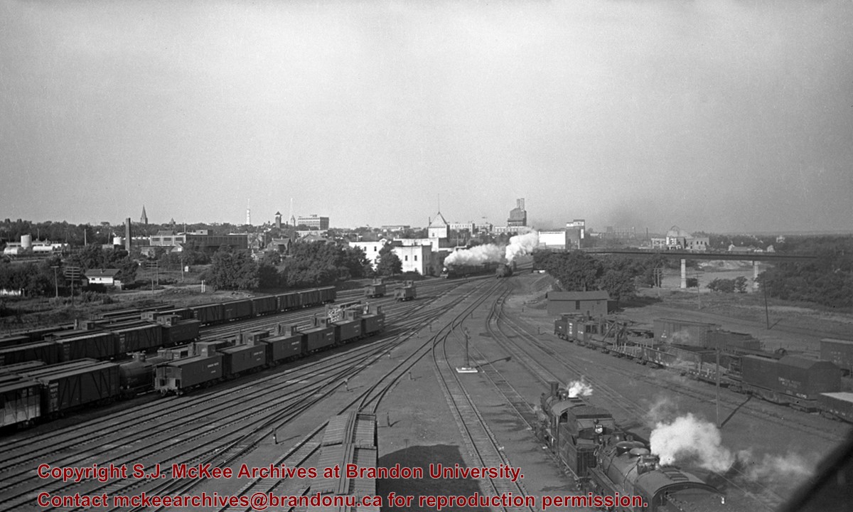
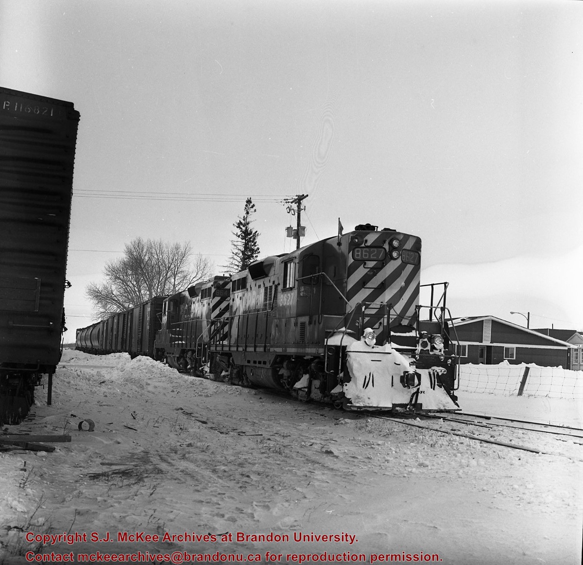
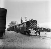
Stuckey's notes: No. 54 Moose Jaw - Winnipeg Local is leaving (just E. of 1st St. Bridge). Original negative. Collection of George H. Harris, Winnipeg, Man
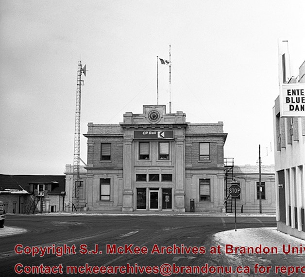
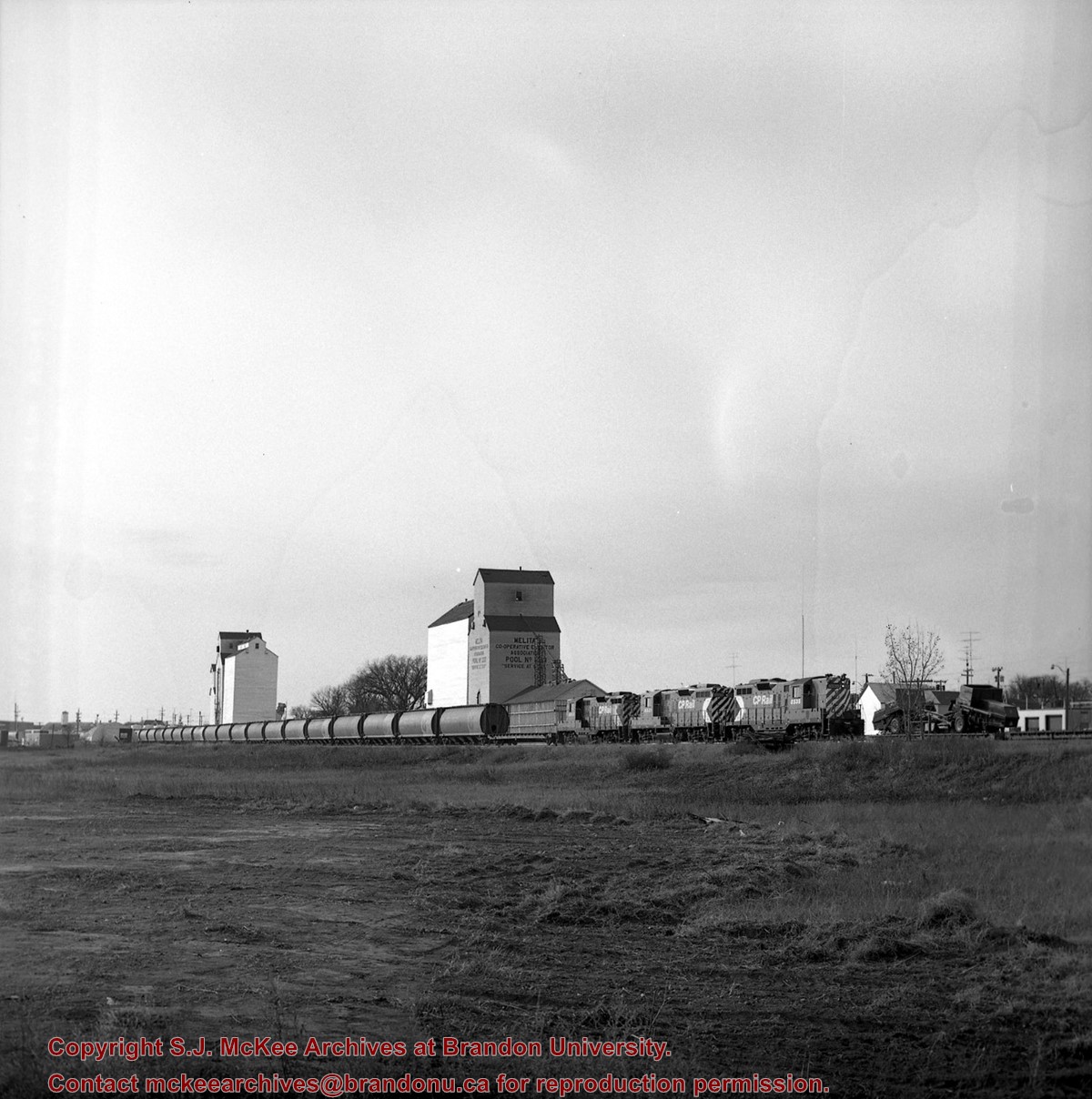
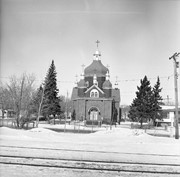
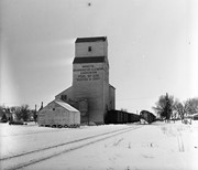
Scope and Content
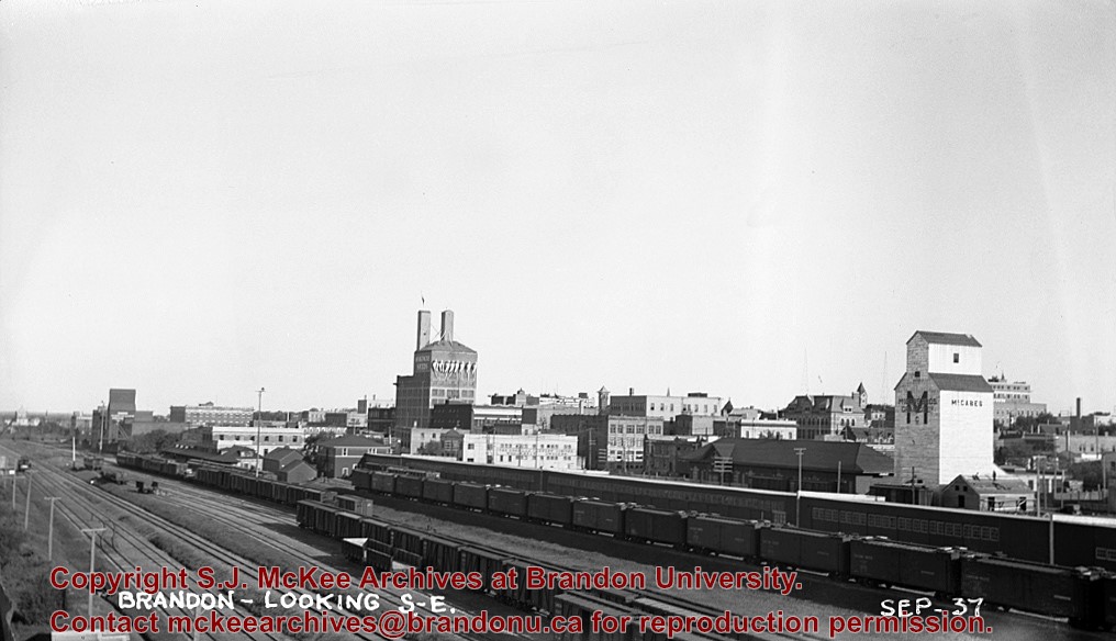
Photograph is looking west southwest along the CPR tracks.
Notes
Corresponds with negative 1-2002.3.9.P16.
Repro Restriction
The McKee Archives is the copyright holder for the Stuckey materials.
Photograph shows Princess Avenue facing east from 10th Street. On the north side of Princess Avenue, a B/A Service Station, Princess Cafe, Lindenberg Seeds, and the Central Fire Station are visible. Old City Hall with the war memorial and the Prince Edward Hotel are visible on the south side of Princess Avenue. Traffic is travelling one-way on Princess Avenue.
Red ink stain is on the front right corner of postcard
Scope and Content
Photograph shows 10th Street facing south from Princess Avenue. Visible landmarks and businesses include: Manitoba Power Commission (MPC)'s power sub-station, First Baptist Church, Wheat City Arena, and the grand stand at the Exhibition Grounds.
The partial sign visible at the bottom of the photograph on the east side of 10th Street reads Yates and Neale, which refers to a plumbing and heating company that dissolved in 1943 to be replaced by Neale, Stothard and Chapman.
Businesses on the west side of 10th Street include: Dominion Tire & Radio Co., Bolts Barber Shop, Elviss T.E. Co. Stables.
Notes
Information concerning Yates and Neale courtesy Jack Stothard. Writing on the front of the postcard reads: Brandon, Looking S.W., Jerrett Photo. This photograph shows a rare view of the 200-block of 10th Street.
.jpg?width=1200&404=no-img.jpg&watermark=wmk)
.jpg?width=180&404=no-img.jpg)


.jpg%3fmaxheight%3d1000%26maxwidth%3d1000%26watermark%3dwmk&description=Northeast+view+from+100+block+of+Tenth+Street)
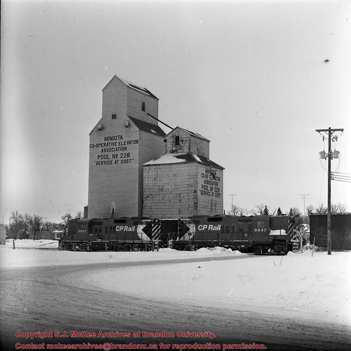
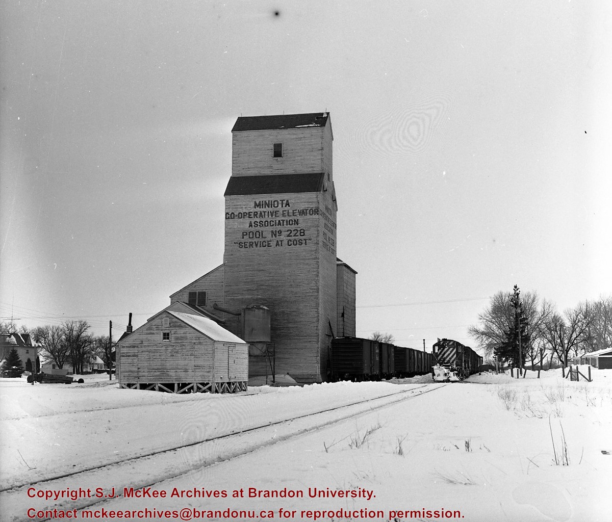
+-+Miniota%2c+Manitoba)
+-+Miniota%2c+Manitoba)