Skip header and navigation

Revise Search

20 records – page 1 of 1.

Red Indian Station (Gasoline) north side Princess Avenue between 9th Street and 10th Street, Brandon, Manitoba

http://archives.brandonu.ca/en/permalink/descriptions8418
Part Of
Joseph H. Hughes collection
Description Level
Item
GMD
graphic
Date Range
c. 1940
Accession Number
3-1997
Part Of
Joseph H. Hughes collection
Description Level
Item
Series Number
3-1997.1
Item Number
3-1997.1.40
Accession Number
3-1997
GMD
graphic
Date Range
c. 1940
Physical Description
10" x 8" (b/w)
Physical Condition
good
Scope and Content
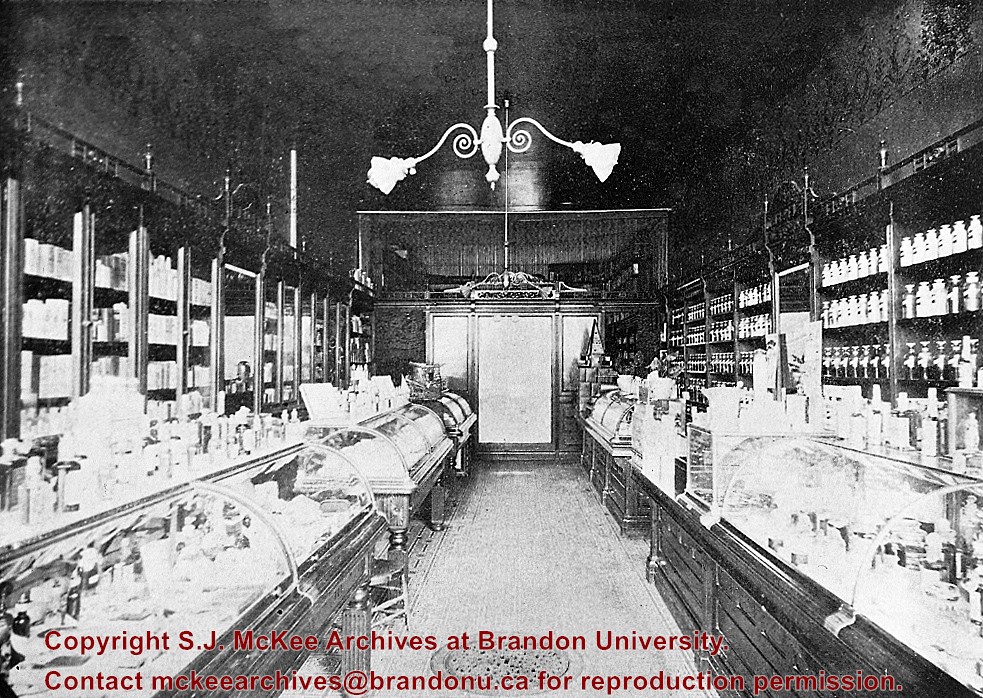
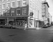
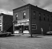
Photograph shows the Red Indian (Gasoline) Station on the north side Princess Avenue between 9th and 10th Streets, Brandon. Attached to the west side of the gas station is another shop which contains Hutchings' Drug Store. The Alexandra Block on 10th Street is visible in the background.
Name Access
Hutchings Drugs
Red Indian Service Station
Princess Avenue
Subject Access
downtowns
street scenes
Brandon business buildings & facilities after 1940
building exteriors
garages
drug stores
Storage Location
RG 5 photograph storage drawer
Images
Show Less
Part Of
RG 11 Lawrence Stuckey fonds
Description Level
Item
GMD
graphic
Date Range
June 27,1963
Accession Number
1-2002
Part Of
RG 11 Lawrence Stuckey fonds
Creator
L.A. Stuckey
Description Level
Item
Series Number
3.1
Item Number
1-2002.3.1EA7
Accession Number
1-2002
GMD
graphic
Date Range
June 27,1963
Physical Description
2 1/2" x 2 1/2"
Material Details
Negative
History / Biographical
Western Motors opened its doors in 1926, and was closed and demolished in 1971.
Custodial History
For custodial history see the collection level description of the Lawrence Stuckey collection.
Scope and Content
Western Motors
Notes
Located on the southwest corner of 10th Street & Princess Ave.
[Mr. Stuckey put two negatives in same envelope, numbered EA7 and EA7a. We have separated them.]
Name Access
Western Motors
Hutchings Drugs
Subject Access
businesses
automobile dealerships
drug stores
Brandon business buildings & facilities after 1940
Repro Restriction
The McKee Archives is the copyright holder for the Stuckey materials.
Storage Location
Lawrence Stuckey collection
Images
Show Less

9th Street aerial view facing south, Brandon, Manitoba

http://archives.brandonu.ca/en/permalink/descriptions8419
Part Of
Joseph H. Hughes collection
Description Level
Item
GMD
graphic
Date Range
c. 1940
Accession Number
3-1997
Part Of
Joseph H. Hughes collection
Creator
Photographer: Jerrett Photo
Description Level
Item
Series Number
3-1997.1
Item Number
3-1997.1.41
Accession Number
3-1997
GMD
graphic
Date Range
c. 1940
Physical Description
5.5" x 3.5" (b/w)
Material Details
postcard
Physical Condition
good
Scope and Content
Postcard shows an aerial view of 9th Street facing south in Brandon, Manitoba. Visible businesses and landmarks include: Beaubier Hotel, YMCA/police station, the original CKX Radio station towers on 8th Street (est. 1928 - moved 1940), the old City Hall, Prince Edward Hotel, and the original Manitoba Power commission smokestack on 10th Street.
Notes
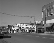
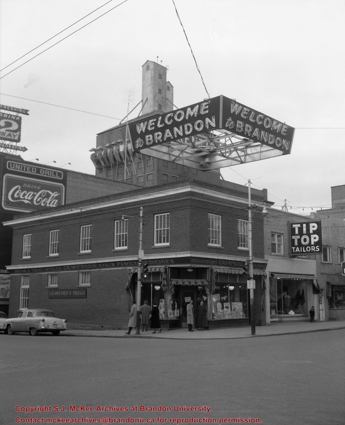
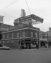
Writing on the front of the photograph reads: Brandon, Man., Jerrett Photo. This photograph shows a rare view of the 800-block between Rosser and Princess Avenues.
Name Access
Beaubier Hotel
City Hall
CKX
Prince Edward Hotel
Manitoba Power Company
Subject Access
downtowns
street scenes
Brandon business buildings & facilities before 1940
aerial views
building exteriors
Storage Location
RG 5 photograph storage drawer
Images
Show Less

Super Thrifty Pharmacy

http://archives.brandonu.ca/en/permalink/descriptions13921
Part Of
Fred McGuinness collection
Description Level
Item
GMD
graphic
Date Range
c.1990
Accession Number
20-2009
Part Of
Fred McGuinness collection
Description Level
Item
Series Number
McG 9
Item Number
20-2009.231
Accession Number
20-2009
GMD
graphic
Date Range
c.1990
Physical Description
5" x 3.5" (b/w)
History / Biographical
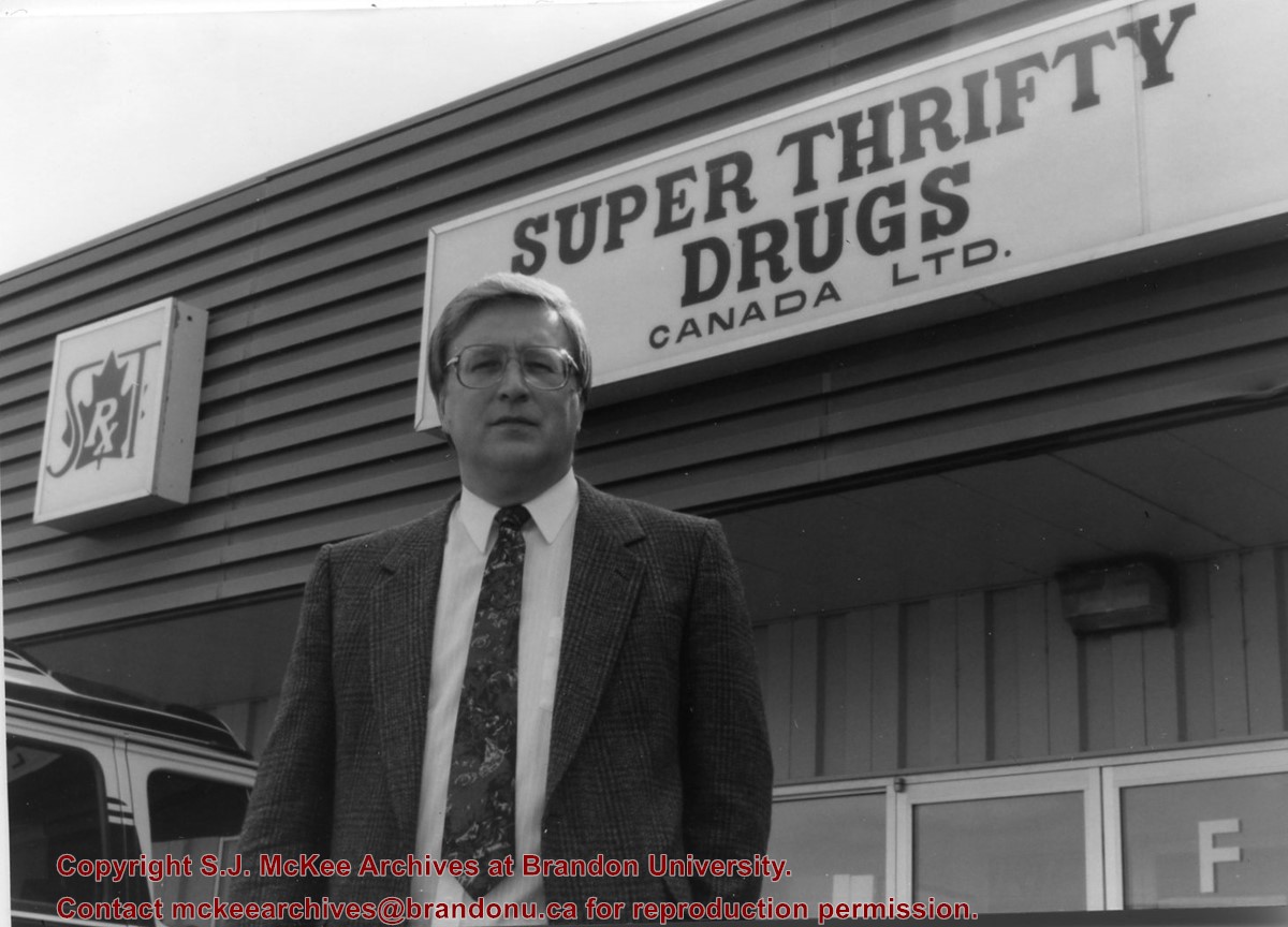
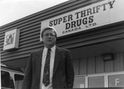
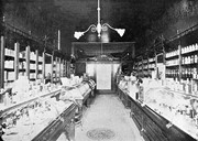
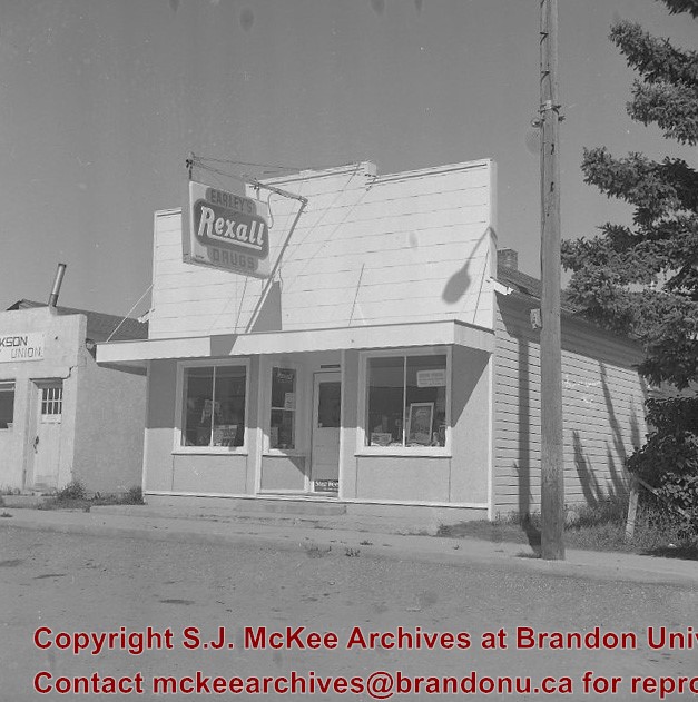
Founded in 1977, Super Thrifty is considered Manitoba's largest independent retail drug store organization. At the time of its founding, Super Thrifty had five drug stores in operation, three in Brandon, one in Hamiota, and one in Rivers.
Scope and Content
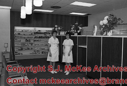
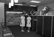
Photograph shows Greg Skura standing in front of the Super Thrifty Centre at 381 Park Avenue East.
Notes
Negatives stored with photograph
Name Access
Greg Skura
Subject Access
drug stores
pharmacists
Brandon business buildings & facilities after 1940
Storage Location
RG 5 photograph storage drawer 2 (hanging photos)
Arrangement
From 20-2009 #4 plastic envelope #2; in Canada Wide Magazines Ltd. envelope post marked 03 November 1990
Images
Show Less

Aerial view of 10th Street facing south from Princess Avenue

http://archives.brandonu.ca/en/permalink/descriptions8420
Part Of
Joseph H. Hughes collection
Description Level
Item
GMD
graphic
Date Range
c.1940
Accession Number
3-1997
Part Of
Joseph H. Hughes collection
Creator
Photographer: Jerrett Photo
Description Level
Item
Series Number
3-1997.1
Item Number
3-1997.1.42
Accession Number
3-1997
GMD
graphic
Date Range
c.1940
Physical Description
5.5" x 3.5" (b/w)
Material Details
postcard
Physical Condition
Red ink stain is on the front right corner of postcard
Scope and Content
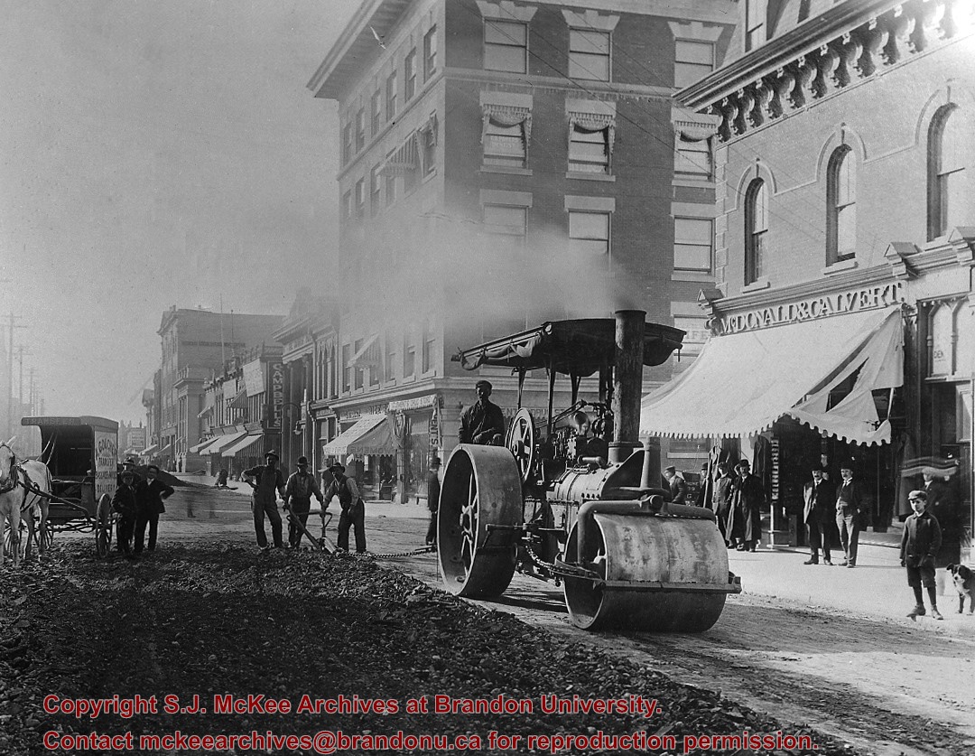
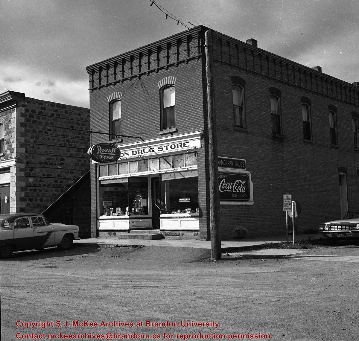
Photograph shows 10th Street facing south from Princess Avenue. Visible landmarks and businesses include: Manitoba Power Commission (MPC)'s power sub-station, First Baptist Church, Wheat City Arena, and the grand stand at the Exhibition Grounds. The partial sign visible at the bottom of the photograph on the east side of 10th Street reads Yates and Neale, which refers to a plumbing and heating company that dissolved in 1943 to be replaced by Neale, Stothard and Chapman. Businesses on the west side of 10th Street include: Dominion Tire & Radio Co., Bolts Barber Shop, Elviss T.E. Co. Stables.
Notes
Information concerning Yates and Neale courtesy Jack Stothard. Writing on the front of the postcard reads: Brandon, Looking S.W., Jerrett Photo. This photograph shows a rare view of the 200-block of 10th Street.
Name Access
Manitoba Power Company
10th Street
Dominion Tire & Radio Co.
T.E. Elviss Co. Stables
First Baptist Church
Subject Access
downtowns
street scenes
Brandon business buildings & facilities before 1940
aerial views
building exteriors
residences
churches
Storage Location
RG 5 photograph storage drawer
Images
Show Less

Halpin's Drug Store

http://archives.brandonu.ca/en/permalink/descriptions9498
Part Of
RG 11 Lawrence Stuckey fonds
Description Level
Item
GMD
graphic
Date Range
[18-?]
Accession Number
1-2002
Part Of
RG 11 Lawrence Stuckey fonds
Description Level
Item
Series Number
3.1
Item Number
1-2002.3.1E27
Accession Number
1-2002
GMD
graphic
Date Range
[18-?]
Physical Description
3 1/2" x 5"
Material Details
Negative
Custodial History
For custodial history see the collection level description of the Lawrence Stuckey collection.
Scope and Content
N.J. Halpin's Drug Store
Notes
[This negative appears to have been produced using a pre-existing published image (P.E. 22/06/09).]
Name Access
N.J. Halpin's Drug Store
Subject Access
businesses
pharmacists
drug stores
Brandon business buildings & facilities before 1940
Repro Restriction
The McKee Archives is the copyright holder for the Stuckey materials.
Storage Location
Lawrence Stuckey collection
Images
Show Less

Clement Block & A.E. McKenzie Building

http://archives.brandonu.ca/en/permalink/descriptions9502
Part Of
RG 11 Lawrence Stuckey fonds
Description Level
Item
GMD
graphic
Date Range
1912
Accession Number
1-2002
Part Of
RG 11 Lawrence Stuckey fonds
Description Level
Item
Series Number
3.1
Item Number
1-2002.3.1E22
Accession Number
1-2002
GMD
graphic
Date Range
1912
Physical Description
3 1/2" x 5"
Material Details
Negative
History / Biographical
Foreground: Clement Block built 1910.
Background: Original 6 storey McKenzie Bldg before upward extension of 1918.
Custodial History
For custodial history see the collection level description of the Lawrence Stuckey collection.
Scope and Content
Clement Block & A.E. McKenzie Building
Notes
From Winnipeg Saturday Post June 15, 1912.
Name Access
Clement Block & A.E. McKenzie Building
Subject Access
businesses
drug stores
seeds
Brandon business buildings & facilities before 1940
Repro Restriction
The McKee Archives is the copyright holder for the Stuckey materials.
Storage Location
Lawrence Stuckey collection
Images
Show Less

Twin Pines Motel postcard

http://archives.brandonu.ca/en/permalink/descriptions13868
Part Of
Fred McGuinness collection
Description Level
Item
GMD
graphic
Date Range
1970
Accession Number
20-2009
Part Of
Fred McGuinness collection
Creator
Photographer: Joe Fartak
Description Level
Item
Series Number
McG 9
Item Number
20-2009.178
Accession Number
20-2009
GMD
graphic
Date Range
1970
Physical Description
3.5" x 6" (colour)
Material Details
postcard
Scope and Content
Postcard shows an exterior view of the Twin Pines Motel
Notes
Writing on the back of the postcard reads: Twin Pines Motel & Restaurant / Brandon, Manitoba, Canada / Located at 10th Street & Queens Avenue / 40 Fully modern units with bath & showers, T. / Kichenettes, winter plug-ins, Ample parking. / For reservations call.... / 30717-C Color Photo by Joe Fartak / Color Productions Ltd., Box 1243, Regina, Sask. The postcard is addressed to Mr. F.A. Rosser and is postmarked Brandon 06 June 1970. A 6-cent Queen Elizabeth red postage stamp portraying various modes of the transportation.
Name Access
City of Brandon
Subject Access
aerial photographs
aerial views
Brandon business buildings & facilities after 1940
Storage Location
RG 5 photograph storage drawer 2 (hanging photos)
Arrangement
From 20-2009 #1 File 13 Sunbeams
Images
Show Less

Medicine Hat Exhibition and Stampede - Parade Day 7

http://archives.brandonu.ca/en/permalink/descriptions14148
Part Of
Fred McGuinness collection
Description Level
Item
GMD
graphic
Date Range
1962
Accession Number
1-2015
Part Of
Fred McGuinness collection
Creator
Photographer: Howard Heid, Medicine Hat News
Description Level
Item
Series Number
McG 9
Item Number
1-2015.217
Accession Number
1-2015
GMD
graphic
Date Range
1962
Physical Description
10" x 8" (b/w)
History / Biographical
The Medicine Hat Exhibition and Stampede Parade Day was held on Thursday, July 19, 1962, at 9:30 a.m. The local newspaper reported that approximately 24,000 people were in attendance to see parade marshall Rod Ashburner leading 175 entries consisting of 90 floats, 75 horses, and 10 bands. There were 19 parade categories eligible for $12,000 in prize money and included: junior and senior cowboys and cowgirls; fancy and Shetland ponies; sulky class open; comic, commercial, industrial and organizational floats; decorated cars; special ranch class; 4-H Clubs; and a non-competitive class. The parade route started at Second St. and Allowance Ave., from Second St. to Ash Ave., north on Ash to First St. SE., from First St. S.E. to Fourth Ave., south to Second St. to South Railway St., south on South Railway St. to Third St., with a finish at McLeod Trail. A route map was published in the Medicine Hat News the day before the parade. Aerial photographs of the parade were taken by Medicine Hat News photographer Howard Heid (1930-2005) from the private helicopter of John Bourn. Bourn was a pilot from Woodville, Wisconsin, who chartered his four-seater helicopter for sight-seers at exhibitions and stampedes across the county. (Sources: Pat Currie, "Let 'Er Go!," Medicine Hat News, 19 July 1962,1; Harald Gunderson, "'Eye in the Sky' Best Parade View," Medicine Hat News, 19 July 1962,1; "Parade Starts at 9:30 Sharp," 18 July 1962)
Scope and Content
Photograph shows an aerial view of the Medicine Hat Exhibition and Stampede Parade route with a focus on the First Street SE and Sixth Avenue intersection. A number of gas stations and garages are visible along this route and include Texaco, Shell, Ford, and B/A. A number of observers can be seen sitting on rooftops.
Notes
This photograph shows the neighbourhood before rezoning and commercial development.
Name Access
Medicine Hat
South Saskatchewan River
Subject Access
parades
floats
aerial photography
aerial views
street scenes
garages
Repro Restriction
Subject to Canadian Copyright Law
Storage Location
RG 5 photograph storage drawer 2 (hanging photos)
Arrangement
BR #3 Family photos
Images
Show Less

Medicine Hat Exhibition and Stampede - Parade Day 8

http://archives.brandonu.ca/en/permalink/descriptions14149
Part Of
Fred McGuinness collection
Description Level
Item
GMD
graphic
Date Range
1962
Accession Number
1-2015
Part Of
Fred McGuinness collection
Creator
Photographer: Howard Heid, Medicine Hat News
Description Level
Item
Series Number
McG 9
Item Number
1-2015.218
Accession Number
1-2015
GMD
graphic
Date Range
1962
Physical Description
10" x 8" (b/w)
History / Biographical
The Medicine Hat Exhibition and Stampede Parade Day was held on Thursday, July 19, 1962, at 9:30 a.m. The local newspaper reported that approximately 24,000 people were in attendance to see parade marshall Rod Ashburner leading 175 entries consisting of 90 floats, 75 horses, and 10 bands. There were 19 parade categories eligible for $12,000 in prize money and included: junior and senior cowboys and cowgirls; fancy and Shetland ponies; sulky class open; comic, commercial, industrial and organizational floats; decorated cars; special ranch class; 4-H Clubs; and a non-competitive class. The parade route started at Second St. and Allowance Ave., from Second St. to Ash Ave., north on Ash to First St. SE., from First St. S.E. to Fourth Ave., south to Second St. to South Railway St., south on South Railway St. to Third St., with a finish at McLeod Trail. A route map was published in the Medicine Hat News the day before the parade. Aerial photographs of the parade were taken by Medicine Hat News photographer Howard Heid (1930-2005) from the private helicopter of John Bourn. Bourn was a pilot from Woodville, Wisconsin, who chartered his four-seater helicopter for sight-seers at exhibitions and stampedes across the county. (Sources: Pat Currie, "Let 'Er Go!," Medicine Hat News, 19 July 1962,1; Harald Gunderson, "'Eye in the Sky' Best Parade View," Medicine Hat News, 19 July 1962,1; "Parade Starts at 9:30 Sharp," 18 July 1962)
Scope and Content
Photograph shows an aerial view of the Medicine Hat Exhibition and Stampede Parade route, with a focus on Second Street SE. Visible store signs include: Gardener's Used Cars, Provincial Treasury Branch, Furvey's Furniture and Appliances, J.J. Moore & Son Furniture, Alberta Credit Jewellers, James Richardson & Sons, Medicine Hat Gas Power Water City Owned Utilities.
Notes
This photograph shows the neighbourhood before rezoning and commercial development.
Name Access
Medicine Hat
South Saskatchewan River
Subject Access
parades
floats
aerial photography
aerial views
street scenes
garages
Repro Restriction
Subject to Canadian Copyright Law
Storage Location
RG 5 photograph storage drawer 2 (hanging photos)
Arrangement
BR #3 Family photos
Images
Show Less

Medicine Hat Exhibition and Stampede - Parade Day 4

http://archives.brandonu.ca/en/permalink/descriptions14145
Part Of
Fred McGuinness collection
Description Level
Item
GMD
graphic
Date Range
1962
Accession Number
1-2015
Part Of
Fred McGuinness collection
Creator
Photographer: Howard Heid, Medicine Hat News
Description Level
Item
Series Number
McG 9
Item Number
1-2015.214
Accession Number
1-2015
GMD
graphic
Date Range
1962
Physical Description
10" x 8" (b/w)
History / Biographical
The Medicine Hat Exhibition and Stampede Parade Day was held on Thursday, July 19, 1962, at 9:30 a.m. The local newspaper reported that approximately 24,000 people were in attendance to see parade marshall Rod Ashburner leading 175 entries consisting of 90 floats, 75 horses, and 10 bands. There were 19 parade categories eligible for $12,000 in prize money and included: junior and senior cowboys and cowgirls; fancy and Shetland ponies; sulky class open; comic, commercial, industrial and organizational floats; decorated cars; special ranch class; 4-H Clubs; and a non-competitive class. The parade route started at Second St. and Allowance Ave., from Second St. to Ash Ave., north on Ash to First St. SE., from First St. S.E. to Fourth Ave., south to Second St. to South Railway St., south on South Railway St. to Third St., with a finish at McLeod Trail. A route map was published in the Medicine Hat News the day before the parade. Aerial photographs of the parade were taken by Medicine Hat News photographer Howard Heid (1930-2005) from the private helicopter of John Bourn. Bourn was a pilot from Woodville, Wisconsin, who chartered his four-seater helicopter for sight-seers at exhibitions and stampedes across the county. (Sources: Pat Currie, "Let 'Er Go!," Medicine Hat News, 19 July 1962,1; Harald Gunderson, "'Eye in the Sky' Best Parade View," Medicine Hat News, 19 July 1962,1; "Parade Starts at 9:30 Sharp," 18 July 1962)
Scope and Content
Photograph shows an aerial view of the Medicine Hat Exhibition and Stampede Parade route with a focus on the First Street SE. A number of gas stations and garages are visible along this route and include Texaco, Shell, Ford, and B/A. The Fraternal Order of Eagles lodge is also visible.
Notes
This photograph appeared on the front page of The Medicine Hat News (19 July 1962).
Name Access
Medicine Hat
South Saskatchewan River
Subject Access
parades
floats
aerial photography
aerial views
street scenes
fraternal organizations
garages
Repro Restriction
Subject to Canadian Copyright Law
Storage Location
RG 5 photograph storage drawer 2 (hanging photos)
Arrangement
BR #3 Family photos
Images
Show Less

Medicine Hat Exhibition and Stampede - Parade Day 6

http://archives.brandonu.ca/en/permalink/descriptions14147
Part Of
Fred McGuinness collection
Description Level
Item
GMD
graphic
Date Range
1962
Accession Number
1-2015
Part Of
Fred McGuinness collection
Creator
Photographer: Howard Heid, Medicine Hat News
Description Level
Item
Series Number
McG 9
Item Number
1-2015.216
Accession Number
1-2015
GMD
graphic
Date Range
1962
Physical Description
10" x 8" (b/w)
History / Biographical
The Medicine Hat Exhibition and Stampede Parade Day was held on Thursday, July 19, 1962, at 9:30 a.m. The local newspaper reported that approximately 24,000 people were in attendance to see parade marshall Rod Ashburner leading 175 entries consisting of 90 floats, 75 horses, and 10 bands. There were 19 parade categories eligible for $12,000 in prize money and included: junior and senior cowboys and cowgirls; fancy and Shetland ponies; sulky class open; comic, commercial, industrial and organizational floats; decorated cars; special ranch class; 4-H Clubs; and a non-competitive class. The parade route started at Second St. and Allowance Ave., from Second St. to Ash Ave., north on Ash to First St. SE., from First St. S.E. to Fourth Ave., south to Second St. to South Railway St., south on South Railway St. to Third St., with a finish at McLeod Trail. A route map was published in the Medicine Hat News the day before the parade. Aerial photographs of the parade were taken by Medicine Hat News photographer Howard Heid (1930-2005) from the private helicopter of John Bourn. Bourn was a pilot from Woodville, Wisconsin, who chartered his four-seater helicopter for sight-seers at exhibitions and stampedes across the county. (Sources: Pat Currie, "Let 'Er Go!," Medicine Hat News, 19 July 1962,1; Harald Gunderson, "'Eye in the Sky' Best Parade View," Medicine Hat News, 19 July 1962,1; "Parade Starts at 9:30 Sharp," 18 July 1962)
Scope and Content
Photograph shows an aerial view of the Medicine Hat Exhibition and Stampede Parade route with a focus on the First Street SE and and the South Railway Street merge. A number of gas stations and garages are visible along this route and include Texaco, Shell, Ford, and B/A. The Fraternal Order of Eagles lodge is also visible.
Notes
This photograph shows the neighbourhood before rezoning and commercial development.
Name Access
Medicine Hat
South Saskatchewan River
Subject Access
parades
floats
aerial photography
aerial views
street scenes
gardens
fraternal organizations
garages
Repro Restriction
Subject to Canadian Copyright Law
Storage Location
RG 5 photograph storage drawer 2 (hanging photos)
Arrangement
BR #3 Family photos
Images
Show Less

Western Medical building

http://archives.brandonu.ca/en/permalink/descriptions12873
Part Of
CKX fonds
Description Level
Item
GMD
graphic
Date Range
1967
Accession Number
11-2010
Part Of
CKX fonds
Creator
CKX
Description Level
Item
Series Number
W
Item Number
11-2010.W5b
Accession Number
11-2010
GMD
graphic
Date Range
1967
Physical Description
1.5" x 1.5" (b/w)
Material Details
Negative
Custodial History
See fonds level of the CKX records for custodial history.
Scope and Content
Image of pharmacists in the Western Medical building.
Name Access
CKX
Western Medical
Subject Access
building interiors
medical buildings
employees
drug stores
Storage Location
CKX fonds - 2010 accessions
Images
Show Less

Paving Rosser Avenue

http://archives.brandonu.ca/en/permalink/descriptions9767
Part Of
RG 11 Lawrence Stuckey fonds
Description Level
Item
GMD
graphic
Date Range
October 1911
Accession Number
1-2002
Part Of
RG 11 Lawrence Stuckey fonds
Description Level
Item
Series Number
3.1
Item Number
1-2002.3.1K5
Accession Number
1-2002
GMD
graphic
Date Range
October 1911
Physical Description
3 1/2" x 5"
Material Details
Negative
History / Biographical
The steam-powered roller in this photo, probably purchased for this large project, continued in use until 1940.
Custodial History
For custodial history see the collection level description of the Lawrence Stuckey collection.
Scope and Content
Paving Rosser Avenue from 8th St. to 10th St.
Notes
Building sub-grade
Photo includes McDonald & Calvert (McDonald Building) and Clement Drugs (Clement Block).
Name Access
McDonald & Calvert
Clement Block
Subject Access
construction
paving
drug stores
Brandon Early Construction Scenes
Repro Restriction
The McKee Archives is the copyright holder for the Stuckey materials.
Storage Location
Lawrence Stuckey collection
Images
Show Less

Rexall dealers in Manitoba - Alexander Pharmacy (Minnedosa)

http://archives.brandonu.ca/en/permalink/descriptions13373
Part Of
CKX fonds
Description Level
Item
GMD
graphic
Date Range
October 1964
Accession Number
11-2010
Part Of
CKX fonds
Creator
CKX
Description Level
Item
Series Number
R
Item Number
11-2010.R87a
Accession Number
11-2010
GMD
graphic
Date Range
October 1964
Physical Description
2.5" x 2.5" (b/w)
Material Details
Negative
Custodial History
See fonds level of the CKX records for custodial history.
Scope and Content
Image of the Alexander Pharmacy building.
Name Access
CKX
Alexander Pharmacy
S.O.S. Department Store
Rexall Drugs
Subject Access
building exteriors
store exteriors
businesses
signs and signboards
cars
drug stores
Storage Location
CKX fonds - 2010 accessions
Images
Show Less

Rexall Drugs (Brandon - Clement's Drug Store)

http://archives.brandonu.ca/en/permalink/descriptions13497
Part Of
CKX fonds
Description Level
Item
GMD
graphic
Date Range
after 1954
Accession Number
11-2010
Part Of
CKX fonds
Creator
CKX
Description Level
Item
Series Number
R
Item Number
11-2010.R27
Accession Number
11-2010
GMD
graphic
Date Range
after 1954
Physical Description
5" x 4" (b/w)
Material Details
Negative
Custodial History
See fonds level of the CKX records for custodial history.
Scope and Content
Image of a Rexall drug store building.
Name Access
CKX
Rexall Drugs
Auto Electric
Harry L. Trump Optometrist
Subject Access
businesses
store exteriors
store displays
building exteriors
signs and signboards
cars
drug stores
Storage Location
CKX fonds - 2010 accessions
Images
Show Less

Rexall dealers in Manitoba - Ealrey's Drugs (Erikson)

http://archives.brandonu.ca/en/permalink/descriptions13372
Part Of
CKX fonds
Description Level
Item
GMD
graphic
Date Range
October 1964
Accession Number
11-2010
Part Of
CKX fonds
Creator
CKX
Description Level
Item
Series Number
R
Item Number
11-2010.R87b
Accession Number
11-2010
GMD
graphic
Date Range
October 1964
Physical Description
2.5" x 2.5" (b/w)
Material Details
Negative
Custodial History
See fonds level of the CKX records for custodial history.
Scope and Content
Image of the Ealrey's Drugs building.
Name Access
CKX
Ealrey's Drugs
Rexall Drugs
Subject Access
building exteriors
store exteriors
businesses
signs and signboards
drug stores
Storage Location
CKX fonds - 2010 accessions
Images
Show Less

Brandon streets - northeast corner of Rosser Avenue and 10th Street

http://archives.brandonu.ca/en/permalink/descriptions11557
Part Of
CKX fonds
Description Level
Item
GMD
graphic
Date Range
after 1954
Accession Number
11-2010
Part Of
CKX fonds
Creator
CKX
Description Level
Item
Item Number
11-2010.B103f
Accession Number
11-2010
GMD
graphic
Date Range
after 1954
Physical Description
5" x 4" (b/w)
Material Details
Negative
Custodial History
See fonds level of the CKX records for custodial history.
Scope and Content
Image of the northeast corner of Rosser Avenue and 10th Street. Visible are Crawford's Drugs and Tip Top Tailors.
Name Access
CKX
Brandon, Manitoba
Crawford's Drug Store
Subject Access
steetscapes
drug stores
Storage Location
CKX fonds - 2010 accessions
Images
Show Less

Rexall Drugs (Russell)

http://archives.brandonu.ca/en/permalink/descriptions13377
Part Of
CKX fonds
Description Level
Item
GMD
graphic
Date Range
1966
Accession Number
11-2010
Part Of
CKX fonds
Creator
CKX
Description Level
Item
Series Number
R
Item Number
11-2010.R84b
Accession Number
11-2010
GMD
graphic
Date Range
1966
Physical Description
2.5" x 2.5" (b/w)
Material Details
Negative
Custodial History
See fonds level of the CKX records for custodial history.
Scope and Content
Image of the Reavie's Pharmacy building.
Name Access
CKX
Rexall Drugs
Reavie's Pharmacy
Subject Access
businesses
building exteriors
cars
signs and signboards
store displays
drug stores
Storage Location
CKX fonds - 2010 accessions
Images
Show Less

Rexall Drugs (Reston)

http://archives.brandonu.ca/en/permalink/descriptions13500
Part Of
CKX fonds
Description Level
Item
GMD
graphic
Date Range
after 1954
Accession Number
11-2010
Part Of
CKX fonds
Creator
CKX
Description Level
Item
Series Number
R
Item Number
11-2010.R25a
Accession Number
11-2010
GMD
graphic
Date Range
after 1954
Physical Description
2.5" x 2.5" (b/w)
Material Details
Negative
Custodial History
See fonds level of the CKX records for custodial history.
Scope and Content
Image of a Rexall drug store building.
Name Access
CKX
Rexall Drugs
Subject Access
businesses
store exteriors
building exteriors
drug stores
cars
signs and signboards
Storage Location
CKX fonds - 2010 accessions
Images
Show Less

20 records – page 1 of 1.