Photograph shows the northwest corner of 10th Street and Princess Avenue. Traffic on the west side of Princess Avenue appears to travelling both ways. A taxi waits at the intersection.
Above the west entrance on the corner building is an electric sign that spells "Hughes Bldg." A second storey has been added to the portion of the Doig's shop that is adjacent to the Alexandra Block.
Postcard shows an aerial view of 9th Street facing south in Brandon, Manitoba. Visible businesses and landmarks include: Beaubier Hotel, YMCA/police station, the original CKX Radio station towers on 8th Street (est. 1928 - moved 1940), the old City Hall, Prince Edward Hotel, and the original Manitoba Power commission smokestack on 10th Street.
Notes
Writing on the front of the photograph reads: Brandon, Man., Jerrett Photo. This photograph shows a rare view of the 800-block between Rosser and Princess Avenues.
Photograph shows Western Motors Ltd. on the southwest corner of 10th Street and Princess Avenue. Anglo gas station is part of the car shop, which sells GM, Chevrolet, and Oldsmobiles.
Hutchings' Drugs is on the ground floor of the Hughes Building on the northwest corner of 10th Street and Princess. Manufacturers Life occupies the second storey.
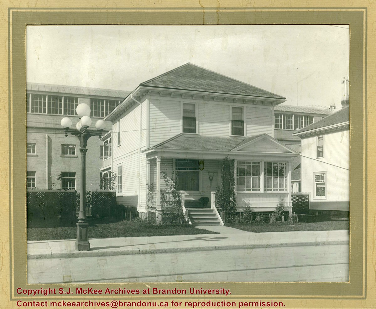
Photograph shows a two-storey wood-framed house with front porch and sunroom. Above a rocking chair and chez lounge, a Union Jack and pennant hang on the exterior wall on the porch. A five-globed black iron street lamp is on the sidewalk in front of the property. The Wheat City Arena can be seen behind the residence.
Notes
Based on the presence of the arena, the location has been identified as 10th Street near Victoria Avenue.
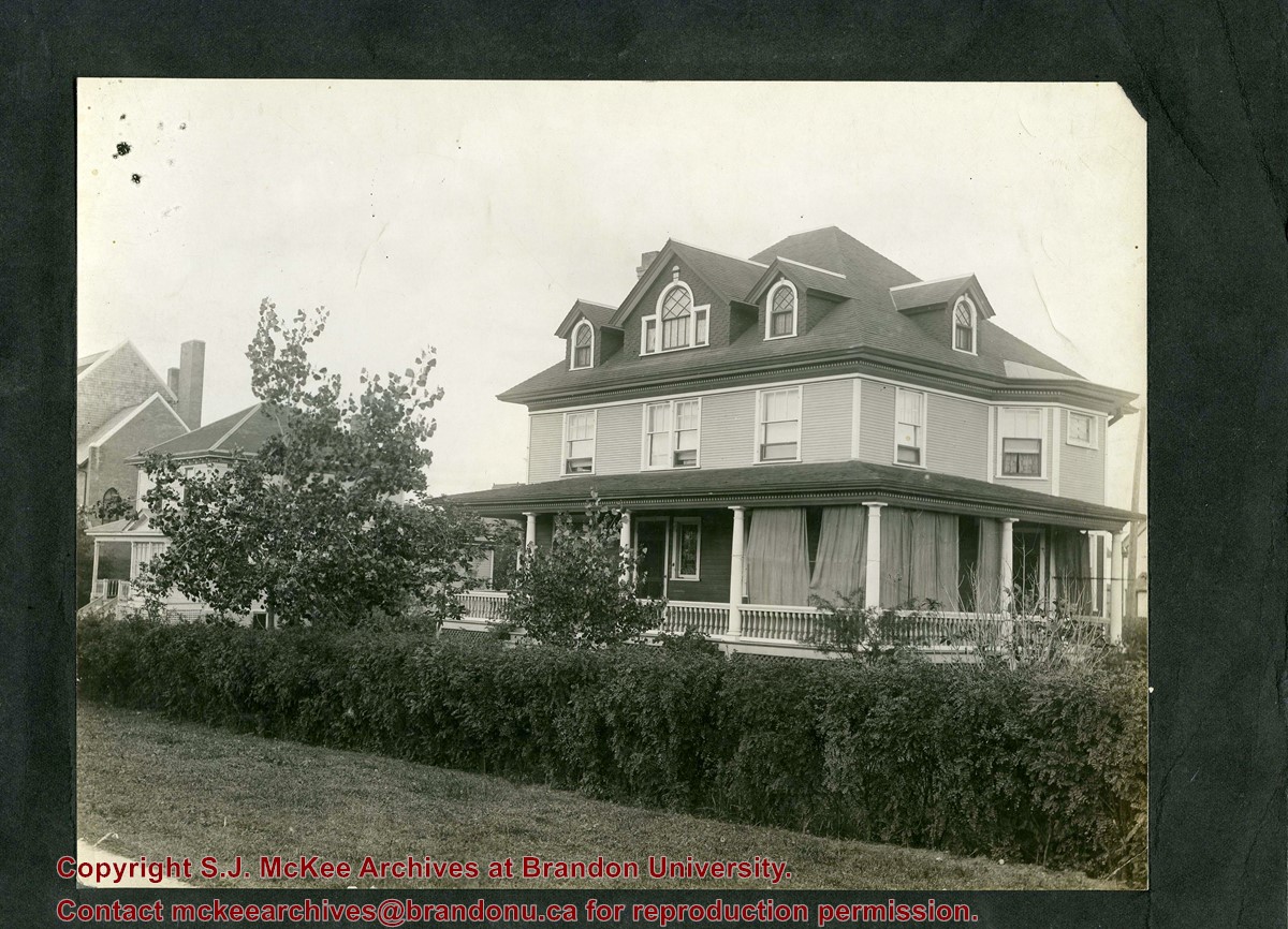
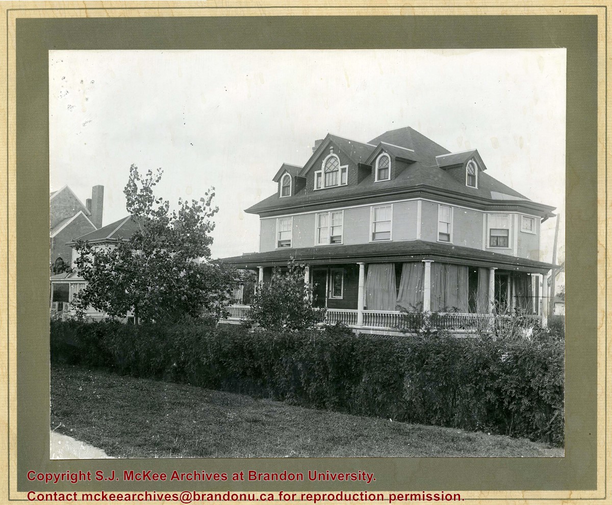
Photograph shows a three-storey wood framed house with a wrap-around porch, second storey bay window, and four gables.
Notes
Photograph is stamped on the back: Hughes & Co. Ltd., 1009 Princess Ave., Brandon, Man. Location has been identified as the southwest side of 10th Street.


