Photograph shows the Kresge store on the southwest corner of 10th Street and Rosser Avenue. Other 10th Street businesses that are visible on the west side of the street include: James Richardson & Son Investments, Beneficial Finance and Loans, Bass' Storkland, Brandon News & Record Shop, Recreation Bowling and Billiards, and Bottomley's. The Welcome Brandon sign can be seen in the top right corner of the photograph.
Photograph shows the west side of the 100-block of 10th Street facing northwest. Visible businesses include: Bottomley's Furniture, Recreation Bowling & Billiards, Fashion Fabrics, Brandon News & Record Shop, Bass' Storkland, Beneficial Finance Co., and the Kresge Store. The Johnny Smith Block is visible in the background.
Photograph shows the southeast corner of 10th Street and Rosser Avenue, Brandon, Manitoba. The Bank of Montreal is situated on the corner. Visible businesses along the east side of 10th Street include: Barclay's Shoe Store, Carlton Cafe, and Ted Heming Jewellers.
Postcard shows an aerial view of 9th Street facing south in Brandon, Manitoba. Visible businesses and landmarks include: Beaubier Hotel, YMCA/police station, the original CKX Radio station towers on 8th Street (est. 1928 - moved 1940), the old City Hall, Prince Edward Hotel, and the original Manitoba Power commission smokestack on 10th Street.
Notes
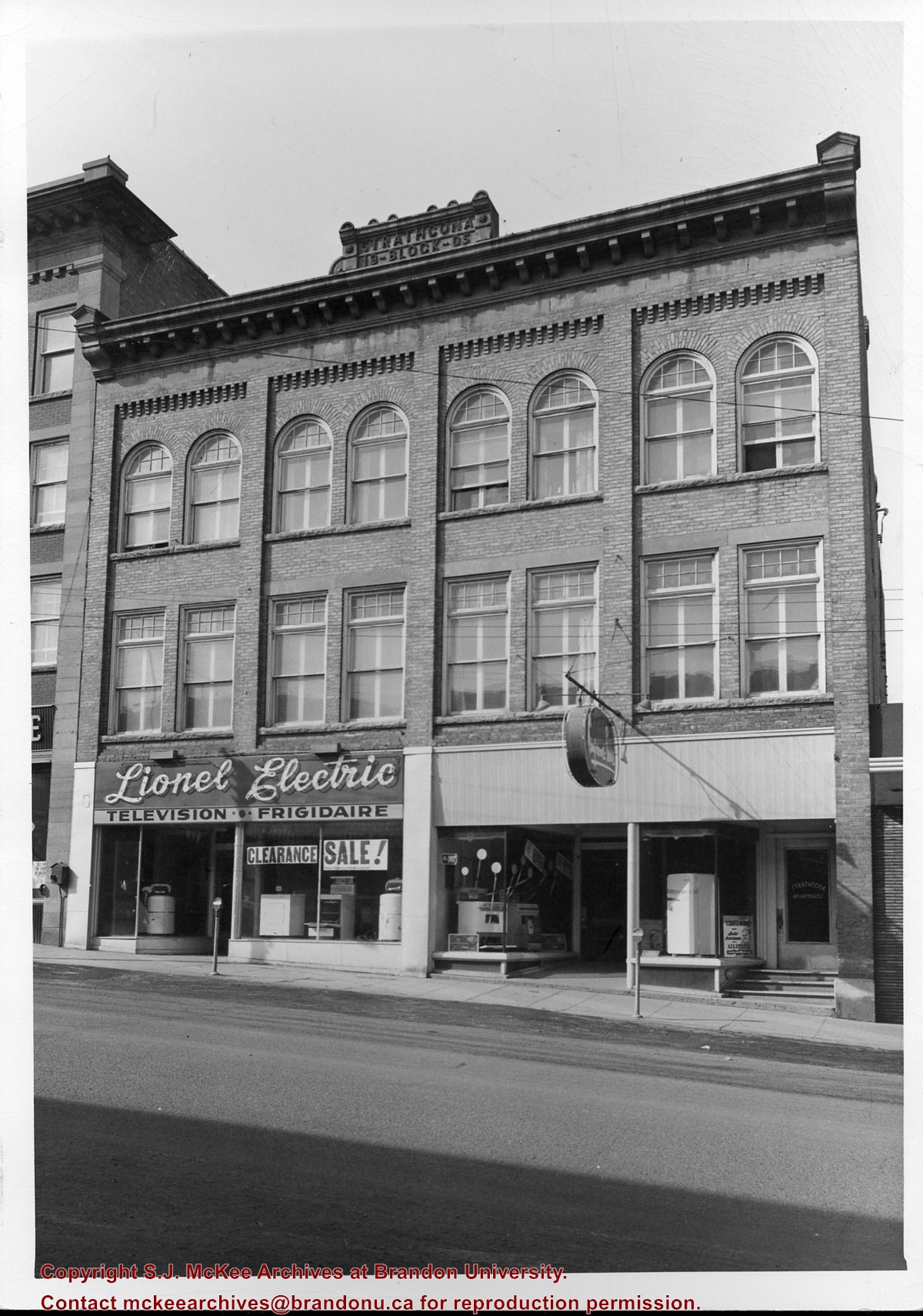
Writing on the front of the photograph reads: Brandon, Man., Jerrett Photo. This photograph shows a rare view of the 800-block between Rosser and Princess Avenues.
The Royal Bank moved to this location on 26 October 1929. An existing building was renovated to accomodate the bank. On 28 May 1976 fire destroyed the buildings from the lane west to the Royal Bank.
Scope and Content
Photograph shows the south side of Rosser Avenue between 7th and 8th Streets, west of the Eaton's building. Visible shops include: Vogue [Ladies Wear], Smith's Drugs, Sobie's Tailored Undergarnments, Household Finance Loans, and The Royal Bank of Canada.
Photograph of east side of 10th Street, Brandon, Manitoba, between Rosser and Princess Avenues. Visible businesses include: The Bank of Montreal, Barclay's Shoe Store, Carlton Cafe (in the former Cigar Factory), and Ted Heming Jewellers. The McKenzie Seed building is visible in the background.
Photograph shows the east side of 10th Street, Brandon, Manitoba, between Rosser and Princess Avenues. Businesses visible in the Brown Block include (from north to south): Singer, Pittsburgh Paint & Glass, O. Stark & Son, Elna Sewing Centre, and Canadian Pacific Telegraphs. The Prince Edward Hotel is visible in the background.
Photograph shows Ted Heming Jewellers on the east side of 10th Street, Brandon, Manitoba, with the Strand Theatre to the south of the building complex. Other visible businesses in the Strand Block include: Hughes & Co. Ltd., Smart's Stationery, Waddell's, and Metropolitan Life.
Notes
Photograph dated from "Gidget," the movie playing at the Strand Theatre
Photograph shows the Strand Block on the east side of 10th Street, Brandon, Manitoba. Visible businesses in the Strand Block include: Hughes & Co. Ltd., Smart's Stationery, Waddell's, the Strand Theatre, and Metropolitan Life.
Notes
Back of the photograph is stamped: Clark Smith Studio, per July 27/59
Photograph shows the northwest corner of 10th Street and Princess Avenue. Traffic on the west side of Princess Avenue appears to travelling both ways. A taxi waits at the intersection.
Above the west entrance on the corner building is an electric sign that spells "Hughes Bldg." A second storey has been added to the portion of the Doig's shop that is adjacent to the Alexandra Block.
Photograph shows Western Motors Ltd. on the southwest corner of 10th Street and Princess Avenue. Anglo gas station is part of the car shop, which sells GM, Chevrolet, and Oldsmobiles.
Hutchings' Drugs is on the ground floor of the Hughes Building on the northwest corner of 10th Street and Princess. Manufacturers Life occupies the second storey.
Photograph shows the north face of the Prince Edward Hotel on Princess Avenue. To the east of the hotel is Old City Hall with the military monument (which has since been relocated to the Brandon Armoury). On the west side of the hotel is Wheelers Esso Service Station.
Notes
The photograph appears to be taken from the Hughes Building on 10th Street.
Photograph shows a sketch of the intersection at 10th Street and Princess Avenue, Brandon, Manitoba facing northeast. A proposed two-storey bowling alley is situated on the northeast corner of 10th Street and Princess Avenue.
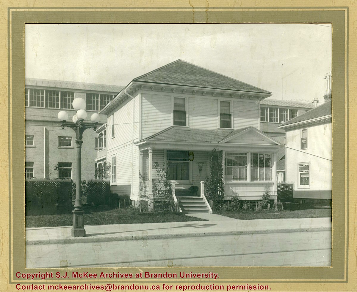
Photograph shows a two-storey wood-framed house with front porch and sunroom. Above a rocking chair and chez lounge, a Union Jack and pennant hang on the exterior wall on the porch. A five-globed black iron street lamp is on the sidewalk in front of the property. The Wheat City Arena can be seen behind the residence.
Notes
Based on the presence of the arena, the location has been identified as 10th Street near Victoria Avenue.
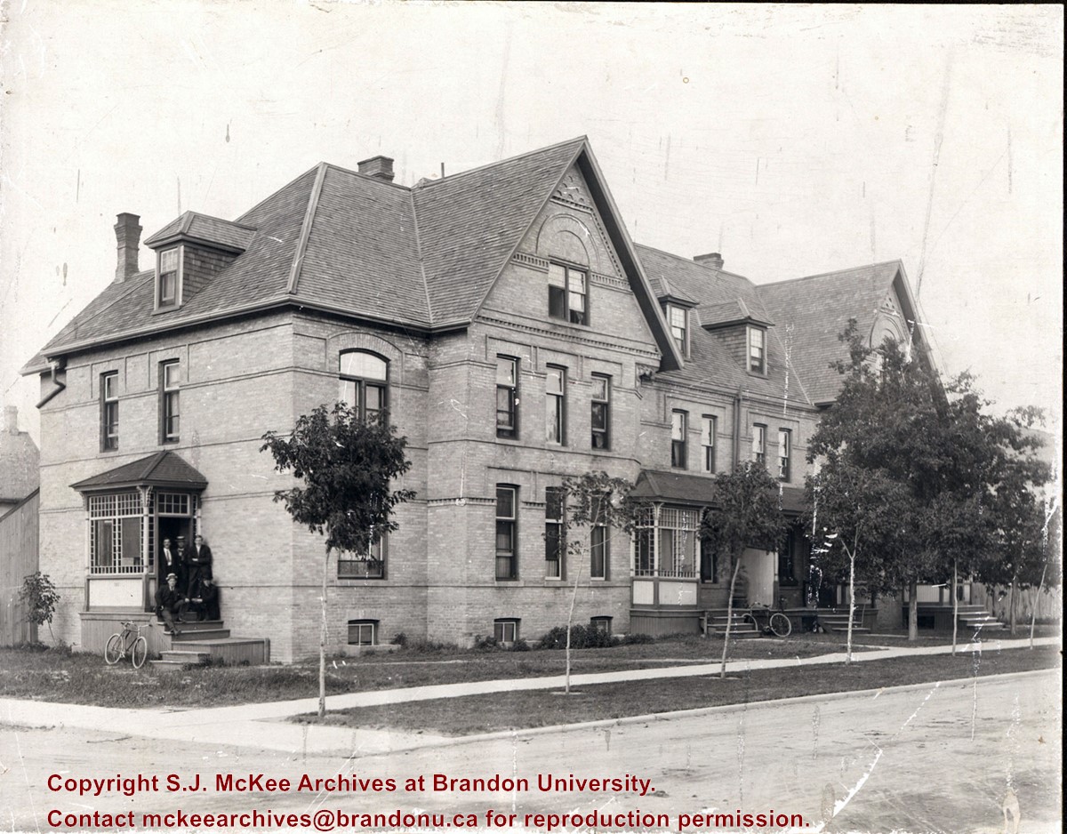
Photograph shows a three-storey multi-family brick house that appears to have at least four units. The structure also has a basement. A group of five men are posing on a stoop on the west side of the building. Sapplings have been planted on the boulevard in front the building.
Notes
Writing on the back of the photograph reads: Lorne Terrace, 12th and Lorne, always in the Hughes Family.
Photograph shows a two-storey wood-framed duplex. The building appears to be situated on a corner. The front verandas have wooden ornamentation and a lattice fence separates the front yards. Flowers and viriginia creeper appear in flower beds along the side of one house.
Notes
The location has been identified as the 7th Street Terrace between Lorne and Louise Avenues.
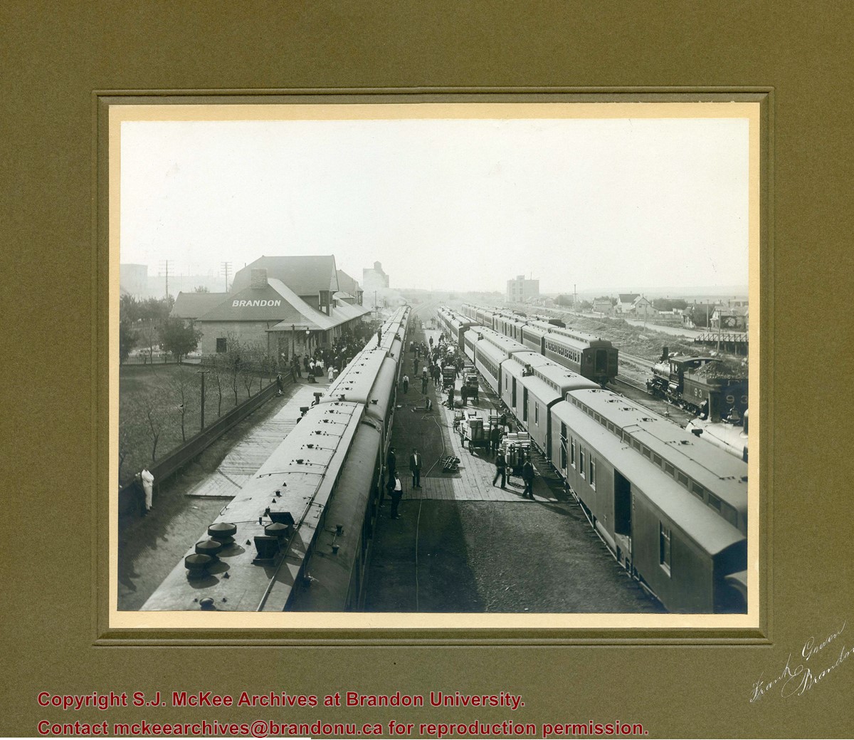
Photograph shows a CPR passenger trains at the old Brandon train station. Carts/trolleys appear to be loaded with wooden crates and metal milk containers. Photograph was likely taken from the 8th Street Bridge. The ramp to the 8th Street Bridge can be seen on the ride of the photograph, where residences line Assiniboine Avenue.
Photograph is scratche and scuffed. Top right corner is creased.
Scope and Content
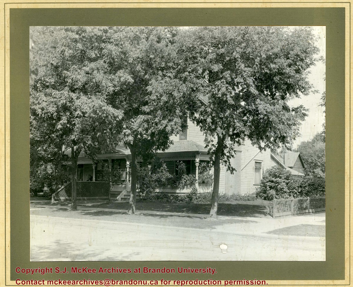
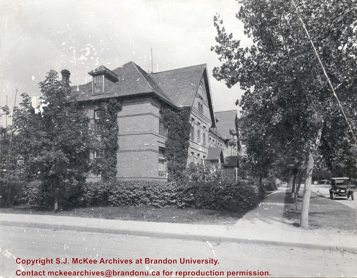
Photograph shows the three storey brick terraced property at 12th Street and Lorne Avenue. The entrance/stoop on the west side of the property appears to have been removed and the Lorne Street entrances have been modified (see 3-1997.72 for a comparison). Ivy is growing up the side of the house and the tree on the boulevard have grown and tower above the roof-line. A motor car is parked on Lorne Avenue in front the property.
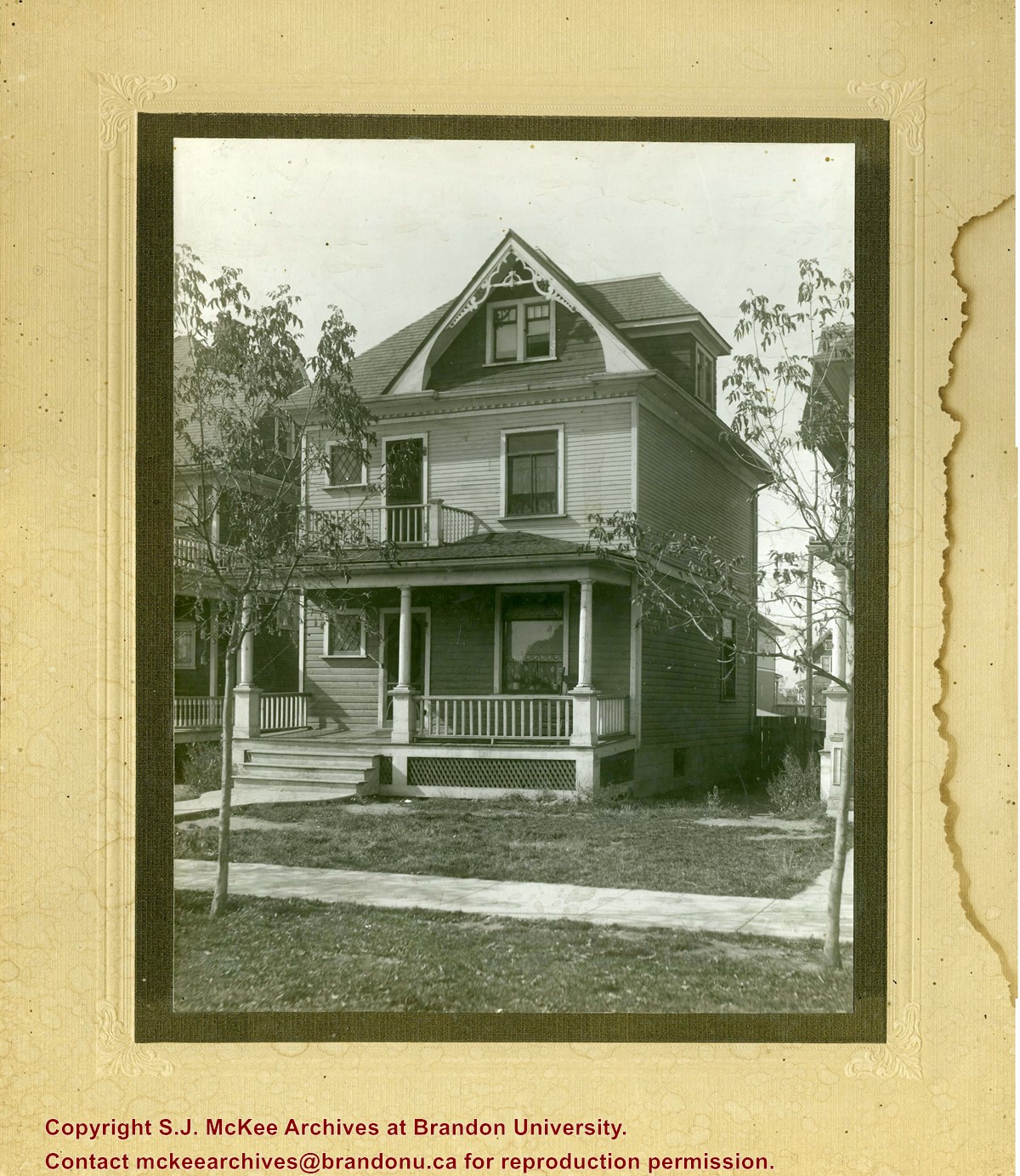
Photograph shows a three-storey wood framed house with a front porch, second storey balcony, and third-storey gable and dormer winder. Saplings have been planted on the boulevard.


