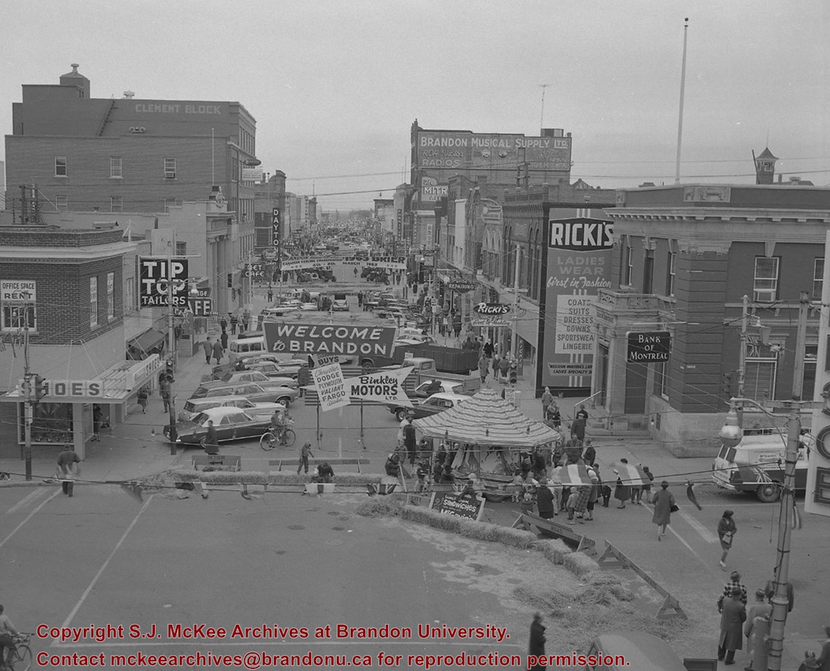
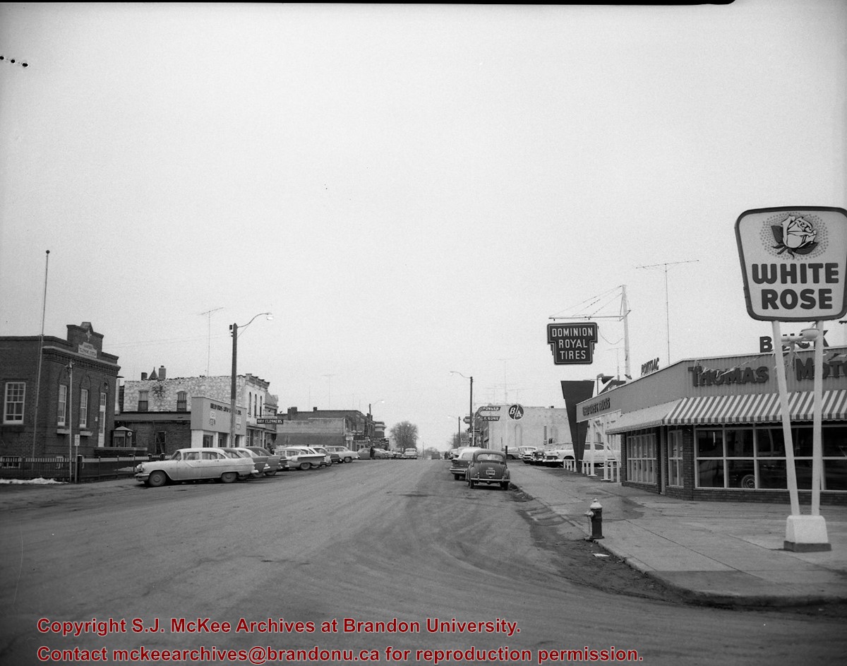
Photograph of 10th Street facing north from Princess Avenue. Vehicles are parallel parked on both sides of the street. The Welcome Brandon sign can be seen at the Rosser Avenue intersection.
Visible businesses on the west side of 10th Street include: Doig's, Box Brothers Hardware and Allied Hardware Stores in the Alexandra Block; followed by Simpsons-Sears in the Strathcona Block. Barry Neill Men's Wear, Kresge's and the Cecil Hotel are also visible. The Johnny Smith Block is visible in the background.
Visible businesses on the east side of 10th Street include: Ollies Steaks and Chops, Elna Sewing Centre, Carlton Cafe, Chop Suey. At the base of the hill the Canadian Pacific train station is visible at the base of the hill.
Notes
Writing on the front of the postcard reads: Tenth St. Brandon, Man.
Photograph of west side of 10th Street, Brandon, Manitoba, facing northwest. Visible businesses in the Alexandra Block include Doig's, Box Brothers Hardware and Allied Hardware Stores, followed by Simpsons-Sears and Barry Neill Men's Wear in the Strathcona Block. The Johnny Smith Block is visible in the background.
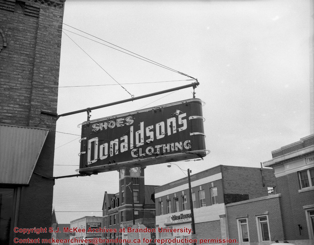
Photograph shows the west side of 10th Street between Rosser and Princess Avenues. Visible businesses include: Brandon News & Record Shop, Fashion Fabrics, Recreation Bowling & Billiards, Bottomley's, Barry Neill Men's Wear, Simpsons-Sears. Painted on the north face of the Strathcona Block are two advertisements, one for Sutherland and Robertson [Grocery] and the other for Boyd Electric Co. Ltd. Union Jack flags hang from some businesses and light standards.
Photograph shows the west side of 10th Street between Rosser and Princess Avenues. Visible businesses include: Recreation Bowling & Billiards, Bottomley's, Barry Neill Men's Wear, Simpsons-Sears, Allied Hardware Stores, Box Brothers Hardware, Doig's. Painted on the north face of the Strathcona Block are two advertisements, one for Sutherland and Robertson [Grocery] and the other for Boyd Electric Co. Ltd.
Photograph shows the southeast corner of 10th Street and Rosser Avenue, Brandon, Manitoba. The Bank of Montreal is situated on the corner. Visible businesses along the east side of 10th Street include: Barclay's Shoe Store, Carlton Cafe, and Ted Heming Jewellers.
Postcard shows an aerial view of 9th Street facing south in Brandon, Manitoba. Visible businesses and landmarks include: Beaubier Hotel, YMCA/police station, the original CKX Radio station towers on 8th Street (est. 1928 - moved 1940), the old City Hall, Prince Edward Hotel, and the original Manitoba Power commission smokestack on 10th Street.
Notes
Writing on the front of the photograph reads: Brandon, Man., Jerrett Photo. This photograph shows a rare view of the 800-block between Rosser and Princess Avenues.
Photograph of east side of 10th Street, Brandon, Manitoba, between Rosser and Princess Avenues. Visible businesses include: The Bank of Montreal, Barclay's Shoe Store, Carlton Cafe (in the former Cigar Factory), and Ted Heming Jewellers. The McKenzie Seed building is visible in the background.
See fonds level of the CKX records for custodial history.
Scope and Content
Image of the southside of the 1100 block of Rosser Avenue in winter. Visible are O.L. Harwood Ltd., the Key Kafe and Northern Auto Parts. The Perth's building, located in the 1200 block, can be seen on the righthand side in the background. A number of vehicles, a pedestrian and a man shovelling snow are also visible.
See fonds level of the CKX records for custodial history.
Scope and Content
Image of the southside of the 1000 and 1100 block of Rosser Avenue looking east in winter. Visible in the foregraound are O.L. Harwood Ltd., and the Key Kafe. Buildings in the 1000 block include: the Imperial Bank of Canada, the original Post Office and Federal Building and the original Merchants Bank. A number of pedestrians are also visible, as are Christmas decorations on the streetlights and telephone poles.


)
)
)
)
)
)
)