For custodial history see the collection level description of the Lawrence Stuckey collection.
Scope and Content
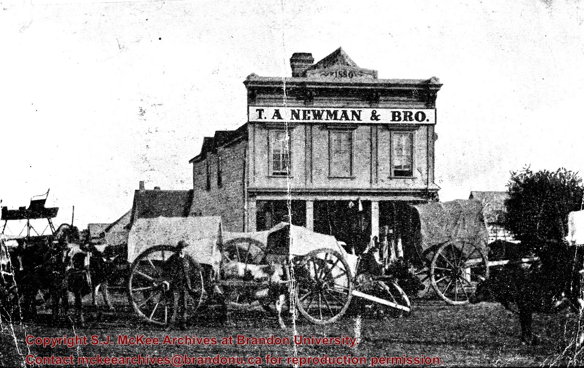
Image of Red River carts, T.A. Newman & Bros. Store.
Notes
[Brandon SE includes communities south of Trans-Canada #1 highway and east of PTH #10.] Lawrence Stuckey originally had this item identified as Cartwright, Manitoba, however Cartwright never had a Newman store.
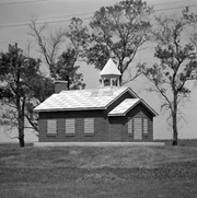
Fonds consists of correspondence, newsclippings, reminiscences, historical information about Grand Valley, name and address lists for students and teachers, invitations to Grand Valley School District reunions (1935 and 1968), the program for the dedication ceremonies and reunion picnic (1968), and the guest book for the 1968 reunion and cairn dedication. The latter includes 3 photographs.
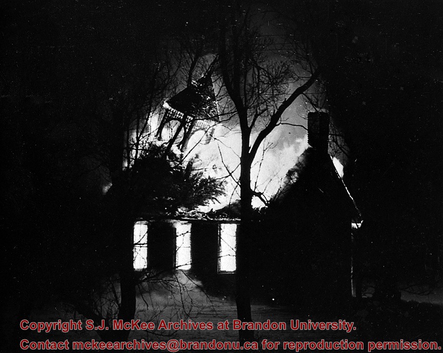
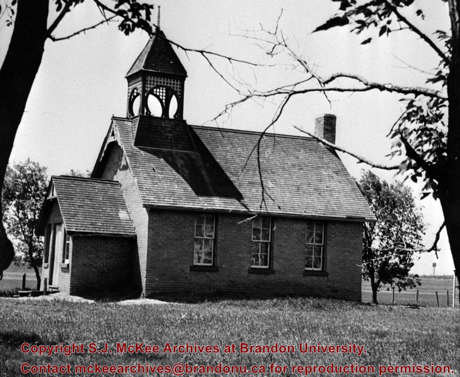
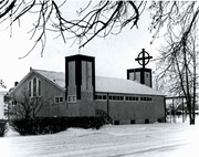
The Berbank Red Cross was founded in November 1917, as a local feature of the Great War. The name Berbank was created by combining the names of the two local districts, Riverbank and Bertha, located south of Brandon in the Rural Municipality of Oakland. The Berbank Red Cross sent supplies of various kinds to local soldiers serving in the Canadian Expeditionary Force in Europe. The organization also organized social gatherings in the Berbank area. With the end of the war most rural Red Cross organizations were disbanded, but the Berbank group agreed to remain intact to assist with the construction of a church. (See accession 28-1997 Berbank Church fonds)
Custodial History
This fonds was accessioned in 1997 by the McKee Archives. Prior custodial history is unknown.
Scope and Content
Fonds includes a minute book, which provides a complete record of every meeting held by the Berbank Red Cross, from its creation in 1917 to 1919, when it became the Berbank Ladies Aid. Fonds also includes a roll call, financial records, and meeting minutes.
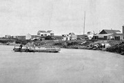
The Snye was a former channel (oxbow lake) of the Assiniboine River. It was located south of the Assiniboine between about 14th and 24th Streets, and during high water in the spring it carried overflow. For many years it was used as a log storage area for Hanbury's Mill. I remember there being bridges over it at 18th & 22nd Streets. It was dammed with a one way flipper valve at 14th Street that allowed water to flow out to the river, but prevented river water backing into it. Water within the Snye became stagnant in summer and formed a breeding area for mosquitoes. It was deemed a health hazard and the river was gradually filled in. LAS.
Custodial History
For custodial history see the collection level description of the Lawrence Stuckey collection.
Scope and Content
Snye River
Notes
[This negative was produced using a previous published image. P.E. 22/07/09]
Additional historical information provided by the Fred McGuinness collection (20-2009).
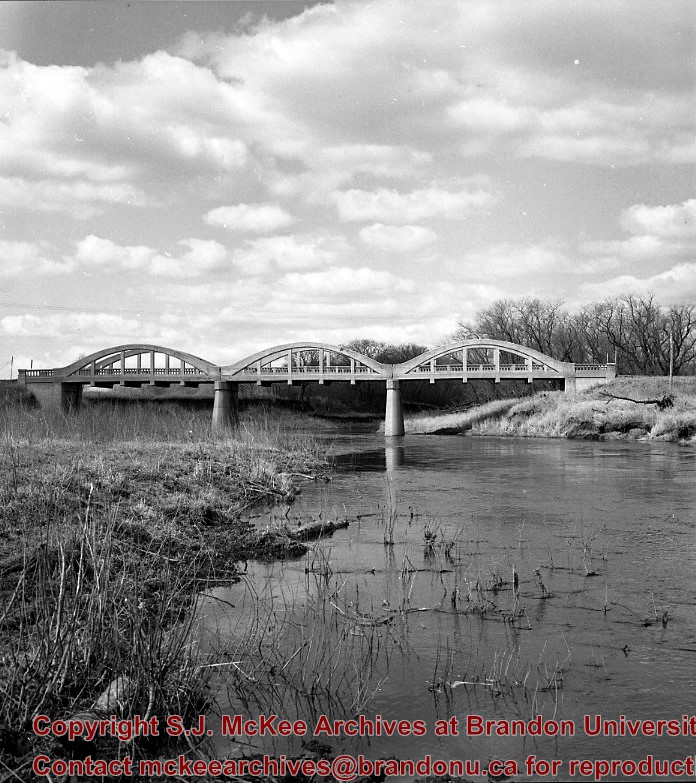
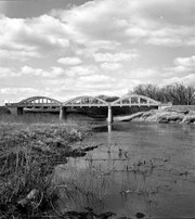
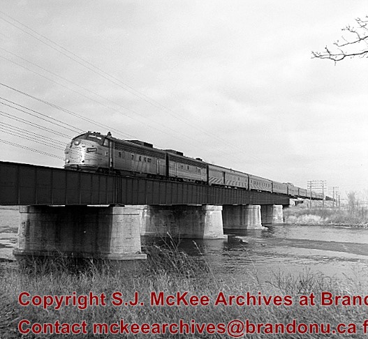
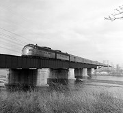
Stuckey's notes: Showing VIA No.1 "Canadian" power units 6507-6604 (ex. CNR GM model FP-9A and FP-9B). Bridge built c. 1912. The bridge was called "The Iron Bridge."
Scope and Content
Photograph shows the train crossing the bridge.
Notes
Corresponds with negative 1-2002.3.9.P26.
Repro Restriction
The McKee Archives is the copyright holder for the Stuckey materials.
These blocks of ice were used to fill the ice houses of the Wheat City Ice Co. (located north of Rosser Avenue on the west side of 15th Street, and south of Princess Avenue on the east side of 17th Street), the CPR icehouses (at the station and 3rd St. & Assiniboine Ave), and the CNR icehouse (at Forth Street and McTavish Avenue). In addition, large quantities of ice were shipped to smaller towns in railcars (usually old refrigerator cars).
Custodial History
For custodial history see the collection level description of the Lawrence Stuckey collection.
Scope and Content
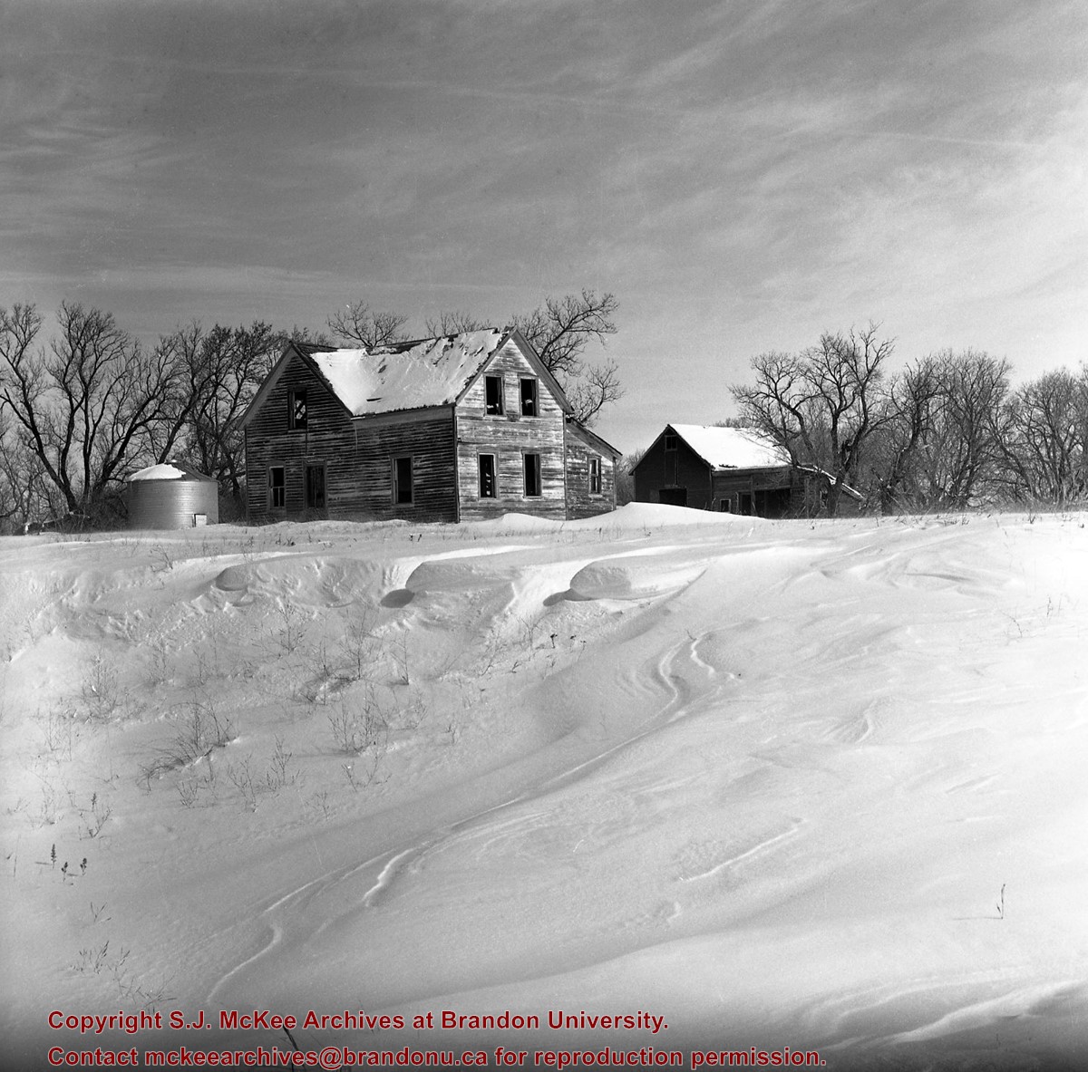
Cutting ice from the Assiniboine River
Notes
This is one of five images that show the method in which ice is cut into blocks and loaded onto sleighs or trucks. Note the large draft horses still in use at this date.
[Mr. Stuckey put five negatives into the same envelope. We have separated them and numbered them H12(1) to H12(5).]
Additional information provided by the Fred McGuinness collection (20-2009).
These blocks of ice were used to fill the ice houses of the Wheat City Ice Co. (located north of Rosser Avenue on the west side of 15th Street, and south of Princess Avenue on the east side of 17th Street), the CPR icehouses (at the station and 3rd St. & Assiniboine Ave), and the CNR icehouse (at Forth Street and McTavish Avenue). In addition, large quantities of ice were shipped to smaller towns in railcars (usually old refrigerator cars).
Custodial History
For custodial history see the collection level description of the Lawrence Stuckey collection.
Scope and Content
Cutting ice from the Assiniboine River
Notes
This is one of five images that show the method in which ice is cut into blocks and loaded onto sleighs or trucks. Note the large draft horses still in use at this date.
[Mr. Stuckey put five negatives into the same envelope. We have separated them and numbered them H12(1) to H12(5).]
Additional information provided by the Fred McGuinness collection (20-2009).


.jpg?width=1200&404=no-img.jpg&watermark=wmk)
.jpg?width=180&404=no-img.jpg)
.jpg?width=1200&404=no-img.jpg&watermark=wmk)
.jpg?width=180&404=no-img.jpg)
.jpg?width=1200&404=no-img.jpg&watermark=wmk)
.jpg?width=180&404=no-img.jpg)
)
)
)
.jpg%3fmaxheight%3d1000%26maxwidth%3d1000%26watermark%3dwmk&description=Cutting+Ice+from+the+Assiniboine+River)
.jpg%3fmaxheight%3d1000%26maxwidth%3d1000%26watermark%3dwmk&description=Cutting+Ice+from+the+Assiniboine+River)
.jpg%3fmaxheight%3d1000%26maxwidth%3d1000%26watermark%3dwmk&description=Cutting+Ice+from+the+Assiniboine+River)