View is west to McDiarmid Drive from approximately 16th Street between Princess and Louise Avenues. Photograph shows: Brandon College, Fleming School, Coronation Park, and West End Community Centre.
View is northwest from the corner of 18th Street and Louise Avenue. Photograph shows the Brandon College campus, the Steam Plant and Kinsmen Stadium. Flora Cowan Hall is under construction.
View is east southeast from approximately 22nd Street between Princess and Louise Avenues. Photograph shows: Brandon College, Stanley Park, Park School, Prince Edward Hotel, First Baptist Church, First Presbyterian Church, Wheat City Arena, First Church United, St. Paul's, Central United Church.
View is southeast from 21st Street and Princess Avenue. Photograph shows: Brandon College, Wheat City Arena, Armories, Reform (Knox) Church, Alexander School, Knox United Church, Kinsmen Playground, Kinsmen Stadium.
Image shows the Brandon College campus from 17th Street looking southwest. The photo was taken after the completion of the original Music Building in 1963, but construction of the Education Building. Also visible are a number of properties on the 200 block of 18th Street and the 200 block of 20th Street.
View is east northeast from approximately 22nd Street between Lorne and Louise Avenues. Photograph shows: Brandon College (before planting of trees in quadrangle and before the Education Building), McKenzie Seeds, Prince Edward Hotel, Central United (St. Paul's) Church, St. Augustine's Church.
View is east from approximatley 22nd Street between Lorne and Louise Avenues. Photograph shows: Darrach Hall, Flora Cowan Hall and the Citizens' Science Building, as well as a number of homes in the area.
Image is looking east northeast from approximately the 300 block of 23rd Street between Lorne and Louise Avenues. Photograph shows the Brandon College campus after the opening of the original Music Building in 1963, but before the construction of the Education Building in 1966. A number of house on the 300 blocks of 22nd and 21st Streets are visible in the foreground, with the A.E. McKenzie Seed Co., the Prince Edward Hotel and various grain elevators on the horizon.
Postcard shows an aerial view of 9th Street facing south in Brandon, Manitoba. Visible businesses and landmarks include: Beaubier Hotel, YMCA/police station, the original CKX Radio station towers on 8th Street (est. 1928 - moved 1940), the old City Hall, Prince Edward Hotel, and the original Manitoba Power commission smokestack on 10th Street.
Notes
Writing on the front of the photograph reads: Brandon, Man., Jerrett Photo. This photograph shows a rare view of the 800-block between Rosser and Princess Avenues.
For custodial history see the collection level description of the Lawrence Stuckey collection.
Scope and Content
Aerial view of downtown Brandon, including area of new Gallery Mall.
Notes
[This eastward aerial view of downtown Brandon seems to portray an outdoor second-story parking garage proposed by the architectural firm Ward, MacDonald and Partners. The proposed overhead parking is depicted as running continuously from Sixth Street to Tenth Street along Rosser Avenue. The negative appears to have been made by photographing an existing illustration. P.E. 03/06/09]
The matting has a large tear and some stains. The photograph itself has a couple of small stains.
Scope and Content
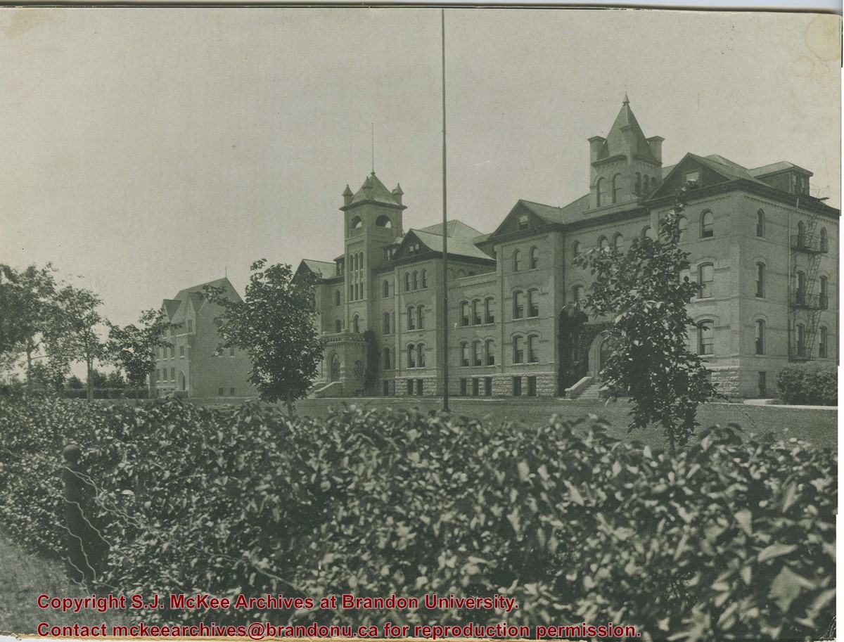
Photograph is looking southwest from the north end of the driveway and 18th Street and shows the Brandon College campus, including the front lawn, Clark Hall, the Brandon College Building and the Citizens' Science Building. Caption on the photograph reads: Brandon College: The Baptist College in Western Canada.
Photograph is looking southwest from the north end of the driveway and 18th Street and shows the Brandon College campus, including the front lawn, Clark Hall, the Brandon College Building and the Citizens' Science Building.
Notes
This photograph was used on a number of the Class photographs in BUPC 9. Duplicate is 9.43.
Photograph is looking northwest probably from the northwest corner of 18th Street and Louise Avenue. The photographer was laying down when s/he took the shot. Photograph shows the field to the south of the Citizens' Science Building, as well as the Citizens' Science Building, part of the Brandon College Building and Clark Hall, and two H-Huts. The photo was taken in summer as the field is full of dandelions.
View is southwest. Photograph shows Clark Hall, the Brandon College Building, the Citizens' Science Building and the driveway running in front of the buildings. Portions of the front lawn and the Kinsmen Staduim are also visible.
View is northwest from the front lawn. Photograph shows the Citizens' Science Building, an H-Hut, the Brandon College Building, Clark Hall and the original Music Building.
See fonds level of the CKX records for custodial history.
Scope and Content
Image is looking southwest across Brandon College campus. Visible are Clark Hall, the Brandon College Building, the Citizens' Science Building and the A.E. McKenzie Building.


.jpg?width=1200&404=no-img.jpg&watermark=wmk)
.jpg?width=180&404=no-img.jpg)
.jpg?width=1200&404=no-img.jpg&watermark=wmk)
.jpg?width=180&404=no-img.jpg)


.jpg%3fmaxheight%3d1000%26maxwidth%3d1000%26watermark%3dwmk&description=Aerial+View+of+Core+Area)
.jpg%3fmaxheight%3d1000%26maxwidth%3d1000%26watermark%3dwmk&description=Aerial+View+of+Core+Area)