Postcard shows an aerial view of 9th Street facing south in Brandon, Manitoba. Visible businesses and landmarks include: Beaubier Hotel, YMCA/police station, the original CKX Radio station towers on 8th Street (est. 1928 - moved 1940), the old City Hall, Prince Edward Hotel, and the original Manitoba Power commission smokestack on 10th Street.
Notes
Writing on the front of the photograph reads: Brandon, Man., Jerrett Photo. This photograph shows a rare view of the 800-block between Rosser and Princess Avenues.
See fonds level of the CKX records for custodial history.
Scope and Content
Image is looking southwest across Brandon College campus. Visible are Clark Hall, the Brandon College Building, the Citizens' Science Building and the A.E. McKenzie Building.
See fonds level of the CKX records for custodial history.
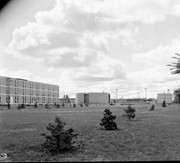
Scope and Content
Image is looking northwest across Brandon College campus. Visible are the H-Huts and the Citizen's Science Building. Behind the Citizen's Science Building are the Brandon College Building and Clark Hall.
See fonds level of the CKX records for custodial history.
Scope and Content
Image is looking south southwest across Brandon College campus. Visible are Clark Hall, the Brandon College Building and the Citizens' Science Building.
See fonds level of the CKX records for custodial history.
Scope and Content
Image is looking northwest across Brandon College campus. Visible is part of an H-Hut, the J.R.C. Evans Lecture Theatre and the A.E. McKenzie Building.
See fonds level of the CKX records for custodial history.
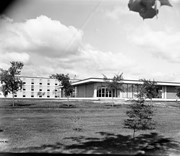
Scope and Content
Image is looking north northwest across Brandon College campus. Visible are the Dining Room, the J.R.C. Evans Lecture Theatre and the A.E. McKenzie Building.
See fonds level of the CKX records for custodial history.
Scope and Content
Image is looking southeast across the Brandon College campus. Visible are portions of the A.E. McKenzie Building, the J.R.C. Evans Lecture Theatre, the Dining Room, and Darrach Hall.
Red ink stain is on the front right corner of postcard
Scope and Content
Photograph shows 10th Street facing south from Princess Avenue. Visible landmarks and businesses include: Manitoba Power Commission (MPC)'s power sub-station, First Baptist Church, Wheat City Arena, and the grand stand at the Exhibition Grounds.
The partial sign visible at the bottom of the photograph on the east side of 10th Street reads Yates and Neale, which refers to a plumbing and heating company that dissolved in 1943 to be replaced by Neale, Stothard and Chapman.
Businesses on the west side of 10th Street include: Dominion Tire & Radio Co., Bolts Barber Shop, Elviss T.E. Co. Stables.
Notes
Information concerning Yates and Neale courtesy Jack Stothard. Writing on the front of the postcard reads: Brandon, Looking S.W., Jerrett Photo. This photograph shows a rare view of the 200-block of 10th Street.
See fonds level of the CKX records for custodial history.
Scope and Content
Image consists of an aerial view looking north at the intersection of Highways 1 and 10 and shows the British American dealer located at the intersection.
See fonds level of the CKX records for custodial history.
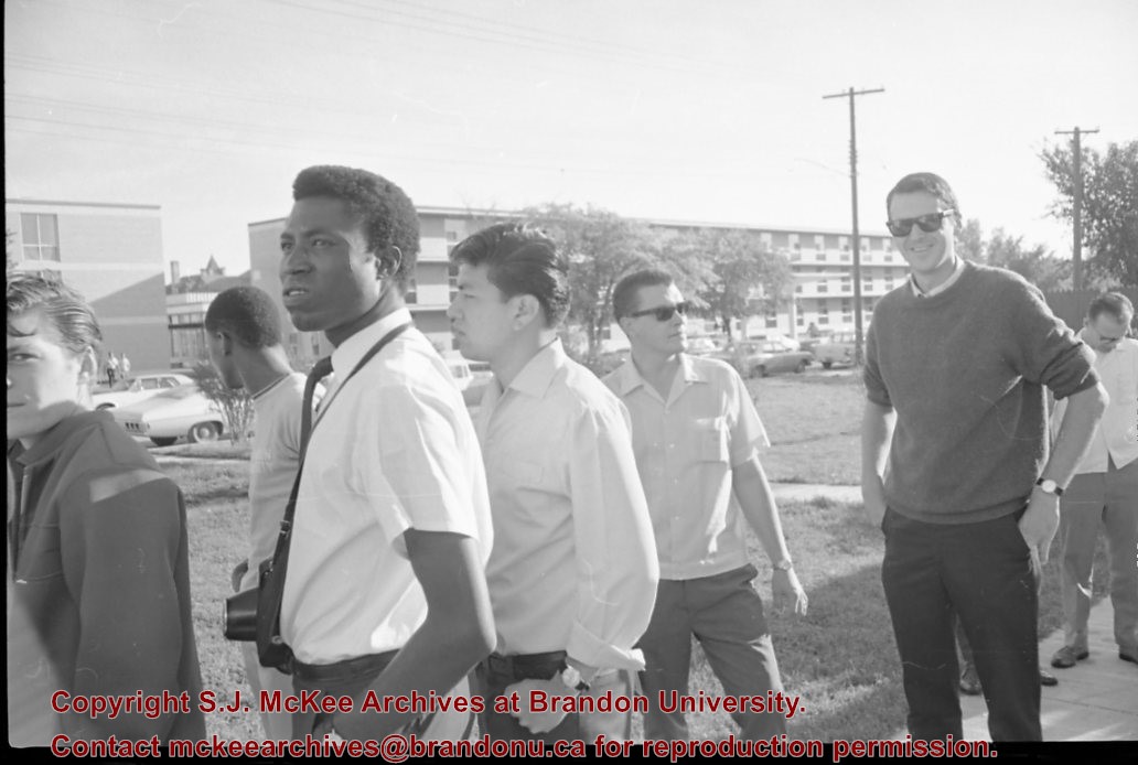
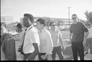
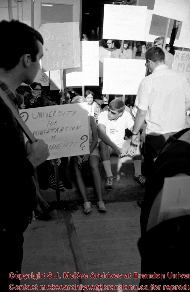
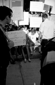
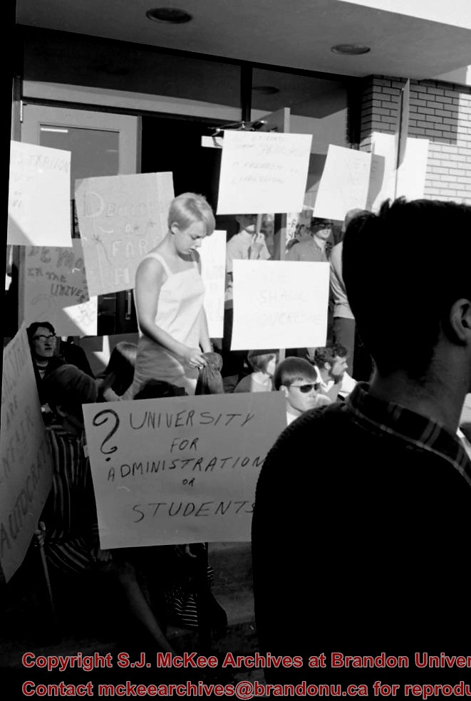
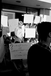
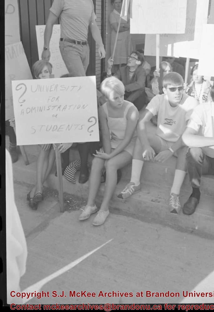
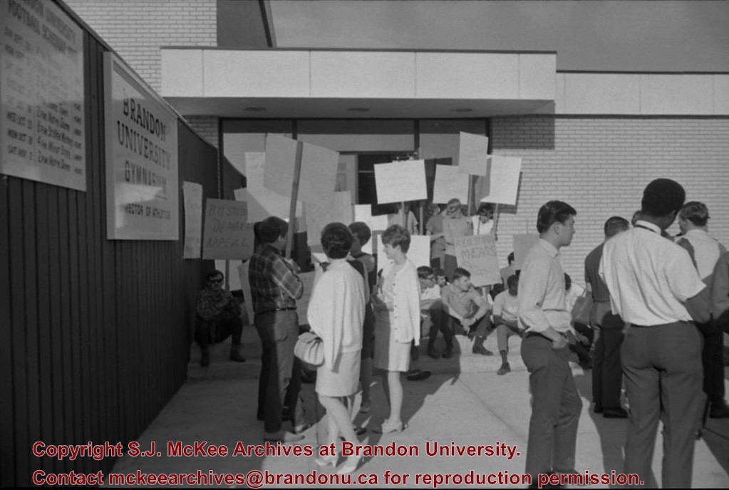
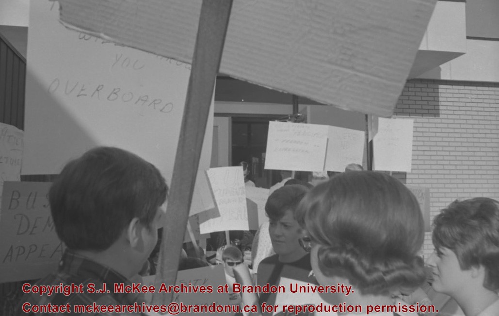
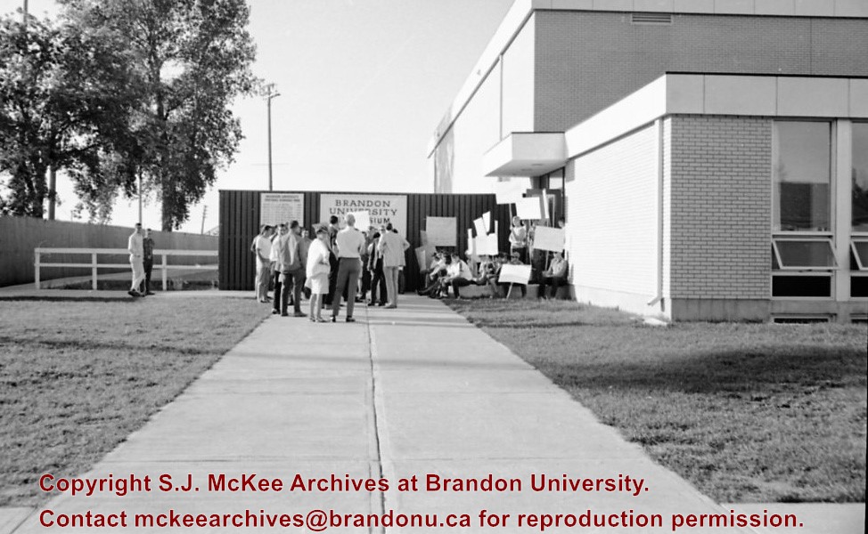
Scope and Content
Image of protesters outside the Gymnasium taken during the Brandon University rampage. Darrach Hall and Flora Cowan Hall are visible in the background.
See fonds level of the CKX records for custodial history.
Scope and Content
Image consists of an aerial view looking southeast at the intersection of Highways 1 and 10 and shows the British American dealer located at the intersection.


