The photograph was taken for the Centennial of Brandon College/University.
Scope and Content
Aerial photograph taken looking southwest from approximately the northeast corner of Princess Avenue and 17th Street. The entire campus, as well as a number of residential streets are visible.
The matting has a large tear and some stains. The photograph itself has a couple of small stains.
Scope and Content
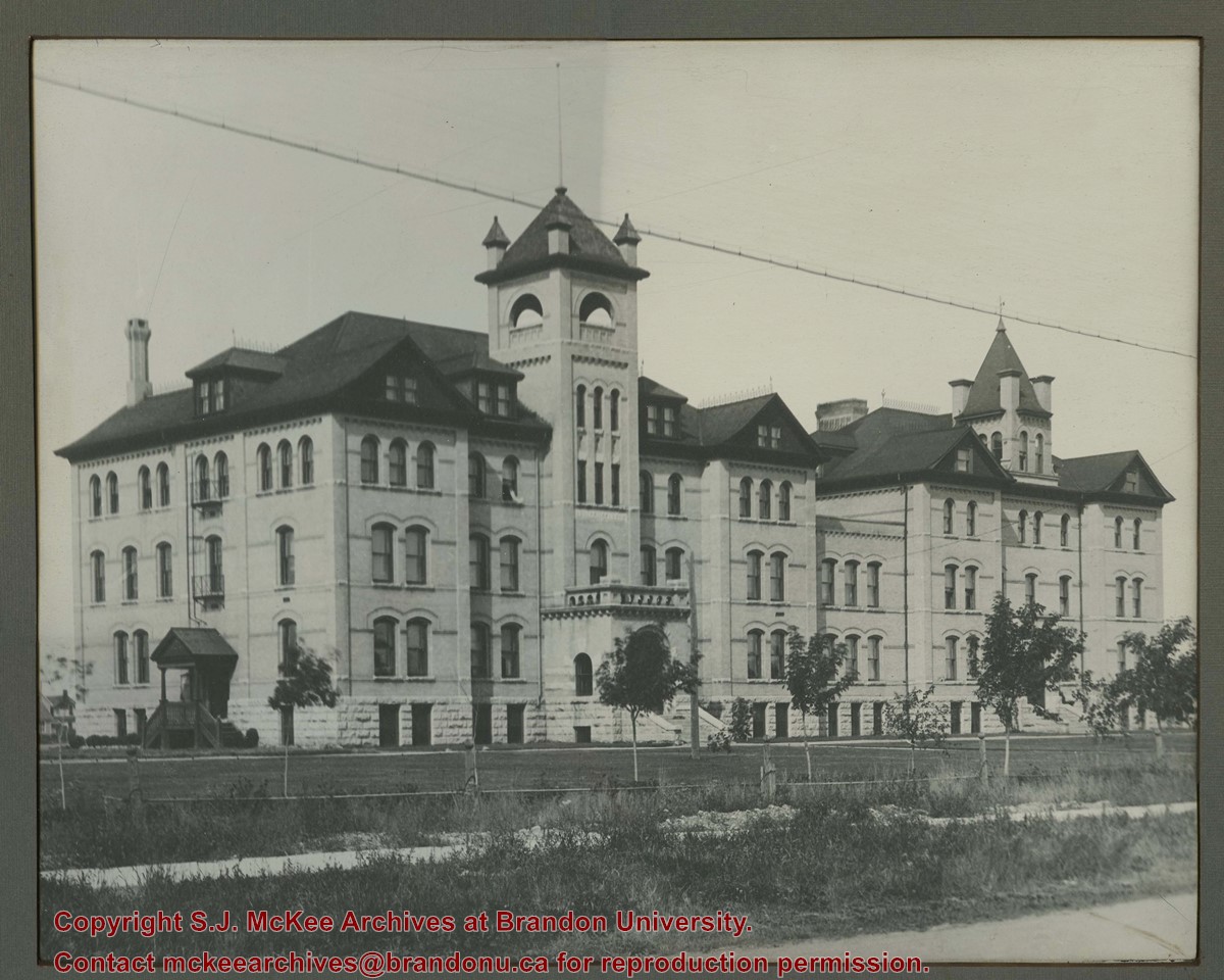
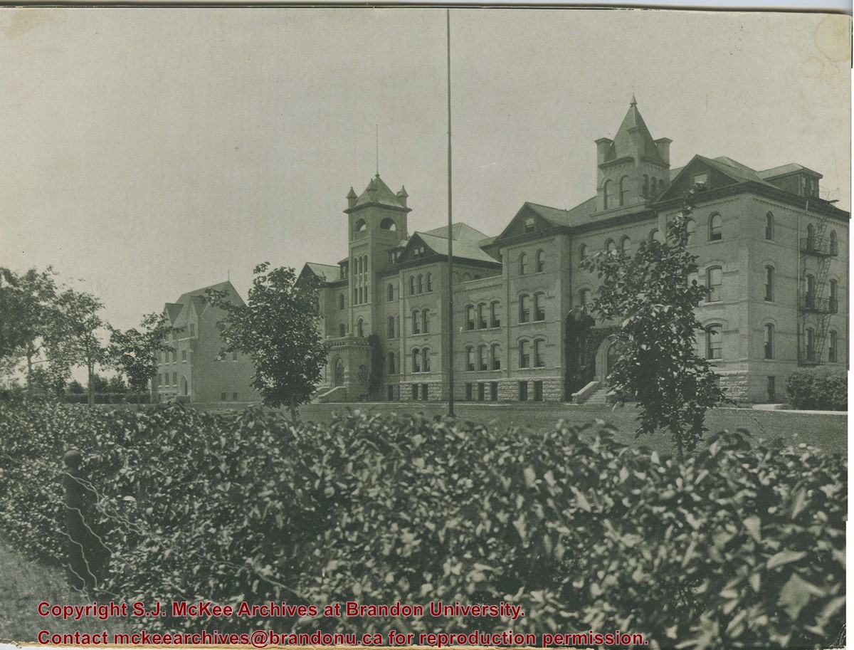
Photograph is looking southwest from the north end of the driveway and 18th Street and shows the Brandon College campus, including the front lawn, Clark Hall, the Brandon College Building and the Citizens' Science Building. Caption on the photograph reads: Brandon College: The Baptist College in Western Canada.
The Brandon University Photograph collection is an artifically created collection. It includes photographs from both Brandon College and Brandon University.
Custodial History
The custodial history is varied. Some photographs were created by officers of the College and the University, or were produced at the request of the institution. Many, as well, have been donated by former faculty members and students. We have tried to record the custodial history for photographs that have been donated by faculty members and students at the item level.
Scope and Content
Fonds has been divided into eleven series, including: (1) Convocation, Scholarships and Awards; (2) Campus Buildings; (3) Library Activities and Archives; (4) Faculties and Schools; (5) Student Activities; (6) Administrative and Support Units; (7) Sports; (8) Portraits; (9) Oversize; (10) Special Events; and (11) Documents, Diplomas and Certificates.
The photograph may have been taken for Brandon University's centennial.
Scope and Content
Photograph is looking northeast from approximately Victoria Avenue and 21st Street and shows the Brandon University campus, Kinsmen Stadium, the Assiniboine River and a number of residential neighbourhoods.
Postcard is of buildings at Brandon University, including Clark Hall and the Original Building prior to the renovations, McMasater Hall, and the Q.E.II School of Music building.
Notes
Writing on the front of the postcard reads: Brandon University. Back of the postcard reads: (Top Left) Brandon University original building (Administration Center.), Bottom Left) Queen Elizabeth II Music Building, (Right) McMaster Hall Residence; Photo by Sandy Black; Printed in Brandon, Manitoba, Canada, by Leech Printing Ltd.
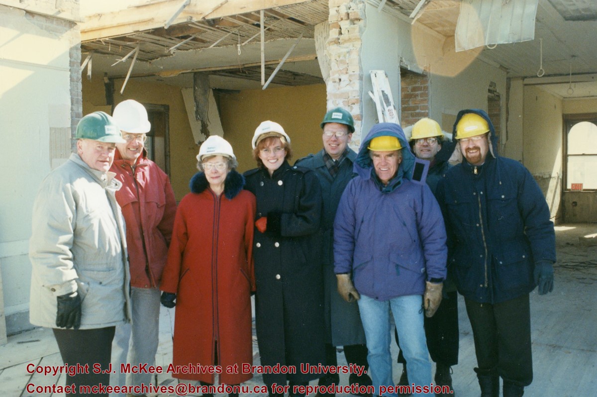
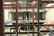
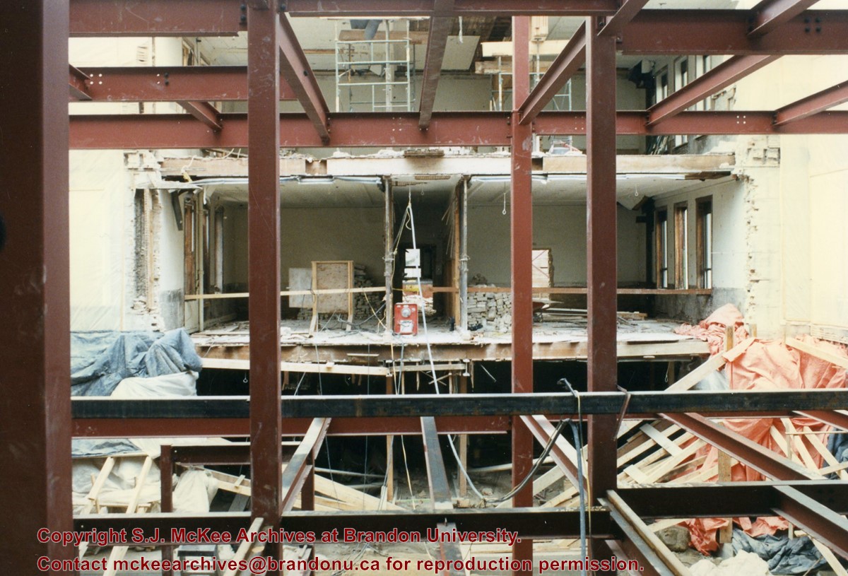
Photograph shows members of the Brandon University Foundation during a tour of the construction site. Members include: Scott Stewart, Doug Adams, Sheri Decter-Hirst.
Series is divided into 13 sub-series, including: (1) Aerials; (2) Brandon College Building & Clark Hall; (3) Citizens' Science Centre & Knowles Douglas Building; (4) Richardson Centre & A.E. McKenzie Building; (5) Healthy Living Centre & Henry Champ Gymnasium; (6) Dining Hall & Residences; (7) Education Building; (8) Original Music Building & the Queen Elizabeth II Music Building; (9) J.R. Brodie Science Centre; (10) Dr. James and Mrs. Lucille Brown Health Studies Complex; (11) Jeff Umphrey Building & Glen P. Sutherland Art Gallery; (12) Physical Plant; (13) H-Huts.
Photograph is looking southwest from the north end of the driveway and 18th Street and shows the Brandon College campus, including the front lawn, Clark Hall, the Brandon College Building and the Citizens' Science Building.
Notes
This photograph was used on a number of the Class photographs in BUPC 9. Duplicate is 9.43.
Photographs have been glued to a backing board that has warped over time
Scope and Content
Photograph shows street view of north side of Rosser Avenue, primarily the 700 block, along which sewer pipe is being laid. Visible buildings and businesses include: The Fleming Block with Lowes Brothers Clothing and Manitoba Farmers Hedge and Wire Fence Company, the Beaubier Block and its Empire Hotel, A.M. Percival (a grocer), the Brandon Hardware Company (600 block), and the Arlington Hotel (500 block) are visible along the north side of the avenue. The Bank of Hamilton Building is on the southeast corner of 8th Street and Rosser Avenue.
Notes
Writing on the front of the photograph matting reads: 290. Page appears to be from a photo album.
Photograph shows residential area of Lorne Avenue from 14th Street facing east.
Notes
Part of "Christie's Brandon Series of Six Colored Picture Postcards of Brandon, Manitoba, The Crown Series, Published by Christie's Bookstore, Brandon, Man." [note: missing sixth postcard]. Writing on the front of the photograph reads: Residential, Brandon, Man. Looking East.
Photograph shows a street view of Lorne Avenue and 4th Street facing west. Brandon College can be seen at the end of Lorne Avenue.
Notes
Part of "Christie's Brandon Series of Six Colored Picture Postcards of Brandon, Manitoba, The Crown Series, Published by Christie's Bookstore, Brandon, Man." [note: missing sixth postcard]. Writing on the front of the photograph reads: Residential Brandon, Man. Looking West. Photograph likely taken from St. Augustine's Church.
Postcard shows an exterior view of the Twin Pines Motel
Notes
Writing on the back of the postcard reads: Twin Pines Motel & Restaurant / Brandon, Manitoba, Canada / Located at 10th Street & Queens Avenue / 40 Fully modern units with bath & showers, T. / Kichenettes, winter plug-ins, Ample parking. / For reservations call.... / 30717-C Color Photo by Joe Fartak / Color Productions Ltd., Box 1243, Regina, Sask.
The postcard is addressed to Mr. F.A. Rosser and is postmarked Brandon 06 June 1970. A 6-cent Queen Elizabeth red postage stamp portraying various modes of the transportation.
Left hand corner of mat is bent. Mock-up instructions are written in pencil at the bottom right hand corner. Portions of the photograph itself are marked with pen.
History / Biographical
The Queen's Hotel was located on the corner of Rosser Avenue and Tenth Street (Steen & Boyce, 1882. Brandon, Manitoba, Canada and Her Industries. Steen & Boyce Publishers Printers & Binders, 81.). Therefore this photo appears to display Rosser Avenue looking east. P.E. 11/06/09
Scope and Content
Photograph shows early Rosser Avenue under construction between 9th Street and 10th Street in the 1880s. Buildings that line the avenue are wood framed and there are wooden boardwalks in front of a few structures. On the north side of Rosser Avenue signs for Fortier & Bucke Commision Agents and Transit House (Hotel) can be seen. On the south side of Rosser Avenue, the Queen's Hotel and Robinson Brothers and Company groceries and dry goods store are open for business. A family appears to be standing on the stoop at the dry goods store. A boy is lounging in the entryway of the Queen's Hotel. A man is standing on a wooden plank that extends across the dirt road of Rosser Avenue between the dry goods store and the commission agents' shop.
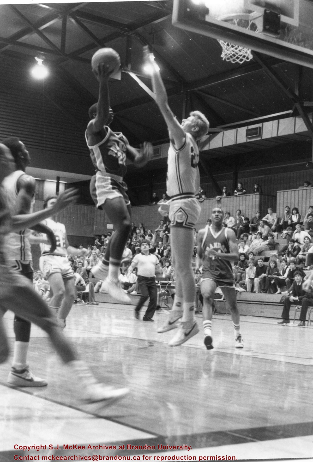
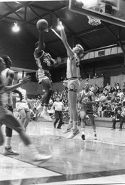
Photograph taken during a game between the Brandon University Bobcats and Lakehead University. Bobcats Kenny Fields (#22) with the ball, Patrick Jebbison (#44) in the background.
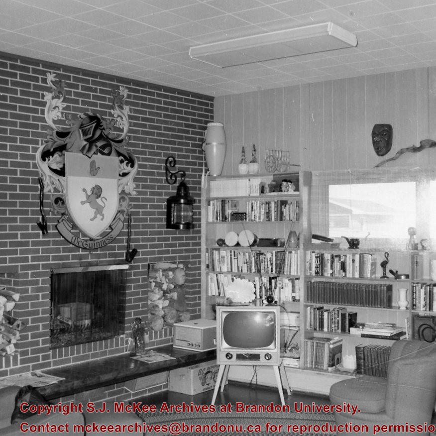
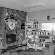
Photograph shows the interior of the McGuinness home (492 6th Street Northeast) in a new housing development in Medicine Hat. The living room has brickfaced fireplace above which there is a large McGuinness coat of arms.
Notes
A negative exists for this photo and is stored with the picture.
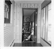
Photograph shows the interior of the McGuinness home (492 6th Street Northeast) in a new housing development in Medicine Hat. This view shows an entrance to a possible den.
Notes
A negative exists for this photo and is stored with the picture.


