Skip header and navigation

Revise Search

20 records – page 7 of 1.

Brandon University photograph collection

http://archives.brandonu.ca/en/permalink/descriptions1
Part Of
Brandon University Photograph Collection
Description Level
Collection
GMD
graphic
Date Range
1900-present
Part Of
Brandon University Photograph Collection
Description Level
Collection
GMD
graphic
Date Range
1900-present
Physical Description
See series level for extent
History / Biographical
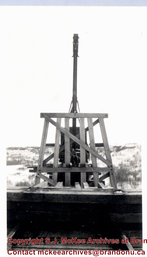
The Brandon University Photograph collection is an artifically created collection. It includes photographs from both Brandon College and Brandon University.
Custodial History
The custodial history is varied. Some photographs were created by officers of the College and the University, or were produced at the request of the institution. Many, as well, have been donated by former faculty members and students. We have tried to record the custodial history for photographs that have been donated by faculty members and students at the item level.
Scope and Content
Fonds has been divided into eleven series, including: (1) Convocation, Scholarships and Awards; (2) Campus Buildings; (3) Library Activities and Archives; (4) Faculties and Schools; (5) Student Activities; (6) Administrative and Support Units; (7) Sports; (8) Portraits; (9) Oversize; (10) Special Events; and (11) Documents, Diplomas and Certificates.
Name Access
S.J. Mckee Archives
Subject Access
photographs
Accruals
Further accruals expected.
Repro Restriction
Copyright provisions apply as per the current Copyright Act.
Storage Range
Photograph storage drawers and oversize storage
Arrangement
This collection is currently being re-numbered and re-housed. As a result there are two different arrangements.
Show Less

Great Northern Railway bridge construction

http://archives.brandonu.ca/en/permalink/descriptions10156
Part Of
RG 12 Brandon and Area Photograph Collection
Description Level
Item
GMD
graphic
Date Range
[19--]
Part Of
RG 12 Brandon and Area Photograph Collection
Description Level
Item
Series Number
3
Item Number
BAPC 3.10
GMD
graphic
Date Range
[19--]
Physical Description
4.5" x 2.5" (b/w)
History / Biographical
Bunclody, MB was located near Souris, MB. The bridge in question crossed the Souris River.
Custodial History
Photograph was donated by a "Mrs. Wilson" in 1989.
Scope and Content
Photograph is a close-up of a moveable crane used for railway maitenance.
Name Access
Great Northern Railway
Bunclody, MB
Subject Access
construction of railroads
machinery
Storage Location
BAPC photograph drawer
Images
Show Less

Great Northern Railway bridge construction

http://archives.brandonu.ca/en/permalink/descriptions10157
Part Of
RG 12 Brandon and Area Photograph Collection
Description Level
Item
GMD
graphic
Date Range
[19--]
Part Of
RG 12 Brandon and Area Photograph Collection
Description Level
Item
Series Number
3
Item Number
BAPC 3.11
GMD
graphic
Date Range
[19--]
Physical Description
4.5" x 2.5" (b/w)
History / Biographical
Bunclody, MB was located near Souris, MB. The bridge in question crossed the Souris River.
Custodial History
Photograph was donated by a "Mrs. Wilson" in 1989.
Scope and Content
Photograph shows a moveable crane used for railway maitenance on snow covered tracks.
Name Access
Great Northern Railway
Bunclody, MB
Subject Access
construction of railroads
machinery
Storage Location
BAPC photograph drawer
Images
Show Less

Aerial view: Brandon University campus

http://archives.brandonu.ca/en/permalink/descriptions605
Part Of
Aerial views and campus photographs
Description Level
Item
GMD
graphic
Date Range
c. 1969
Part Of
Aerial views and campus photographs
Description Level
Item
Series Number
2.1
Item Number
2.1.12
GMD
graphic
Date Range
c. 1969
Physical Description
3.5" x 3.5" (b/w)
Scope and Content
View is northeast. Brandon University campus and some of the surrounding residential areas.
Images
Show Less

Aerial view: Brandon University campus

http://archives.brandonu.ca/en/permalink/descriptions607
Part Of
Aerial views and campus photographs
Description Level
Item
GMD
graphic
Date Range
c. 1970
Part Of
Aerial views and campus photographs
Description Level
Item
Series Number
2.1
Item Number
2.1.14
GMD
graphic
Date Range
c. 1970
Physical Description
5" x 3" (b/w)
Scope and Content
View is north northwest from the roof of Flora Cowan Hall (?). Photograph shows: the J.R.C. Evans Lecture Theatre, the A.E. McKenzie Building and the Western Manitoba Centennial Auditorium as well as a number of houses on 20th Street.
Images
Show Less

Aerial view: Brandon University campus

http://archives.brandonu.ca/en/permalink/descriptions618
Part Of
Aerial views and campus photographs
Description Level
Item
GMD
graphic
Date Range
c. 1969
Part Of
Aerial views and campus photographs
Description Level
Item
Series Number
2.1
Item Number
2.1.26
GMD
graphic
Date Range
c. 1969
Physical Description
3.5" x 3.5" (b/w)
Scope and Content
Taken from an airplane, photograph is looking northwest from approximatley 15th Street and Louise Avenue. Shown are a number of residential blocks, the Brandon University campus, the railroad tracks and the Assiniboine River to approximatley 34th Street.
Images
Show Less

Aerial view: Brandon University campus

http://archives.brandonu.ca/en/permalink/descriptions619
Part Of
Aerial views and campus photographs
Description Level
Item
GMD
graphic
Date Range
c. 1969
Part Of
Aerial views and campus photographs
Description Level
Item
Series Number
2.1
Item Number
2.1.27
GMD
graphic
Date Range
c. 1969
Physical Description
3.5" x 3.5" (b/w)
Scope and Content
Taken from an airplane, photograph is looking north northwest from almost right above the Brandon University campus.
Images
Show Less

Aerial view: Brandon University campus

http://archives.brandonu.ca/en/permalink/descriptions620
Part Of
Aerial views and campus photographs
Description Level
Item
GMD
graphic
Date Range
c. 1969
Part Of
Aerial views and campus photographs
Description Level
Item
Series Number
2.1
Item Number
2.1.28
GMD
graphic
Date Range
c. 1969
Physical Description
3.5" x 3.5" (b/w)
Scope and Content
Taken from an airplane, photograph is looking north from approximately Louise Avenue between 18th and 20th Streets.
Notes
Photograph is slightly out of focus.
Show Less

Brandon University campus front lawn

http://archives.brandonu.ca/en/permalink/descriptions769
Part Of
Aerial views and campus photographs
Description Level
Item
GMD
graphic
Date Range
May 1978
Part Of
Aerial views and campus photographs
Description Level
Item
Series Number
2.1
Item Number
2.1.143
GMD
graphic
Date Range
May 1978
Physical Description
3.5" x 5" (colour)
Scope and Content
Photograph is looking south and shows the front lawn. The John R. Brodie Science Centre is in the background.
Images
Show Less

Brandon University campus front lawn

http://archives.brandonu.ca/en/permalink/descriptions772
Part Of
Aerial views and campus photographs
Description Level
Item
GMD
graphic
Date Range
May 1978
Part Of
Aerial views and campus photographs
Description Level
Item
Series Number
2.1
Item Number
2.1.32
GMD
graphic
Date Range
May 1978
Physical Description
5" x 3.5" (colour)
Scope and Content
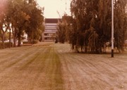
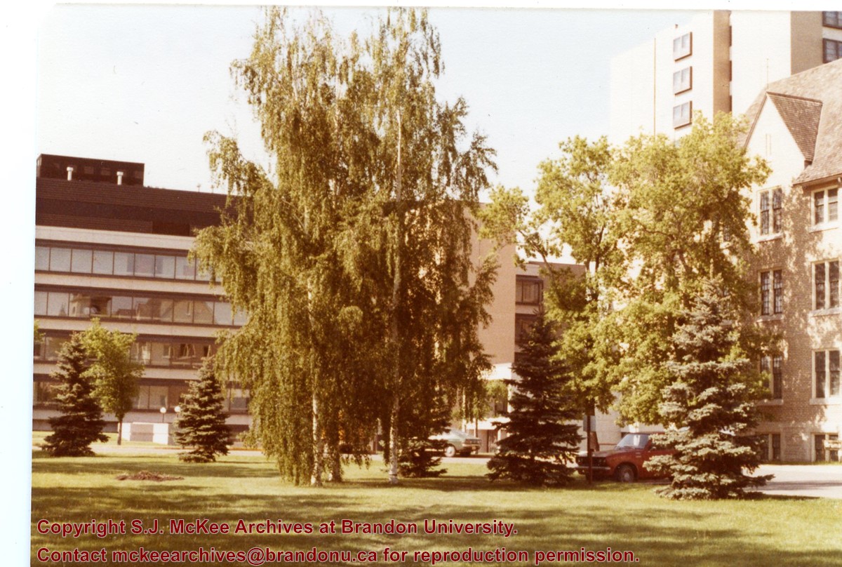
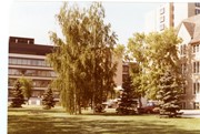
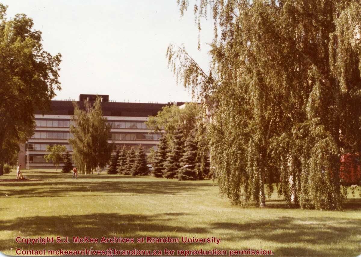
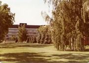
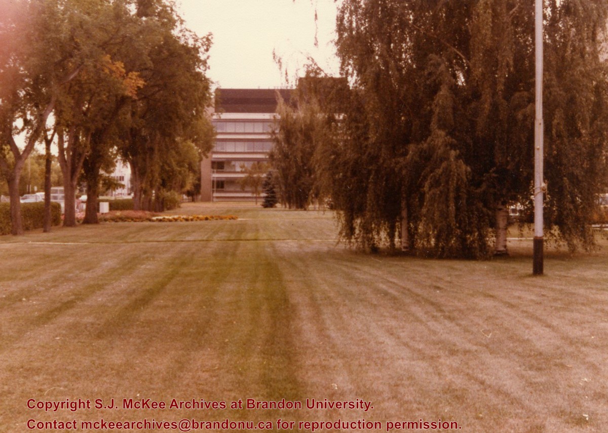
View is south southwest. Photograph shows the Brandon University campus front lawn in summer, with the John R. Brodie Science Centre, McMaster Hall, and the Citizens' Science Building in the background.
Images
Show Less

Brandon University campus front lawn

http://archives.brandonu.ca/en/permalink/descriptions774
Part Of
Aerial views and campus photographs
Description Level
Item
GMD
graphic
Date Range
May 1978
Part Of
Aerial views and campus photographs
Description Level
Item
Series Number
2.1
Item Number
2.1.33
GMD
graphic
Date Range
May 1978
Physical Description
5" x 3.5" (colour)
Scope and Content
View is south. Photograph shows the Brandon University campus front lawn in summer. The John R. Brodie Science Centre is in the background.
Images
Show Less

Brandon University campus front lawn

http://archives.brandonu.ca/en/permalink/descriptions869
Part Of
Aerial views and campus photographs
Description Level
Item
GMD
graphic
Date Range
May 1978
Part Of
Aerial views and campus photographs
Description Level
Item
Series Number
2.1
Item Number
2.1.38
GMD
graphic
Date Range
May 1978
Physical Description
5" x 3.5" (colour)
Scope and Content
View is north encompassing the front lawn of the Brandon University campus. The Education Building can be seen in the background.
Show Less

Proposed model of the Brandon University campus

http://archives.brandonu.ca/en/permalink/descriptions919
Part Of
Aerial views and campus photographs
Description Level
Item
GMD
graphic
Date Range
c. 1960s
Part Of
Aerial views and campus photographs
Description Level
Item
Series Number
2.1
Item Number
2.1.45
GMD
graphic
Date Range
c. 1960s
Physical Description
7" x 5" (b/w)
Scope and Content
A model of the proposed campus of Brandon University.
Show Less

Aerial view: Brandon University campus

http://archives.brandonu.ca/en/permalink/descriptions8046
Part Of
Aerial views and campus photographs
Description Level
Item
GMD
graphic
Date Range
late 1970s
Part Of
Aerial views and campus photographs
Description Level
Item
Series Number
2.1
Item Number
2.1.115
GMD
graphic
Date Range
late 1970s
Physical Description
5" x 3.5" (colour)
Scope and Content
View is southwest from approximately Princess Avenue and 17th Street. Photograph shows the Brandon University campus in fall, as well as the southwest portion of the city.
Images
Show Less

Aerial view: Brandon University campus

http://archives.brandonu.ca/en/permalink/descriptions8047
Part Of
Aerial views and campus photographs
Description Level
Item
GMD
graphic
Date Range
1967-1969
Part Of
Aerial views and campus photographs
Description Level
Item
Series Number
2.1
Item Number
2.1.116
GMD
graphic
Date Range
1967-1969
Physical Description
5" x 4" (colour)
Scope and Content
View is south southwest from approximatley the east corner of 18th Street and Princess Avenue. Photograph shows the Brandon University campus, Kinsmen Stadium, Earl Oxford school and a number of residential blocks, particularly southwest of 18th Street.
Images
Show Less

Aerial view: Brandon University campus

http://archives.brandonu.ca/en/permalink/descriptions8048
Part Of
Aerial views and campus photographs
Description Level
Item
GMD
graphic
Date Range
1967-1969
Part Of
Aerial views and campus photographs
Description Level
Item
Series Number
2.1
Item Number
2.1.117
GMD
graphic
Date Range
1967-1969
Physical Description
5" x 4" (colour)
Scope and Content
View is southeast from approximatley 23rd Street and Rosser Avenue. Photograph shows the Brandon University campus, Kinsmen Stadium, Earl Oxford school, the Fair Grounds (including the Grandstand and Racetrack) and a number of residential blocks, particularly in the southeast part of the city.
Images
Show Less

Aerial view: Brandon University campus

http://archives.brandonu.ca/en/permalink/descriptions8049
Part Of
Aerial views and campus photographs
Description Level
Item
GMD
graphic
Date Range
1967-1969
Part Of
Aerial views and campus photographs
Description Level
Item
Series Number
2.1
Item Number
2.1.118
GMD
graphic
Date Range
1967-1969
Physical Description
5" x 3.5" (colour)
Scope and Content
View is west from 17th Street between Louise and Princess Avenues. Photograph shows the Brandon University Campus, Fleming School and Coronation Park, as well as a number of residential blocks.
Images
Show Less

Aerial view: Brandon University campus

http://archives.brandonu.ca/en/permalink/descriptions8050
Part Of
Aerial views and campus photographs
Description Level
Item
GMD
graphic
Date Range
c. 2000
Part Of
Aerial views and campus photographs
Creator
Photographer: Sandy Black
Description Level
Item
Series Number
2.1
Item Number
2.1.119
GMD
graphic
Date Range
c. 2000
Physical Description
8" x 5" (colour)
Scope and Content
View is southwest from the 200 block of 17th Street. Photograph shows the Brandon University campus, Kinsmen Stadium, Fleming School and a number of residential blocks.
Show Less

Aerial view: Brandon University campus

http://archives.brandonu.ca/en/permalink/descriptions8051
Part Of
Aerial views and campus photographs
Description Level
Item
GMD
graphic
Date Range
c. 1978
Part Of
Aerial views and campus photographs
Description Level
Item
Series Number
2.1
Item Number
2.1.120
GMD
graphic
Date Range
c. 1978
Physical Description
7" x 5" (colour)
Scope and Content
View is south southeast from approsimatley Rosser Avenue and 21st Street. Photograph shows the Brandon University campus, Kinsmen Stadium, Earl Oxford School, the Fair Grounds (including the Grand Stand and Race Track), and a number of residential blocks.
Images
Show Less

Aerial view: Brandon University campus

http://archives.brandonu.ca/en/permalink/descriptions8053
Part Of
Aerial views and campus photographs
Description Level
Item
GMD
graphic
Date Range
c. 1967
Part Of
Aerial views and campus photographs
Description Level
Item
Series Number
2.1
Item Number
2.1.122
GMD
graphic
Date Range
c. 1967
Physical Description
10" x 8" (colour)
Scope and Content
View is south southwest from approximatley the southwest corner of 18th Street and Princess Avenue. Photograph shows the University campus, Kinsmen Stadium, Earl Oxford School and residential blocks.
Images
Show Less

20 records – page 7 of 1.