View is southwest from approximatley 16th Street between Princess and Rosser Avenues. Photograph shows the Brandon University campus, as well as surrounding residential blocks, including Flemming, J.R. Reid and Vincent Massey schools.
View is west southwest from approximatley 16th Street between Princess and Lorne Avenues. Photograph shows the Brandon University campus, as well as surrounding residential blocks between 16th and 23rd Streets, Princess and Louise Avenues..
View is west from approximatley 17th Street between Lorne and Louise Avenues. Photograph shows a portion of the Brandon University campus (excluding the Education Building and anything north of it), as well as surrounding residential blocks from approximatley 17th Street to 22nd Street.
View is west northwest from approximatley 16th Street and Louise Avenue. Photograph shows the Brandon University campus, prior to the Library Extension, and a large portion of the city to the west of the campus.
The photograph was taken for the Centennial of Brandon College/University.
Scope and Content
Aerial photograph taken looking southwest from approximately the northeast corner of Princess Avenue and 17th Street. The entire campus, as well as a number of residential streets are visible.
Brandon College looking south from 19th Street. Photograph was taken after Flora Cowan Hall was built but before construction of the Education Building.
Image shows the Brandon College campus from 17th Street looking southwest. The photo was taken after the completion of the original Music Building in 1963, but construction of the Education Building. Also visible are a number of properties on the 200 block of 18th Street and the 200 block of 20th Street.
Image is looking east northeast from approximately the 300 block of 23rd Street between Lorne and Louise Avenues. Photograph shows the Brandon College campus after the opening of the original Music Building in 1963, but before the construction of the Education Building in 1966. A number of house on the 300 blocks of 22nd and 21st Streets are visible in the foreground, with the A.E. McKenzie Seed Co., the Prince Edward Hotel and various grain elevators on the horizon.
Postcard shows an aerial view of the city of Brandon
Notes
Writing on the back of the postcard reads: No. 10. Brandon, Manitoba, Canada / Aerial View of Brandon / Distributed by Clements Drug Store / Brandon, Manitoba, Canada / Photos by: R.J. "Bob" Snazel. / Printed by: D.W. Friesen & Sons Ltd. Altona, Manitoba, Canada. The postcard is addressed to Mr. F.A. Rosser and is postmarked Brandon 30 May 1970. A 6-cent Queen Elizabeth red postage stamp portraying various modes of the transportation. The stamp has been cancelled with a postmark that reads "Help Retarded Children."
See fonds level of the CKX records for custodial history.
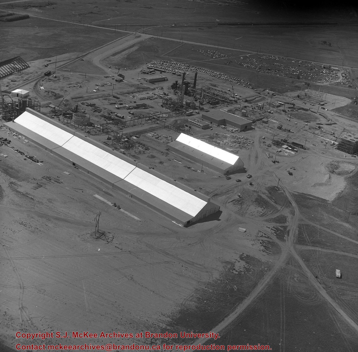
Scope and Content
Image consists of an aerial view looking north at the intersection of Highways 1 and 10 and shows the British American dealer located at the intersection.
See fonds level of the CKX records for custodial history.
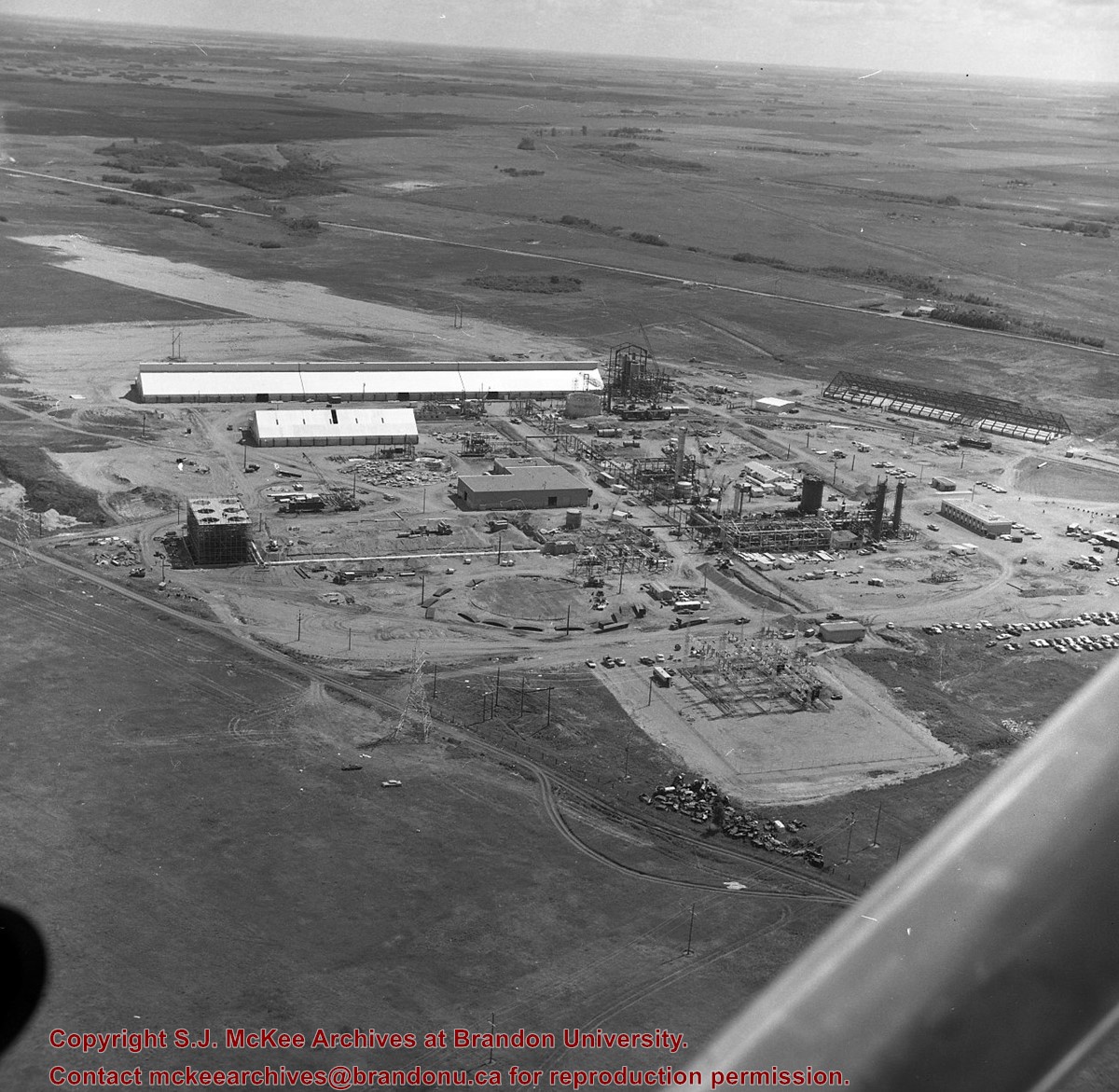
Scope and Content
Image consists of an aerial view looking southeast at the intersection of Highways 1 and 10 and shows the British American dealer located at the intersection.
See fonds level of the CKX records for custodial history.
Scope and Content
Image consists of an aerial view looking northeast at the intersection of Highways 1 and 10 and shows the British American dealer located at the intersection.
Postcard shows an exterior view of the Twin Pines Motel
Notes
Writing on the back of the postcard reads: Twin Pines Motel & Restaurant / Brandon, Manitoba, Canada / Located at 10th Street & Queens Avenue / 40 Fully modern units with bath & showers, T. / Kichenettes, winter plug-ins, Ample parking. / For reservations call.... / 30717-C Color Photo by Joe Fartak / Color Productions Ltd., Box 1243, Regina, Sask.
The postcard is addressed to Mr. F.A. Rosser and is postmarked Brandon 06 June 1970. A 6-cent Queen Elizabeth red postage stamp portraying various modes of the transportation.
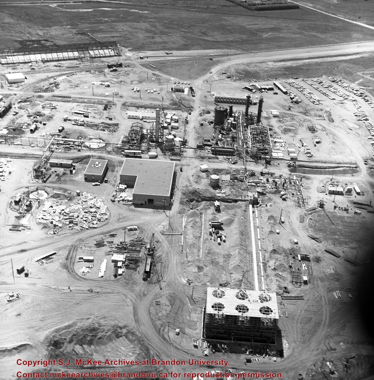
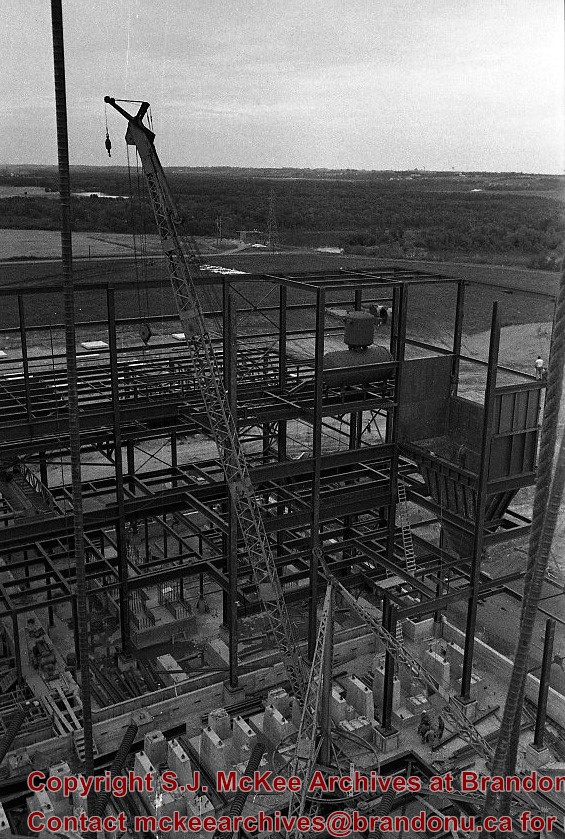
The idea of the Keystone Centre was first mentioned in 1958, at a meeting of the board of directors of the Manitoba Winter Fair. The Manitoba Winter Fair wanted a new facility because the old Wheat City Arena had a leaking roof and a deteriorating west wall. The old facility also had limited space and the Winter Fair felt it needed more space for expansion. The Provincial Exhibition of Manitoba also had problems with their facilities, such as old barns and poor display areas. The idea of the Keystone Centre was put on hold until 1969, when the boards of the Provincial Exhibition and the Manitoba Winter Fair joined together as the Provincial Exhibition Association of Manitoba and the Wheat City Arena was sold and demolished. The original estimate for the cost of the Keystone Centre facilities was $4.5 million and funding would be proportioned so that the federal and provincial governments would each put in one-third of the money, with the rest coming from local donations. The financial campaign for the Keystone Centre began in 1970, and construction began in November 1970. The grand opening of the Centre was in March 1973, and coincided with the Royal Manitoba Winter Fair of that year.
Custodial History
This fonds was accessioned by the McKee Archives in 1998. Prior custodial history is unknown.
Scope and Content
Fonds contains many folders full of correspondence, financial statements, meeting minutes and other documents relating to the development and construction of the Keystone Centre from 1970-1974, including those from the Keystone Executive Committee, as well as the Building Committee. Fonds also contains one folder that pertains to the Brandon Area Agricultural Development Survey from 1959. This folder contains the names and locations of all farmers in the Brandon area in 1959. The Brandon Area Agricultural Development Survey was created in 1959, in order to make farming in the Brandon area more profitable. The survey was aided by Doane Agricultural Service from St. Louis, Missouri, who had success creating agricultural development programs in the United States. Fonds also contains folders from the Provincial Exhibition with correspondence, pamphlets, estimates, and studies from the 1960's. There is also one folder belonging to the Manitoba Winter Fair, which contains correspondence and financial statements relating to the Wheat City Arena. Fonds also contains information pertaining to the proposals made in the 1960's, for the building of the Keystone Centre, as well as one folder about the Keystone campaign from 1970-73. There is also one folder about the opening of the Keystone Centre, which contains newspaper clippings and guest lists. Finally, the fonds contains information about a court case involving Albert Bobyk and Robert Stewart. Stewart was the project manager for the Building Committee and Bobyk worked on the Keystone Center. The fonds includes a report about the trial of the two men who were charged with fraud involving their work on the Keystone Centre.


