View is south southwest from approximatley the southwest corner of 18th Street and Princess Avenue. Photograph shows the University campus, Kinsmen Stadium, Earl Oxford School and residential blocks.
View is west from 17th Street between Louise and Princess Avenues to approximalety 25th Street. Photograph shows the University campus, Fleming School, Coronation Park and residential blocks.
View is southeast from north of the corner of Princess Avenue and 22nd Street to approximatley Brandon Avenue. Photograph shows the University campus, Kinsmen Stadium, Earl Oxford School, and residential blocks. Brandon Collegiate Institute (BCI) is visible in the upper left corner.
View is west southwest from approximatley the northside of Princess Avenue just east of 18th Street. Photograph shows the University campus, part of Kinsmen Stadium and residential blocks.
View is northwest from approximatley the southeast corner of 18th Street and Louise Avenue. Photograph shows the University campus and residential blocks.
View is southwest from approximatley the corner of 17th Street and Princess Avenue to McDiarmid Drive. Photograph shows the Brandon University campus, Kinsmen Stadium, Fleming School, Coronation Park and residential blocks.
View is west northwest from aproximatley 15th Street and Louise Avenue to 34th Street. Photograph shows the Brandon University campus, part of Kinsmen Stadium, Fleming School, Coronoation Park, Valleyview Centennial School, Sacred Heart School ?, and residential blocks.
View is west northwest from aproximatley 16th Street and Louise Avenue to west of 34th Street. Photograph shows the Brandon University campus, part of Kinsmen Stadium, Coronoation Park, Valleyview Centennial School, part of the Assiniboine River and residential blocks.
View is southwest from approximatley 16th Street and Princess Avenue to McDiarmid Drive. Photograph shows the Brandon University campus, Kinsmen Stadium, Fleming School, Coronation Park, J.R. Ried School and residential blocks.
View is north northwest from the roof of Flora Cowan Hall (?). Photograph shows: the J.R.C. Evans Lecture Theatre, the A.E. McKenzie Building and the Western Manitoba Centennial Auditorium as well as a number of houses on 20th Street.
Taken from an airplane, photograph is looking northwest from approximatley 15th Street and Louise Avenue. Shown are a number of residential blocks, the Brandon University campus, the railroad tracks and the Assiniboine River to approximatley 34th Street.
View is north northwest from the John R. Brodie Science Center (?). Photograph shows: Citizens' Science Building, Brandon College Building and Clark Hall, the Education Building and the driveway running in front of the buildings.
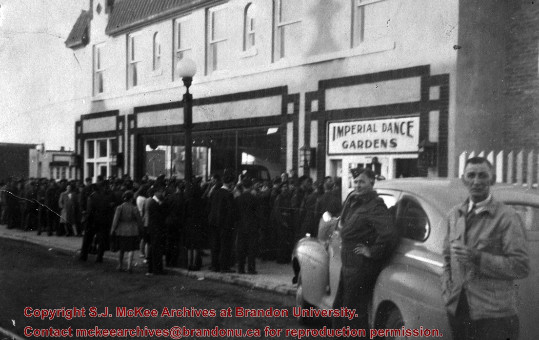
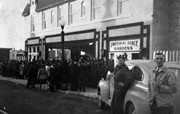
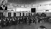
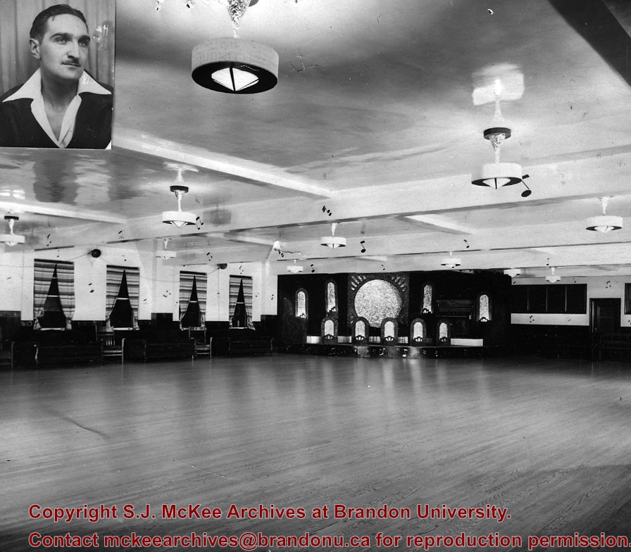
Named "Imperial" as building was owned by Imperial Oil Co., which had offices on the ground floor. Located on the east side of Tenth Street, south of Princess Avenue.
Custodial History
For custodial history see the collection level description of the Lawrence Stuckey collection.
Scope and Content
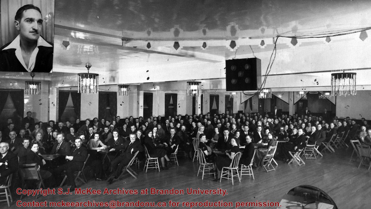
Imperial Dance Gardens (bandstand). Inset: Jack Jewsbury - opened Imperial in the spring of 1934.
Notes
From Roy Brown collection
Additional historical information provided by the Fred McGuinness collection (20-2009).
Photograph is looking northwest probably from the northwest corner of 18th Street and Louise Avenue. The photographer was laying down when s/he took the shot. Photograph shows the field to the south of the Citizens' Science Building, as well as the Citizens' Science Building, part of the Brandon College Building and Clark Hall, and two H-Huts. The photo was taken in summer as the field is full of dandelions.
View is southwest. Photograph shows Clark Hall, the Brandon College Building, the Citizens' Science Building and the driveway running in front of the buildings. Portions of the front lawn and the Kinsmen Staduim are also visible.


)
)
)