The McKee Archives is the copyright holder for the Stuckey materials.
Storage Location
Lawrence Stuckey collection
Arrangement
[Mr. Stuckey put one negative in an envelope and taped the print to the outside of the envelope. We have separated them and numbered the negative CA20(1) and the print CA20(1a).]
Photograph shows the Red Indian (Gasoline) Station on the north side Princess Avenue between 9th and 10th Streets, Brandon. Attached to the west side of the gas station is another shop which contains Hutchings' Drug Store. The Alexandra Block on 10th Street is visible in the background.
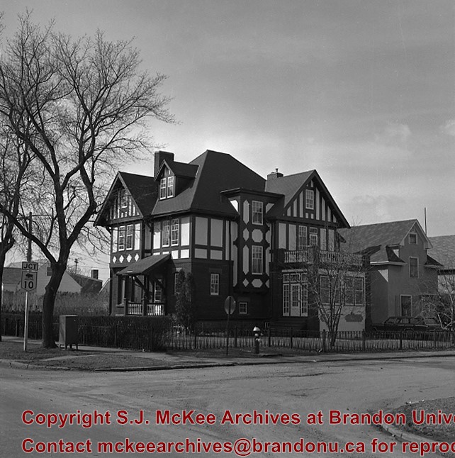
Casa Maley was constructed in 1912 by Henry F. Maley, founder and owner of the Brandon Brewery Company. Erected towards the end of Brandon’s great economic boom, the house is representative of those stately homes that grace the central area of the city. The Tudor styling, expressed in the half timbers and dramatic play of dark and light patterns, was a popular architectural expression of the era. The spacious interior includes an ornate staircase constructed in quarter cut oak and, throughout the house, wood detailing of exquisite craftsmanship. The house was purchased by Dr. McDiarmid, whose family occupied the home for the next sixty years. It is currently used as a bed and breakfast establishment.
Scope and Content
Photograph is looking northwest and shows 1605 Victoria Avenue.
Notes
Manitoba Municipal Heritage Site No. 80. History/Bio taken from the Manitoba Culture, Heritage, Tourism and Sport webpage, available at: http://www.gov.mb.ca/chc/hrb/mun/m080.html (August 2008).
Repro Restriction
The McKee Archives is the copyright holder for the Stuckey materials.
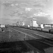
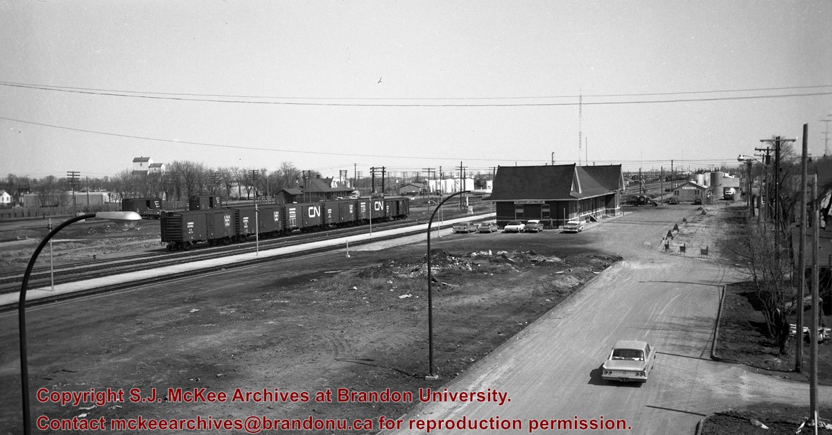
Image is looking east northeast from approximately the 300 block of 23rd Street between Lorne and Louise Avenues. Photograph shows the Brandon College campus after the opening of the original Music Building in 1963, but before the construction of the Education Building in 1966. A number of house on the 300 blocks of 22nd and 21st Streets are visible in the foreground, with the A.E. McKenzie Seed Co., the Prince Edward Hotel and various grain elevators on the horizon.
See fonds level description of the Alf Fowler collection for custodial history.
Scope and Content
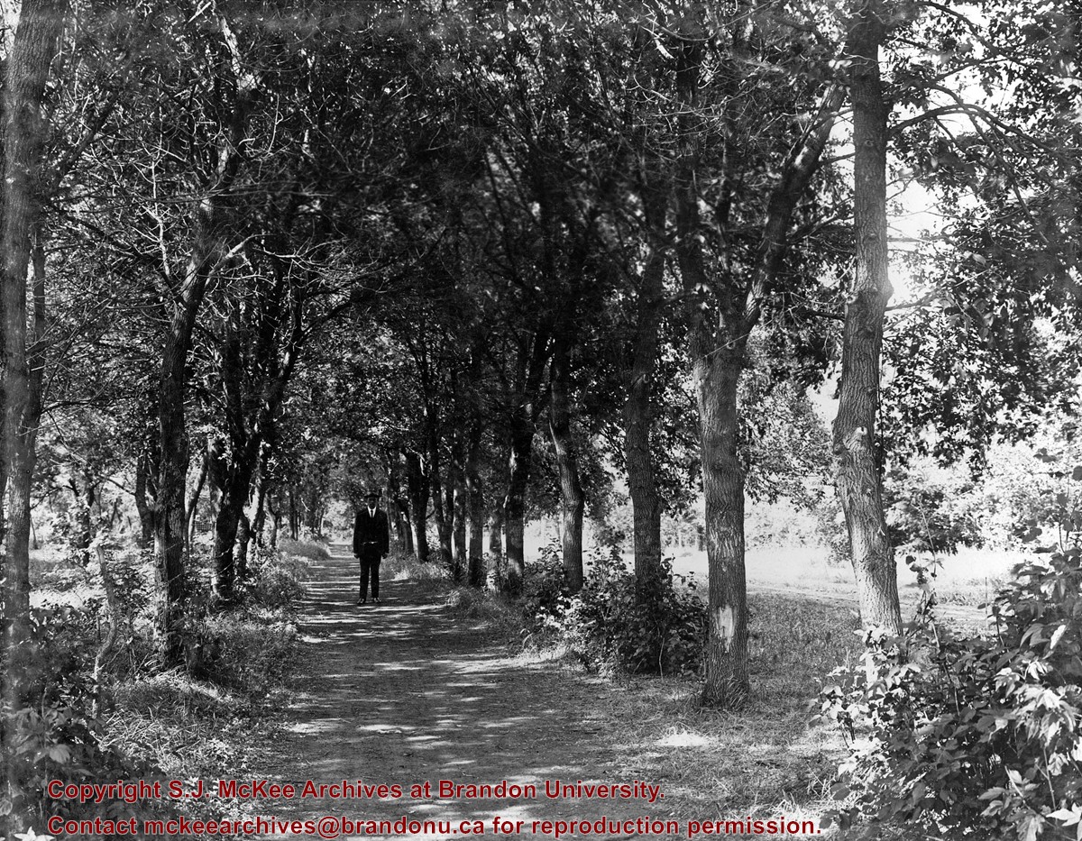
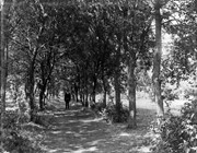
Photo shows a man standing in the middle of a lane, which is lined with trees. The parkland was south of Richmond Avenue and may be part of Patmore Nurseries.
Storage Range
RG 5 Western Manitoba Manuscript collection - photograph storage drawer
For custodial history see the collection level description of the Lawrence Stuckey collection.
Scope and Content
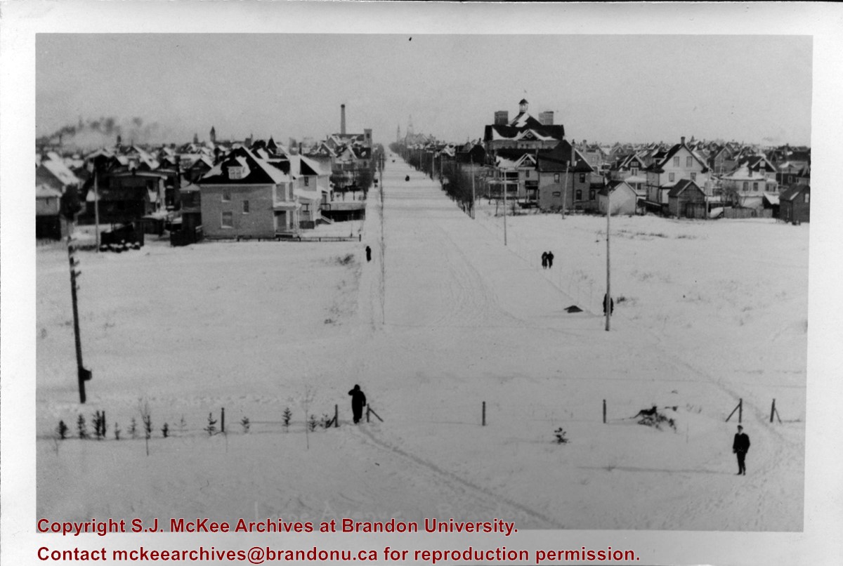
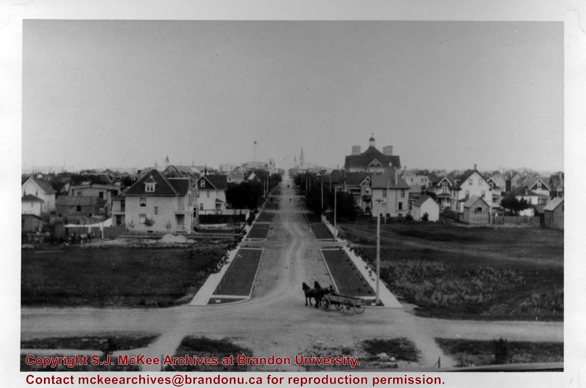
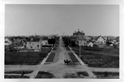
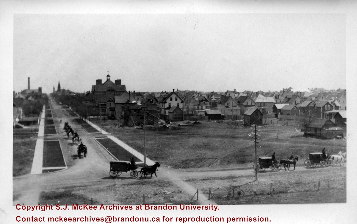
View of Assiniboine Avenue running west, from Ninth Street North
Notes
Second building from right - Westbrook & Fairchild Implements. At left - Western Hotel; Data [courtesy of] Roy Brown from Henderson's [Directory]; From Manitoba Archives
Photograph shows a funeral procession travelling west on Lorne Avenue and turning south onto 18th Street in Brandon. The photograph was taken from Brandon College.
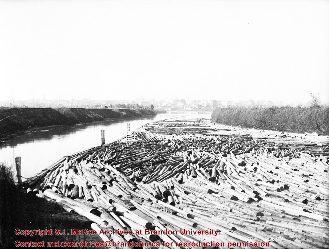
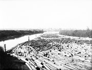
Probably the peak of the sawmilling industry in Brandon was "The Big Drive" in 1910, when 125 drivers brought 5 million board feet of timber down the Assiniboine to Hanbury's Mill
Most of these logs were cut in the Riding Mountains in winter and floated down the Little Saskatchewan and Birdtail Rivers to the Assiniboine.
Custodial History
For custodial history see the collection level description of the Lawrence Stuckey collection.
Scope and Content
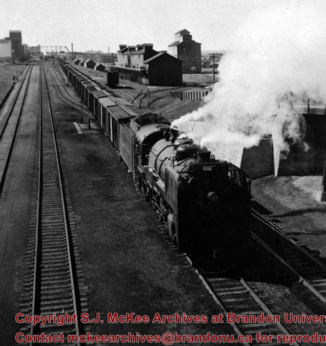
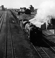
Logs, destined for Hanbury Manufacturing Co., in the Assiniboine River
Notes
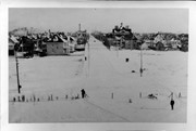
View from First Street North
Courtesy of the family of E.C. Higgins (Mrs. Millen Dunbar nee May Higgins).
.jpg?width=1200&404=no-img.jpg&watermark=wmk)
.jpg?width=180&404=no-img.jpg)
.jpg?width=1200&404=no-img.jpg&watermark=wmk)
.jpg?width=180&404=no-img.jpg)


.jpg?width=1200&404=no-img.jpg&watermark=wmk)
.jpg?width=180&404=no-img.jpg)


.jpg%3fmaxheight%3d1000%26maxwidth%3d1000%26watermark%3dwmk&description=Skyline+from+First+Street+Bridge)
.jpg%3fmaxheight%3d1000%26maxwidth%3d1000%26watermark%3dwmk&description=Skyline+from+First+Street+Bridge)
+north+side+Princess+Avenue+between+9th+Street+and+10th+Street%2c+Brandon%2c+Manitoba)
+from+1st+street+bridge)
.jpg%3fmaxheight%3d1000%26maxwidth%3d1000%26watermark%3dwmk&description=Northeast+view+from+100+block+of+Tenth+Street)