Skip header and navigation

Revise Search

20 records – page 1 of 1.

Education Building

http://archives.brandonu.ca/en/permalink/descriptions679
Part Of
Education building
Description Level
Item
GMD
graphic
Date Range
c. 1967
Part Of
Education building
Description Level
Item
Series Number
2.7
Item Number
2.7.1
GMD
graphic
Date Range
c. 1967
Physical Description
3.5" x 5.5" (colour)
Scope and Content
Postcard of the Education Building. Shows the east side of the building and the main entrance.
Images
Show Less

Education Building

http://archives.brandonu.ca/en/permalink/descriptions682
Part Of
Education building
Description Level
Item
GMD
graphic
Date Range
c. 1967
Part Of
Education building
Description Level
Item
Series Number
2.7
Item Number
2.7.2
GMD
graphic
Date Range
c. 1967
Physical Description
4.75" x 3.5" (b/w)
Scope and Content
Photograph is looking northwest from the front lawn and shows parked cars and the Education Building, particularly the south side of the building.
Images
Show Less

Education Building

http://archives.brandonu.ca/en/permalink/descriptions865
Part Of
Education building
Description Level
Item
GMD
graphic
Date Range
c. early 1970s
Part Of
Education building
Description Level
Item
Series Number
2.7
Item Number
2.7.3
GMD
graphic
Date Range
c. early 1970s
Physical Description
5" x 2.25" (b/w)
Scope and Content
Photograph is looking west from the driveway and shows the east side of the Education Building, including the main entrance.
Images
Show Less

Education Building

http://archives.brandonu.ca/en/permalink/descriptions868
Part Of
Education building
Description Level
Item
GMD
graphic
Date Range
c. 1970s
Part Of
Education building
Description Level
Item
Series Number
2.7
Item Number
2.7.5
GMD
graphic
Date Range
c. 1970s
Physical Description
3.25" x 4.5" (b/w)
Scope and Content
Photograph is looking northwest from the front lawn and shows the south east corner of the Education Building.
Notes
Similar to BUPC 2.7.2 but without the cars and people in the foreground.
Images
Show Less

Education Building

http://archives.brandonu.ca/en/permalink/descriptions870
Part Of
Education building
Description Level
Item
GMD
graphic
Date Range
c. late 1960s/early 1970s
Part Of
Education building
Description Level
Item
Series Number
2.7
Item Number
2.7.6
GMD
graphic
Date Range
c. late 1960s/early 1970s
Physical Description
3.25" x 4" (b/w)
Scope and Content
Photograph is looking northwest from the front lawn and shows the south and east sides of the Education Building.
Notes
Similar to BUPC 2.7.5.
Images
Show Less

Education Building

http://archives.brandonu.ca/en/permalink/descriptions3023
Part Of
Education building
Description Level
Item
GMD
graphic
Date Range
May, 1978
Part Of
Education building
Description Level
Item
Series Number
2.7
Item Number
2.7.8
GMD
graphic
Date Range
May, 1978
Physical Description
3.5" x 5" (colour)
Scope and Content
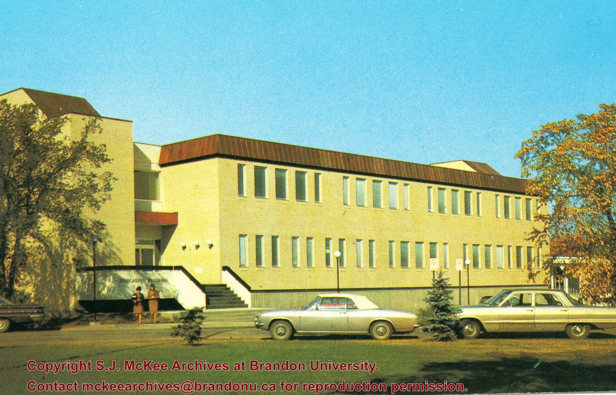
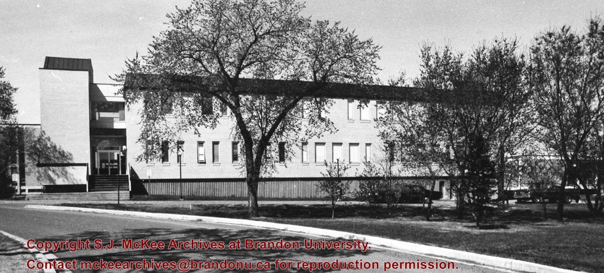
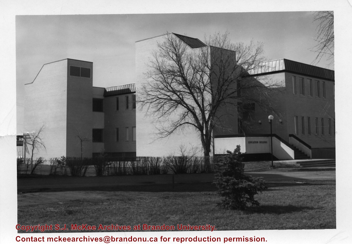
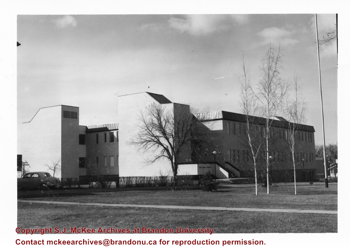
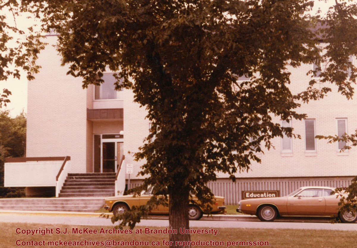
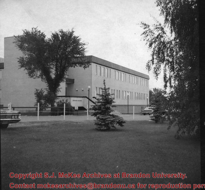
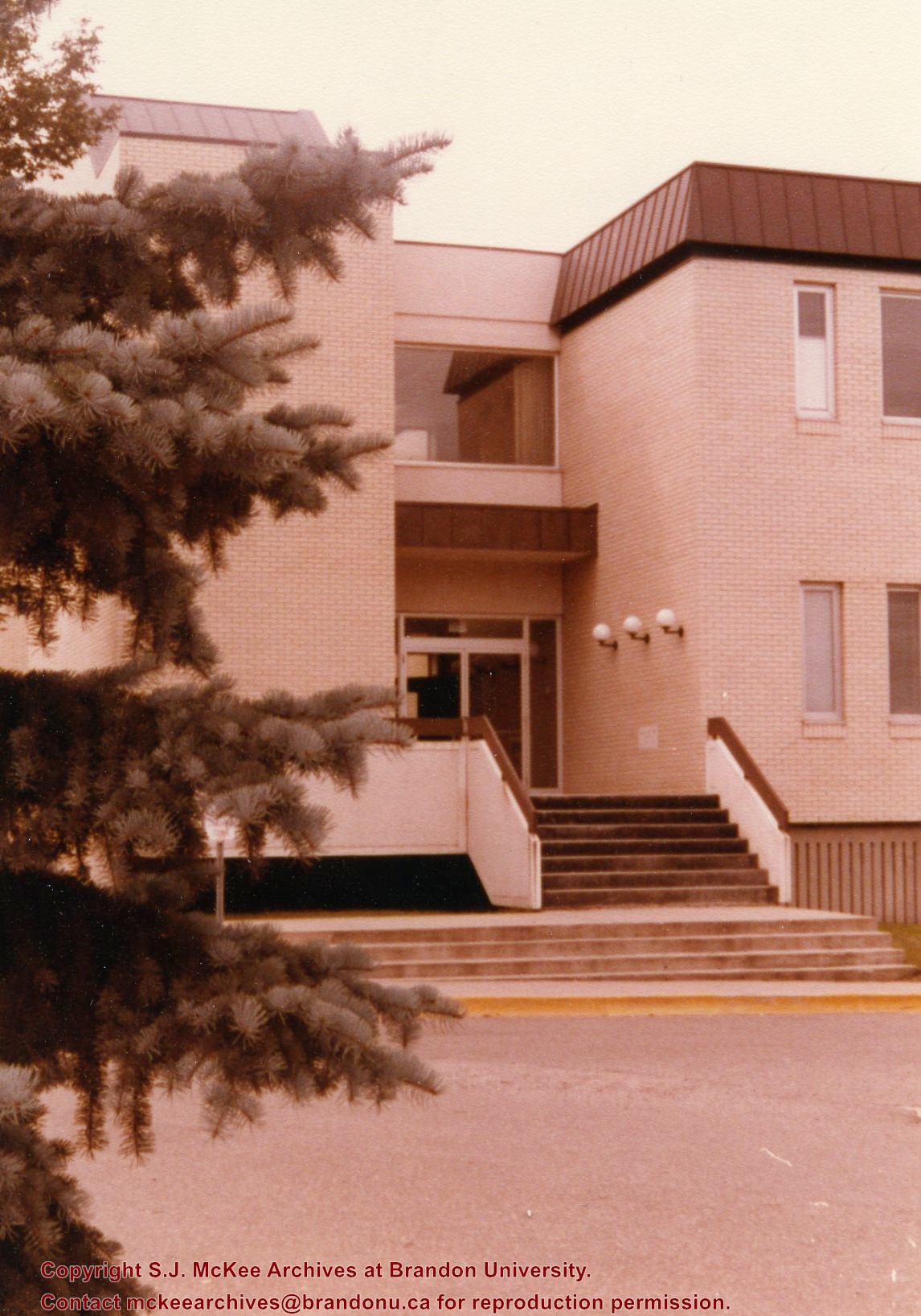
Photograph is looking west southwest and shows the Education Building, including the main entrance. Photograph was taken before the construction of the wheelchair ramp (built in the mid 1980s).
Images
Show Less

Education Building

http://archives.brandonu.ca/en/permalink/descriptions8210
Part Of
Education building
Description Level
Item
GMD
graphic
Date Range
c. 1971
Part Of
Education building
Description Level
Item
Series Number
2.7
Item Number
2.7.9
GMD
graphic
Date Range
c. 1971
Physical Description
2.5" x 2.5" (b/w)
Scope and Content
Contact print is looking northwest from the front lawn and shows the east side and southeast corner of the Education Building.
Images
Show Less

Aerial view: Brandon College Building

http://archives.brandonu.ca/en/permalink/descriptions606
Part Of
Aerial views and campus photographs
Description Level
Item
GMD
graphic
Date Range
c. 1988
Part Of
Aerial views and campus photographs
Description Level
Item
Series Number
2.1
Item Number
2.1.13
GMD
graphic
Date Range
c. 1988
Physical Description
3.5" x 5" (colour)
Scope and Content
View is north northeast. Photograph shows the Brandon College Building in the foreground with the Education Building and North Hill in the background. Photo was taken from the roof of McMaster Hall.
Images
Show Less

Aerial view: Citizens' Science Building

http://archives.brandonu.ca/en/permalink/descriptions611
Part Of
Aerial views and campus photographs
Description Level
Item
GMD
graphic
Date Range
c. 1980s
Part Of
Aerial views and campus photographs
Description Level
Item
Series Number
2.1
Item Number
2.1.21
GMD
graphic
Date Range
c. 1980s
Physical Description
5" x 3.5" (b/w)
Scope and Content
View is northwest, taken from the John R. Brodie Science Centre. Photograph shows: Citizens' Science Building in the foreground, the Brandon College Building and Clark Hall in the background, as well as the driveway in front of the buildings.
Images
Show Less

Citizens' Science Building, Brandon College Building and Clark Hall

http://archives.brandonu.ca/en/permalink/descriptions816
Part Of
Aerial views and campus photographs
Description Level
Item
GMD
graphic
Date Range
October 1981
Part Of
Aerial views and campus photographs
Description Level
Item
Series Number
2.1
Item Number
2.1.142
GMD
graphic
Date Range
October 1981
Physical Description
8" x 10" (b/w)
Scope and Content
Photograph is looking northwest probably from the John R. Brodie Science Centre and shows the Citzens' Science Building, the Brandon College Building, Clark Hall and a portion of the driveway and grounds in front of the buildings.
Images
Show Less

Aerial view: Brandon College and Original Music Building

http://archives.brandonu.ca/en/permalink/descriptions603
Part Of
Aerial views and campus photographs
Description Level
Item
GMD
graphic
Date Range
c. 1965
Part Of
Aerial views and campus photographs
Description Level
Item
Series Number
2.1
Item Number
2.1.10
GMD
graphic
Date Range
c. 1965
Physical Description
5" x 4" (b/w)
Scope and Content
View is west southwest from 17th Street and Princess Avenue. Photograph shows: Clark Hall, A.E. McKenzie Building and original Music Building.
Images
Show Less

Aerial view: Evans Theatre, McKenzie Building, WMCA

http://archives.brandonu.ca/en/permalink/descriptions609
Part Of
Aerial views and campus photographs
Description Level
Item
GMD
graphic
Date Range
c. 1970s
Part Of
Aerial views and campus photographs
Description Level
Item
Series Number
2.1
Item Number
2.1.16
GMD
graphic
Date Range
c. 1970s
Physical Description
10" x 8" (b/w)
Scope and Content
View is northwest. Photograph shows: J.R.C. Evans Lecture Theater, A.E. McKenzie Building, and Western Manitoba Centennial Auditorium (WMCA).
Images
Show Less

Laying the cornerstone of the Education Building

http://archives.brandonu.ca/en/permalink/descriptions681
Part Of
Education building
Description Level
Item
GMD
graphic
Date Range
January 1967
Part Of
Education building
Description Level
Item
Series Number
2.7
Item Number
2.7.10
GMD
graphic
Date Range
January 1967
Physical Description
5" x 7" (b/w)
Scope and Content
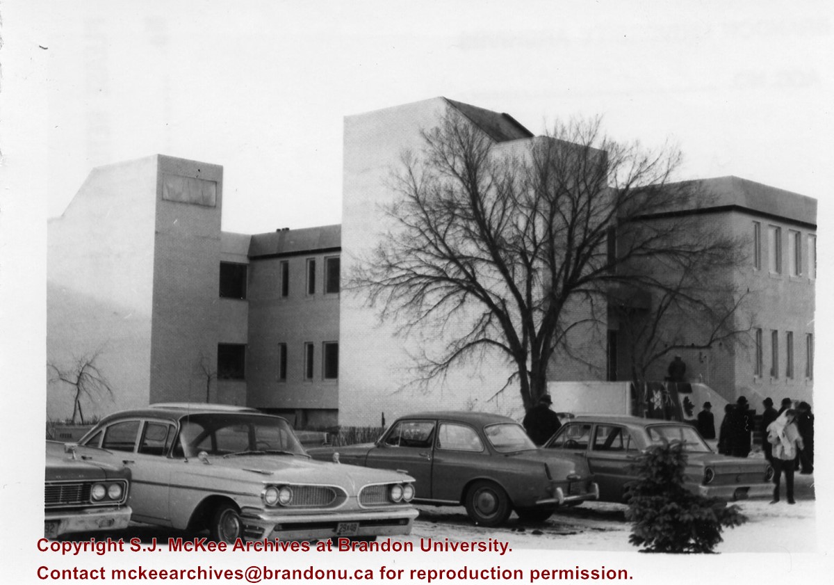
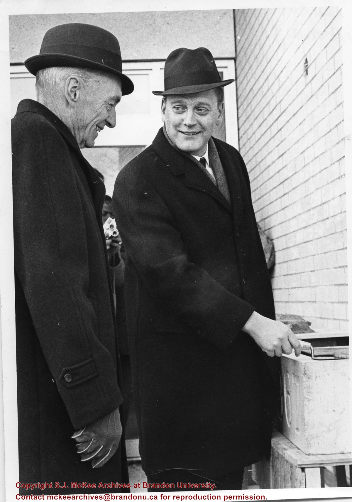
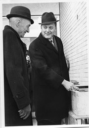
Photograph shows the laying of the cornerstone for the Education Building. L to R: Dr. John E. Robbins (Brandon College/University President) and Hon. George Johnston (Minister of Education).
Images
Show Less

Education Building main entrance

http://archives.brandonu.ca/en/permalink/descriptions3021
Part Of
Education building
Description Level
Item
GMD
graphic
Date Range
May, 1978
Part Of
Education building
Description Level
Item
Series Number
2.7
Item Number
2.7.7
GMD
graphic
Date Range
May, 1978
Physical Description
3.5" x 5" (colour)
Scope and Content
Photograph is looking west northwest from the driveway and shows the main entrance to the Education Building.
Images
Show Less

Aerial view: Flora Cowan, Gymnasium, Darrach Hall

http://archives.brandonu.ca/en/permalink/descriptions614
Part Of
Aerial views and campus photographs
Description Level
Item
GMD
graphic
Date Range
c. 1970
Part Of
Aerial views and campus photographs
Description Level
Item
Series Number
2.1
Item Number
2.1.18
GMD
graphic
Date Range
c. 1970
Physical Description
8" x 10" (b/w)
Scope and Content
View is southwest from the John R. Brodie Science Centre. Photograph shows: Flora Cowan Hall, the Brandon University Gymnasium, Darrach Hall, the Quill trailer and the Jeff Umphrey Centre.
Images
Show Less

Aerial view: Brandon University campus

http://archives.brandonu.ca/en/permalink/descriptions605
Part Of
Aerial views and campus photographs
Description Level
Item
GMD
graphic
Date Range
c. 1969
Part Of
Aerial views and campus photographs
Description Level
Item
Series Number
2.1
Item Number
2.1.12
GMD
graphic
Date Range
c. 1969
Physical Description
3.5" x 3.5" (b/w)
Scope and Content
View is northeast. Brandon University campus and some of the surrounding residential areas.
Images
Show Less

Aerial view: Brandon University campus

http://archives.brandonu.ca/en/permalink/descriptions607
Part Of
Aerial views and campus photographs
Description Level
Item
GMD
graphic
Date Range
c. 1970
Part Of
Aerial views and campus photographs
Description Level
Item
Series Number
2.1
Item Number
2.1.14
GMD
graphic
Date Range
c. 1970
Physical Description
5" x 3" (b/w)
Scope and Content
View is north northwest from the roof of Flora Cowan Hall (?). Photograph shows: the J.R.C. Evans Lecture Theatre, the A.E. McKenzie Building and the Western Manitoba Centennial Auditorium as well as a number of houses on 20th Street.
Images
Show Less

Aerial view: Brandon University campus

http://archives.brandonu.ca/en/permalink/descriptions618
Part Of
Aerial views and campus photographs
Description Level
Item
GMD
graphic
Date Range
c. 1969
Part Of
Aerial views and campus photographs
Description Level
Item
Series Number
2.1
Item Number
2.1.26
GMD
graphic
Date Range
c. 1969
Physical Description
3.5" x 3.5" (b/w)
Scope and Content
Taken from an airplane, photograph is looking northwest from approximatley 15th Street and Louise Avenue. Shown are a number of residential blocks, the Brandon University campus, the railroad tracks and the Assiniboine River to approximatley 34th Street.
Images
Show Less

Aerial view: Brandon University campus

http://archives.brandonu.ca/en/permalink/descriptions619
Part Of
Aerial views and campus photographs
Description Level
Item
GMD
graphic
Date Range
c. 1969
Part Of
Aerial views and campus photographs
Description Level
Item
Series Number
2.1
Item Number
2.1.27
GMD
graphic
Date Range
c. 1969
Physical Description
3.5" x 3.5" (b/w)
Scope and Content
Taken from an airplane, photograph is looking north northwest from almost right above the Brandon University campus.
Images
Show Less

Aerial view: Brandon College campus

http://archives.brandonu.ca/en/permalink/descriptions622
Part Of
Aerial views and campus photographs
Description Level
Item
GMD
graphic
Date Range
c. 1962
Part Of
Aerial views and campus photographs
Description Level
Item
Series Number
2.1
Item Number
2.1.20
GMD
graphic
Date Range
c. 1962
Physical Description
10" x 8" (b/w)
Scope and Content
View is northwest from approximately the corner of 18th Street and Louise Avenue. Photograph shows the Brandon College campus after the completion of Flora Cowan Hall.
Notes
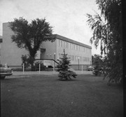
BUPC 2.1.24 is a smaller version of this photograph.
Images
Show Less

20 records – page 1 of 1.