The Citizens' Science Building was built in 1922 and financed by Brandon citizens. It was renamed the Knowles-Douglas Student Union Centre c. 1984 in honour of Brandon College graduates Stanley Knowles and Tommy Douglas, both of the Class of 1930. The Knowles-Douglas Addition was completed in 1987.
Scope and Content
Sub-series consists of photographs of the Citizens' Science Building and the Knowles-Douglas buildings, which include the Knowles-Douglas Student Union Centre and the Knowles-Douglas Addition.
Photograph is looking northwest probably from the John R. Brodie Science Centre and shows the Citzens' Science Building, the Brandon College Building, Clark Hall and a portion of the driveway and grounds in front of the buildings.
View is north northeast. Photograph shows the Brandon College Building in the foreground with the Education Building and North Hill in the background. Photo was taken from the roof of McMaster Hall.
View is northeast, taken from the John R. Brodie Science Centre. Photograph shows: the Brandon College Building, the Student Services H-Hut, the Education Building, and the Student Union Building (Citizens' Science Building), as well as 18th Street and some houses. The trailer to the south of the Education Building was a Canada Manpower office in the 1960s. It was latter moved over by the Gymnasium, where it became the Quill office.
View is southeast and was probably taken from the roof of McMaster Hall. Photograph shows the greenhouse situated on top of the John R. Brodie Science Centre.
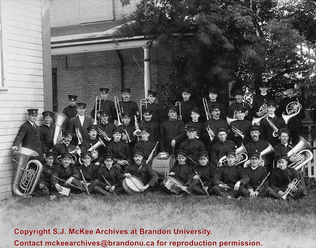
For custodial history see the collection level description of the Lawrence Stuckey collection.
Scope and Content
Aerial view of downtown Brandon, including area of new Gallery Mall.
Notes
[This eastward aerial view of downtown Brandon seems to portray an outdoor second-story parking garage proposed by the architectural firm Ward, MacDonald and Partners. The proposed overhead parking is depicted as running continuously from Sixth Street to Tenth Street along Rosser Avenue. The negative appears to have been made by photographing an existing illustration. P.E. 03/06/09]
View is north northwest from the roof of Flora Cowan Hall (?). Photograph shows: the J.R.C. Evans Lecture Theatre, the A.E. McKenzie Building and the Western Manitoba Centennial Auditorium as well as a number of houses on 20th Street.
Taken from an airplane, photograph is looking northwest from approximatley 15th Street and Louise Avenue. Shown are a number of residential blocks, the Brandon University campus, the railroad tracks and the Assiniboine River to approximatley 34th Street.
View is northwest from approximately the corner of 18th Street and Louise Avenue. Photograph shows the Brandon College campus after the completion of Flora Cowan Hall.
Notes
BUPC 2.1.24 is a smaller version of this photograph.
View is southwest from approximately Princess Avenue and 17th Street. Photograph shows the Brandon University campus in fall, as well as the southwest portion of the city.
View is south southwest from approximatley the east corner of 18th Street and Princess Avenue. Photograph shows the Brandon University campus, Kinsmen Stadium, Earl Oxford school and a number of residential blocks, particularly southwest of 18th Street.
View is southeast from approximatley 23rd Street and Rosser Avenue. Photograph shows the Brandon University campus, Kinsmen Stadium, Earl Oxford school, the Fair Grounds (including the Grandstand and Racetrack) and a number of residential blocks, particularly in the southeast part of the city.


.jpg?width=1200&404=no-img.jpg&watermark=wmk)
.jpg?width=180&404=no-img.jpg)
.jpg?width=1200&404=no-img.jpg&watermark=wmk)
.jpg?width=180&404=no-img.jpg)


.jpg%3fmaxheight%3d1000%26maxwidth%3d1000%26watermark%3dwmk&description=Aerial+View+of+Core+Area)
.jpg%3fmaxheight%3d1000%26maxwidth%3d1000%26watermark%3dwmk&description=Aerial+View+of+Core+Area)