Brandon College looking south from 19th Street. Photograph was taken after Flora Cowan Hall was built but before construction of the Education Building.
Image shows the Brandon College campus from 17th Street looking southwest. The photo was taken after the completion of the original Music Building in 1963, but construction of the Education Building. Also visible are a number of properties on the 200 block of 18th Street and the 200 block of 20th Street.
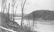
Image is looking east northeast from approximately the 300 block of 23rd Street between Lorne and Louise Avenues. Photograph shows the Brandon College campus after the opening of the original Music Building in 1963, but before the construction of the Education Building in 1966. A number of house on the 300 blocks of 22nd and 21st Streets are visible in the foreground, with the A.E. McKenzie Seed Co., the Prince Edward Hotel and various grain elevators on the horizon.
Postcard shows an aerial view of the city of Brandon
Notes
Writing on the back of the postcard reads: No. 10. Brandon, Manitoba, Canada / Aerial View of Brandon / Distributed by Clements Drug Store / Brandon, Manitoba, Canada / Photos by: R.J. "Bob" Snazel. / Printed by: D.W. Friesen & Sons Ltd. Altona, Manitoba, Canada. The postcard is addressed to Mr. F.A. Rosser and is postmarked Brandon 30 May 1970. A 6-cent Queen Elizabeth red postage stamp portraying various modes of the transportation. The stamp has been cancelled with a postmark that reads "Help Retarded Children."
View is southwest from approximatley 16th Street between Princess and Rosser Avenues. Photograph shows the Brandon University campus, as well as surrounding residential blocks, including Flemming, J.R. Reid and Vincent Massey schools.
View is west southwest from approximatley 16th Street between Princess and Lorne Avenues. Photograph shows the Brandon University campus, as well as surrounding residential blocks between 16th and 23rd Streets, Princess and Louise Avenues..
View is west from approximatley 17th Street between Lorne and Louise Avenues. Photograph shows a portion of the Brandon University campus (excluding the Education Building and anything north of it), as well as surrounding residential blocks from approximatley 17th Street to 22nd Street.
View is west northwest from approximatley 16th Street and Louise Avenue. Photograph shows the Brandon University campus, prior to the Library Extension, and a large portion of the city to the west of the campus.
View is southwest from approximatley 16th Street between Lorne Avenue and Princess Avenue. The view extends to approximately 26th Street. Photograph shows the Brandon University campus, Kinsmen Stadium, Fleming School, Coronation Park and residential blocks.
Photograph shows a southwestern view of Clark Hall and the Brandon College Original Building. The Citizen Science Building is absent from the campus grounds.
Notes
Part of "Souvenir of Brandon, Manitoba, Canada [viewbook], Printed by Photogelatine Engraving Co. Limited, Ottawa." Dates obtained from the Burchill's Music Store Henderson's Brandon City Directory listings (1927-1929). Writing on the front of the photograph reads: Brandon College, Brandon, Man.
Photograph shows residential area of Lorne Avenue from 14th Street facing east.
Notes
Part of "Christie's Brandon Series of Six Colored Picture Postcards of Brandon, Manitoba, The Crown Series, Published by Christie's Bookstore, Brandon, Man." [note: missing sixth postcard]. Writing on the front of the photograph reads: Residential, Brandon, Man. Looking East.
Photograph shows the construction of the McGuinness home in a new housing development in Medicine Hat, 492 6th Street Northeast. Aerial view shows that neighbouring blocks have yet to be constructed.
Photograph was in possession of Mrs. Ruby Miles, who passed the image on to Fred McGuinness. McGuinness makes reference to Mrs. Miles and this photograph in his Sunbeams column (Source: F.A. Rosser, "Another interesting chat with a daughter of the plains," Brandon Sun 18 Aug 1981).
Scope and Content
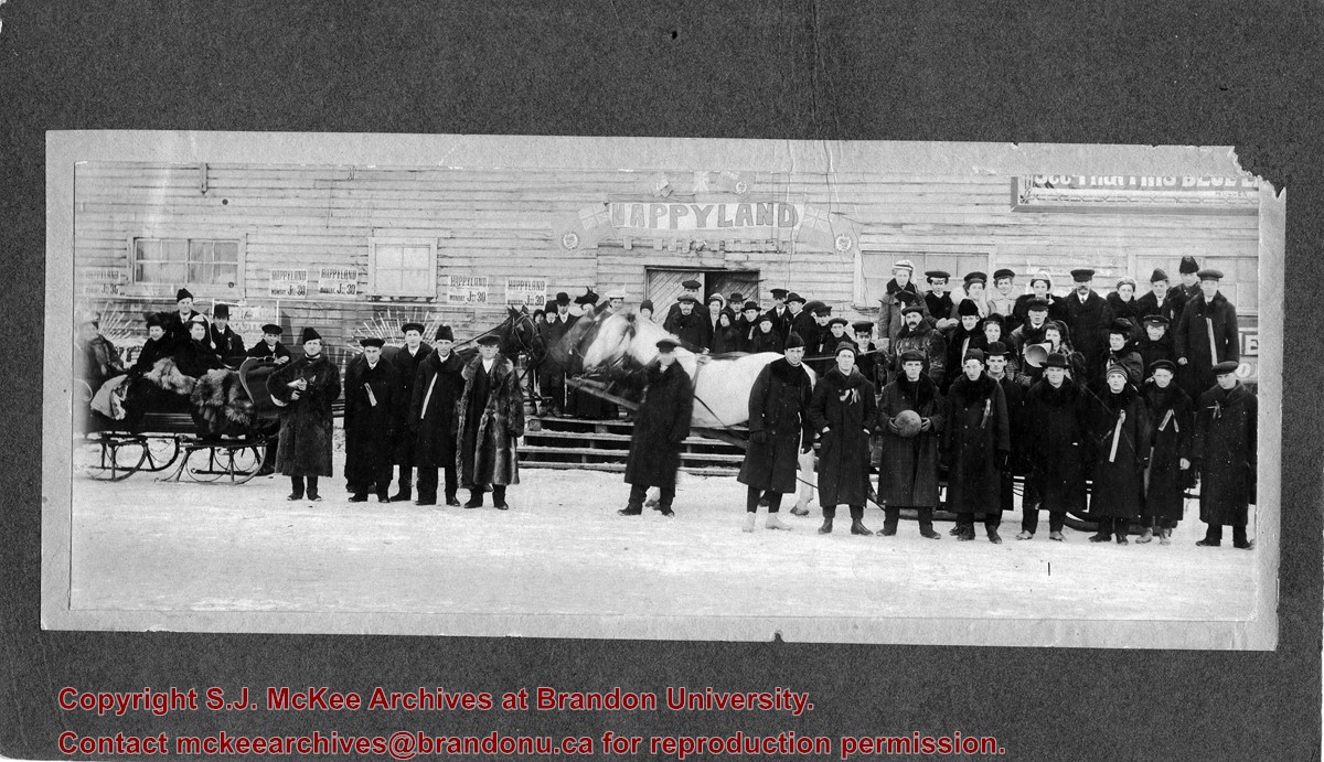
Photograph allegedly shows the Wheat City Business College graduating class standing outside a woodframed building in the winter. Affixed to the building are posters/advertisements that read: Happyland, Monday July 30 [1906?]. A banner spelling Happyland in large block letters hangs above the building's door that is numbered 209. Surrounding the banner are the red ensign/Dominion of Canada flags.
The students are wearing long wintercoats with fur collars, some are wearing fur hats. The men appear to have ribbons pinned to their lapels. On the left of the photograph, a group of three female students are sitting in a horse-drawn sleigh and have fur robes on their laps. On the right, a number of students are standing on a horse-drawn sled. Two individuals can be seen holding megaphones, another student is holding a basketball.
Notes
Writing on the back of the photograph reads: 1909, Tenth Street and Princess. Two yellow labels are affixed to the back of the photograph. one reads: graduating class, Wheat City Business College. The other reads Mrs. K.L. McGregor, 157-4th St.
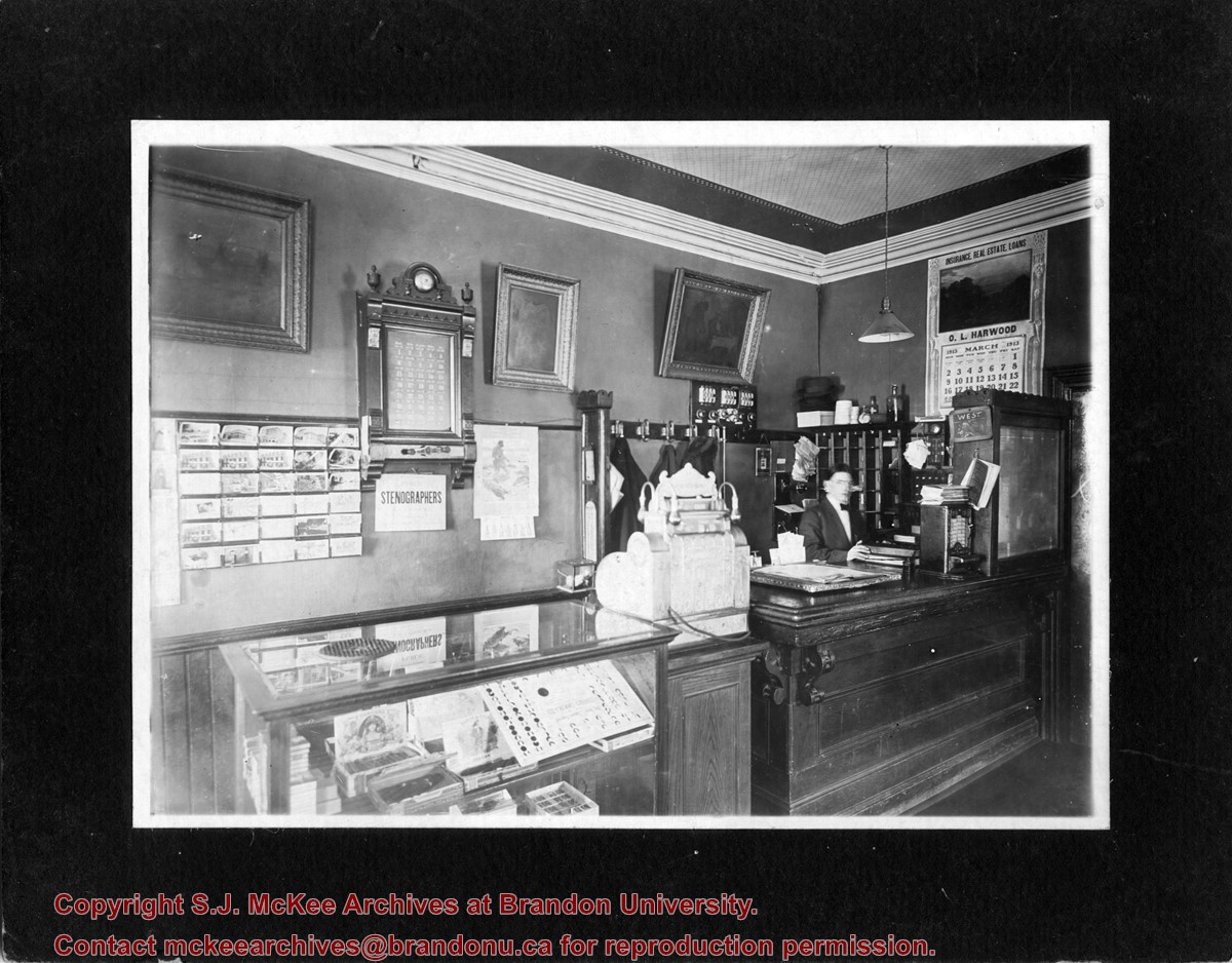
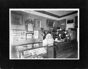
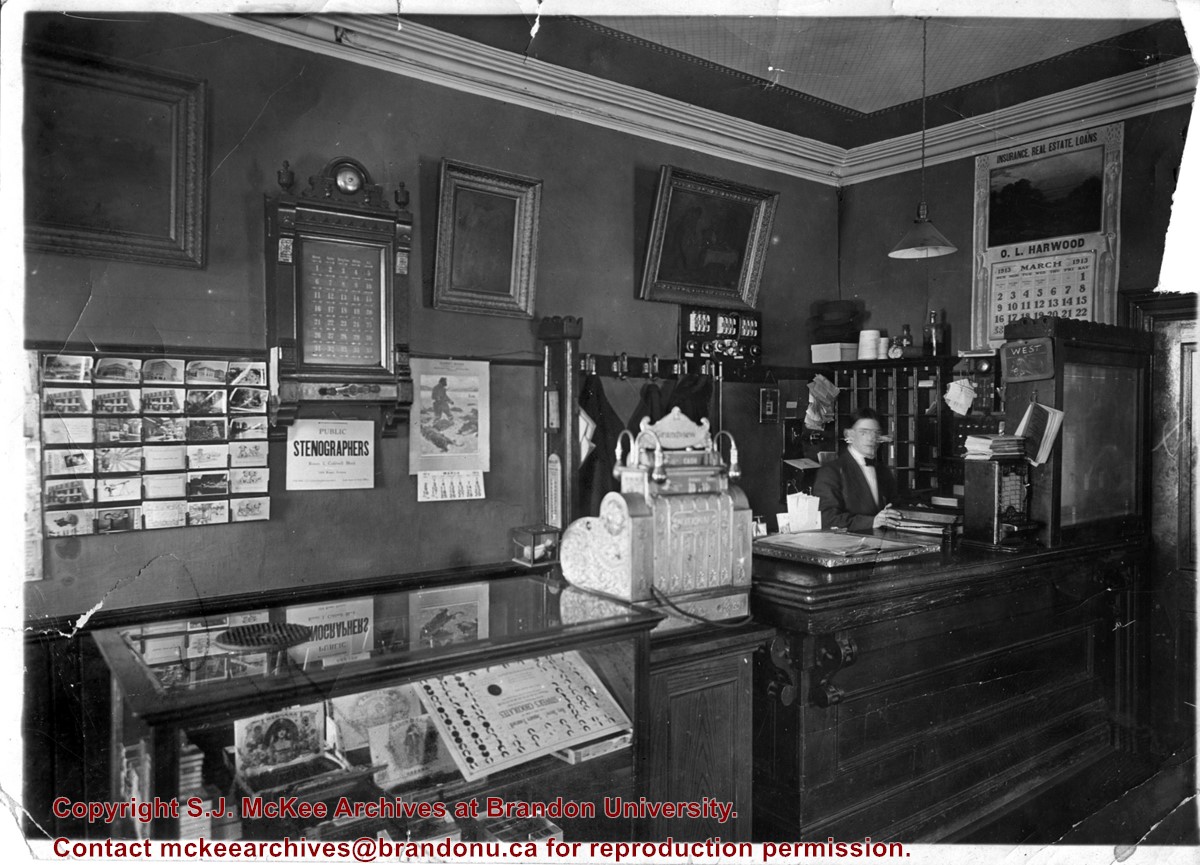
Photograph shows the possible interior of the Grandview Hotel. A young man is working behind the counter that holds a cash register and tobacco display case. A calendar for March 1913 advertises O.L. Harwood's Insurance, Real Estate, and Loans. Below the hotel's 35-room call box is an advertisement for the Public Stenographers Company. A postcard stand holds cards of Brandon's courthouse and other prominent buildings.
Photograph shows the possible interior of the Grandview Hotel. A young man is working behind the counter that holds a cash register and tobacco display case. A calendar for March 1913 advertises O.L. Harwood's Insurance, Real Estate, and Loans. Below the hotel's 35-room call box is an advertisement for the Public Stenographers Company. A postcard stand holds cards of Brandon's courthouse and other prominent buildings.
Notes
Date ascertained from calendar above counter. This photograph is a duplicate of 20-2009.23 but is in sharper focus. Grand View is written in pencil on the back of the photograph.
Photograph is looking west from the sidewalk between Clark Hall and the Education Building and shows the east side of the A.E. McKenzie Building as well as a trailer that housed the Canada Manpower office (career councelling) in the 1960s. The trailer was later moved near the Kinsmen Stadium where it housed the Quill office.
Photograph shows the McGuinness home in a new housing development in Medicine Hat, 492 6th Street Northeast. Aerial view shows that neighbouring blocks have yet to be constructed and the backyard to the McGuinness home is completed.


