Skip header and navigation

Revise Search

20 records – page 1 of 1.

Curries Landing (Assiniboine River)

http://archives.brandonu.ca/en/permalink/descriptions11132
Part Of
RG 11 Lawrence Stuckey fonds
Description Level
Item
GMD
graphic
Date Range
Apr. 12, 1977
Part Of
RG 11 Lawrence Stuckey fonds
Creator
L.A. Stuckey
Description Level
Item
Series Number
3.3
Item Number
1-2002.3.3.BSE[366a]
GMD
graphic
Date Range
Apr. 12, 1977
Physical Description
2.5" x 2.5"
Material Details
Negative
Custodial History
For custodial history see the collection level description of the Lawrence Stuckey collection.
Scope and Content
Image of Curries Landing (Assiniboine River).
Notes
[Brandon SE includes communities south of Trans-Canada #1 highway and east of PTH #10.]
Name Access
Curries Landing
Assiniboine River
Subject Access
Rivers
Storage Location
Lawrence Stuckey collection
Arrangement
[Mr. Stuckey put three negatives in the same envelope. We have separated them and numbered the negatives (366a) to(366c)].
Images
Show Less

Curries Landing (Assiniboine River)

http://archives.brandonu.ca/en/permalink/descriptions11134
Part Of
RG 11 Lawrence Stuckey fonds
Description Level
Item
GMD
graphic
Date Range
Apr. 12, 1977
Part Of
RG 11 Lawrence Stuckey fonds
Creator
L.A. Stuckey
Description Level
Item
Series Number
3.3
Item Number
1-2002.3.3.BSE[366b]
GMD
graphic
Date Range
Apr. 12, 1977
Physical Description
2.5" x 2.5"
Material Details
Negative
Custodial History
For custodial history see the collection level description of the Lawrence Stuckey collection.
Scope and Content
Image of Curries Landing (Assiniboine River).
Notes
[Brandon SE includes communities south of Trans-Canada #1 highway and east of PTH #10.]
Name Access
Curries Landing
Assiniboine River
Subject Access
Rivers
Storage Location
Lawrence Stuckey collection
Arrangement
[Mr. Stuckey put three negatives in the same envelope. We have separated them and numbered the negatives (366a) to(366c)].
Images
Show Less

Curries Landing (Assiniboine River)

http://archives.brandonu.ca/en/permalink/descriptions11135
Part Of
RG 11 Lawrence Stuckey fonds
Description Level
Item
GMD
graphic
Date Range
Apr. 12, 1977
Part Of
RG 11 Lawrence Stuckey fonds
Creator
L.A. Stuckey
Description Level
Item
Series Number
3.3
Item Number
1-2002.3.3.BSE[366c]
GMD
graphic
Date Range
Apr. 12, 1977
Physical Description
2.5" x 2.5"
Material Details
Negative
Custodial History
For custodial history see the collection level description of the Lawrence Stuckey collection.
Scope and Content
Image of Curries Landing (Assiniboine River).
Notes
[Brandon SE includes communities south of Trans-Canada #1 highway and east of PTH #10.]
Name Access
Curries Landing
Assiniboine River
Subject Access
Rivers
Storage Location
Lawrence Stuckey collection
Arrangement
[Mr. Stuckey put three negatives in the same envelope. We have separated them and numbered the negatives (366a) to(366c)].
Images
Show Less

Souris River Bridge, Treesbank

http://archives.brandonu.ca/en/permalink/descriptions10937
Part Of
RG 11 Lawrence Stuckey fonds
Description Level
Item
GMD
graphic
Date Range
1968
Accession Number
1-2002
Part Of
RG 11 Lawrence Stuckey fonds
Creator
L.A. Stuckey
Description Level
Item
Series Number
3.3
Item Number
1-2002.3.3.BSE[357]
Accession Number
1-2002
GMD
graphic
Date Range
1968
Physical Description
2.5" x 2.5" (b/w)
Material Details
Negative
Custodial History
For custodial history see the collection level description of the Lawrence Stuckey collection.
Scope and Content
Image of Souris River Bridge, Treesbank.
Notes
[Brandon SE includes communities south of Trans-Canada #1 highway and east of PTH #10.]
Name Access
Souris River
Treesbank, Manitoba
Subject Access
bridges
Rivers
Repro Restriction
The McKee Archives is the copyright holder of the Stuckey materials.
Storage Location
Lawrence Stuckey collection
Images
Show Less
Part Of
RG 11 Lawrence Stuckey fonds
Description Level
Item
GMD
graphic
Date Range
[192-?]
Accession Number
1-2002
Part Of
RG 11 Lawrence Stuckey fonds
Description Level
Item
Series Number
3.1
Item Number
1-2002.3.1M30(26)
Accession Number
1-2002
GMD
graphic
Date Range
[192-?]
Physical Description
3 1/2" x 5"
Material Details
Negative
Custodial History
For custodial history see the collection level description of the Lawrence Stuckey collection.
Scope and Content
J.C. Donaldson, President of Winter Fair 1928 - 1929.
Notes
Mr. Stuckey originally placed 32 negatives in one envelope labeled “M – Presidents of Fair Boards 1882 – 1972”; We have separated and renumbered these negatives as M30(1) to M30(32) inclusively; Records of the Provincial Exhibition Association are held in the S.J. McKee Archives (RG2) including photos of board members.
Name Access
J.C. Donaldson
Presidents of Fair Boards
Subject Access
fairs
exhibitions
Provincial Exhibitions
officials
Brandon Exhibitions & Facilities
Repro Restriction
The McKee Archives is the copyright holder for the Stuckey materials.
Storage Location
Lawrence Stuckey collection
Images
Show Less

New CPR bridge over Souris River, east of Treesbank, Manitoba

http://archives.brandonu.ca/en/permalink/descriptions10407
Part Of
RG 11 Lawrence Stuckey fonds
Description Level
Item
GMD
graphic
Date Range
October 22, 1978
Accession Number
1-2002
Part Of
RG 11 Lawrence Stuckey fonds
Creator
L.A. Stuckey
Description Level
Item
Series Number
3.3
Item Number
1-2002.3.3.CPR[59a]
Accession Number
1-2002
GMD
graphic
Date Range
October 22, 1978
Physical Description
2.25" x 2.25 (b/w)
Material Details
Negative
Custodial History
For custodial history see the collection level description of the Lawrence Stuckey collection.
Scope and Content
Image of CPR bridge over Souris River, east of Treesbank, Manitoba, taken along the CPR lines south of mainline.
Name Access
CPR
Treesbank, Manitoba
Souris River
Subject Access
railways
bridges
Rivers
geographic features
Repro Restriction
The McKee Archives is the copyright holder of the Stuckey materials.
Storage Location
Lawrence Stuckey collection
Arrangement
[Mr. Stuckey put two negatives in same envelope. We have separated them and numbered them (59a) and (59b)].
Images
Show Less

New CPR bridge over Souris River, east of Treesbank, Manitoba

http://archives.brandonu.ca/en/permalink/descriptions10408
Part Of
RG 11 Lawrence Stuckey fonds
Description Level
Item
GMD
graphic
Date Range
October 22, 1978
Accession Number
1-2002
Part Of
RG 11 Lawrence Stuckey fonds
Creator
L.A. Stuckey
Description Level
Item
Series Number
3.3
Item Number
1-2002.3.3.CPR[59b]
Accession Number
1-2002
GMD
graphic
Date Range
October 22, 1978
Physical Description
2.25" x 2.25 (b/w)
Material Details
Negative
Custodial History
For custodial history see the collection level description of the Lawrence Stuckey collection.
Scope and Content
Image of CPR bridge over Souris River, east of Treesbank, Manitoba, taken along the CPR lines south of mainline.
Name Access
CPR
Treesbank, Manitoba
Souris River
Subject Access
railways
bridges
Rivers
geographic features
Repro Restriction
The McKee Archives is the copyright holder of the Stuckey materials.
Storage Location
Lawrence Stuckey collection
Arrangement
[Mr. Stuckey put two negatives in same envelope. We have separated them and numbered them (59a) and (59b)].
Images
Show Less
Part Of
RG 11 Lawrence Stuckey fonds
Description Level
Item
GMD
graphic
Date Range
1913
Accession Number
1-2002
Part Of
RG 11 Lawrence Stuckey fonds
Description Level
Item
Series Number
3.1
Item Number
1-2002.3.1N3
Accession Number
1-2002
GMD
graphic
Date Range
1913
Physical Description
3 1/2" x 5"
Material Details
Negative
History / Biographical
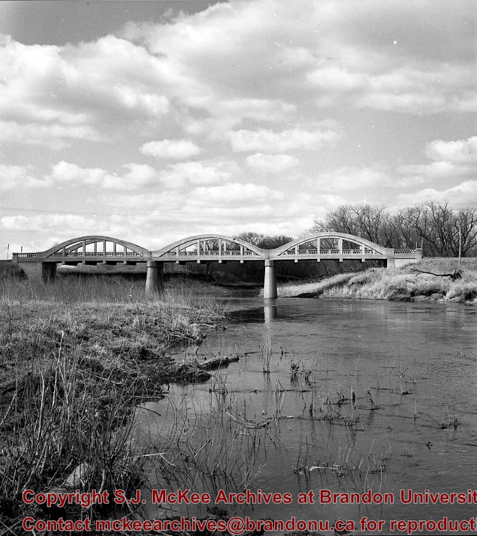
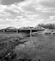
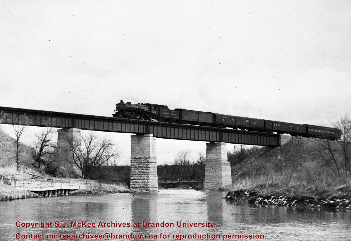
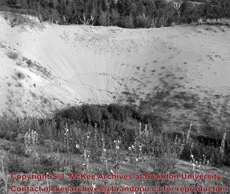
The Snye was a former channel (oxbow lake) of the Assiniboine River. It was located south of the Assiniboine between about 14th and 24th Streets, and during high water in the spring it carried overflow. For many years it was used as a log storage area for Hanbury's Mill. I remember there being bridges over it at 18th & 22nd Streets. It was dammed with a one way flipper valve at 14th Street that allowed water to flow out to the river, but prevented river water backing into it. Water within the Snye became stagnant in summer and formed a breeding area for mosquitoes. It was deemed a health hazard and the river was gradually filled in. LAS.
Custodial History
For custodial history see the collection level description of the Lawrence Stuckey collection.
Scope and Content
Snye River
Notes
[This negative was produced using a previous published image. P.E. 22/07/09]
Additional historical information provided by the Fred McGuinness collection (20-2009).
Name Access
Snye River
Subject Access
natural waterways
Rivers
Brandon Miscellaneous History
Repro Restriction
The McKee Archives is the copyright holder for the Stuckey materials.
Storage Location
Lawrence Stuckey collection
Images
Show Less

Swimming Hole- Little Souris River

http://archives.brandonu.ca/en/permalink/descriptions9904
Part Of
RG 11 Lawrence Stuckey fonds
Description Level
Item
GMD
graphic
Date Range
August 3, 1939
Accession Number
1-2002
Part Of
RG 11 Lawrence Stuckey fonds
Creator
L.A. Stuckey
Description Level
Item
Series Number
3.1
Item Number
1-2002.3.1O8
Accession Number
1-2002
GMD
graphic
Date Range
August 3, 1939
Physical Description
2 1/2" x 2 1/2"
Material Details
Negative
Custodial History
For custodial history see the collection level description of the Lawrence Stuckey collection.
Scope and Content
Swimming hole on the Little Souris River
Notes
Located six miles south of Brandon, Manitoba
Name Access
Swimming Hole
Subject Access
natural waterways
Rivers
swimming
Brandon Environs
Repro Restriction
The McKee Archives is the copyright holder for the Stuckey materials.
Location Copy
1-2002.3.9.88
Storage Location
Lawrence Stuckey collection
Images
Show Less

CPR no. 55 Engine 1210 on Souris River bridge, Treesbank, Manitoba

http://archives.brandonu.ca/en/permalink/descriptions10405
Part Of
RG 11 Lawrence Stuckey fonds
Description Level
Item
GMD
graphic
Date Range
April 22, 1954
Accession Number
1-2002
Part Of
RG 11 Lawrence Stuckey fonds
Creator
L.A. Stuckey
Description Level
Item
Series Number
3.3
Item Number
1-2002.3.3.CPR[58]
Accession Number
1-2002
GMD
graphic
Date Range
April 22, 1954
Physical Description
5" x 3.5" (b/w)
Material Details
Copy negative
History / Biographical
Stuckey's notes: 1210, 4-6-2- class G-5B. Built at Montreal Locomotive Works 1945.
Custodial History
For custodial history see the collection level description of the Lawrence Stuckey collection.
Scope and Content
Image of CPR no. 55 engine 1210 on Souris River bridge, Treesbank, Manitoba, taken along the CPR lines south of mainline.
Name Access
CPR
Treesbank, Manitoba
Souris River
Subject Access
railways
trains
locomotives
bridges
Rivers
geographic features
Repro Restriction
The McKee Archives is the copyright holder of the Stuckey materials.
Storage Location
Lawrence Stuckey collection
Images
Show Less

Stockton Ferry, Stockton, Manitoba

http://archives.brandonu.ca/en/permalink/descriptions11022
Part Of
RG 11 Lawrence Stuckey fonds
Description Level
Item
GMD
graphic
Date Range
May 23, 1981
Part Of
RG 11 Lawrence Stuckey fonds
Creator
L.A. Stuckey
Description Level
Item
Series Number
3.3
Item Number
1-2002.3.3.BSE[361]
GMD
graphic
Date Range
May 23, 1981
Physical Description
2.5" x 2.5"
Material Details
Negative
Custodial History
For custodial history see the collection level description of the Lawrence Stuckey collection.
Notes
[Brandon SE includes communities south of Trans-Canada #1 highway and east of PTH #10.]
Name Access
Assiniboine River
Stockton, Manitoba
Stockton Ferry
Subject Access
ferries
Transportation
water transportation
ferry services
Rivers
Storage Location
Lawrence Stuckey collection
Images
Show Less

Assiniboine River; Treesbank Ferry - Stockton Ferry

http://archives.brandonu.ca/en/permalink/descriptions11023
Part Of
RG 11 Lawrence Stuckey fonds
Description Level
Item
GMD
graphic
Date Range
May 23, 1981
Part Of
RG 11 Lawrence Stuckey fonds
Creator
L.A. Stuckey
Description Level
Item
Series Number
3.3
Item Number
1-2002.3.3.BSE[362a]
GMD
graphic
Date Range
May 23, 1981
Physical Description
2.5" x 2.5"
Material Details
Negative
History / Biographical
Mr. Stuckey's notes: Jacques Wendover and Errol Bredin.
Custodial History
For custodial history see the collection level description of the Lawrence Stuckey collection.
Scope and Content
Image of Assiniboine River; Treesbank Ferry - Stockton Ferry.
Notes
[Brandon SE includes communities south of Trans-Canada #1 highway and east of PTH #10.]
Name Access
Assiniboine River
Stockton, Manitoba
Stockton Ferry
Treesbank Ferry
Jacques Wendover
Errol Bredin
Subject Access
ferries
Transportation
water transportation
ferry services
Rivers
Storage Location
Lawrence Stuckey collection
Arrangement
[Mr. Stuckey put four negatives in the same envelope. We have separated them and numbered the negatives (362a) to (362d)].
Images
Show Less

Assiniboine River; Treesbank Ferry - Stockton Ferry

http://archives.brandonu.ca/en/permalink/descriptions11024
Part Of
RG 11 Lawrence Stuckey fonds
Description Level
Item
GMD
graphic
Date Range
May 23, 1981
Part Of
RG 11 Lawrence Stuckey fonds
Creator
L.A. Stuckey
Description Level
Item
Series Number
3.3
Item Number
1-2002.3.3.BSE[362b]
GMD
graphic
Date Range
May 23, 1981
Physical Description
2.5" x 2.5"
Material Details
Negative
History / Biographical
Mr. Stuckey's notes: Jacques Wendover and Errol Bredin.
Custodial History
For custodial history see the collection level description of the Lawrence Stuckey collection.
Scope and Content
Image of Assiniboine River; Treesbank Ferry - Stockton Ferry.
Notes
[Brandon SE includes communities south of Trans-Canada #1 highway and east of PTH #10.]
Name Access
Assiniboine River
Stockton, Manitoba
Stockton Ferry
Treesbank Ferry
Jacques Wendover
Errol Bredin
Subject Access
ferries
Transportation
water transportation
ferry services
Rivers
Storage Location
Lawrence Stuckey collection
Arrangement
[Mr. Stuckey put four negatives in the same envelope. We have separated them and numbered the negatives (362a) to (362d)].
Images
Show Less

Assiniboine River; Treesbank Ferry - Stockton Ferry

http://archives.brandonu.ca/en/permalink/descriptions11025
Part Of
RG 11 Lawrence Stuckey fonds
Description Level
Item
GMD
graphic
Date Range
May 23, 1981
Part Of
RG 11 Lawrence Stuckey fonds
Creator
L.A. Stuckey
Description Level
Item
Series Number
3.3
Item Number
1-2002.3.3.BSE[362c]
GMD
graphic
Date Range
May 23, 1981
Physical Description
2.5" x 2.5"
Material Details
Negative
History / Biographical
Mr. Stuckey's notes: Jacques Wendover and Errol Bredin.
Custodial History
For custodial history see the collection level description of the Lawrence Stuckey collection.
Scope and Content
Image of Assiniboine River; Treesbank Ferry - Stockton Ferry.
Notes
[Brandon SE includes communities south of Trans-Canada #1 highway and east of PTH #10.]
Name Access
Assiniboine River
Stockton, Manitoba
Stockton Ferry
Treesbank Ferry
Jacques Wendover
Errol Bredin
Subject Access
ferries
Transportation
water transportation
ferry services
Rivers
Storage Location
Lawrence Stuckey collection
Arrangement
[Mr. Stuckey put four negatives in the same envelope. We have separated them and numbered the negatives (362a) to (362d)].
Images
Show Less

Assiniboine River; Treesbank Ferry - Stockton Ferry

http://archives.brandonu.ca/en/permalink/descriptions11026
Part Of
RG 11 Lawrence Stuckey fonds
Description Level
Item
GMD
graphic
Date Range
May 23, 1981
Part Of
RG 11 Lawrence Stuckey fonds
Creator
L.A. Stuckey
Description Level
Item
Series Number
3.3
Item Number
1-2002.3.3.BSE[362d]
GMD
graphic
Date Range
May 23, 1981
Physical Description
2.5" x 2.5"
Material Details
Negative
History / Biographical
Mr. Stuckey's notes: Jacques Wendover and Errol Bredin.
Custodial History
For custodial history see the collection level description of the Lawrence Stuckey collection.
Scope and Content
Image of Assiniboine River; Treesbank Ferry - Stockton Ferry.
Notes
[Brandon SE includes communities south of Trans-Canada #1 highway and east of PTH #10.]
Name Access
Assiniboine River
Stockton, Manitoba
Stockton Ferry
Treesbank Ferry
Jacques Wendover
Errol Bredin
Subject Access
ferries
Transportation
water transportation
ferry services
Rivers
Storage Location
Lawrence Stuckey collection
Arrangement
[Mr. Stuckey put four negatives in the same envelope. We have separated them and numbered the negatives (362a) to (362d)].
Images
Show Less

Edward Walker fonds

http://archives.brandonu.ca/en/permalink/descriptions4888
Part Of
RG 5 Western Manitoba Manuscript Collection
Description Level
Fonds
GMD
graphic
Date Range
1896-1920; predominant 1896-1910
Accession Number
24-2006
Part Of
RG 5 Western Manitoba Manuscript Collection
Description Level
Fonds
Accession Number
24-2006
GMD
graphic
Date Range
1896-1920; predominant 1896-1910
Physical Description
55 glass plate negatives (52 at 5x7; 3 at 3X5)
History / Biographical
Edward Walker was born in Lymm, Cheshire, England in 1836. He emigrated to Canada at age 59 in 1895, from Stockport, England. Walker came to Canada with three of his children - Dora, Daisy and Theo - and settled in Millwood, Manitoba. In childhood, Walker was a victim of polio and walked with the aid of two canes throughout his adult life. Walker was a professional photographer. Once in Canada, he also took out a homestead at N.W. 18-19-229, though it appears that his son Theo did most of the work required to gain title to the property. In addition to his work as a photographer, Walker was appointed post-master for Millwood in 1901, and operated a small store. Edward Walker retired as postmaster in 1920. He died in 1923.
Custodial History
The Walker fonds arrived at the S.J. McKee Archives as part of the Lawrence Stuckey Collection in 2001. While the circumstances are not known, it seems evident that Stuckey acquired the Walker negatives in the course of his professional career as a photographer and collector.
Scope and Content
Fonds contains a variety of images of Millwood, Manitoba and the surrounding agricultural community, its people, and life produced by Edward Walker in the course of his work as a professional photographer. These images were produced from gelatin dry plate negatives, a process introduced around 1880, to replace the wet collodin process in which a photographic solution was applied to a glass plate just prior to exposure. Edward Walker’s pictorial account of life in and around Millwood Manitoba circa 1900, is an important photographic legacy of pioneer life on the upper reaches of the Assiniboine Valley. The village of Millwood was located in the Assiniboine River valley close to the Manitoba-Saskatchewan border just a few miles northwest of Binscarth and a similar distance southwest of Russell. It came into existence in 1887, with the construction of the Manitoba and North-Western Railway, a road that ran diagonally through the new West from Prince Albert, North West Territories to Portage la Prairie Manitoba.
Notes
Description by Tom Mitchell.
Storage Location
2006 accessions
Storage Range
2006 accessions
Related Material
Several prints were located with the Walker Negatives. These were created by Lawrence Stuckey and have been located with the Lawrence Stuckey collection and identified as "Edward Walker" prints. RG 6, 8.2.4 (Library - S.J. McKee Archives - Archival displays).
Arrangement
Edward Walker – Millwood negatives 1. Manitoba and Northwestern railway steam shovel loading flat cars for the “fill” c. 1900 2. Completed “fill” near Millwood c. 1900 3. Steam shovel filling flat cars for the “fill” 4. Boy and pony 5. Farmer in field 6. Portrait – man 7. Portrait – man and woman 8. Portrait – man and women 9. Portrait – man 10. Portrait – little girl 11. Baseball game in progress 12. Cottage home 13. Portrait – man 14. Portrait – little girl 15. Gentlemen, horse and dog. 16. Portrait – two men 17. Portrait – mother and daughter 18. Mill and new Mill elevators c. 1896 19. Horse power in harness 
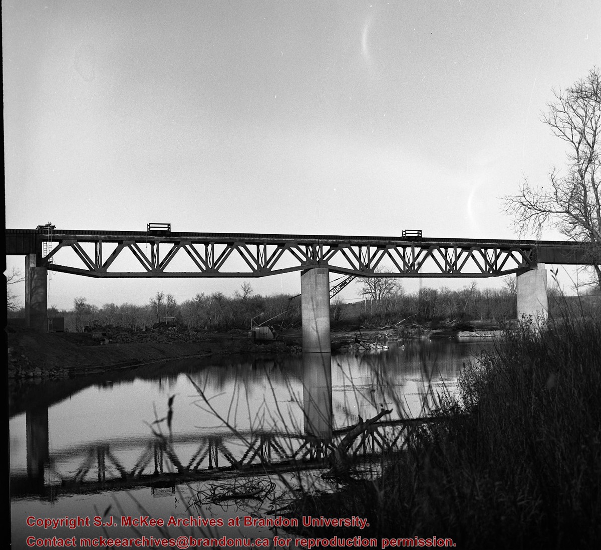
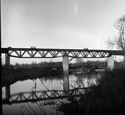
20. Construction of railway bridge 21. Construction railway bridge 22. First automobile Millwood 23. Man, horse, carriage 24. Horse, sled filled with dead moose 25. Harvest scene reaper in action 26. Aboriginal people, tee pee 27. North Western railway bridge over the Assiniboine c. 1900 28. Railway trestle near the “Clay Dump”, on west hill near Harrowby 29. Team of horse in harness drawing a sled 30. Boy, horse with steer tethered to horse’s tail 31. Horse drawn wagon with children, woman and dog
Show Less
Part Of
RG 11 Lawrence Stuckey fonds
Description Level
Item
GMD
graphic
Date Range
November 13, 1976
Accession Number
1-2002
Part Of
RG 11 Lawrence Stuckey fonds
Creator
L.A. Stuckey
Description Level
Item
Series Number
3.1
Item Number
1-2002.3.1NA2
Accession Number
1-2002
GMD
graphic
Date Range
November 13, 1976
Physical Description
2 1/2" x 2 1/2"
Material Details
Negative
History / Biographical
Built during the spring of 1941.
Custodial History
For custodial history see the collection level description of the Lawrence Stuckey collection.
Scope and Content
Third Street Dam [on the Assinibline River].
Notes
[looking south-west (P.E.)]
Name Access
Third Street Dam
Subject Access
natural waterways
Rivers
manmade geographic features
dams
Brandon Miscellaneous History
Repro Restriction
The McKee Archives is the copyright holder for the Stuckey materials.
Storage Location
Lawrence Stuckey collection
Images
Show Less
Part Of
RG 11 Lawrence Stuckey fonds
Description Level
Item
GMD
graphic
Date Range
April 1, 1989
Accession Number
1-2002
Part Of
RG 11 Lawrence Stuckey fonds
Creator
L.A. Stuckey
Description Level
Item
Series Number
3.1
Item Number
1-2002.3.1NA2a
Accession Number
1-2002
GMD
graphic
Date Range
April 1, 1989
Physical Description
2 1/2" x 2 1/2"
Material Details
Negative
History / Biographical
Built during the spring of 1941.
Custodial History
For custodial history see the collection level description of the Lawrence Stuckey collection.
Scope and Content
Third Street Dam [on the Assinibline River].
Notes
[looking north-west (P.E.)]
Name Access
Third Street Dam
Subject Access
natural waterways
Rivers
manmade geographic features
dams
Brandon Miscellaneous History
Repro Restriction
The McKee Archives is the copyright holder for the Stuckey materials.
Storage Location
Lawrence Stuckey collection
Images
Show Less

Lawrence Stuckey slide collection

http://archives.brandonu.ca/en/permalink/descriptions9512
Part Of
RG 11 Lawrence Stuckey fonds
Description Level
Series
GMD
graphic
Date Range
1954-1982
Accession Number
1-2002
Part Of
RG 11 Lawrence Stuckey fonds
Description Level
Series
Series Number
2
Accession Number
1-2002
GMD
graphic
Date Range
1954-1982
Physical Description
approximately 3838 colour slides
History / Biographical
For history/bio information see the collection level description of the Lawrence Stuckey collection.
Custodial History
For custodial history see the collection level description of the Lawrence Stuckey collection.
Scope and Content
Series consists of slides created from photographs taken by Lawrence Stuckey during his travels throughout Manitoba, other parts of Canada and the United States. Although Lawrence and his wife Mavis travelled for pleasure, their destinations were often chosen deliberately to enable Lawrence to explore and photograph specific landscapes, flora and fauna.
Name Access
Glendenning
Assiniboine River
Souris River
Sidney
Manitoba
Whiteshell
Carberry Hills
Baldhead Hills
Sprucewoods
Duck Mountains
Rossburn
Thompson
Kelsey Trail
E.T. Seton Park
Steeprock Bay
Steeprock River
Flin Flon
Rocky Lake
Lake Winnipegosis
Turtle Mountains
Riding Mountain National Park
Moon Lake
Lake Katherine
Clear Lake
Arrowhead Trail
B&B Trail
Ominik Trail
Gorge Creek
Scarborough
Ontario
Edwards Gardens
Royal Botanical Gardens
Prince Albert
Saskatoon
Lake Madge
Winnipeg
Saskatchewan
International Peace Gardens
South Dakota
Black Hills
North Dakota
Quebec
Kenora
Qu'Appelle Valley
Theodore Roosevelt National Monument
Toronto
Point Pelee
Port Dover
Windsor
Yellowstone National Park
Wyoming
Ottawa
Scotsbluff
Nebraska
Mt. Evans Road
Colorado
Berthoud Pass
Milner Pass
Dinosaur Park
Trail Ridge
Rollins Pass
Grand Teton
Beartooth Pass
Craters of the Moon
Idaho
Medicine Bow National Fort
Michigan
Wisconsin
Quebec City
Mont. Tremblant Park
Sugar Camp
Satine-Anne-de-Bellevue Canal
Montreal
Banff National Park
Larch Valley
Sentinel Pass
Lake Louise
Moraine Lake
Athabaska River
Plain of Six
Columbia Icefields
Bow River
Victoria Glacier
Yoho Pass
Yoho National Park
Wapta Falls
Hoodoo Park
Waterfall Valley
Highline Trail
Burgess Pass
Takakaw Falls
Kicking Horse
Skyline Trail
Waterton Lakes National Park
Emerald Lake
Yoho Valley
Twin Falls Creek
Trans Canada Highway
Subject Access
geographic features
manmade geographic features
natural geographic features
political geographic features
natural phenomena
natural waterways
bridges
canals
mines
roads
trails
monuments
historical markers
lakes
mountains
national parks
parks
hills
valleys
Rivers
cities
towns
landscapes
creeks
gardens
Plants
trees
badlands
glaciers
icefields
hoodoos
waterfalls
beaches
forests
Accruals
Additional slides of flora and fauna taken by Stuckey during his travels are housed in the McKee Archives. Those slides are unprocessed at present.
Repro Restriction
The McKee Archives is the copyright holder for the Stuckey materials.
Storage Location
Lawrence Stuckey collection
Show Less
Part Of
RG 11 Lawrence Stuckey fonds
Description Level
Item
GMD
graphic
Date Range
August 28, 1939
Accession Number
1-2002
Part Of
RG 11 Lawrence Stuckey fonds
Creator
L.A. Stuckey
Description Level
Item
Series Number
3.1
Item Number
1-2002.3.1O7
Accession Number
1-2002
GMD
graphic
Date Range
August 28, 1939
Physical Description
2 1/2" x 2 1/2"
Material Details
Negative
Custodial History
For custodial history see the collection level description of the Lawrence Stuckey collection.
Scope and Content
Devil's Punchbowl
Name Access
Devil's Punchbowl
Subject Access
natural geographic features
natural waterways
valleys
Brandon Environs
Repro Restriction
The McKee Archives is the copyright holder for the Stuckey materials.
Location Copy
1-2002.3.9.87
Storage Location
Lawrence Stuckey collection
Images
Show Less

20 records – page 1 of 1.