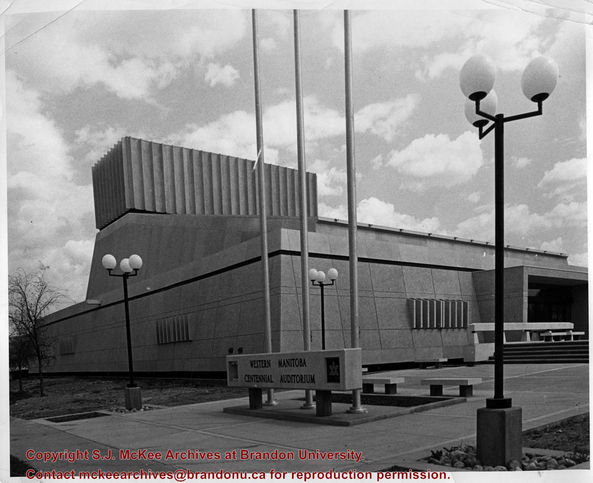
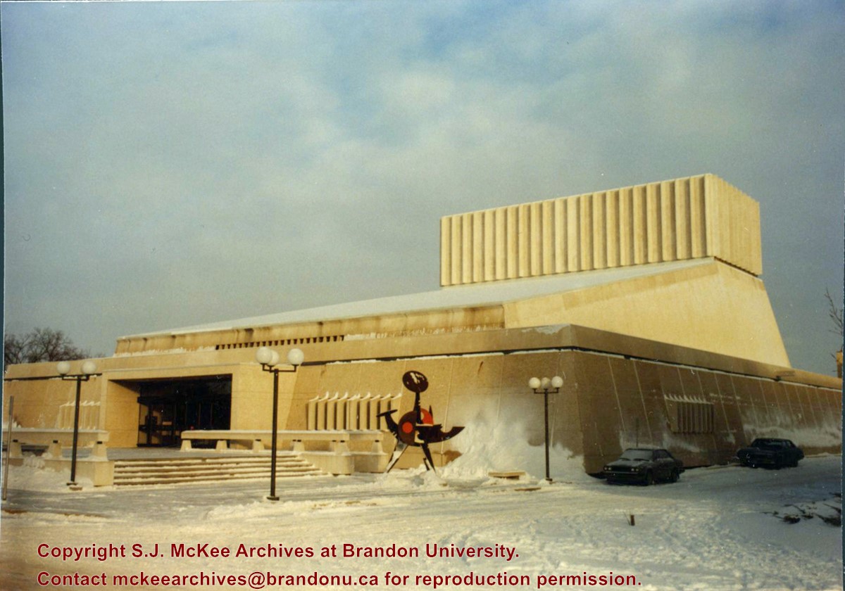
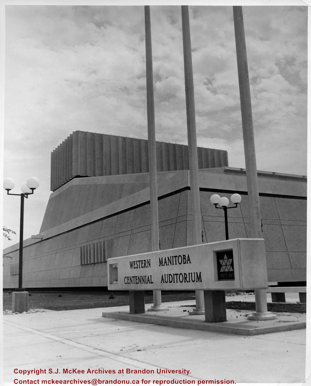
View is looking east northeast. Photograph shows the front steps, main entrance and west side of the Western Manitoba Centennial Auditorium (WMCA). Brandon University's Education Building is in the background.
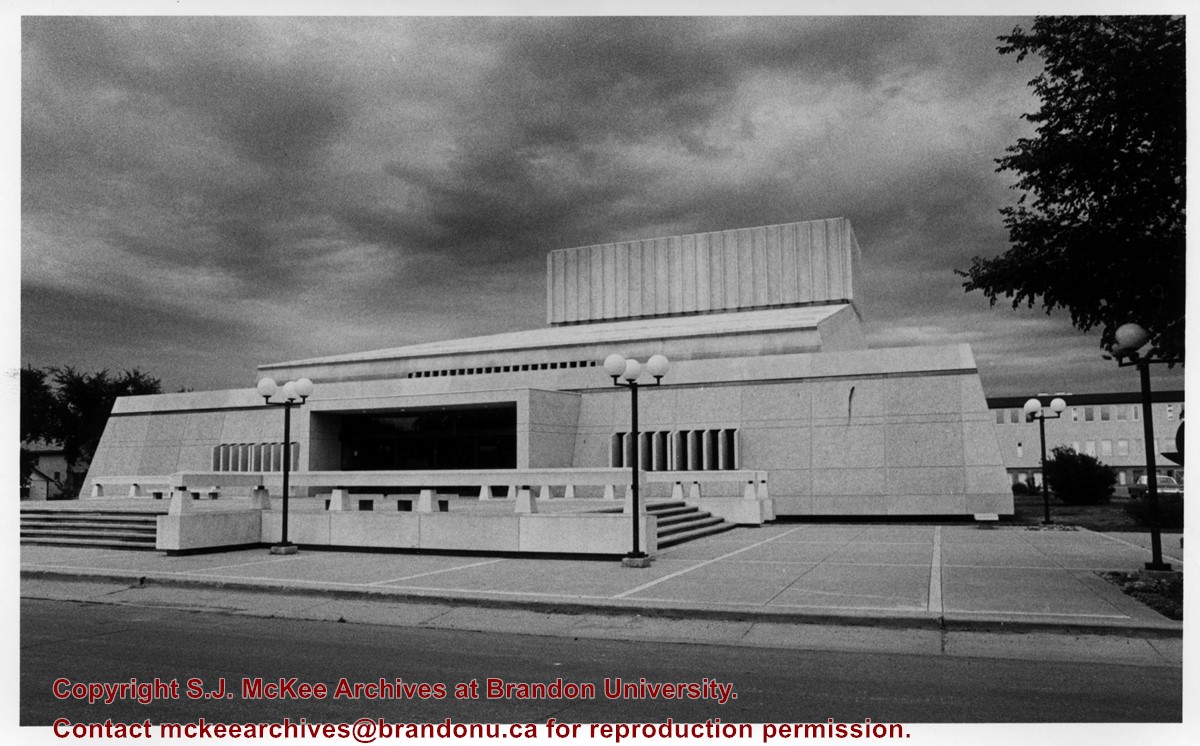
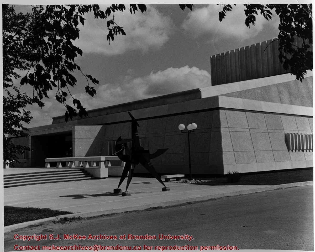
View is looking northeast. Photograph shows the southwest corner of the Western Manitoba Centennial Auditorium (WMCA). Victor Tolgesy's sculpture Explorer is in the foreground.
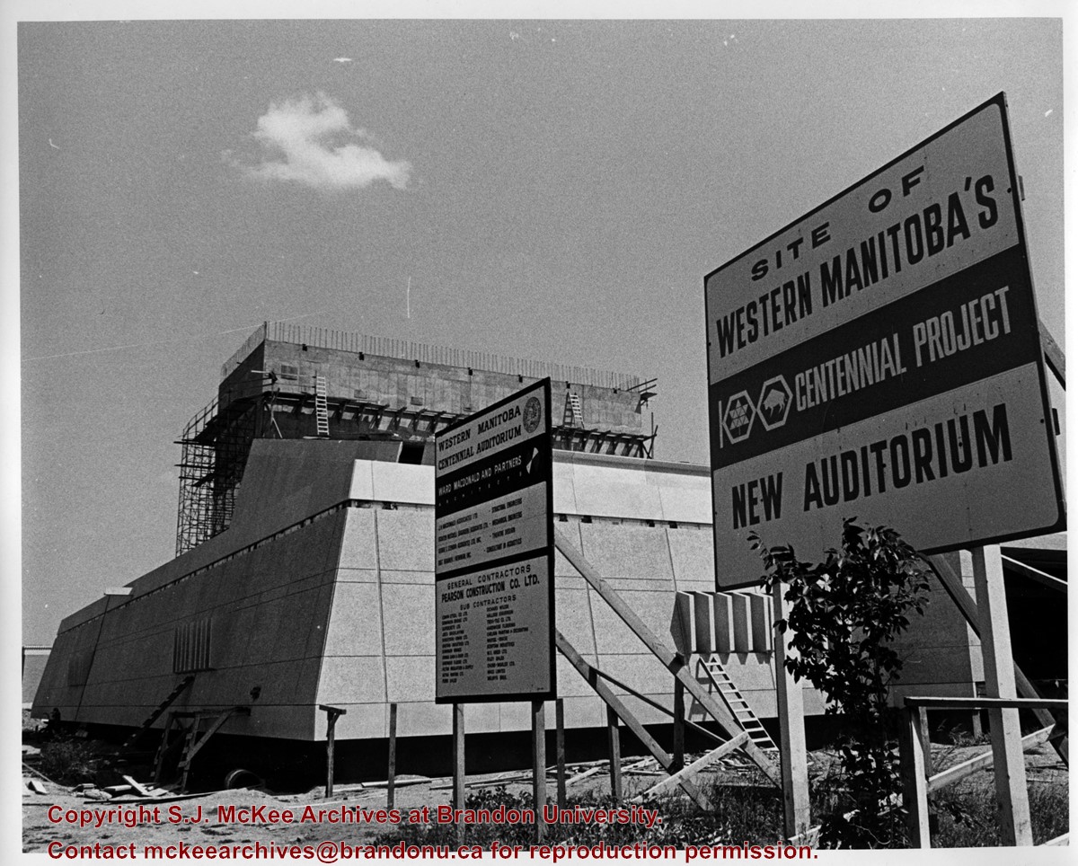
View is looking east southeast. Photograph shows the Western Manitoba Centennial Auditorium (WMCA) under construction. There are two signs in the foreground. One lists the names of the architectural firm, the engineers, contractiors and subcontractors involved with the project. The other reads: Site of Western Manitoba's 100 Centennial Project New Auditorium
Photograph of the Western Manitoba Centennial Auditorium (WMCA). View is looking northeast from 20th Street. Victory Tolgesy's "Explorer" in the foreground.
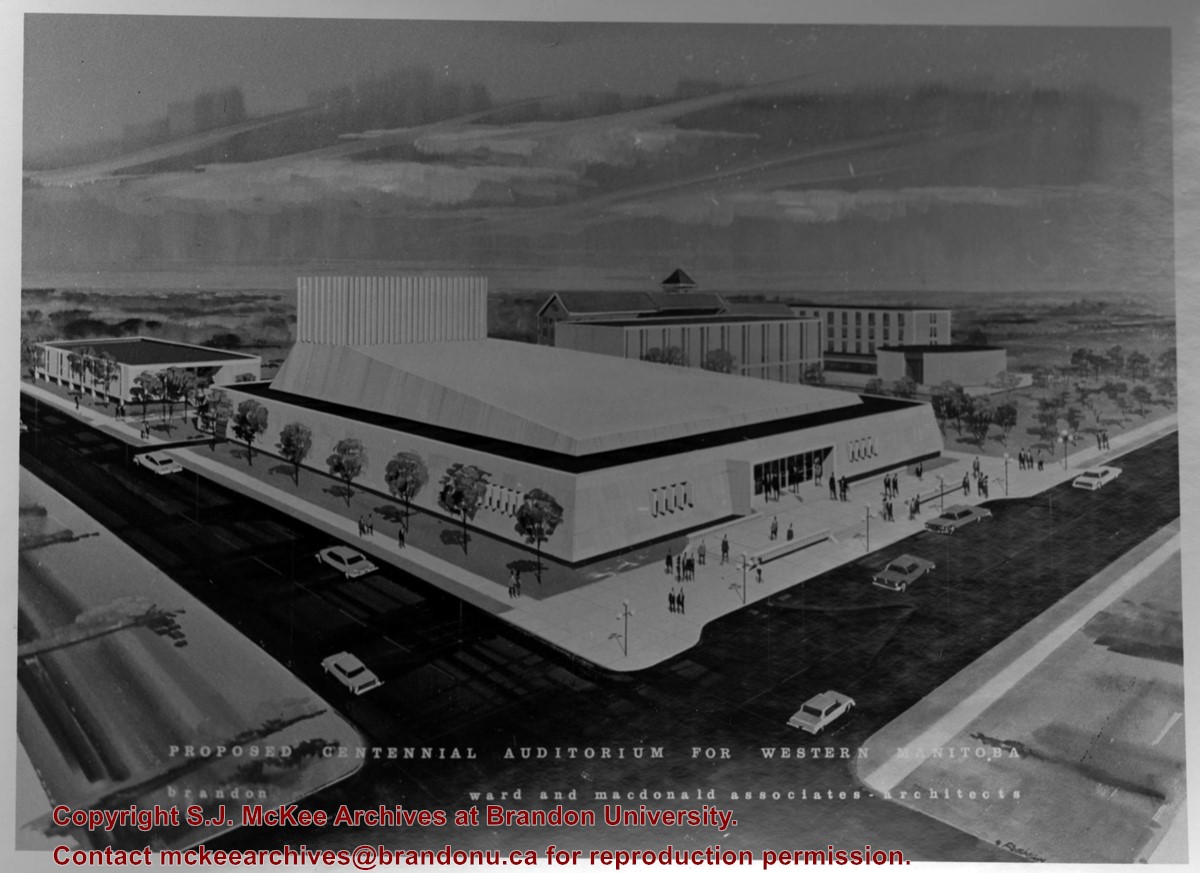
Photograph is a proposed model for a centennial auditorium for western Manitoba prepared by Ward and Macdonald Associates - Architects. View is southeast from the northwest corner of Princess Avenue and 20th Street. The model includes the proposed auditorium as well as a number of buildings on the Brandon College campus.
This collection contains photographs of Brandon and Area that do not belong to particular collections or fonds held at the S.J. McKee Archives. It is, in short, an artificially created collection.
The collection has been divided into the following series: (1) Rural Images; (2) Urban Images; (3) Transportation; (4) Education; (5) Portraits; (6) Associations; (7) and Athletics.
Notes
In addition to this collection, photographs relating to Brandon and area may be found in the Lawrence Stuckey collection, the Alf Fowler collection, the A.E. McKenzie Company fonds, Hughes and Company collection, and the Provincial Exhibition of Manitoba Association fonds.
Storage Location
BAPC - Brandon and Area photograph collection photograph drawer (oversize in map drawer)
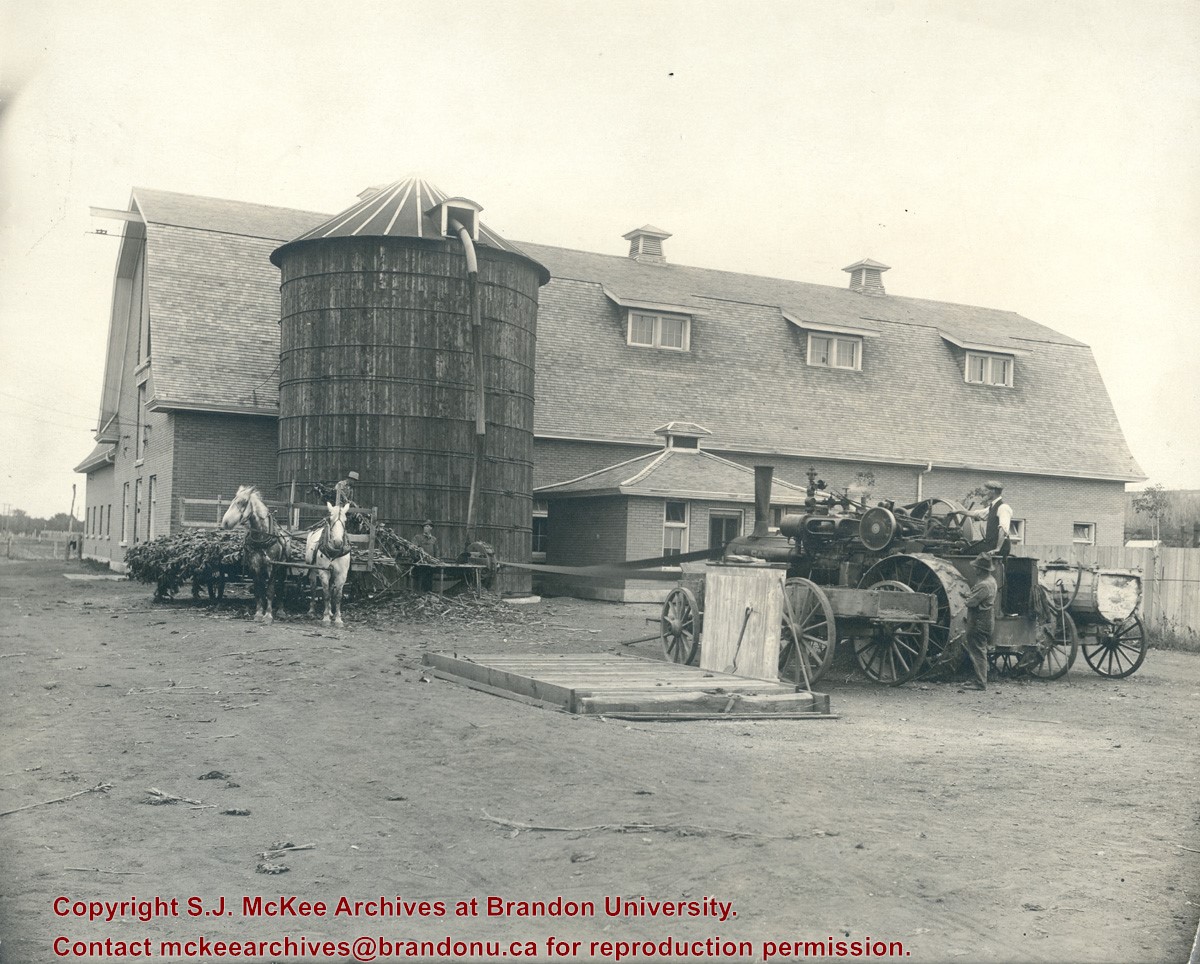
Photograph shows the Manitoba Agricultural College located at Treesbank, MB. Photograph shows a large barn-like structure comprised of brick and a wooden silo in the side yard. A steam engine is processing a field crop (corn perhaps) that is then being funneled into the silo.
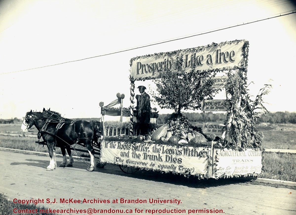
Photograph shows a float advertisement for the Manitoba Agricultural College. The photograph was taken at Treesbank, MB. The banners on the float read: "Prosperity like a Tree" "If the Roots Suffer, the Leaves Wither and the Trunk Dies."
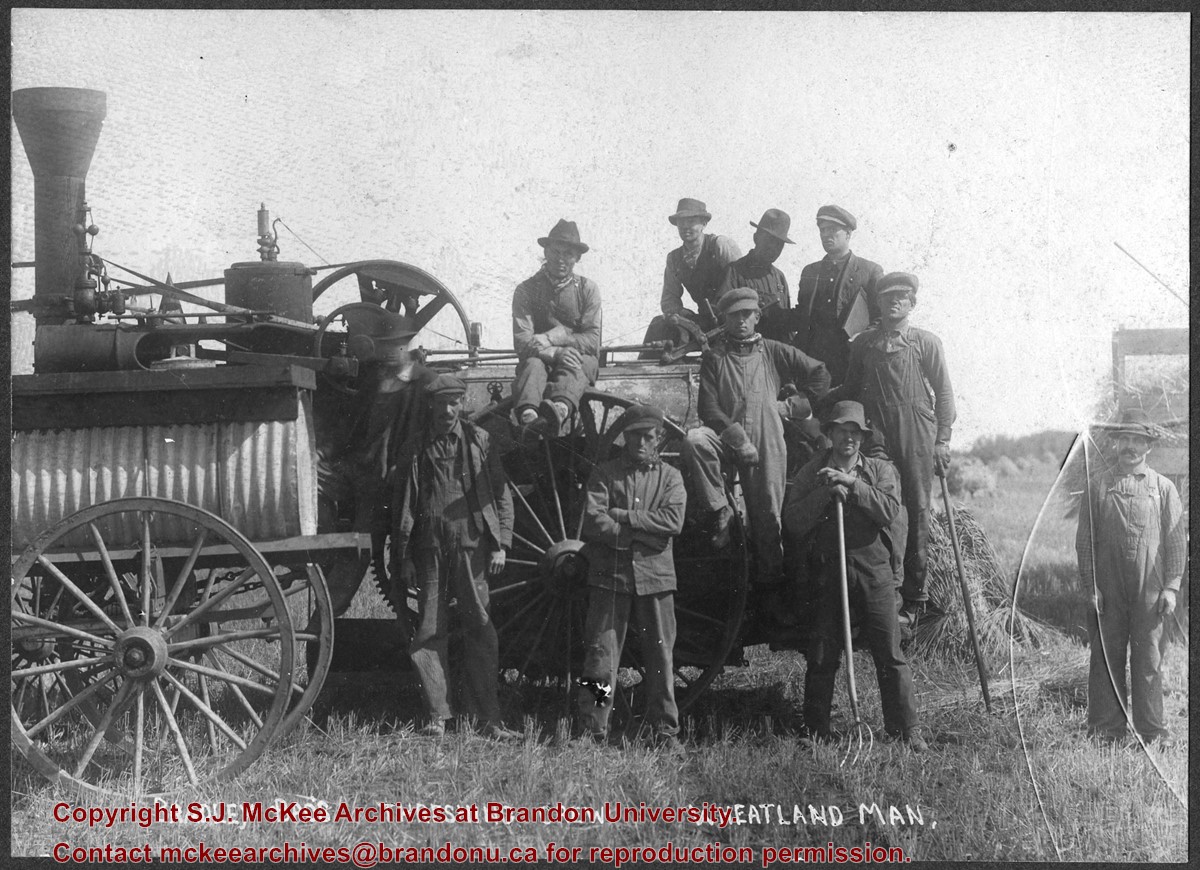
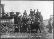
Photograph shows the Bradley Bros. threshing crew of Wheatland, MB posing in a field. Faint writing in pencil on the back of the photo reads: Bill Le Paga(?), Tom B, Dave R., Andy R.
Photograph shows the removal of one of the houses formerly located on 20th Street between Louise and Princess Avenues. The houses on those blocks were removed to create parking lots for the University. A Fed Zavislak Ltd. Well Drilling & Trucking pickup truck is visible at the curb.
Photograph shows the removal of one of the houses formerly located on 20th Street between Louise and Princess Avenues. The houses on those blocks were removed to create parking lots for the University.
View is northeast from the Brandon College Building. Photograph shows the inside of the Brandon College Building after it had been gutted and then partially rebuilt. The exterior fascade of the west side of the building can be clearly seen in this photograph. A number of houses on the east side of 200 block of 18th Street are also visible, as is the stone fence on Princess Avenue and the flag pole on the front lawn.
Brandon College looking south from 19th Street. Photograph was taken after Flora Cowan Hall was built but before construction of the Education Building.
Image shows the Brandon College campus from 17th Street looking southwest. The photo was taken after the completion of the original Music Building in 1963, but construction of the Education Building. Also visible are a number of properties on the 200 block of 18th Street and the 200 block of 20th Street.
View is southwest from approximatley 16th Street between Princess and Rosser Avenues. Photograph shows the Brandon University campus, as well as surrounding residential blocks, including Flemming, J.R. Reid and Vincent Massey schools.
View is west southwest from approximatley 16th Street between Princess and Lorne Avenues. Photograph shows the Brandon University campus, as well as surrounding residential blocks between 16th and 23rd Streets, Princess and Louise Avenues..
View is west from approximatley 17th Street between Lorne and Louise Avenues. Photograph shows a portion of the Brandon University campus (excluding the Education Building and anything north of it), as well as surrounding residential blocks from approximatley 17th Street to 22nd Street.


