Skip header and navigation

Revise Search

6 records – page 1 of 1.

Aerial view: Brandon College campus

http://archives.brandonu.ca/en/permalink/descriptions8272
Part Of
Aerial views and campus photographs
Description Level
Item
GMD
graphic
Date Range
c. 1964
Part Of
Aerial views and campus photographs
Description Level
Item
Series Number
2.1
Item Number
2.1.1
GMD
graphic
Date Range
c. 1964
Physical Description
4" x 5" (b/w)
Scope and Content
Photograph is looking northwest from approximately the southeast corner of 18th Street and Louise Avenue.
Name Access
Flora Cowan Residence
Subject Access
Aerial views Brandon College
Images
Show Less

Front lawn and Clark Hall

http://archives.brandonu.ca/en/permalink/descriptions815
Part Of
Aerial views and campus photographs
Description Level
Item
GMD
graphic
Date Range
c. 1980s
Part Of
Aerial views and campus photographs
Description Level
Item
Series Number
2.1
Item Number
2.1.50
GMD
graphic
Date Range
c. 1980s
Physical Description
8" x 10" (b/w)
Scope and Content
Photograph shows a woman reading in the seating area on the front lawn in front of Clark Hall.
Images
Show Less

Citizens' Science Building, Brandon College Building and Clark Hall

http://archives.brandonu.ca/en/permalink/descriptions816
Part Of
Aerial views and campus photographs
Description Level
Item
GMD
graphic
Date Range
October 1981
Part Of
Aerial views and campus photographs
Description Level
Item
Series Number
2.1
Item Number
2.1.142
GMD
graphic
Date Range
October 1981
Physical Description
8" x 10" (b/w)
Scope and Content
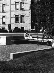
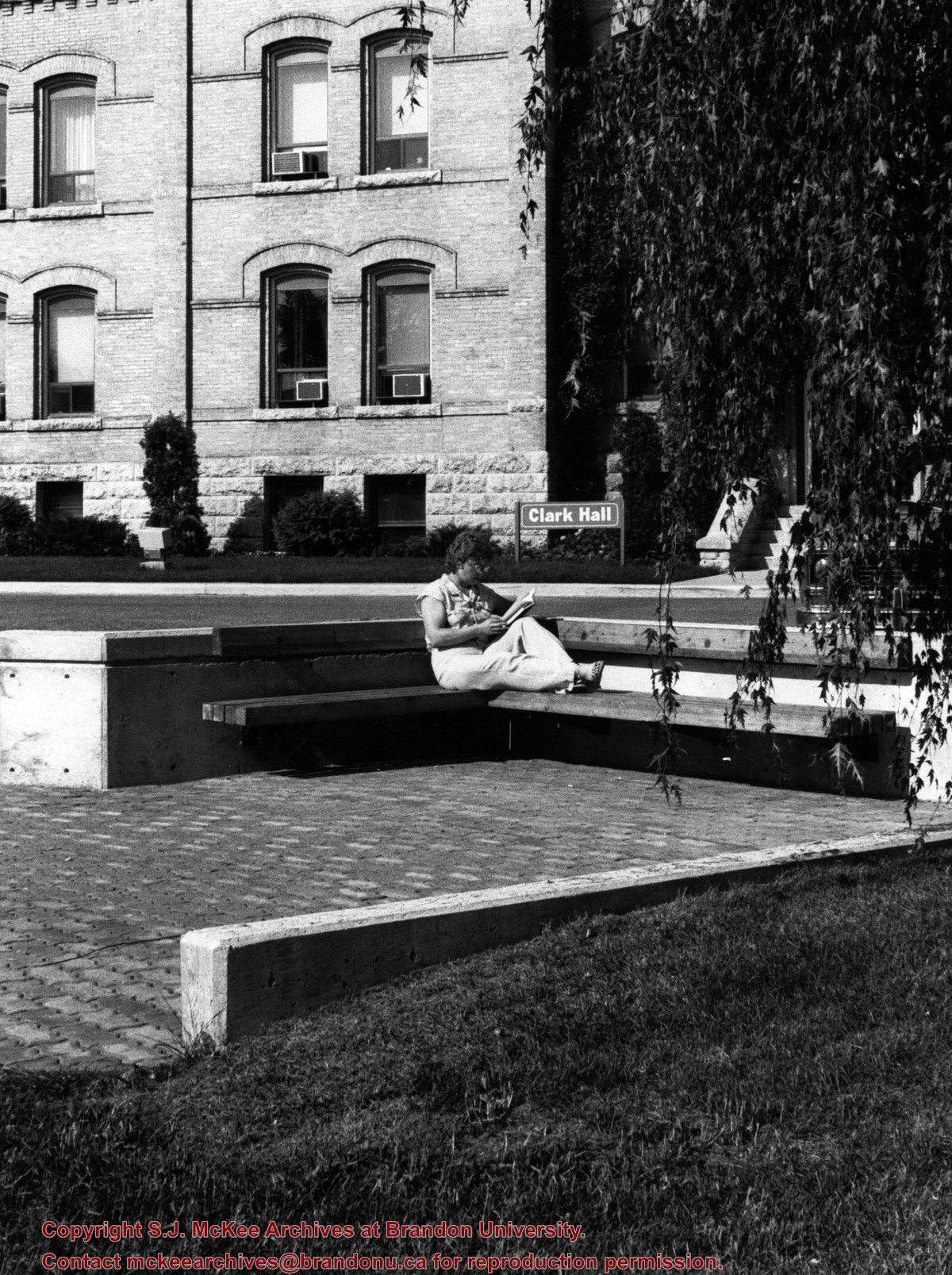
Photograph is looking northwest probably from the John R. Brodie Science Centre and shows the Citzens' Science Building, the Brandon College Building, Clark Hall and a portion of the driveway and grounds in front of the buildings.
Images
Show Less

Aerial view: Clark Hall, Education Building, Student Union Building

http://archives.brandonu.ca/en/permalink/descriptions612
Part Of
Aerial views and campus photographs
Description Level
Item
GMD
graphic
Date Range
c. 1960s
Part Of
Aerial views and campus photographs
Description Level
Item
Series Number
2.1
Item Number
2.1.17
GMD
graphic
Date Range
c. 1960s
Physical Description
10" x 8" (b/w)
Scope and Content
View is northeast, taken from the John R. Brodie Science Centre. Photograph shows: the Brandon College Building, the Student Services H-Hut, the Education Building, and the Student Union Building (Citizens' Science Building), as well as 18th Street and some houses. The trailer to the south of the Education Building was a Canada Manpower office in the 1960s. It was latter moved over by the Gymnasium, where it became the Quill office.
Images
Show Less
Part Of
CKX fonds
Description Level
Item
GMD
graphic
Date Range
after 1954
Accession Number
11-2010
Part Of
CKX fonds
Creator
CKX
Description Level
Item
Series Number
H
Item Number
11-2010.H8b
Accession Number
11-2010
GMD
graphic
Date Range
after 1954
Physical Description
5" x 4" (b/w)
Material Details
Negative
Custodial History
See fonds level of the CKX records for custodial history.
Scope and Content
Image of the southside of the 1100 block of Rosser Avenue in winter. Visible are O.L. Harwood Ltd., the Key Kafe and Northern Auto Parts. The Perth's building, located in the 1200 block, can be seen on the righthand side in the background. A number of vehicles, a pedestrian and a man shovelling snow are also visible.
Name Access
CKX
O.L. Harwood Ltd.
Key Kafe
Northern Auto Parts
Perth's
Rosser Avenue
11th Street
Subject Access
street scenes
downtown
winter
building exteriors
real estate brokers
insurance agents
cafes
restaurants
Storage Location
CKX fonds - 2010 accessions
Images
Show Less
Part Of
CKX fonds
Description Level
Item
GMD
graphic
Date Range
after 1954
Accession Number
11-2010
Part Of
CKX fonds
Creator
CKX
Description Level
Item
Series Number
H
Item Number
11-2010.H8a
Accession Number
11-2010
GMD
graphic
Date Range
after 1954
Physical Description
5" x 4" (b/w)
Material Details
Negative
Custodial History
See fonds level of the CKX records for custodial history.
Scope and Content
Image of the southside of the 1000 and 1100 block of Rosser Avenue looking east in winter. Visible in the foregraound are O.L. Harwood Ltd., and the Key Kafe. Buildings in the 1000 block include: the Imperial Bank of Canada, the original Post Office and Federal Building and the original Merchants Bank. A number of pedestrians are also visible, as are Christmas decorations on the streetlights and telephone poles.
Name Access
CKX
O.L. Harwood Ltd.
Key Kafe
Rosser Avenue
11th Street
Subject Access
street scenes
downtown
winter
building exteriors
real estate brokers
insurance agents
cafes
restaurants
banks
Storage Location
CKX fonds - 2010 accessions
Images
Show Less

6 records – page 1 of 1.