See sub sub series level (RG 6, 8.4.1) for history/bio information.
Custodial History
See sub sub series level (RG 6, 8.4.1) for custodial history.
Scope and Content
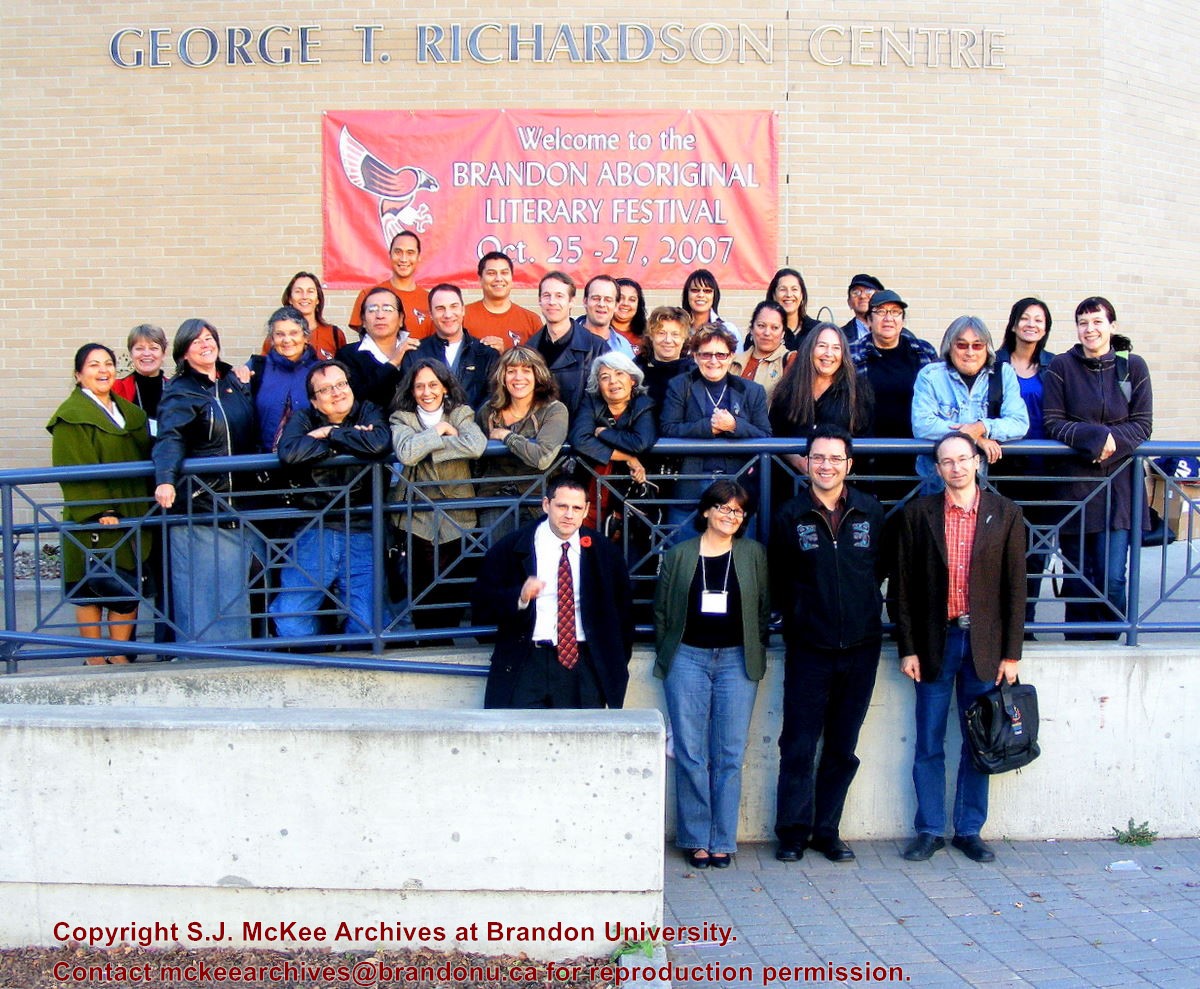
Group photograph of participants, volunteers and organization committee members taken in front of the George T. Richardson Centre.
Back Row (L-R): Dot Sinclair; John Steppler; ?; Paul DePasquale; Cheyenne Spence; Jill Oman; Marine Debryne; Errol Kinistino
Second Row (L-R): Di Brandt; Maria Campbell; Tomson Highway; Greg Scofield; Warren Cariou; ?; Lisa Whitecloud; Marie Baker (Annharte); Rosanna Deerchild
Third Row (L-R): Eden Robinson, Yvette Nolan; Daniel David Moses; Joanne Arnott, Kateri Akiwenzie-Damm; Louise Halfe; Linda Burridge; Colleen Cutschall; Duncan Mercredi; Katherena Vermette
Front Row (L-R): Neal McLeod; Lorraine Meyer; Richard Van Camp; Armand Garnet Ruffo
Storage Location
RG 6 Brandon University fonds
Series 8: Library Services
8.4 Library special events
8.4.1 Brandon Aboriginal Literary Festival
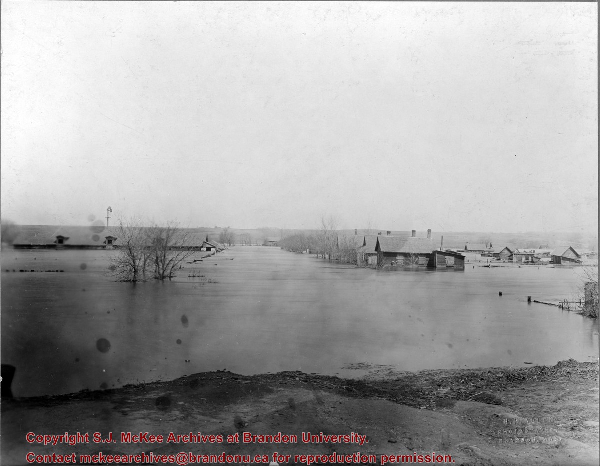
The "flats" refers to the Assiniboine River floodplane from 18th Street to First Street on either side of the river. See p. 223 of G.F. Barker's Brandon: A City for a description of the 1922 flood.
Custodial History
The photo was owned by Mrs. Wes Railton prior to its donation to the Archives.
Scope and Content
Photograph contains an image of houses on the Assiboine floodplane (Brandon's "flats") submerged in flood-waters.
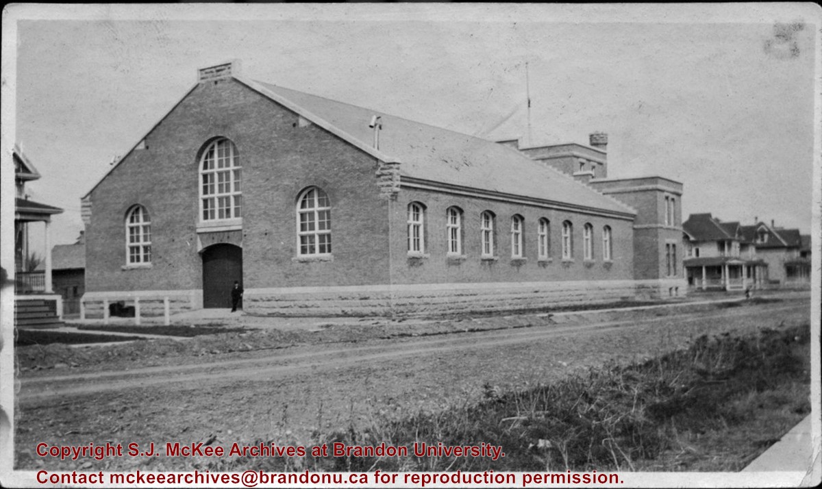
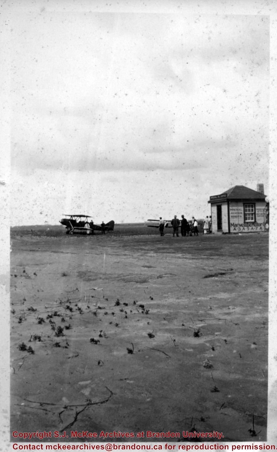
The Brandon Armoury was built in 1907. The extension on the southside was built in 1937.
Custodial History
The photograph was donated to the Archives by Cy Kenny in 2005.
Scope and Content
Photograph is looking northwest from the east side of 11th Street. It shows the back and east side of the Brandon Armoury, which is located on the at 1116 Victoria Avenue.
See sub sub series level (RG 6, 8.4.1) for history/bio information.
Custodial History
See sub sub series level (RG 6, 8.4.1) for custodial history.
Scope and Content
File consists of grant application materials and progress reports to the Brandon Neighbourhood Renewal Corporation and correspondence regarding funding, reports and thank you letters to funders.
Storage Location
RG 6 Brandon University fonds
Series 8: Library Services
8.4 Library special events
8.4.1 Brandon Aboriginal Literary Festival
View is northwest from the roof of the John R. Brodie Science Centre. Photograph shows the roof of the Knowles Douglas Students' Union Centre, the Citizens' Science Building, and the Brandon College Building and Clark Hall during renovation.
Photograph was taken from the roof of the Library and shows the walkway and flower bed on the southeast corner of the George T. Richardson Centre. The Physical Plant H-Hut is visible in the top right hand corner.
View is southwest from the roof of the George T. Richardson Centre. Photograph shows the curved glass wall of the John E. Robbins Library, the walkway between the Library and the Dining Hall, the Dining Hall and Darrach Hall.
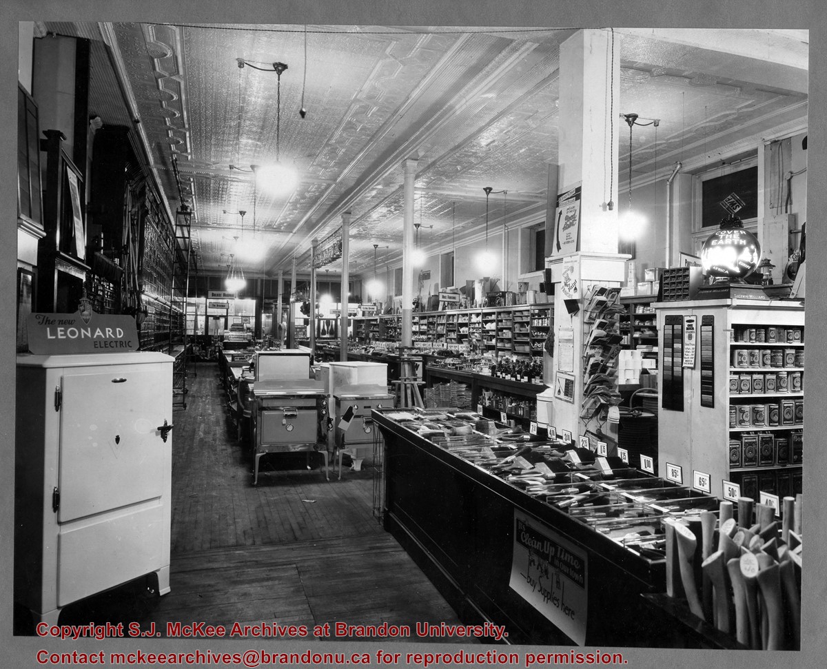
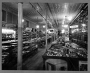
Brandon Hardware Co. Ltd. founded in 1882, making it one of Brandon's earliest mercantiles. It was incorporated in 1902, and their location on Rosser Avenue at the corner of 7th Street was constructed in 1903. For a number of years, J.B. Curran was the managing director. The building was destroyed by fire in 1983.
Custodial History
Katy Singleton was given this photo in her role as Heritage Coordinator for the City of Brandon. She transferred it to the McKee Archives in 2013.
Scope and Content
Item is a photograph of of the interior of the Brandon Hardware Co. Ltd. looking towards the front of the store from the back.
Brandon Hardware Co. Ltd. founded in 1882, making it one of Brandon's earliest mercantiles. It was incorporated in 1902, and their location on Rosser Avenue at the corner of 7th Street was constructed in 1903. For a number of years, J.B. Curran was the managing director. The building was destroyed by fire in 1983.
Custodial History
Katy Singleton was given this photo in her role as Heritage Coordinator for the City of Brandon. She transferred it to the McKee Archives in 2013.
Scope and Content
Item is a photograph of of the interior of the Brandon Hardware Co. Ltd. looking towards the back of the store from the front.
Brandon College looking south from 19th Street. Photograph was taken after Flora Cowan Hall was built but before construction of the Education Building.
View is north probably from the roof of McMaster Hall. Photograph shows the construction of the new roof on Clark Hall and the Brandon College Building.
View is north probably from the roof of McMaster Hall. Photograph shows the construction of the extension to Clark Hall and the skywalk. Also visible are the A.E. McKenzie Building, the Brandon College Building, the Education Building, the original Music Building and the Western Manitoba Centennial Auditorium, as well as the walkway that runs north between the buildings and the courtyard.
View is northeast probably from the roof of McMaster Hall. Photograph shows the construction of the new roof on Clark Hall and the Brandon College Building. A portion of the east side of the 000 and 100 blocks of 18th Street, as well as the corner of 18th Street and Rosser Avenue are visible in the upper left hand corner. This includes the "Downtown Brandon" sign.
View is north northeast probably from the roof of McMaster Hall. Photograph shows the construction of the new roof on Clark Hall and the Brandon College Building, as well as the construction of the extension to Clark Hall and the skywalk. Portions of the city as far north as the Assiniboine River are also visible.
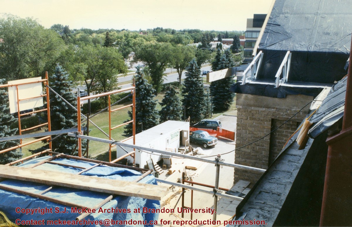
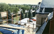
View is southeast from the roof of Clark Hall. Photograph shows some of the scaffolding and materials, as well as the construction trailer (Bird Construction) located on the driveway during the restoration of Clark Hall and the Brandon College Building.


