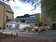
Located at the centre of the Brandon University campus, the Physical Plant H-Hut was destroyed following the opening of the new $3.9M, 13,600 square-foot physical plant on 07 April 2010.
Custodial History
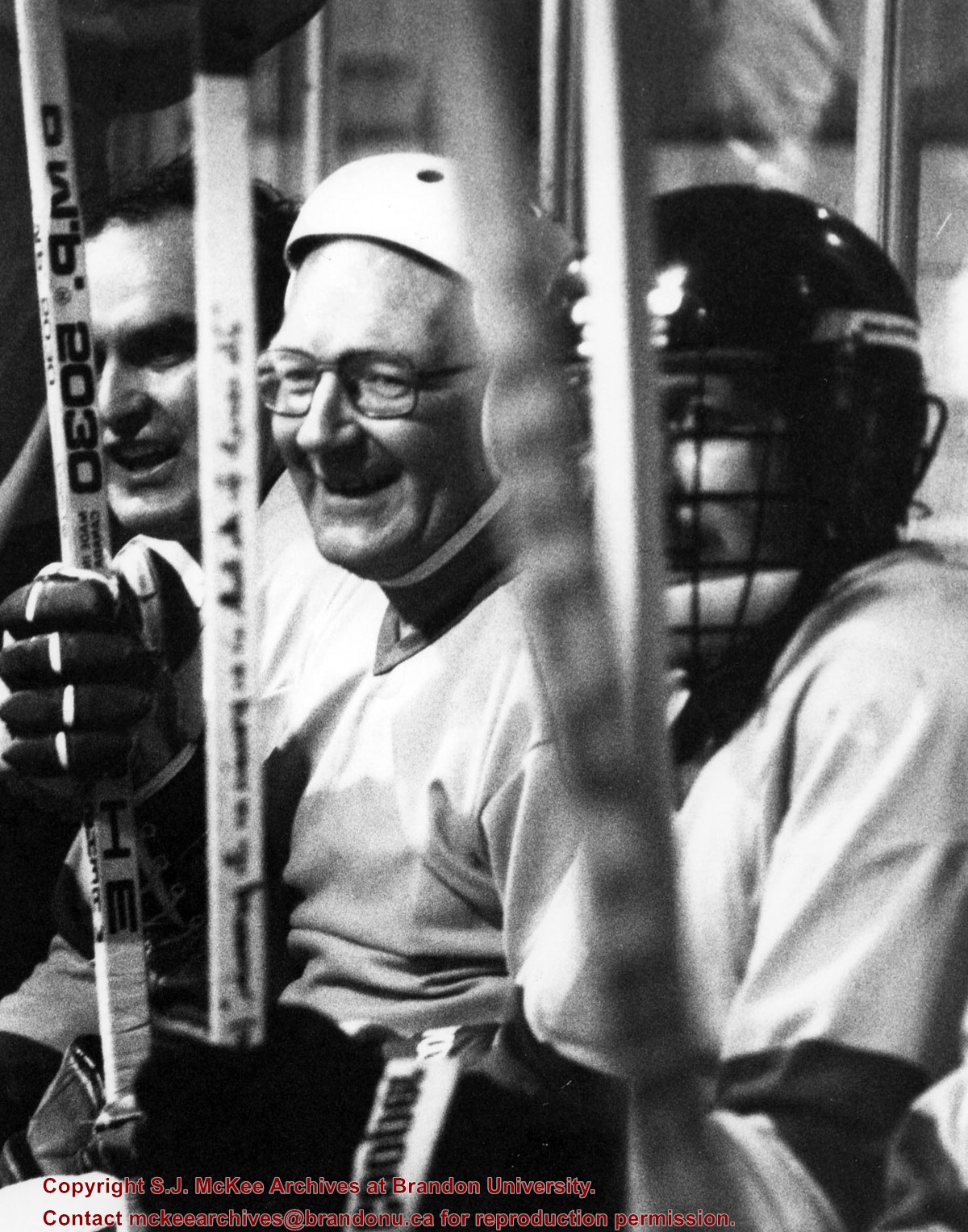
Photograph was taken by McKee Archives project archivist Jill Sutherland.
Scope and Content
Photograph shows the demolition of the Physical Plant H-Hut. The photograph is looking southeast. The John R. Brodie Science Centre, the Geology H-Hut, and portions of the Citizens' Science Building (BUSU Building), Knowles-Douglas expansion (KDC) and McMaster Hall are visible in the background.
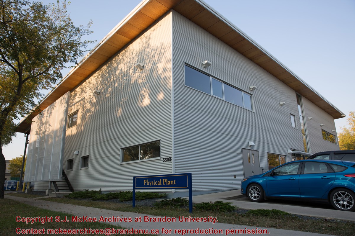
A $3.9M, 13,600 square-foot physical plant was opened on 07 April 2010. Located south of the steam plant on 20th Street by Darrach Hall, the building replaced the old Physical Plant occupying the World War II H-Huts. The new building serves as the hub for many campus operations, providing services from security and technical support, to building maintenance, deliveries, grounds keeping, cleaning, and capital project management.
Custodial History
Photograph is part of a series of campus images commissioned by the McKee Archives and Communications in the lead up to Brandon University's 50th Anniversary celebration.
Scope and Content
Photograph shows the new Physical Plant building located on the west side of 20th Street, just north of Louise Avenue. The photograph is looking southwest and shows the exterior of the building, as well as part of the parking lot.
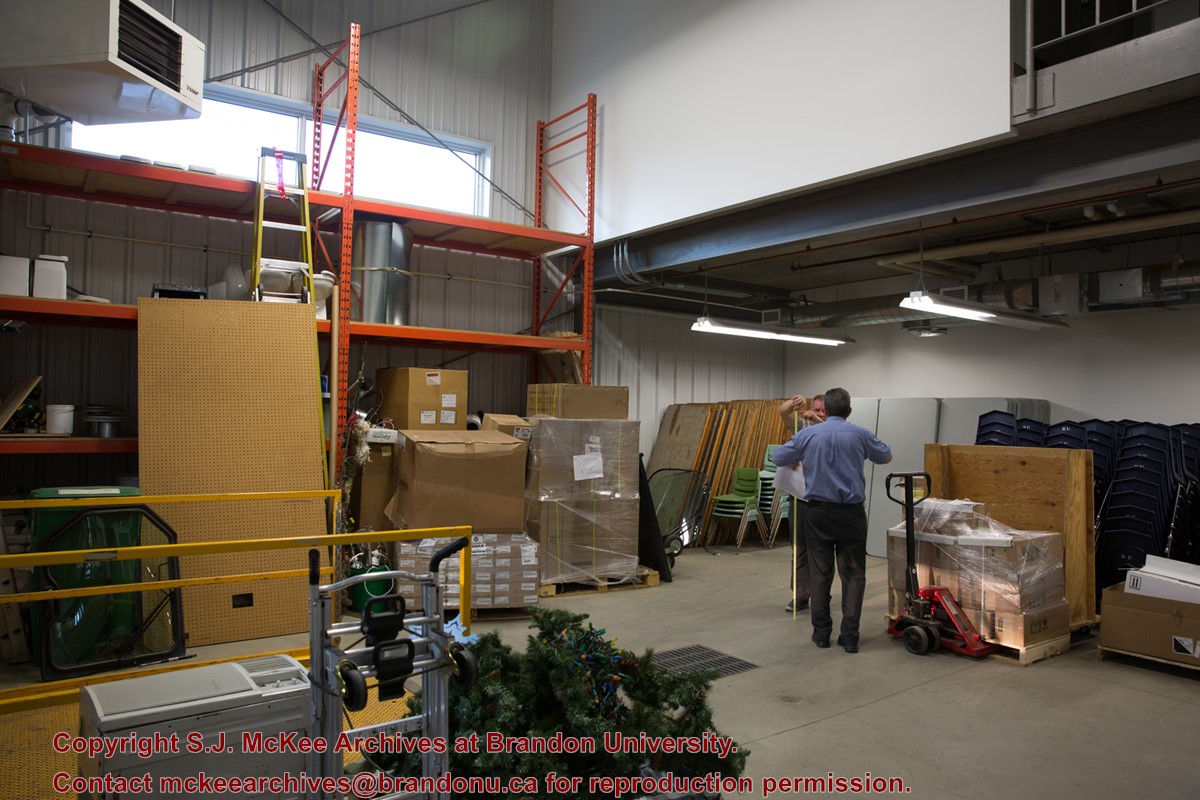
A $3.9M, 13,600 square-foot physical plant was opened on 07 April 2010. Located south of the steam plant on 20th Street by Darrach Hall, the building replaced the old Physical Plant occupying the World War II H-Huts. The new building serves as the hub for many campus operations, providing services from security and technical support, to building maintenance, deliveries, grounds keeping, cleaning, and capital project management.
Custodial History
Photograph is part of a series of campus images commissioned by the McKee Archives and Communications in the lead up to Brandon University's 50th Anniversary celebration.
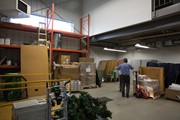
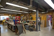
Scope and Content
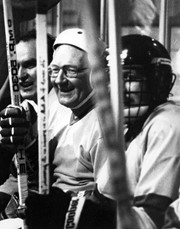
Photograph shows a storage/work space inside the new Physical Plant building located on the west side of 20th Street, just north of Louise Avenue. The man with his back to the camera is Al Puhach, Maintenacne Supervisor. The man facing the camera is Gord Neal, Director of Physical Plant.
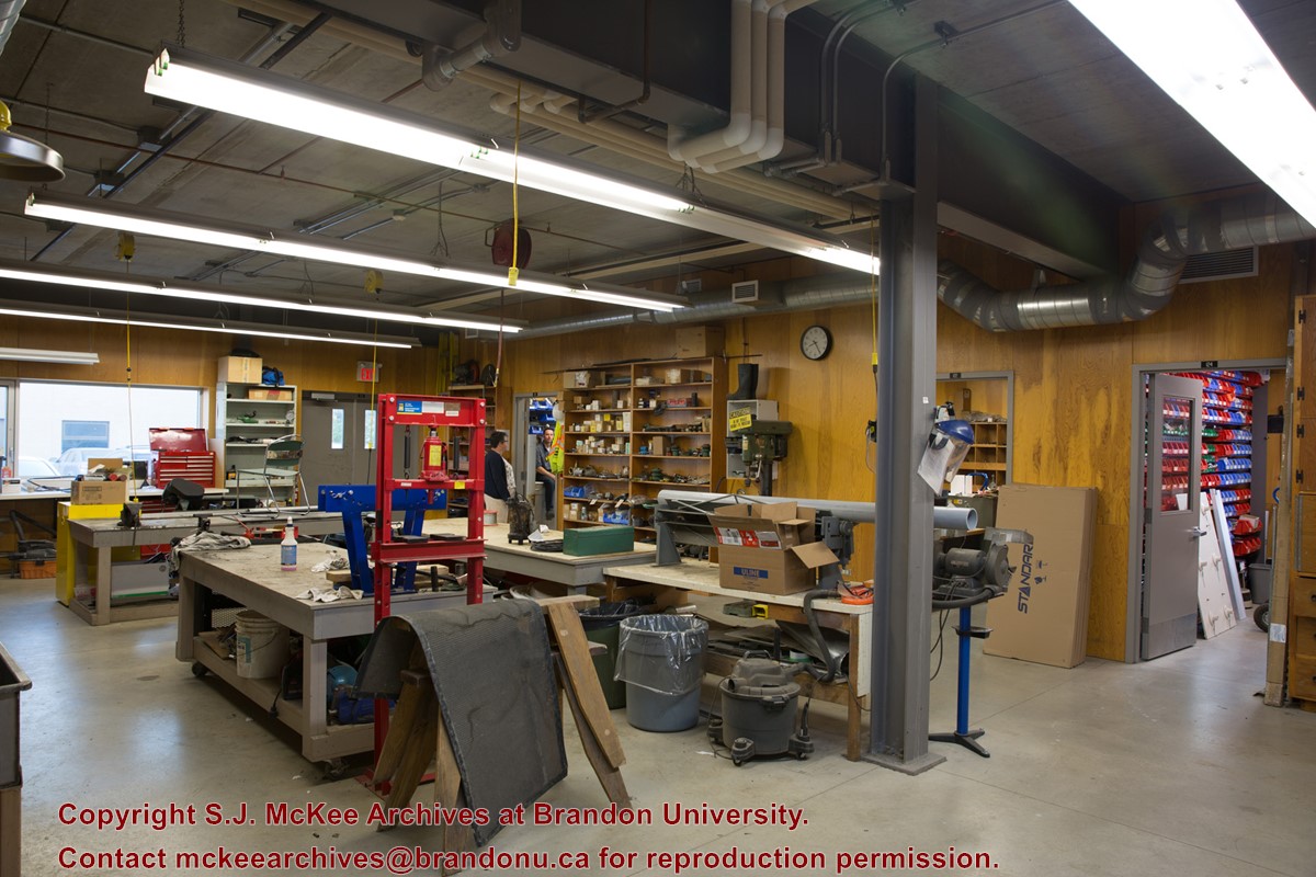
A $3.9M, 13,600 square-foot physical plant was opened on 07 April 2010. Located south of the steam plant on 20th Street by Darrach Hall, the building replaced the old Physical Plant occupying the World War II H-Huts. The new building serves as the hub for many campus operations, providing services from security and technical support, to building maintenance, deliveries, grounds keeping, cleaning, and capital project management.
Custodial History
Photograph is part of a series of campus images commissioned by the McKee Archives and Communications in the lead up to Brandon University's 50th Anniversary celebration.
Scope and Content
Photograph shows a work space inside the new Physical Plant building located on the west side of 20th Street, just north of Louise Avenue. The woman in the background is Stacey Harper, Physical Plant Office Assistant. The man in the background is Brent Cuvelier, Carpenter.
The photograph was taken for the Centennial of Brandon College/University.
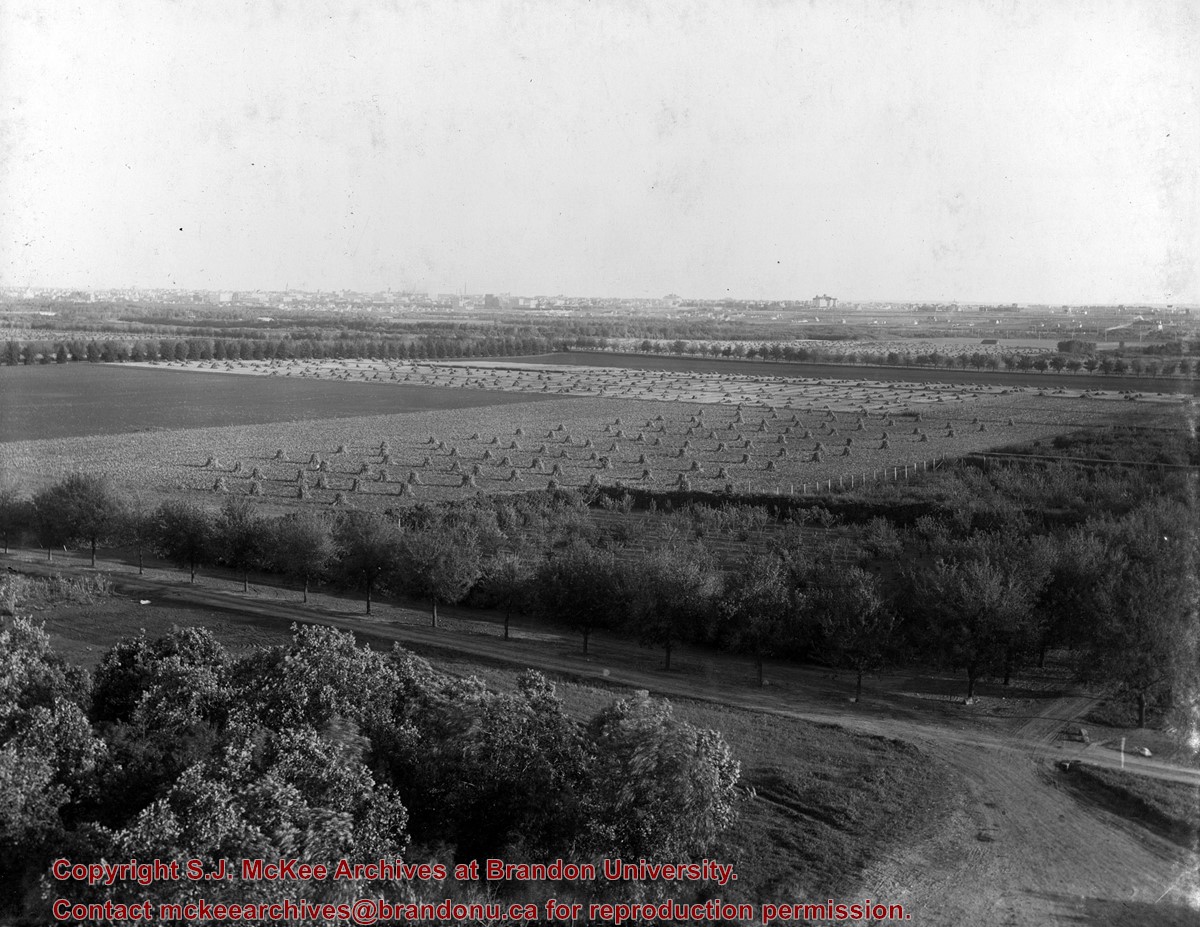
Scope and Content
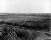
Aerial photograph taken looking southwest from approximately the northeast corner of Princess Avenue and 17th Street. The entire campus, as well as a number of residential streets are visible.
The photograph may have been taken for Brandon University's centennial.
Scope and Content
Photograph is looking northeast from approximately Victoria Avenue and 21st Street and shows the Brandon University campus, Kinsmen Stadium, the Assiniboine River and a number of residential neighbourhoods.
See fonds level description of the Alf Fowler collection for custodial history.
Scope and Content
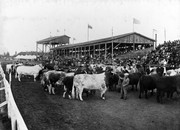
Photo shows the old Grand Stand on the Exhibition Grounds (now the Keystone Grounds) during what appears to be a cattle auction or show. Unlike the other photos of the Grand Stand in the collection, this photo was taken from the track looking into the Grand Stand rather than looking onto the track from the Grand Stand.
Storage Range
RG 5 Western Manitoba Manuscript collection - photograph storage drawer
See fonds level description of the Alf Fowler collection for custodial history.
Scope and Content
Photo was taken of 10th Street from Pacific Avenue looking sourth. Visible businesses include: the Cecil Hotel; the Canadian Bank of Commerce; Campbell and Campbell; and the Bank of British North America
Storage Range
RG 5 Western Manitoba Manuscript collection - photograph storage drawer
See fonds level description of the Alf Fowler collection for custodial history.
Scope and Content
Photo was taken of Rosser Avenue from 7th Street looking west. Visible businesses include: ? and Ball; Vincent & MacPherson; W.N. Finlay; Christie's; J. Burchill; the Empire Hotel; and Fleming's Drug Store. A number of people and vehicles are visible on both sides of the street.
Notes
A digital scan of the photograph is available on a CD located in the Archives' office.
Storage Range
RG 5 Western Manitoba Manuscript collection - photograph storage drawer
See fonds level description of the Alf Fowler collection for custodial history.
Scope and Content
Photo was taken of Rosser Avenue, looking east from 11th Street. Visible in the photo are the Merchant's Bank of Canada, A. Smith, and the Union Bank of Canada. A number of people and vehicles are also visible.
Storage Range
RG 5 Western Manitoba Manuscript collection - photograph storage drawer


