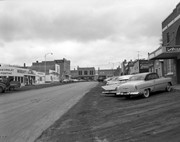
Photograph shows the west side of the 200-block on 10th Street. Visible businesses include: Chamber of Commerce Tourist Information, Dominion Tire & Radio Co., Bonnie's Bonnet Shop, Steve's Grill, Wally's Taxi, and Western Motors Ltd. The painted advertisement for Doig, Rankin and Robertson is visible on the Alexandra Block. Christmas ornaments are displayed from light standards and include Santa Claus and a Christmas elf.
See fonds level description of the Alf Fowler collection for custodial history.
Scope and Content
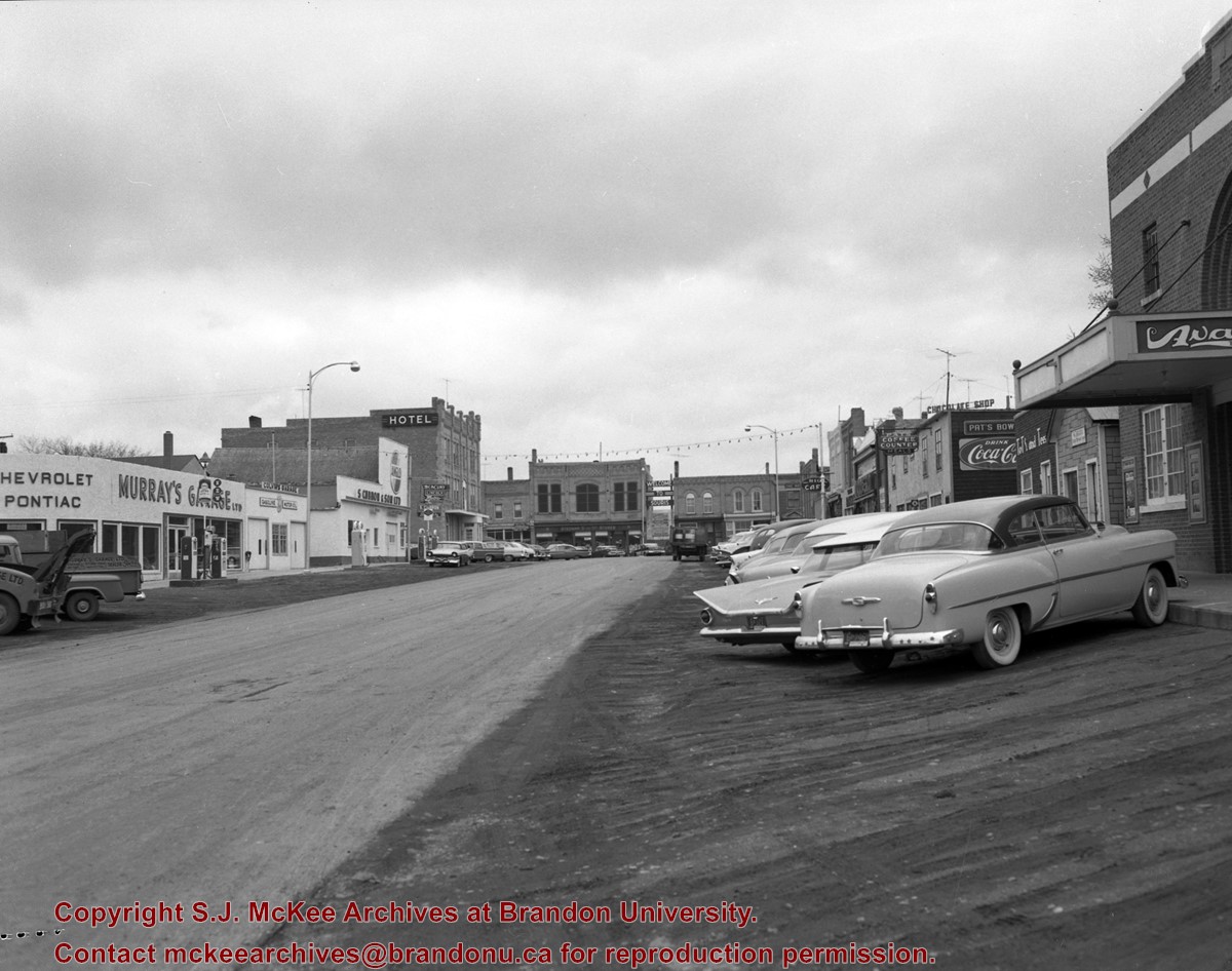
Photo was taken of Rosser Avenue from 7th Street looking west. Visible businesses include: ? and Ball; Vincent & MacPherson; W.N. Finlay; Christie's; J. Burchill; the Empire Hotel; and Fleming's Drug Store. A number of people and vehicles are visible on both sides of the street.
Notes
A digital scan of the photograph is available on a CD located in the Archives' office.
Storage Range
RG 5 Western Manitoba Manuscript collection - photograph storage drawer
Photograph shows the west side of the 200-block on 10th Street. Visible businesses include: Chamber of Commerce Tourist Information, Dominion Tire & Radio Co., Steve's Grill, Wally's Taxi, and the garage entrances to Western Motors Ltd. A Santa Claus Christmas ornament is displayed from a light standard.
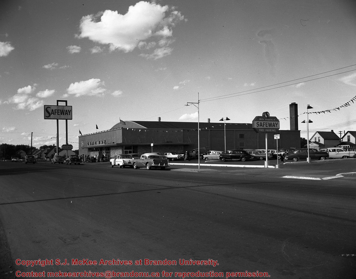
Photograph shows a street view of 10th Street facing north. There are many automobiles parked along the street and several pedestrians in summer dress are on the sidewalks and street. Visible business signs include: Hentzman & Co. Pianos (possibly belonging to J.J.H. McLean Co. Ltd.), the Strand Theatre, T & D Clothes, Campbell & Campbell, the CPR Station, and Bowling Alley and Billiards.
Notes
Part of "Souvenir of Brandon, Manitoba, Canada [viewbook], Printed by Photogelatine Engraving Co. Limited, Ottawa." Dates obtained from the Burchill's Music Store Henderson's Brandon City Directory listings (1927-1929). Writing on the front of the photograph reads: 10th St., looking north (C.P.R. Station at end of Street) Brandon, Man.
Published by Western News Agency Ltd., Winnipeg, (46 pp.)
Physical Description
9.25" x 6.75" (b/w)
Material Details
Small pamphlet containing photo essay
History / Biographical
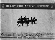
Established as Sewell Camp in 1909, it was renamed after Major-General Sir Sam Hughes, Canada's Minister of Militia and Defence, in 1915. During World War I (1914–1918), more than 38,000 troops of the Canadian Expeditionary Force trained there. Many of the soldiers later distinguished themselves at the battle of Vimy Ridge, in April 1917.
Extensive trench systems, grenade and rifle ranges, and military structures were built in 1915 and 1916. A variety of retail stores on a double-avenued area close to the main camp formed a lively commercial midway. Camp Hughes was dismantled in the 1930s as part of an unemployment relief project.
The Camp Hughes Military Training Site, located at NE 34-10-16 W, 10 kms west of Carberry,
R.M. of North Cypress, was designated Manitoba Provincial Heritage Site No. 82 on April 18, 1994.
Custodial History
Donated by Earl Johnson, publisher of the Baldur Gazette, through the "good offices" of Fred McGuinness.
Scope and Content
Item is a small pamphlet containing 50 black & white photographs in a photo essay entitled: Ready for Active Service, Camp Hughes Manitoba.
Notes
McGuinness wrote about Camp Hughes and how he acquired the pamphlet in a Viewpoint column in the November 1, 2001 edition of the Brandon Sun. A copy of the article is with the pamphlet. History/Bio information taken from the Manitoba Government Exlpore Our Heritage Website at: http://www.gov.mb.ca/chc/hrb/prov/p082.html (December 14, 2009).
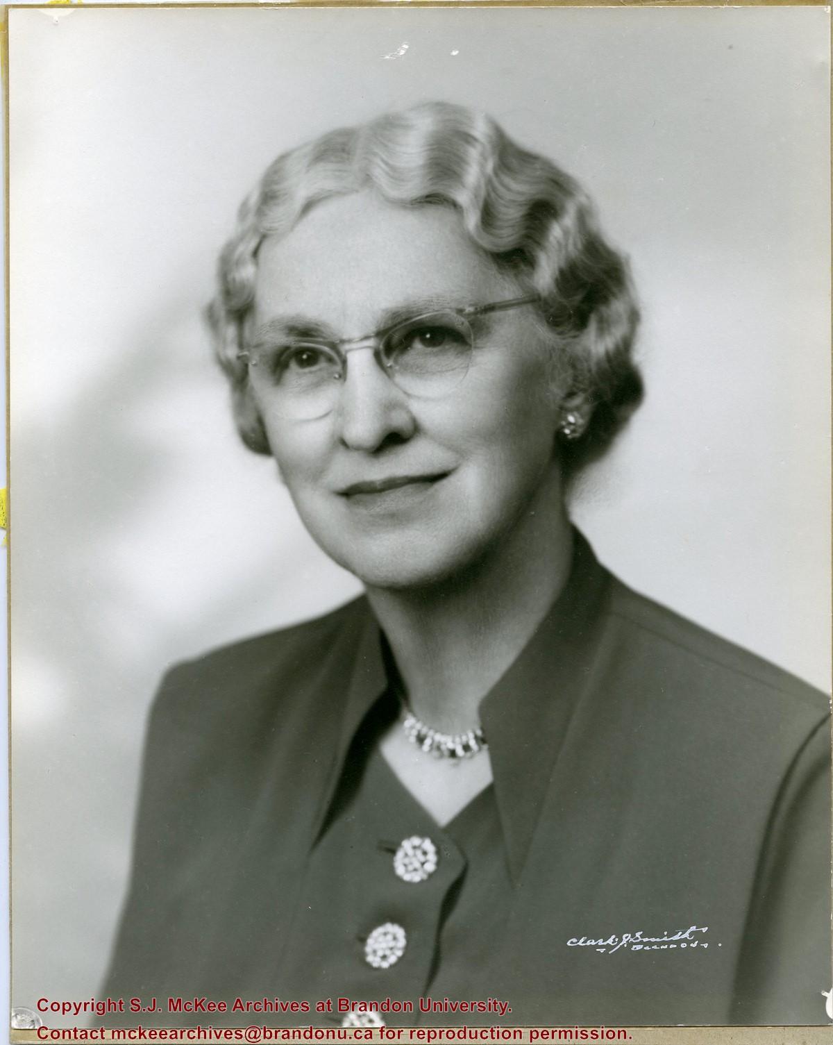
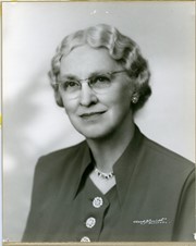
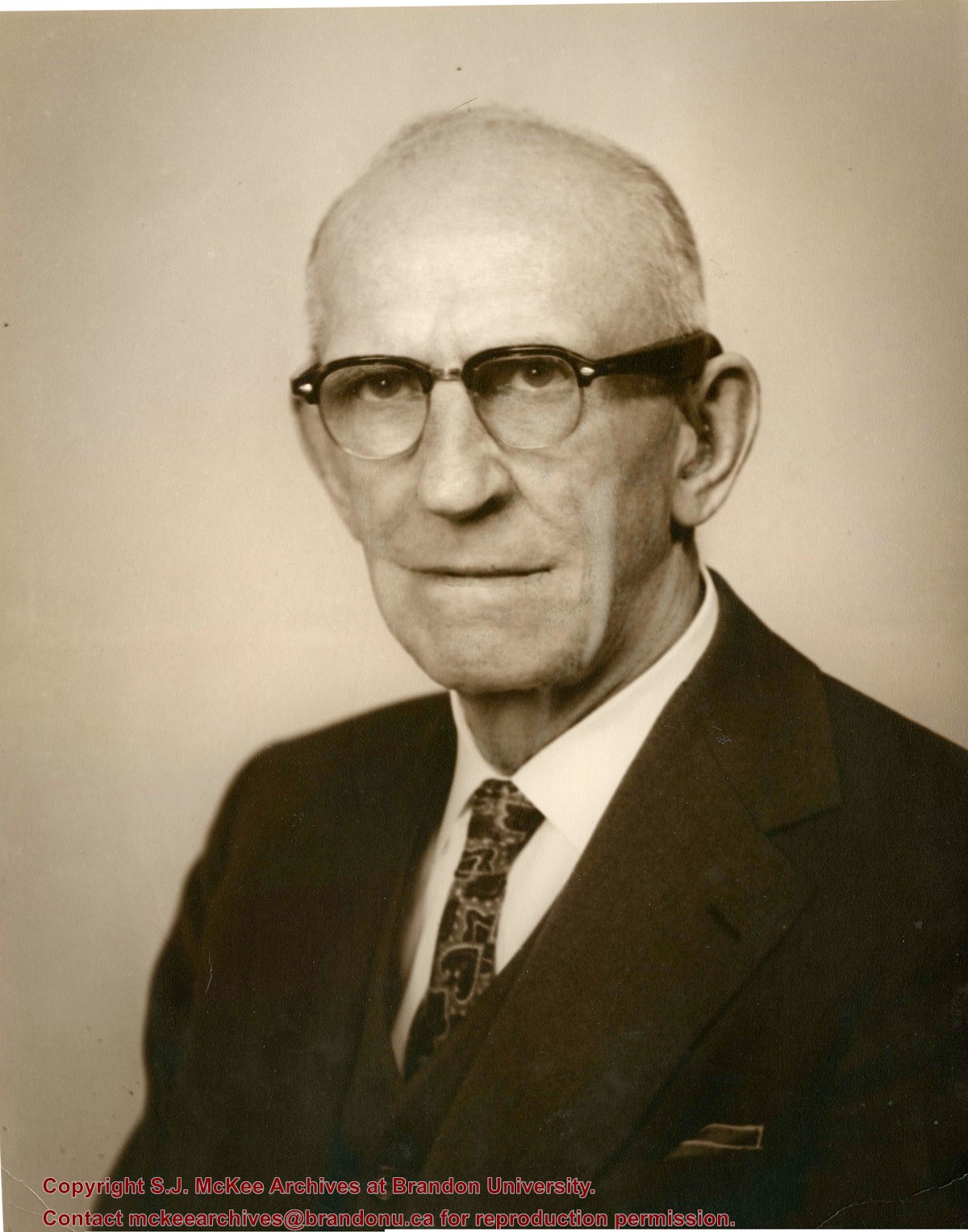
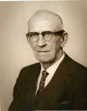
Photograph shows a portrait of an elderly woman with crimped hair and wearing classes. The woman has been identified as Elma Hughes, wife of Willard J. Hughes.
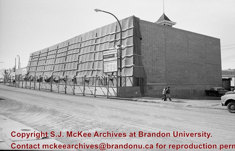
Image is looking east northeast from approximately the 300 block of 23rd Street between Lorne and Louise Avenues. Photograph shows the Brandon College campus after the opening of the original Music Building in 1963, but before the construction of the Education Building in 1966. A number of house on the 300 blocks of 22nd and 21st Streets are visible in the foreground, with the A.E. McKenzie Seed Co., the Prince Edward Hotel and various grain elevators on the horizon.
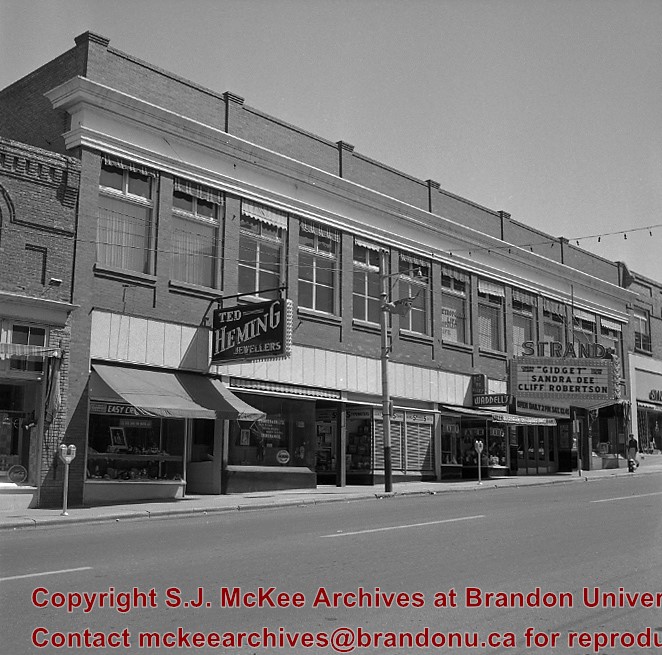
The Hughes block was built in 1916. It is located on the east side of the 100 block of 10th Street. The Strand Theatre opened November 27, 1916, and showed the city's first "talking" picture December 14, 1929. The Clark Smith Studio, to the right of the Strand sign, had been in the same approximate location since 1907, and eventually moved into the new building. The studio was purchased from Clark J. Smith by L.A. Stuckey on January 1, 1958.
Custodial History
For custodial history see the collection level description of the Lawrence Stuckey collection.
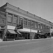
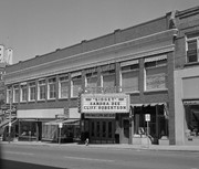
Photographs have been glued to a backing board that has warped over time
Scope and Content
Photograph shows street view of north side of Rosser Avenue, primarily the 700 block, along which sewer pipe is being laid. Visible buildings and businesses include: The Fleming Block with Lowes Brothers Clothing and Manitoba Farmers Hedge and Wire Fence Company, the Beaubier Block and its Empire Hotel, A.M. Percival (a grocer), the Brandon Hardware Company (600 block), and the Arlington Hotel (500 block) are visible along the north side of the avenue. The Bank of Hamilton Building is on the southeast corner of 8th Street and Rosser Avenue.
Notes
Writing on the front of the photograph matting reads: 290. Page appears to be from a photo album.
Photograph has been glued to a backing board that has warped over time
History / Biographical
On 16 November 1906, Manitoba was hit by a severe winter storm that began that Thursday evening and extended through the weekend. The Brandon Daily Sun ("Storm Extends Over a Large Territory," 17 Nov. 1906, 1) reported that rail and telegraph services had been disrupted, country roads were impassable, and business in town was at a stand still. Following the weekend, the daily reported the blizzard was one of the greatest in recent memory. CPR trains had been caught in drifts by Carberry and an express car had caught fire and was destroyed ("Worst Storm in Many Years," Brandon Daily Sun, 19 Nov. 1906, 1).
Scope and Content
Photograph shows street view of intersection of the 000 block of 8th Street and Rosser Avenue in the winter. Businesses on the east side of 8th Street from Pacific to Rosser Avenues are clearly visible and include: a Lunch Room (likely Aagaard's Lunch Counter), the Hotel Imperial Annex, Liverpool House (a boarding house), R.S. Thompson and Company Real Estate Office (Land Office), a barber shop (likely J. Coulter's), Frank Gowen photography studio. Fleming's Drug Store on the corner of 8th Street and Rosser Avenue has been replaced by the Bank of Hamilton. The Imperial Hotel is visible on the west side of 8th Street. The 8th Street Bridge is visible in the background.
Notes
Writing on the front of the photograph matting reads: 338, November 1906. Page appears to be from a photo album. The photograph appears to be taken from the interior of a builing on the southwest corner of 8th Street and Rosser Avenue.


.jpg?width=1200&404=no-img.jpg&watermark=wmk)
.jpg?width=180&404=no-img.jpg)
.jpg?width=1200&404=no-img.jpg&watermark=wmk)
.jpg?width=180&404=no-img.jpg)


)
)
)
)
.jpg%3fmaxheight%3d1000%26maxwidth%3d1000%26watermark%3dwmk&description=Hughes+Block+(Strand+Theatre+building))
.jpg%3fmaxheight%3d1000%26maxwidth%3d1000%26watermark%3dwmk&description=Hughes+Block+(Strand+Theatre+building))