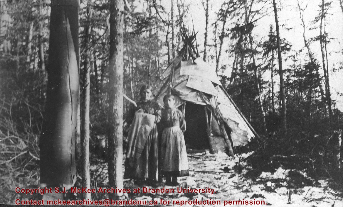
Photograph shows two aboriginal women standing before a tipi in the brush.
Notes
Writing beneath the photograph in the album reads: At the Indian Settlement. Based on provenience of images in the album, the aboringals in question may be from the Michipicoten band.
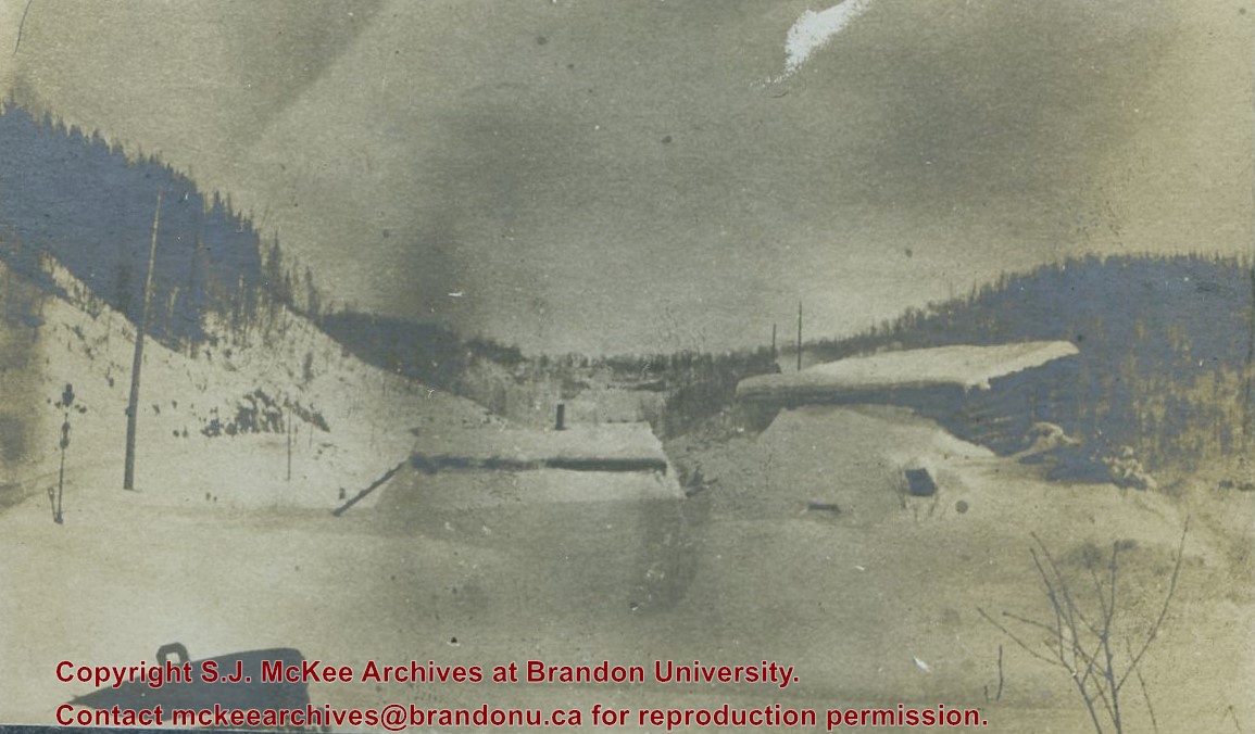
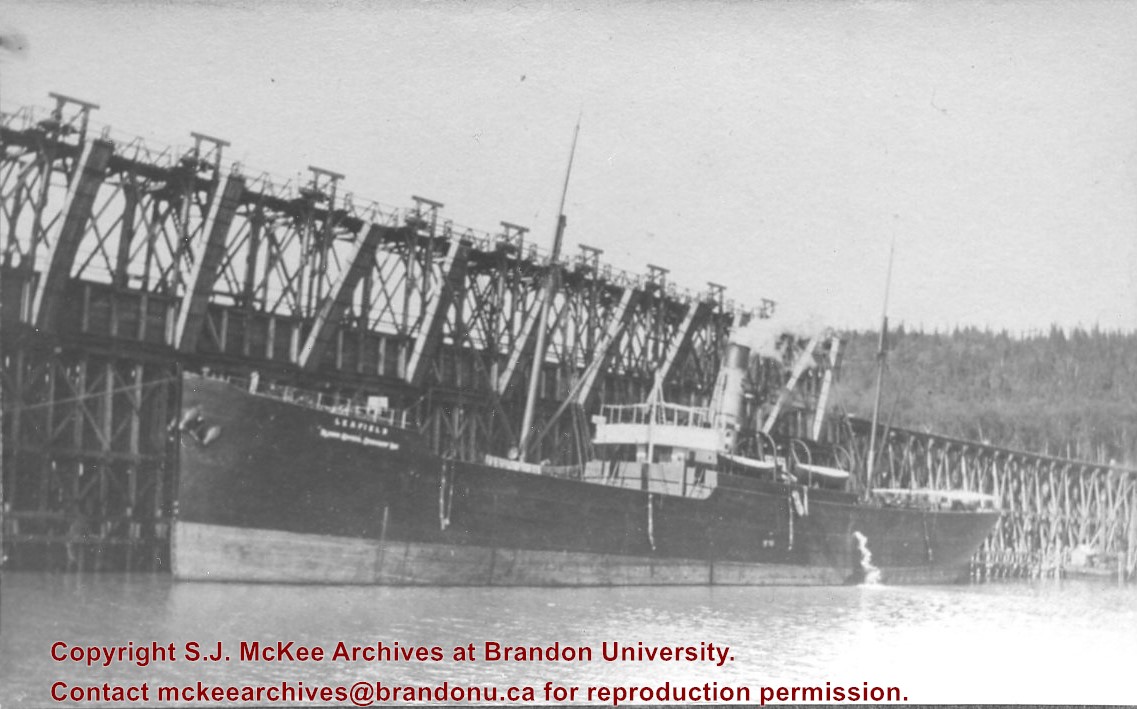
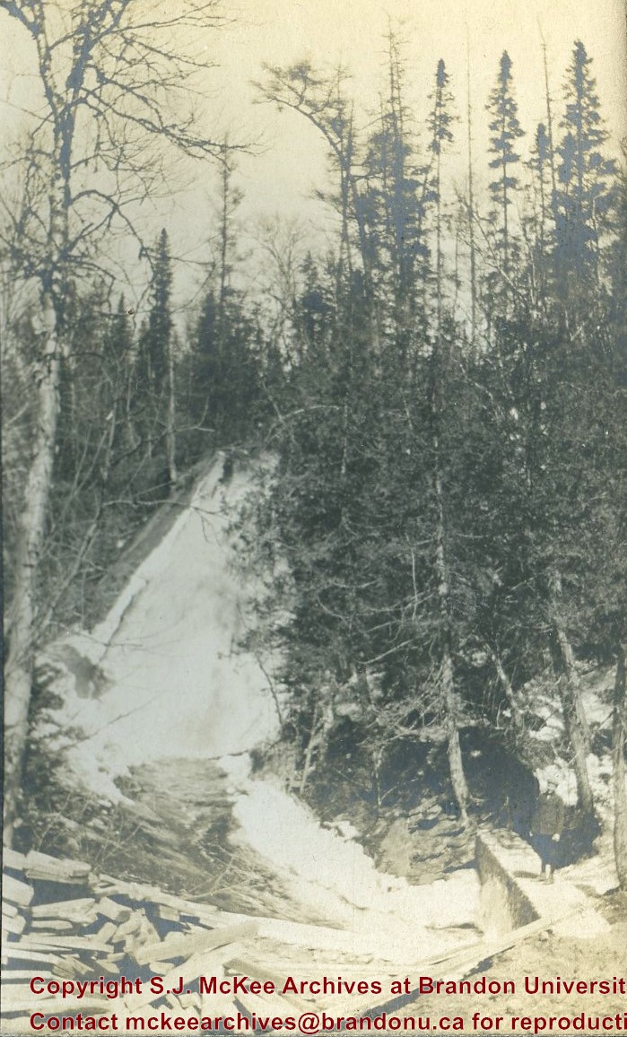
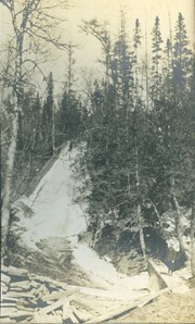
The Lake Talbot tresle was a point along the Algoma Central Railway line that connected the Helen Mine to the Michipicoten Harbour. It is located north of Wawa and southwest of the Helen Mine.
Scope and Content
Photograph shows several men walking a railway line. Before them is a tresle bridge.
Notes
Writing beneath the photograph in the album reads: Lake Talbott Tresle [sic.]
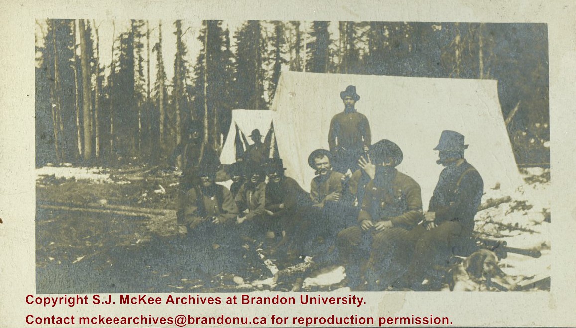
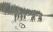
Photograph shows eight men on a frozen lake or river. Four men are harnessed to a toboggan loaded with logs. Four men walk alongside the toboggan with guide ropes.
Notes
Writing beneath the photograph in the album reads: Gettin in provisions
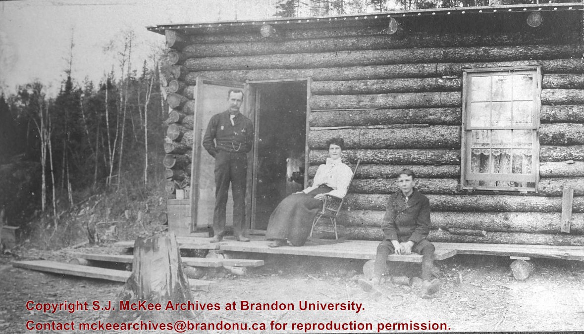
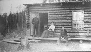
Photograph shows a family before a log cabin. A man wearing a long-sleeved shirt, tie, and vest with watch fob stands at the entryway to the home. A woman wearing a white blouse and long skirt sits on a rocking chair on a rough a rough-hewn porch. A boy wearing a pea coat sits on the porch to the right of the man and woman. Lace curtains are hanging in the window.
Notes
Writing beneath the photograph in the album reads: Mr. D.H. Hopkins and family
Trembley was a point along the Algoma Central Railway line that connected the Helen Mine to the Michipicoten Harbour. It is located southwest of Wawa, Ontario.
Scope and Content
Photograph shows railroad tracks. A line of ore cars stretch along one track. Writing on the side of one of the cars (#3017) reads: Algoma Central Railway Co.
Notes
Writing beneath the photograph in the album reads: Trembley - Ore Cars
In 1901, American entrepreneur Francis Hector Clergue (1856-1939) obtained the charter for the Ontario, Hudson Bay and Western Railway. Following his purchase, he reincoporated the Algoma Central Railway to the Algoma Central and Hudson's Bay Railway. (Source: Sault St. Mairie Public Library, "Transportation - Algoma Central Railway," Sault History Online, 2008)
Scope and Content
Photograph shows railroad tracks cutting through the Canadian Shield.
Notes
Writing beneath the photograph in the album reads: Algoma Central & Hundson Bay Ry.
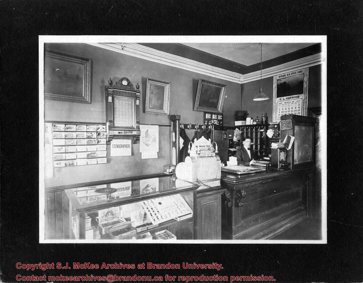
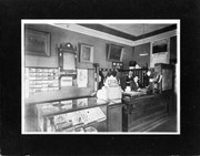
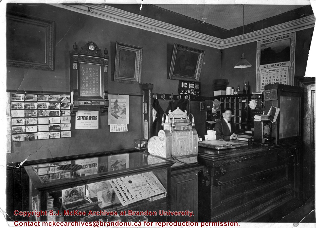
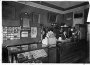
Photograph shows the possible interior of the Grandview Hotel. A young man is working behind the counter that holds a cash register and tobacco display case. A calendar for March 1913 advertises O.L. Harwood's Insurance, Real Estate, and Loans. Below the hotel's 35-room call box is an advertisement for the Public Stenographers Company. A postcard stand holds cards of Brandon's courthouse and other prominent buildings.
Photograph shows the possible interior of the Grandview Hotel. A young man is working behind the counter that holds a cash register and tobacco display case. A calendar for March 1913 advertises O.L. Harwood's Insurance, Real Estate, and Loans. Below the hotel's 35-room call box is an advertisement for the Public Stenographers Company. A postcard stand holds cards of Brandon's courthouse and other prominent buildings.
Notes
Date ascertained from calendar above counter. This photograph is a duplicate of 20-2009.23 but is in sharper focus. Grand View is written in pencil on the back of the photograph.
Postcard shows an aerial view of the city of Brandon
Notes
Writing on the back of the postcard reads: No. 10. Brandon, Manitoba, Canada / Aerial View of Brandon / Distributed by Clements Drug Store / Brandon, Manitoba, Canada / Photos by: R.J. "Bob" Snazel. / Printed by: D.W. Friesen & Sons Ltd. Altona, Manitoba, Canada. The postcard is addressed to Mr. F.A. Rosser and is postmarked Brandon 30 May 1970. A 6-cent Queen Elizabeth red postage stamp portraying various modes of the transportation. The stamp has been cancelled with a postmark that reads "Help Retarded Children."
View is north northeast. Photograph shows the Brandon College Building in the foreground with the Education Building and North Hill in the background. Photo was taken from the roof of McMaster Hall.
View is north northwest from the roof of Flora Cowan Hall (?). Photograph shows: the J.R.C. Evans Lecture Theatre, the A.E. McKenzie Building and the Western Manitoba Centennial Auditorium as well as a number of houses on 20th Street.
View is northwest, taken from the John R. Brodie Science Centre. Photograph shows: Citizens' Science Building in the foreground, the Brandon College Building and Clark Hall in the background, as well as the driveway in front of the buildings.
Taken from an airplane, photograph is looking northwest from approximatley 15th Street and Louise Avenue. Shown are a number of residential blocks, the Brandon University campus, the railroad tracks and the Assiniboine River to approximatley 34th Street.


