3 m textual records; 100 photographs and drawings; 19 books and pamphlets
History / Biographical
John Tyman was born in Kent County, England. After briefly serving with the British Army, Tyman attended the University of Oxford. He came to Canada first in the summer of 1957 to work for a short time, before returning to England in the fall. In 1959, he returned to study at McGill University, and obtained an M.A. in 1961. In 1962, he moved to Brandon to establish a Geography department at Brandon College. Tyman served as a professor and, for a short time, as Dean of Science during his time at Brandon University. In 1970, he obtained a Ph.D. from the Oxford University. In 1976, Tyman left Brandon University and moved to Australia. In Australia he taught at Mount Gravatt College in Brisbane until his retirement in 1994. As of January 2006, John Tyman continues to reside in Australia.
Custodial History
The Tyman fonds remained in the possession of the Geography Department at Brandon University following Dr. Tyman's departure to Australia in 1976. With Dr. Tyman's approval the records were transferred to the McKee Archives in May 2001.
Scope and Content
This fonds contains a copy of "By Section, Township & Range: Studies in Prairie Settlement," by John Langston Tyman. This publication was based on Tyman's doctoral thesis, which is also included in the fonds. His doctoral thesis was completed in 1970 and titled, "The Disposition of Farm Lands in Western Manitoba, 1870 - 1930: Studies in Prairie Settlement."
Fonds also includes extensive research materials compiled by Dr. Tyman on prairie settlement. They include: copies of the Annual Report of the Department of the Interior; documents relating to C.P.R. land sales (c.1870-1900); personal accounts and local histories of municipalities in southern Manitoba such as Shoal Lake, Justice, and local C.P.R. lines; the Canadian Homestead Settlement Co.; The Free Land Homestead Co,; the Canadian Northwest Lands Co.; the N.W.H.B., C.N.R., Lake Manitoba Railway & Canal Co.; land grants given to Veterans; Wellams and Dominion Steamship Co.; maps of southern Manitoba RM's; Sowden and Co. (a land settlement company); correspondance to a Rev. L.O. Armstrong in Emerson (c. 1885); legislation; agricultural progress; history of school lands; correspondance to and from J. Tyman (c.1960); the settlement of Icelandic, Hungarian, and Scandinavian immigrants; a plethora of maps both relating to prairie settlement and to world geography; a manuscript by William Pearce (1925); a transcript titled "Patterns of Settlement"; 5 rolls of microfilm containing maps and copies of some publications acquired by Dr. Tyman; a number of books and c.1900 publications to do with prairie settlement; maps by township and range of the prairies; 100 photos and drawings all c.1880 to 1900; extensive township summaries; and extensive land disposal records as recorded by the Lands Department, including the names of settlers.
Notes
Fonds level description written by Mike White (2001).
Many documents in this collection were copied from originals at the Glenbow-Alberta Institute, Calgary, Alberta, Library and Archives Canada, the Archives of Manitoba, land titles and corporate offices.
Storage Location
MG 3 Brandon University Teaching and Administration
1.3 John Langston Tyman
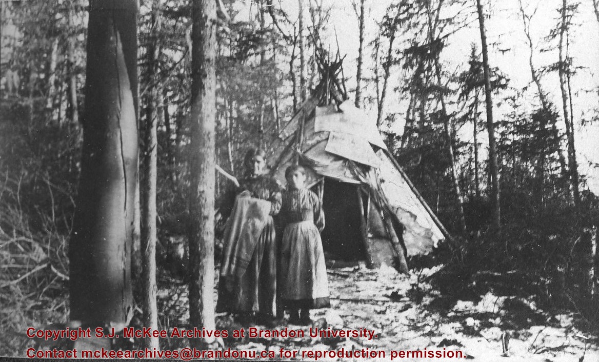
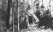
Photograph shows two aboriginal women standing before a tipi in the brush.
Notes
Writing beneath the photograph in the album reads: At the Indian Settlement. Based on provenience of images in the album, the aboringals in question may be from the Michipicoten band.
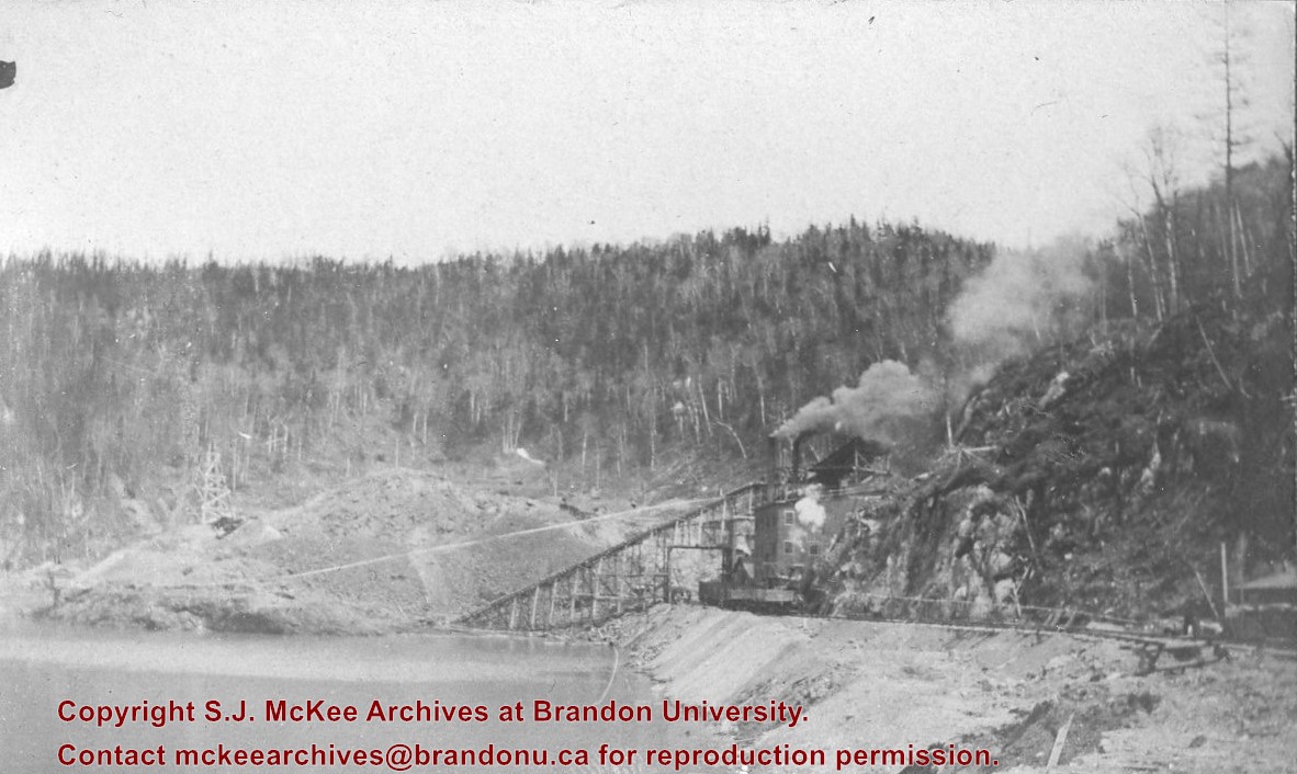
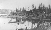
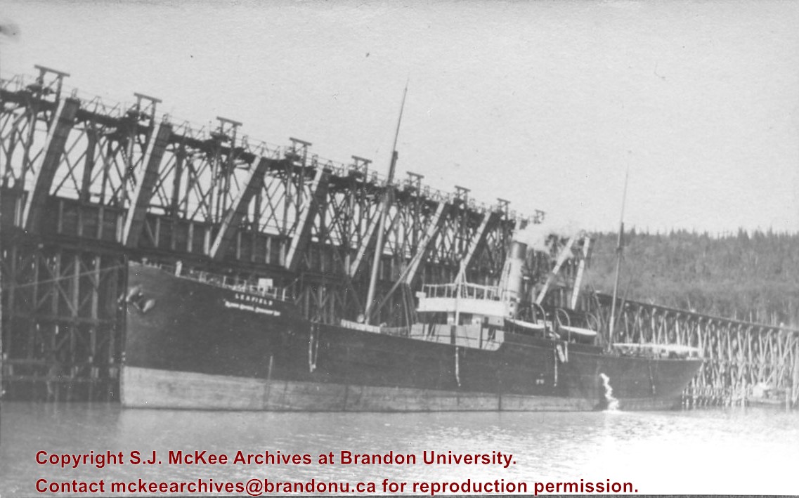
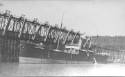
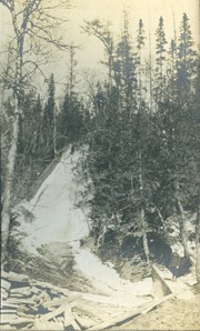
The Lake Talbot tresle was a point along the Algoma Central Railway line that connected the Helen Mine to the Michipicoten Harbour. It is located north of Wawa and southwest of the Helen Mine.
Scope and Content
Photograph shows several men walking a railway line. Before them is a tresle bridge.
Notes
Writing beneath the photograph in the album reads: Lake Talbott Tresle [sic.]
An album that was donated to the McKee Archives by Lenore (Gusdal) Dinsdale ’45. The album contains candid shots of student life from approximately 1942-45.There are 154 pictures of various sizes with explanations of the events and people photographed
Notes
RED ALBUM. Donated by: Lenore (Gusdal) Dinsdale ‘45
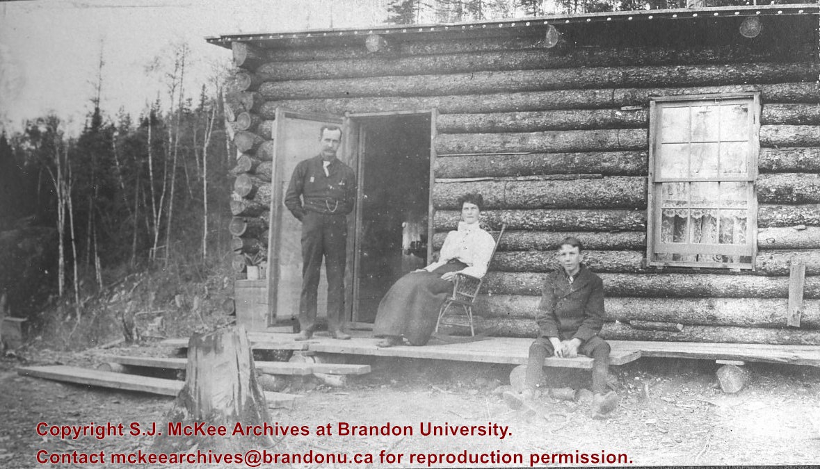
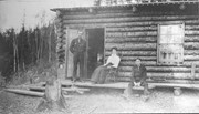
Photograph shows a family before a log cabin. A man wearing a long-sleeved shirt, tie, and vest with watch fob stands at the entryway to the home. A woman wearing a white blouse and long skirt sits on a rocking chair on a rough a rough-hewn porch. A boy wearing a pea coat sits on the porch to the right of the man and woman. Lace curtains are hanging in the window.
Notes
Writing beneath the photograph in the album reads: Mr. D.H. Hopkins and family
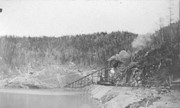
Trembley was a point along the Algoma Central Railway line that connected the Helen Mine to the Michipicoten Harbour. It is located southwest of Wawa, Ontario.
Scope and Content
Photograph shows railroad tracks. A line of ore cars stretch along one track. Writing on the side of one of the cars (#3017) reads: Algoma Central Railway Co.
Notes
Writing beneath the photograph in the album reads: Trembley - Ore Cars
Martin Kavanagh was born in Wicklow, Ireland in 1895. He was educated in Wexford, Dublin and London. Following his arrival in Canada in 1923, Kavanagh was employed as the Principal of Treherene High School. In 1929, he joined the staff of Brandon Collegiate Institute. He taugh Latin and Geography at the Collegiate until 1963. In 1946, Kavanagh published The Assiniboine Basin: A Study of Discovery, Exploration and settlenment. In 1963, he published La verendrye - His Life and Times. Martin Kavanagh died in 1987.
Custodial History
Fonds remained in the possession of Kevin Kavanagh and James Wall following Martin Kavanagh's death. Wall donated his portion of the fonds to the McKee Archives in November 2004. Kevin Kavanagh donated his portion of the fonds in December 2004.
Scope and Content
Fonds contains an unpublished autobiography written by Martin Kavanagh and several draft narratives for a slide presenation based on Kavanagh's biography of La Verendrye. Fonds also contains one file of business correspondence c. 1971.
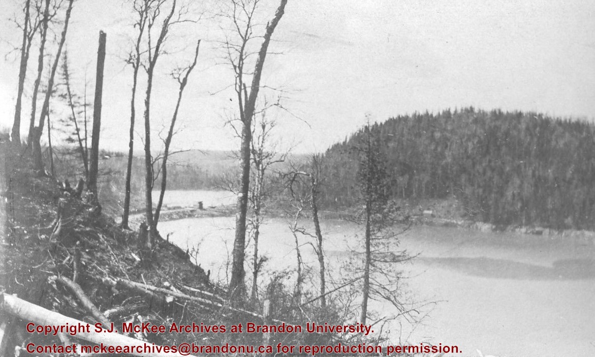
In 1901, American entrepreneur Francis Hector Clergue (1856-1939) obtained the charter for the Ontario, Hudson Bay and Western Railway. Following his purchase, he reincoporated the Algoma Central Railway to the Algoma Central and Hudson's Bay Railway. (Source: Sault St. Mairie Public Library, "Transportation - Algoma Central Railway," Sault History Online, 2008)
Scope and Content
Photograph shows railroad tracks cutting through the Canadian Shield.
Notes
Writing beneath the photograph in the album reads: Algoma Central & Hundson Bay Ry.


