In 1901, American entrepreneur Francis Hector Clergue (1856-1939) obtained the charter for the Ontario, Hudson Bay and Western Railway. Following his purchase, he reincoporated the Algoma Central Railway to the Algoma Central and Hudson's Bay Railway. (Source: Sault St. Mairie Public Library, "Transportation - Algoma Central Railway," Sault History Online, 2008)
Scope and Content
Photograph shows railroad tracks cutting through the Canadian Shield.
Notes
Writing beneath the photograph in the album reads: Algoma Central & Hundson Bay Ry.
Trembley was a point along the Algoma Central Railway line that connected the Helen Mine to the Michipicoten Harbour. It is located southwest of Wawa, Ontario.
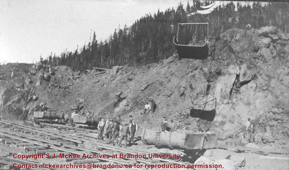
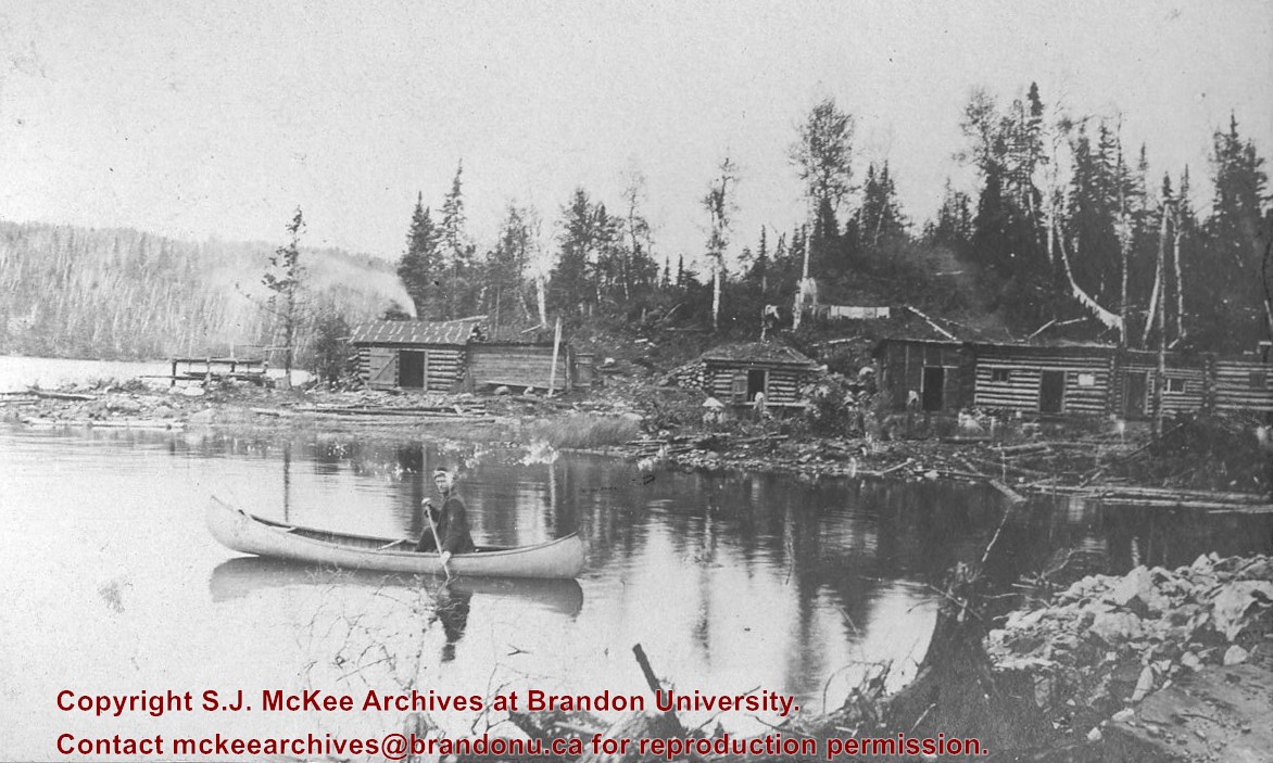
Scope and Content
Photograph shows railroad tracks. A line of ore cars stretch along one track. Writing on the side of one of the cars (#3017) reads: Algoma Central Railway Co.
Notes
Writing beneath the photograph in the album reads: Trembley - Ore Cars
Brient was a point along the Algoma Central Railway line that connected the Helen Mine to the Michipicoten Harbour. It is located southwest of Wawa, Ontario.
Scope and Content
Photograph shows ore box cars in a railway yard.
Notes
Writing beneath the photograph in the album reads: yard at Brient
Paper clip marks stain the top and bottom right corners
History / Biographical
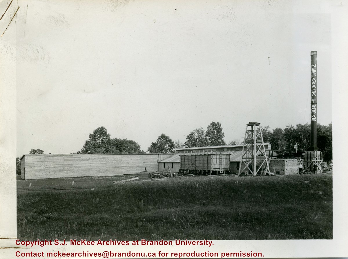
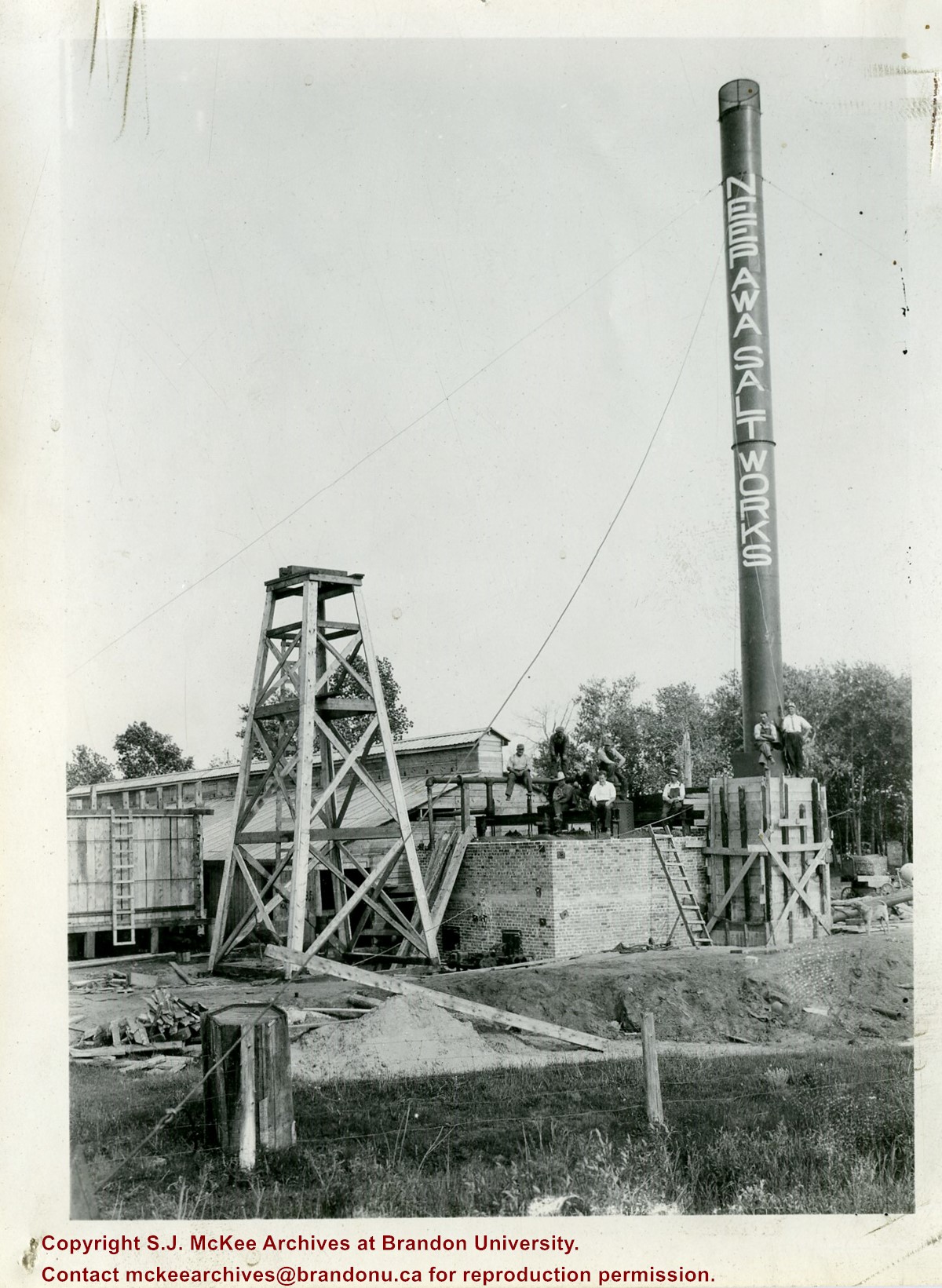
In 1932, the Neepawa Salt Company began producing salt from saline pools in the Neepawa area. According to Virgina Petch (2006), brine was pumped from two drilled wells and salt was extracted via vacuum pan evaporation process. (Source: "Salt-Making in Manitoba," Manitoba History Journal, No. 51, 2006)
Scope and Content
Photograph shows an overview of the salt well at the Neepawa Salt Works.
Paper clip marks stain the top and bottom right corners
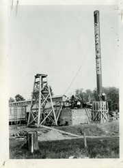
History / Biographical
In 1932, the Neepawa Salt Company began producing salt from saline pools in the Neepawa area. According to Virgina Petch (2006), brine was pumped from two drilled wells and salt was extracted via vacuum pan evaporation process. (Source: "Salt-Making in Manitoba," Manitoba History Journal, No. 51, 2006)
Scope and Content
Photograph shows a close-up of a salt well pump at the Neepawa Salt Works.
Reg Forbes was born September 16, 1924. He and his wife Clara have two children, Bob and Faye. Forbes served in the Royal Canadian Air Force as a Navigator during World War II. From 1945-1949, he attended the University of Manitoba where he received his B.Sc.A. While working as Village Councillor and as Secretary-Treasurer for the Pilot Mound Hospital, Forbes initiated the "Save the Soil Campaign," a soil conservation programme that became province-wide, between 1952-1962.
From 1956-1975, Forbes was the Principal of the Agricultrual Extension Centre in Brandon, where he reorganized the Adult Education Centre into the Agricultural Extension Centre. During this period, Forbes was a founding member of the West-Man Regional Development Corporation and a founder of the Manitoba Committee on Rural Leadership. He was also instrumental in the amalgamation of the Royal Manitoba Winter Fair and the Provincial Exhibition and in the resulting construction of the Keystone Centre.
From 1975-1977 Forbes was a Commissioner for the Grain Handling and Transportation Commission (Hall Commission/GHTC). Following his work with the Commission, Forbes was employed as the General Manager of the Provincial Exhibition of Manitoba (1977-1979), the Director of the Grain Handling & Transportation Section of the Manitoba Department of Agriculture (1979-1983), the Industrial Commissioner for the Brandon Industrial Commission (1983-1986), and as the Westarc Group Inc. Project Director for delivery under contract of Canadian Rural Transition Programme in Manitoba.
Forbes also held a number of voluntary and elected positions, such as Long-term Director and President of the Royal Manitoba Winter Fair and of the Provincial Exhibition of Manitoba. In 1970-1971, he was the President of the Agricultural Institute of Canada, and from 1978-1981, Forbes was the first chairman of the Agricultural Advisory Committee of the Canadian Broadcasting Corportation. He was also a member of the Canada West Foundation Board, the Brandon University Board of Governers (1974-1976), and the Federal-Provincial Transportation and Industrial Development Advisory Committee (TIDAC). Forbes is also a Fellow of the Agricultural Institute of Canada. In 1977, he received the Jubilee Medal and in 1987, he was given the Distinguished Agrologist Award by the Manitoba Institute of Agrologists.
Custodial History
Reg Forbes donated his working collection of briefs, correspondence and other documents relating to his work as a commissioner of the Grain Handling and Transportation Committee (GHTC) to the McKee Archives c. 1985.
Scope and Content
The majority of the collection consists of records created and received by the Royal Commission on Grain Handling and Transportation (GHTC). Included are documents detailing numerious hearings from all four Western provinces. In addition to the GHTC hearings, there are also a number of documents given to the GHTC as reference material. These include information on the Snavely Commision, documents for the province of Alberta, various reports, the Prairie Regional Studies in Economic Geography (No. 1-27) and General Information. The collection also includes two maps given to the GHTC.
For history/bio information see the collection level description of the Lawrence Stuckey collection.
Custodial History
For custodial history see the collection level description of the Lawrence Stuckey collection.
Scope and Content
Series consists of slides created from photographs taken by Lawrence Stuckey during his travels throughout Manitoba, other parts of Canada and the United States. Although Lawrence and his wife Mavis travelled for pleasure, their destinations were often chosen deliberately to enable Lawrence to explore and photograph specific landscapes, flora and fauna.


