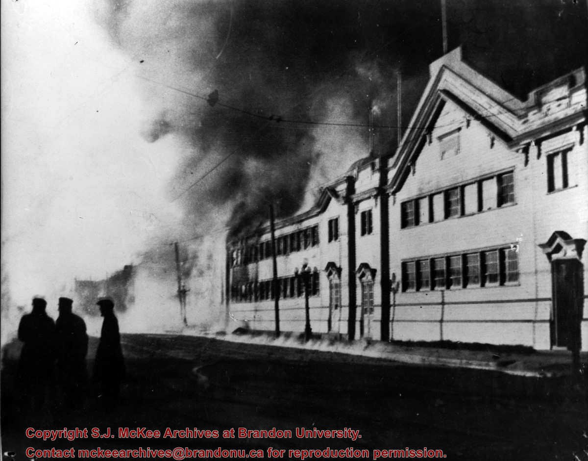
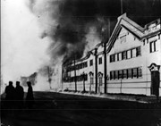
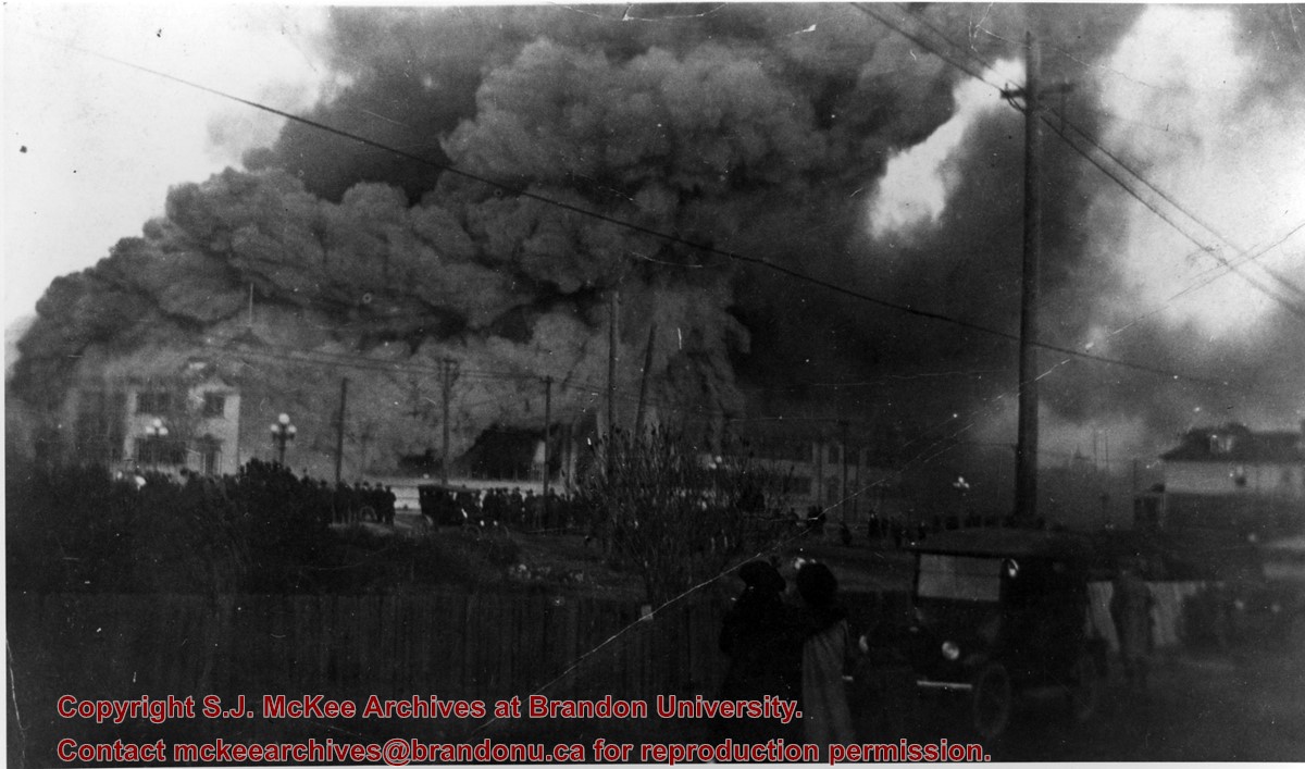
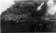
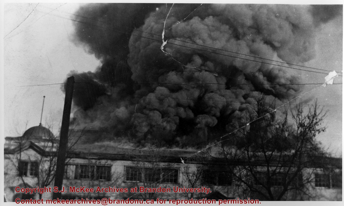
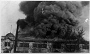
Photograph of spectators gathered to watch the Royal North-West Mounted Police (RNWMP) horse barns on fire. The barns were located in the Winter Fair Building on the Fair Grounds.
Donated to the Brandon College Library by Hilda Hesson in 1967.
Scope and Content
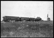
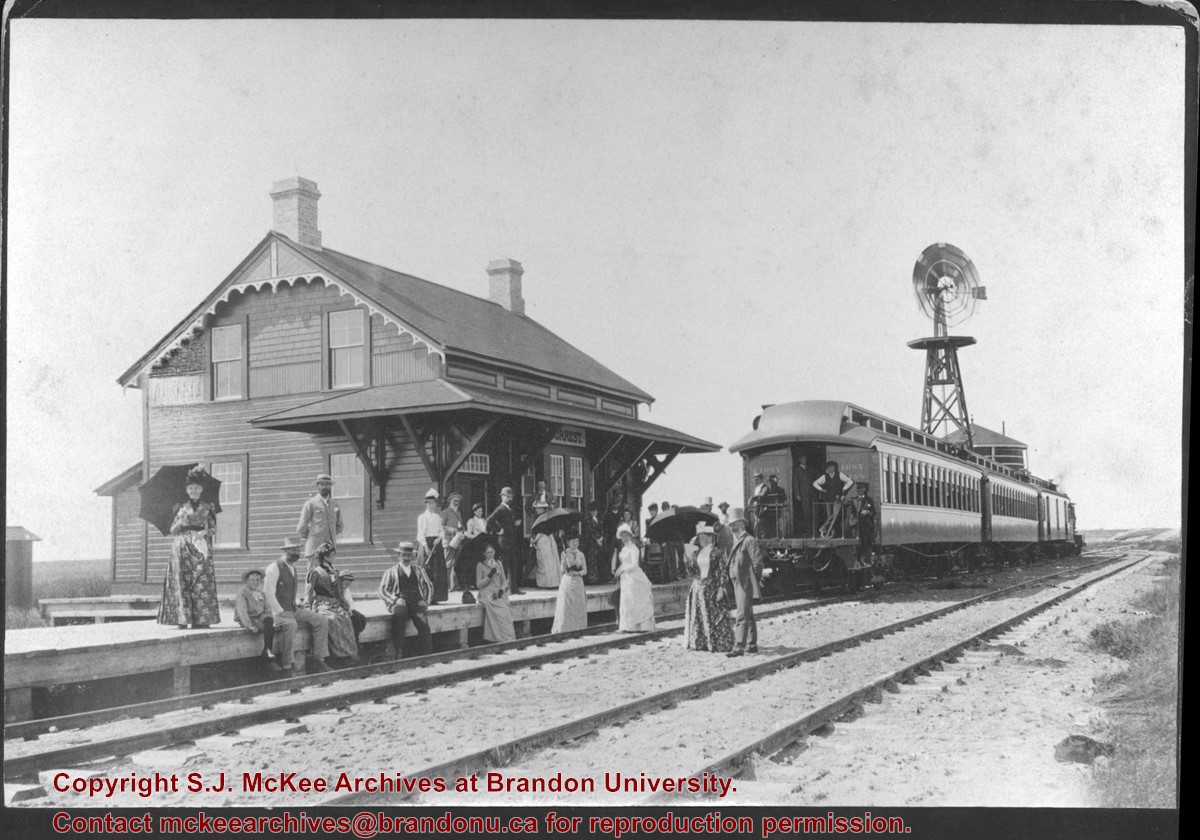
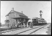
Photograph of an "outing" by train to Forrest, MB. Writing on the back of the photo states that the man in the striped blazer is very likely T. Mayne Daly. Photo was taken at the Great North West Railway station.
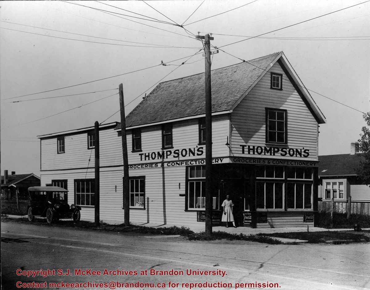
Thompson's Groceries and Confectionary was established in 1923 by Arthur Thompson (b. 1881 - d. May14, 1957) at 764 13th Street. From approximately 1925-1927, the store was operated by Alexander Thompson at 762 13th Street. The fate of the store from 1929-1935 is unclear. In 1929, Alexander Thompson was a grocer at 748 7th Street and in 1931 a Mrs. A Thompson was a grocer at 802 14th Street. There were two Thompson grocery and confectionary businesses in Brandon in 1933: Thompson's Confectionary at 745 13th Street and Thompson & Co. at 702 12th Street. In 1935, Arthur Thompson appears to have either taken over one of the earlier businesses or reopened his own grocery in its original location at 762 13th Street. He operated his store at this location into the mid-1950s. At some point following Thompson's death the building was bought by Frank Fitzpatrick and used for his upholstery store.
Custodial History
Donated by Frank Fitzpatrick.
Scope and Content
Photograph is looking northwest at the extrior of Thompson's Grocieries and Confectionary.
Notes
History/Bio information taken from Henderson's Directories (1917-1955) for Brandon, MB.
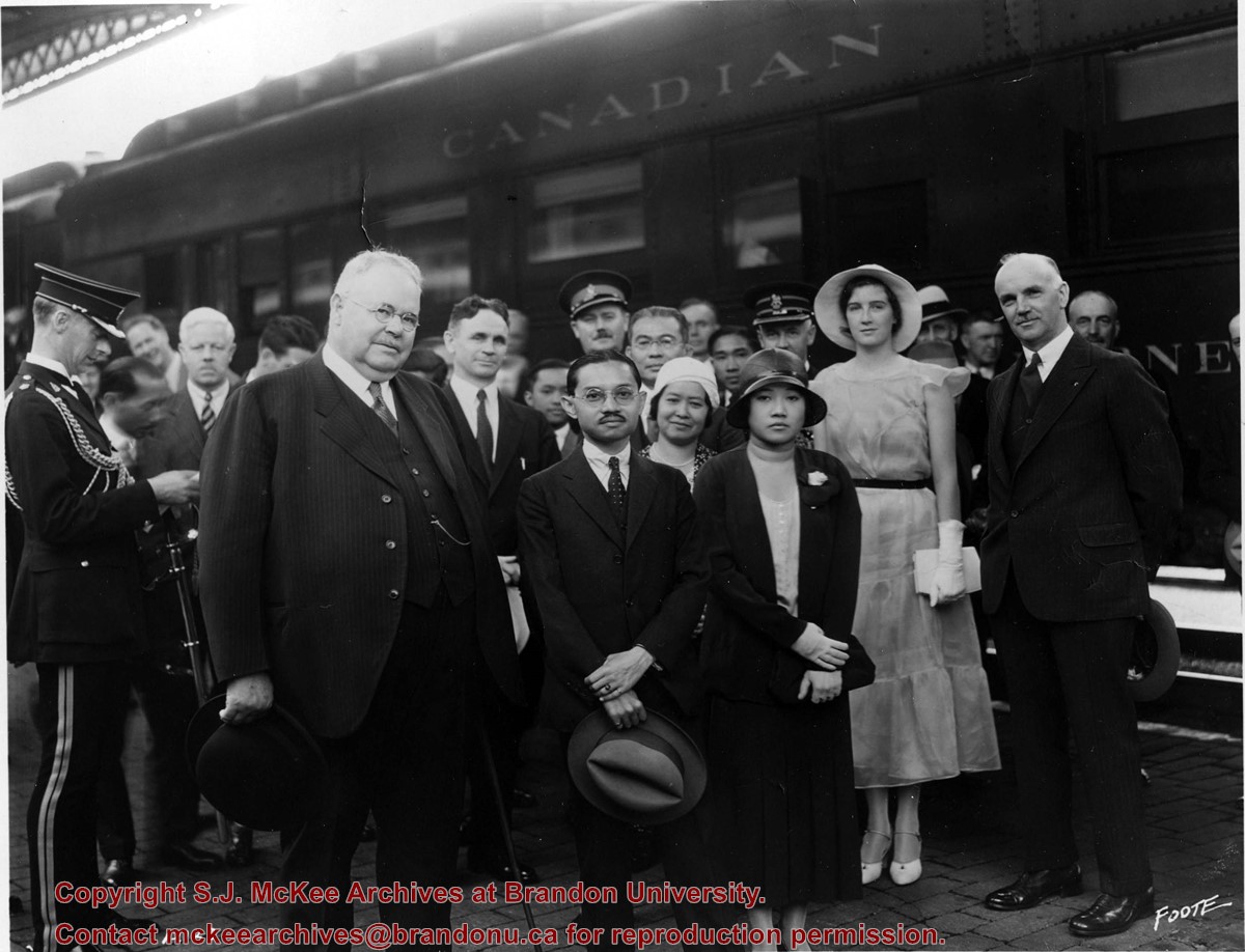
Photograph shows a reception of the King and Queen of Siam at the Winnipeg Railway Station by Manitoba dignitaries. L to R: Major M.Turner, Hon. J.D. McGregor, Premier John Bracken (1922-1943), Their Majesties the King and Queen of Siam, Miss Phyllis Webb, and Mayor Ralph Webb (1925-1927, 1930-1934).
Notes
This photograph was originally part of the J.D. McGregor fonds.
Photographs in this series fall under the general heading of urban images of the City of Brandon. They include parades, buildings, businesses, natural phenomena such as fires and floods, special events and cityscapes.
Storage Location
Brandon and Area photograph collection photograph drawer (regular and oversize)
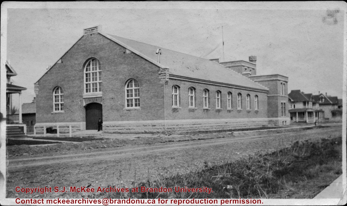
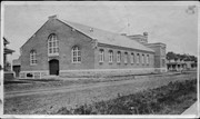
The Brandon Armoury was built in 1907. The extension on the southside was built in 1937.
Custodial History
The photograph was donated to the Archives by Cy Kenny in 2005.
Scope and Content
Photograph is looking northwest from the east side of 11th Street. It shows the back and east side of the Brandon Armoury, which is located on the at 1116 Victoria Avenue.
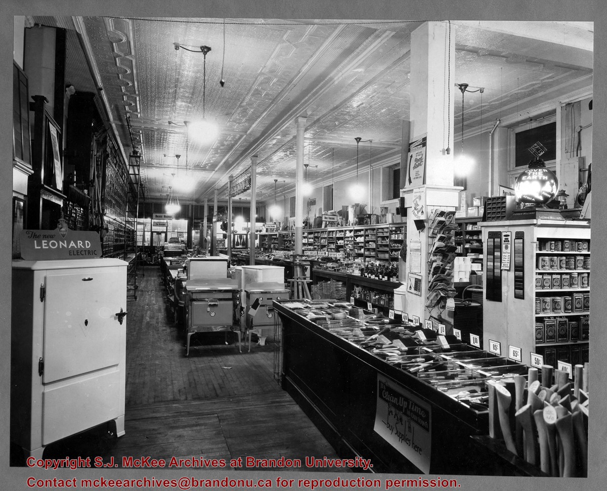
Brandon Hardware Co. Ltd. founded in 1882, making it one of Brandon's earliest mercantiles. It was incorporated in 1902, and their location on Rosser Avenue at the corner of 7th Street was constructed in 1903. For a number of years, J.B. Curran was the managing director. The building was destroyed by fire in 1983.
Custodial History
Katy Singleton was given this photo in her role as Heritage Coordinator for the City of Brandon. She transferred it to the McKee Archives in 2013.
Scope and Content
Item is a photograph of of the interior of the Brandon Hardware Co. Ltd. looking towards the front of the store from the back.
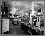
Brandon Hardware Co. Ltd. founded in 1882, making it one of Brandon's earliest mercantiles. It was incorporated in 1902, and their location on Rosser Avenue at the corner of 7th Street was constructed in 1903. For a number of years, J.B. Curran was the managing director. The building was destroyed by fire in 1983.
Custodial History
Katy Singleton was given this photo in her role as Heritage Coordinator for the City of Brandon. She transferred it to the McKee Archives in 2013.
Scope and Content
Item is a photograph of of the interior of the Brandon Hardware Co. Ltd. looking towards the back of the store from the front.
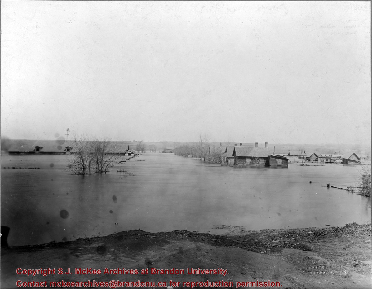
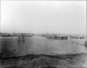
The "flats" refers to the Assiniboine River floodplane from 18th Street to First Street on either side of the river. See p. 223 of G.F. Barker's Brandon: A City for a description of the 1922 flood.
Custodial History
The photo was owned by Mrs. Wes Railton prior to its donation to the Archives.
Scope and Content
Photograph contains an image of houses on the Assiboine floodplane (Brandon's "flats") submerged in flood-waters.
Photograph is looking northwest probably from the northwest corner of 18th Street and Louise Avenue. The photographer was laying down when s/he took the shot. Photograph shows the field to the south of the Citizens' Science Building, as well as the Citizens' Science Building, part of the Brandon College Building and Clark Hall, and two H-Huts. The photo was taken in summer as the field is full of dandelions.
View is southwest from approximately 18th Street and Lorne Avenue. Photograph shows the Brandon University campus in winter, including: the Brandon University sign, the John R. Brodie Science Centre, the Citizens' Science Building and McMaster Hall.
View is southwest from the north side of Princess Avenue. Photograph shows the original Music Building, the north driveway entrance and parts of Clark Hall and the Brandon College building.
View is southwest from the sidewalk on the west side of 18th Street. Photograph shows the Brandon University sign, the front lawn, the Citizens' Science Building, McMaster Hall and the John R. Brodie Science Centre.
View is south from the north side of Princess Avenue. Photograph shows the walkway leading south across campus, the original Music Building, the A.E. McKenzie Building, the J.R.C. Evans Lecture Theatre, Flora Cowan Hall and Darrach Hall.
View is southwest from Princess Avenue. Photograph shows the original Music Building, the A.E. McKenzie Building, the J.R.C. Evans Lecture Theatre and Darrach Hall. Also visible are the field where the Western Manitoba Centennial Auditorium now stands, as well as a number of houses on 20th Street.


