Image is looking east northeast from approximately the 300 block of 23rd Street between Lorne and Louise Avenues. Photograph shows the Brandon College campus after the opening of the original Music Building in 1963, but before the construction of the Education Building in 1966. A number of house on the 300 blocks of 22nd and 21st Streets are visible in the foreground, with the A.E. McKenzie Seed Co., the Prince Edward Hotel and various grain elevators on the horizon.
View is north, taken from approximatley 19th Street and Rosser Avenue. Photograph shows: Clark Hall, the A.E. McKenzie Building, the J.R.C. Evans Lecture Theatre, H-Huts, Darrach Hall and Flora Cowan Hall, as well as a number of homes in the area.
Red ink stain is on the front right corner of postcard
Scope and Content
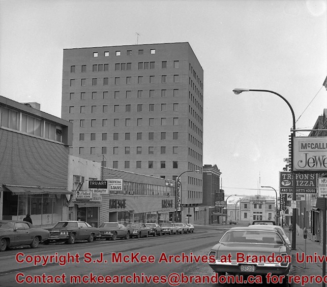
Photograph shows 10th Street facing south from Princess Avenue. Visible landmarks and businesses include: Manitoba Power Commission (MPC)'s power sub-station, First Baptist Church, Wheat City Arena, and the grand stand at the Exhibition Grounds.
The partial sign visible at the bottom of the photograph on the east side of 10th Street reads Yates and Neale, which refers to a plumbing and heating company that dissolved in 1943 to be replaced by Neale, Stothard and Chapman.
Businesses on the west side of 10th Street include: Dominion Tire & Radio Co., Bolts Barber Shop, Elviss T.E. Co. Stables.
Notes
Information concerning Yates and Neale courtesy Jack Stothard. Writing on the front of the postcard reads: Brandon, Looking S.W., Jerrett Photo. This photograph shows a rare view of the 200-block of 10th Street.
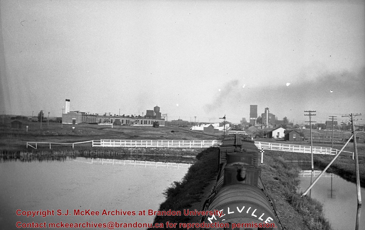
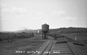
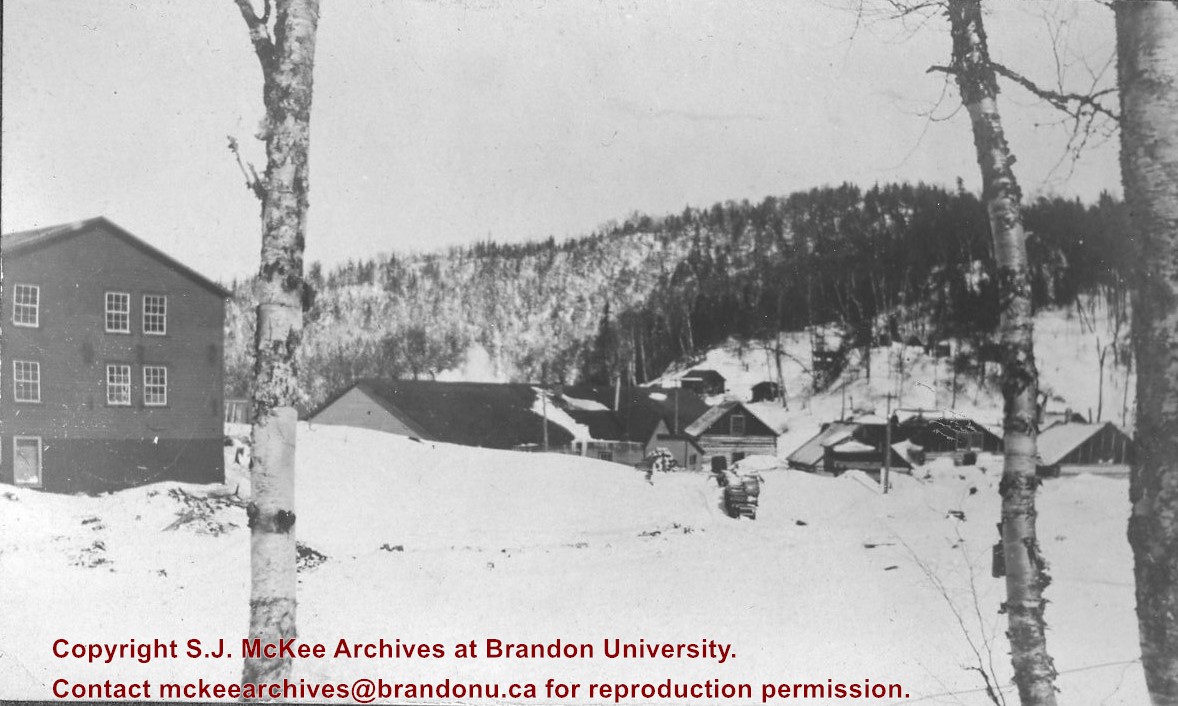
Stuckey's notes: Meeting no. 2 at Uno, Manitoba. No.2 (6047), arriving Melville, Saskatchewan. George Harris, Ed Radcliffe & L.A. Stuckey were hobos. Collection of George H. Harris, Winnipeg, Manitoba.
Custodial History
For custodial history see the collection level description of the Lawrence Stuckey collection.
Scope and Content
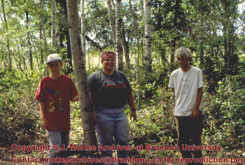
Image of two views from the top of no. 403 (3593), taken along the CNR mainline, Rivers substation.
Notes
From the collection of George H. Harris, Winnipeg, Manitoba.
Stuckey's notes: Meeting no. 2 at Uno, Manitoba. No.2 (6047), arriving Melville, Saskatchewan. George Harris, Ed Radcliffe & L.A. Stuckey were hobos. Collection of George H. Harris, Winnipeg, Manitoba.
Custodial History
For custodial history see the collection level description of the Lawrence Stuckey collection.
Scope and Content
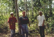
Image of two views from the top of no. 403 (3593), taken along the CNR mainline, Rivers substation.
Notes
From the collection of George H. Harris, Winnipeg, Manitoba.
See fonds level of the CKX records for custodial history.
Scope and Content
Image consists of an aerial view looking southeast at the intersection of Highways 1 and 10 and shows the British American dealer located at the intersection.
See fonds level of the CKX records for custodial history.
Scope and Content
Image consists of an aerial view looking northeast at the intersection of Highways 1 and 10 and shows the British American dealer located at the intersection.
Field journals have been scanned in multi-page PDF files. Artifact catalogues are PDF files in spreadsheet format. Photographs are in jpeg format.
History / Biographical
During the mid 1990’s to the early 2000’s archaeological surveying and testing took place on Flintstone Hill. In 1997 testing at the site revealed a bison skull eroding from the cutbank. A field crew dug a series of overlapping trenches down the slope of the profile and produced a schematic drawing. A radiocarbon date from the lower edge of the profile gave a date of 10,400 RCY.
Test units along the cutbank recovered lithics, soil samples, fire-cracked rock, charcoal, bison remains including a very large bison skull measuring 430-440 cm and thought to be an ancient species.
Radiocarbon dates at Flintstone hill gave dates of: a hearth dating to 3250+/-70 R.C.Y. (BETA 109529); a butchered atlas bone 4090+/-70 R.C.Y. (BETA 109990); and bone fragments accompanied by Swan River Chert and Knife River Flint lithic flakes 5350+/-50 (BETA 109530). While no diagnostic tools were recovered, these dates suggest that this occupation, which is contemporary with the Atkinson site, may be a Gowen occupation.
Scope and Content
Sub-sub-sub series contains: Summary information of field methology, number and co-ordinates of excavations, personnel and their staff position; Field journals are daily records of recoveries, features and activities at the site; Site records include excavation level and unit summaries, feature sheets, profiles; sample records and maps; Artifact catalogues are lists and identifications of all artifacts recovered; Photographs are of excavation units, features, the landscape and personnel.
Flintstone Hill is located on the north bank of the Souris River. It is a deeply stratified lacustrine, fluvial and aeolian soil profile that has been exposed by the river through stream-bank erosion. This section is thought to be the most complete middle to late Holocene exposure on the northeastern plains. While the value of the site is primarily for paleo-environmental research and reconstruction, cultural deposits have been identified at the site. Local collectors have picked up lithic materials as they eroded out of the bank for the past several decades and it was they who had named the site. Mr. Bruce Timms from Lauder first drew the Flintstone Hill site to the attention of Dr. Nicholson of Brandon University.
During the mid 1990’s to the early 2000’s archaeological testing took place on Flintstone Hill. In 1998, an archaeological field crew dug a series of overlapping trenches down the slope of the profile and produced a schematic drawing. A peat layer at the bottom of this profile, dated from the top at 9,400 RCY and at the bottom to 10,400 RCY, has provided details of marsh plant and insect communities at this time.
Subsequent archaeological investigations at the site recovered several cultural deposits including: a hearth dating to 3250+/-70 R.C.Y. (BETA 109529); a butchered atlas bone 4090+/-70 R.C.Y. (BETA 109990); and bone fragments accompanied by Swan River Chert and Knife River Flint lithic flakes 5350+/-50 (BETA 109530). While no diagnostic tools were recovered, these dates suggest that this occupation, which is contemporary with the Atkinson site, may be a Gowen occupation.
Extensive paleo-environmental research has been conducted at the site. Dr. Running, a geomorphologist from the University of Wisconsin – Eau Claire, participated in the Study of Cultural Adaptations in the Prairie Ecozone (SCAPE) Project and he and his students tested the site for several years. He was joined in this effort by Dr. Havholm, Dr. Boyd, Dr. Wiseman, Dr. Beaudoin, and other SCAPE researchers in the interpretation of the paleo-environment of the Glacial Lake Hind basin. The following article is recommended reading.
Running, Garry L., Karen G. Havholm, Matt Boyd and Dion J. Wiseman
2002 Holocene Stratigraphy and Geomorphology of Flintstone Hill, Lauder Sandhills, Glacial Lake Hind Basin, Southwestern Manitoba. Geographie Physique et Quaternaire
56(2-3):291-303.
Scope and Content
Sub series has been divided into two sub sub series including: (1) Flintstone Hill 1997 (2) Flintstone Hill 1998-2000
Field journals have been scanned in multi-page PDF files. Artifact catalogues are PDF files in spreadsheet format. Photographs are in jpeg format.
History / Biographical
In 1998, 1999 and 2000 further testing took place on Flintstone Hill. Five test units were excavated and a series of small exploratory tests took place. Recoveries included: lithics, soil samples, fire-cracked rock, charcoal, and bison bones.
Unfortunately, despite the encouraging radiocarbon dates and scattered recoveries there was no area where extensive excavations were feasible. The unstable nature of the river bank with frequent spring flooding and erosion of the dunes has impacted potential sites.
Scope and Content
Sub-sub-sub series contains: Summary information of field methology, number and co-ordinates of excavations, personnel and their staff position; Field journals are daily records of recoveries, features and activities at the site; Site records include excavation level and unit summaries, feature sheets, profiles; sample records and maps; Artifact catalogues are lists and identifications of all artifacts recovered; Photographs are of excavation units, features, the landscape and personnel.
Field journals have been scanned in multi-page PDF files. Artifact catalogues are PDF files in spreadsheet format. Photographs are in jpeg format
History / Biographical
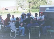
Over a period from 1997 to 2000 over 40 test pits were surveyed and five test units put in. Crew members included: Bev Nicholson, Scott Hamilton, Matt Boyd, Tomasin Playford, Lori Mokelki, T.J Hall, Rea Postoloski, Andy Belcourt, Jace Moon, Michelle Drysdale as well as others.


)
)