Saskatchewan's Fourth Meridian (meridian 110 degrees west of Greenwich) forms the western boundary of the province and is part of the world's longest surveyed straight line.
Scope and Content
Photograph shows the platform party at the dedication of the Fourth Meridian monument.
Photograph was taken by Christy Henry on August 10, 2002 following the grand opening of the Labyrinth of Peace. The Labyrinth is situated in the Assiniboine River Corridor near the Discovery Centre in Brandon, Manitoba.
Custodial History
See series level of the Christy Henry fonds for Custodial History.
Scope and Content
Photograph shows the centre symbol - a wheat sheaf carved into a piece of stone shaped like the province of Manitoba - of the Labyrinth of Peace.
Storage Location
RG 5 photograph storage drawer
32-2007
Related Material
Additional information on the history of the Labyrinth of Peace project can be found in RG 6 (Brandon University fonds) 7.1.6 (Department of Religion) File 1.
Photograph was taken by Christy Henry on August 10, 2002 following the grand opening of the Labyrinth of Peace. The Labyrinth is situated in the Assiniboine River Corridor near the Discovery Centre in Brandon, Manitoba.
Custodial History
See series level of the Christy Henry fonds for Custodial History.
Scope and Content
Photograph shows the information board for the Labyrinth of Peace.
Storage Location
RG 5 photograph storage drawer
32-2007
Related Material
Additional information on the history of the Labyrinth of Peace project can be found in RG 6 (Brandon University fonds) 7.1.6 (Department of Religion) File 1.
For custodial history see the collection level description of the Lawrence Stuckey collection.
Scope and Content
Stanley Park from old PC.
Notes
Shows bandstand
[By "PC" Mr. Stuckey likely meant to indicate Park School (built 1904, demolished 1978). Park School was, at the time the photo was taken, located directly across Lorne Avenue from Stanley Park. P.E. 22/07/09]
This wedge-shaped tract of woodland was located west of 34th Street on the south side of the Canadian Pacific Railway. It was formerly owned by the Great Northern Railway, and was acquired by the CPR when the GN line was abandoned in 1936. In 1978 Marathon Realty (CPR) sold this 7 acre property to a developer who planned to build condominiums. However this residential development was objected to for two reasons: [The proposed location] was home to many species of flora & fauna, and it was too close to the CPR mainline. Local residents took out a petition against the development. [Mr. Stuckey] wrote a letter to the editor of the Brandon Sun, [expressing the] attitudes of CPR officials, and read a statement to the Provincial Planning Board suggesting development be refused and the area become an undeveloped park. These efforts would prove successful - see file on same.
Custodial History
For custodial history see the collection level description of the Lawrence Stuckey collection.
Scope and Content
John Indian's Bush (also known as Bang's Bush)
Notes
Additional historical information provided by the Fred McGuinness collection (20-2009). Stuckey's letter to the editor appears in the July 22, 1978 issue of The Brandon Sun.
This wedge-shaped tract of woodland was located west of 34th Street on the south side of the Canadian Pacific Railway. It was formerly owned by the Great Northern Railway, and was acquired by the CPR when the GN line was abandoned in 1936. In 1978 Marathon Realty (CPR) sold this 7 acre property to a developer who planned to build condominiums. However this residential development was objected to for two reasons: [The proposed location] was home to many species of flora & fauna, and it was too close to the CPR mainline. Local residents took out a petition against the development. [Mr. Stuckey] wrote a letter to the editor of the Brandon Sun, [expressed the] attitudes of CPR officials, and read a statement to the provincial planning board suggesting development be refused and the area become an undeveloped park. These efforts would prove successful - see file on same.
Custodial History
For custodial history see the collection level description of the Lawrence Stuckey collection.
Scope and Content
John Indian's Bush (also known as Bang's Bush).
Notes
Additional historical information provided by the Fred McGuinness collection (20-2009). Stuckey's letter to the editor appears in the July 22, 1978 issue of The Brandon Sun.
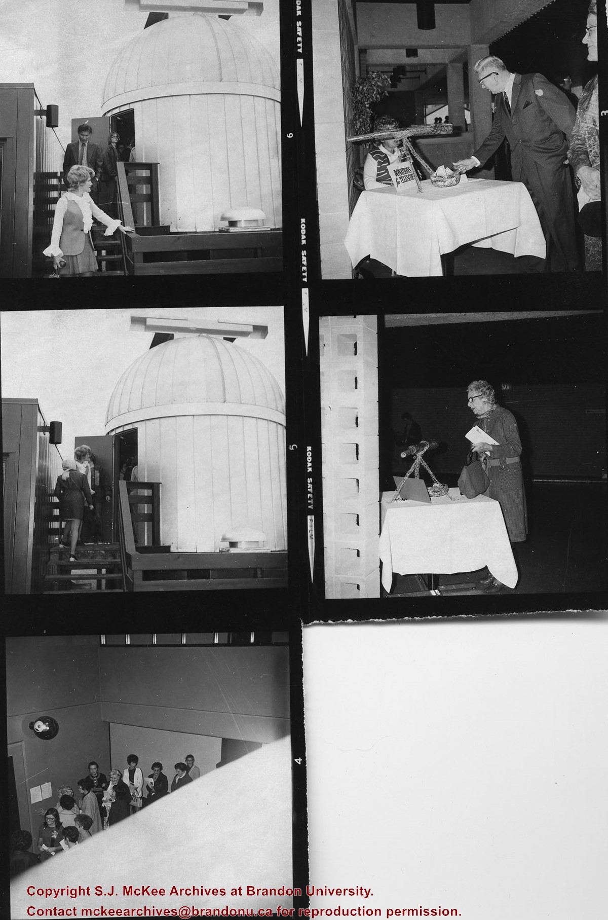
The Observatory is located on the roof of McMaster Hall.
Scope and Content
Item is five contact prints taken at the opening of the Observatory.
Print 1: Steps to the Observatory (man on the steps is Westly Wong)
Print 2: Steps to the Observatory
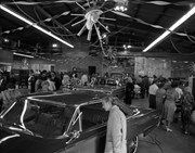
Print 3: Visitors
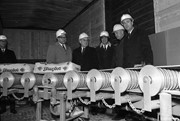
Print 4: Foyer of McMaster Hall (Prof. R.M. Simmons making a donation towards a telescope)
Print 5: Foyer of McMaster Hall (female visitor)
According to the Manitoba Historical Society, the Volunteer Monument was unveiled at Winnipeg's Old City Hall on September 28, 1886. The monument commemorated the soldiers of 90th Winnipeg Rifles (also known as the "Little Black Devils") who were killed during the 1885 North West Rebellion. In 1968, the monument was moved to the east side of Main Street, between the Centennial Concert Hall and the Manitoba Museum.
Scope and Content
Photograph shows a parade marching south along Main Street in front of the Volunteer Monument on Winnipeg's Old City Hall grounds (1886-1962). The parade was in honour of Queen Victoria's Diamond Jubilee that was held June 22, 1899. Businesses visible on the west (left) side of Main Street include: the Great Northern Railway Line, Gurney Stove & Range Co., Sherman House, The Arlington Hotel, Hurtley & Co., Central Drug Hall, Inman Optical Co. On the east side of Main Street, the Conferation Life Block is draped with bunting and a large ensign flag is flying from its tower. Specators line the streets and can be seen on roof tops and leaning from windows.
Notes
The front of the photograph reads: Jublee [sic.] Procession June 22/99 Winnipeg
Photograph given to Fred McGuinness by Helen Turner
Scope and Content
Photograph shows a man - George Porterfield - dressed in a three-piece and hat sitting at the reins of a horse drawn buggy. The buggy appears to be parked on Lorne Avenue beside the bandstand at Stanely Park.
Notes
Note attached to the back of the photograph reads: This George Porterfield, who lived on a farm 4.9.19. Delivered eggs, cream & milk in Brandon by this method in the early 1920. Maybe he was out courting Mary, he looks pretty dressed up.
See sub sub series level (RG 6, 8.4.1) for history/bio information.
Custodial History
See sub sub series level (RG 6, 8.4.1) for custodial history.
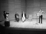
Scope and Content
Photograph of the authors who gave readings at the Welcome and Opening Ceremonies held on October 25 in the Lorne Watson Recital Hall. L-R: Lorraine Mayer (Chair), Maria Campbell, Tomson Highway and Gregory Scofield.
Storage Location
RG 6 Brandon University fonds
Series 8: Library Services
8.4 Library special events
8.4.1 Brandon Aboriginal Literary Festival


.jpg?width=1200&404=no-img.jpg&watermark=wmk)
.jpg?width=180&404=no-img.jpg)
.jpg?width=1200&404=no-img.jpg&watermark=wmk)
.jpg?width=180&404=no-img.jpg)


.jpg%3fmaxheight%3d1000%26maxwidth%3d1000%26watermark%3dwmk&description=John+Indian%27s+Bush)
.jpg%3fmaxheight%3d1000%26maxwidth%3d1000%26watermark%3dwmk&description=John+Indian%27s+Bush)