The Medicine Hat Exhibition and Stampede Parade Day was held on Thursday, July 19, 1962, at 9:30 a.m. The local newspaper reported that approximately 24,000 people were in attendance to see parade marshall Rod Ashburner leading 175 entries consisting of 90 floats, 75 horses, and 10 bands. There were 19 parade categories eligible for $12,000 in prize money and included: junior and senior cowboys and cowgirls; fancy and Shetland ponies; sulky class open; comic, commercial, industrial and organizational floats; decorated cars; special ranch class; 4-H Clubs; and a non-competitive class.
The parade route started at Second St. and Allowance Ave., from Second St. to Ash Ave., north on Ash to First St. SE., from First St. S.E. to Fourth Ave., south to Second St. to South Railway St., south on South Railway St. to Third St., with a finish at McLeod Trail. A route map was published in the Medicine Hat News the day before the parade.
Aerial photographs of the parade were taken by Medicine Hat News photographer Howard Heid (1930-2005) from the private helicopter of John Bourn. Bourn was a pilot from Woodville, Wisconsin, who chartered his four-seater helicopter for sight-seers at exhibitions and stampedes across the county.
(Sources: Pat Currie, "Let 'Er Go!," Medicine Hat News, 19 July 1962,1; Harald Gunderson, "'Eye in the Sky' Best Parade View," Medicine Hat News, 19 July 1962,1; "Parade Starts at 9:30 Sharp," 18 July 1962)
Scope and Content
Photograph shows an aerial view of possibly 8th Street NW and Tweed Avenue NW. A Safeway grocery store, park and residential area are visible. Many of hte homes appear to have gardens.
Notes
This photograph shows the neighbourhood before rezoning and commercial development.
Postcard is bent, inked stained, and has emulsion artifacts
Scope and Content
Photograph shows a wood-framed bungalow with ornamental woodwork on the porch and roof. The home has a wooden picket fence. A woman and child are seated on one side of the ballustrade and a woman in an overcoat and hat is seated on either side of the ballustrade. Neighbouring homes are also visible.
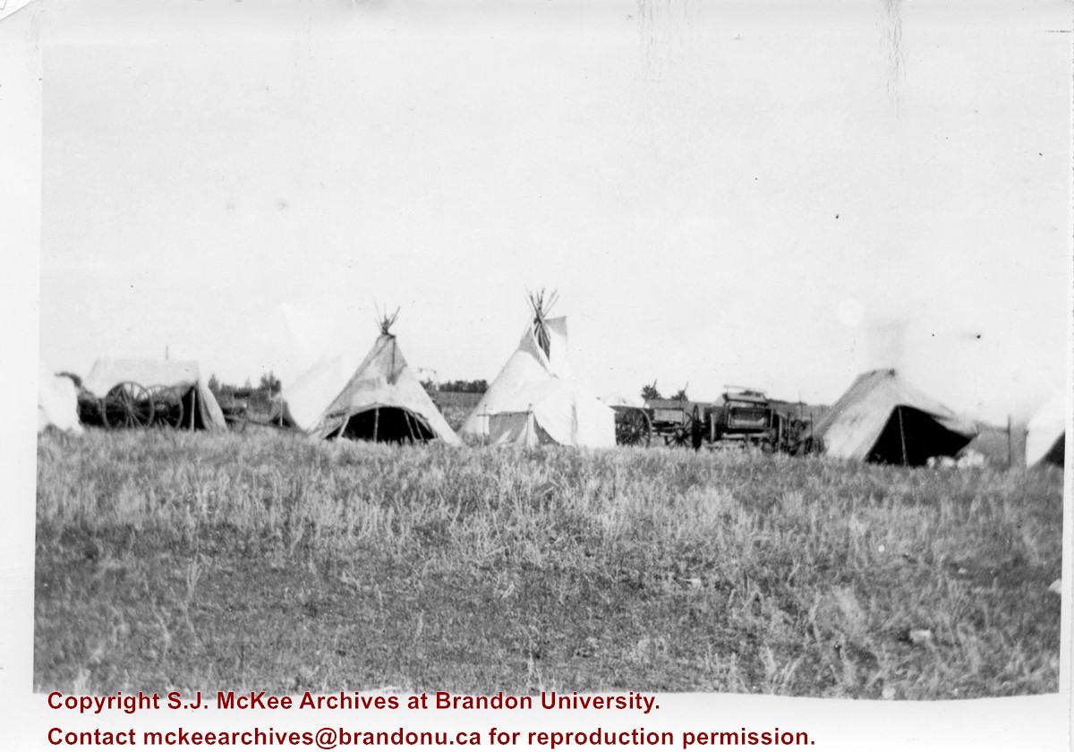
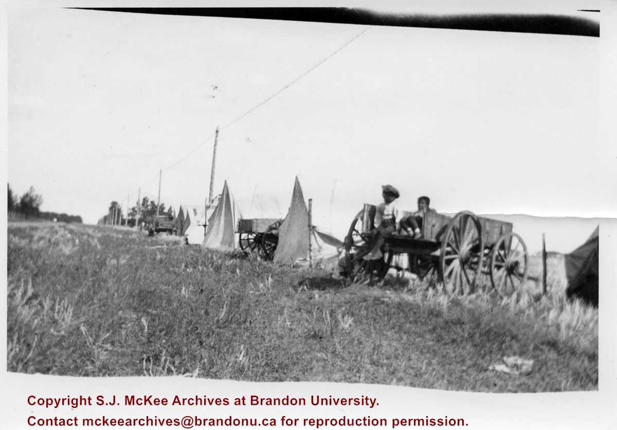
Photograph shows the Aboriginal camp site at the Brandon Fair. Pictured are wagon carts, tipis, and canvas tents.
Notes
Writing on back of photograph reads: 6 prints [20-2009.145 to 20-2009.150]. Indians at the Brandon Fair. Camping off 18th St. back of fair grounds. 1923
Photograph shows exterior views of five Brandon churches: Baptist Church, Presbyterian Church, St. Matthew's Church, Catholic Church and Monastery, and Methodist Church.
Notes
Part of "Christie's Brandon Series of Six Colored Picture Postcards of Brandon, Manitoba, The Crown Series, Published by Christie's Bookstore, Brandon, Man." [note: missing sixth postcard]. Writing on the front of the photograph reads: Baptist Church, Presbyterian Church Brandon Man., St. Matthew's Church, Catholic Church and Monastery, Methodist Church.
Photograph shows a southwestern view of Clark Hall and the Brandon College Original Building. The Citizen Science Building is absent from the campus grounds.
Notes
Part of "Souvenir of Brandon, Manitoba, Canada [viewbook], Printed by Photogelatine Engraving Co. Limited, Ottawa." Dates obtained from the Burchill's Music Store Henderson's Brandon City Directory listings (1927-1929). Writing on the front of the photograph reads: Brandon College, Brandon, Man.
Photograph shows two separate views. One is of the main entrance of (Old) City Hall on Princess Avenue. The other view shows the ediface of the YMCA building as well as the adjacent St. Paul's United and First United Churches on 8th Street.
Notes
Part of "Souvenir of Brandon, Manitoba, Canada [viewbook], Printed by Photogelatine Engraving Co. Limited, Ottawa." Dates obtained from the Burchill's Music Store Henderson's Brandon City Directory listings (1927-1929). Writing on the front of the photograph reads: City Hall - Brandon, Man; YMCA, St. Paul's United & First Church United, Brandon, Man.
Photograph was given to Fred McGuinness by Linda Bilkoski (nee Lepard) of Lac du Bonnet, MB.
Scope and Content
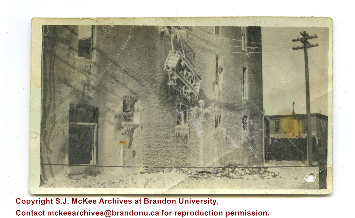
Photograph shows the remains of the Syndicate Block after the fire in January 1916. The building is situated on the southwest corner of Seventh Street and Rosser Avenue. Ice from the firefighting process covers the building. The tailor shop J.S. Laughton & Son (701 Rosser Avenue) can be seen on the north side of Rosser Avenue.
Erected in 1889, on the southeast corner of Rosser Avenue and 7th Street at 806 Rosser Avenue, this block was designed by Brandon architect W.H. Shillinglaw. At the time of its construction the structure housed the Nation & Shewan Department Store, one of Brandon’s largest and most successful drygoods businesses, owned and operated by Fred Nation and Alexander Shewan.
Major improvements were made to the store and an annex was added in 1910. Some of the renovation additions included, but were not limited to, an updated frontage with new copper sash windows and prismatic glass tops, plate glass windows, new fixtures and carpet. With the renovations the floor space of the business was to be almost doubled. The stock of the business also increased, with the Brandon Weekly Sun reporting that when finished, Nation & Shewan would be a “store of which the citizens of Brandon will be justly proud.” The drygoods firm operated until Nation’s death 1926, when it became known as A. Shewan Limited. From 1933 to 1944, the business was known as Shewan and Son. Shortly thereafter, the Metroplitan Stores Ltd began operating out of the Nation & Shewan Block.
In 2000, the Town Centre prepared to knock down the Red Apple Building, formerly the Nation & Shewan Block. The demolition was to make way for the new atrium and entrance for the mall, and begin a new period of redevelopment at the downtown shopping centre.
[History/Bio written by Christy Henry (SJ McKee Archives) and Eileen Trott (Daly House Museum), researched by Morganna Maylon, for 2015 photographic exhibition "Gowen's Brandon: Then and Now".]
Custodial History
Photograph was given to Fred McGuinness by Linda Bilkoski (nee Lepard) of Lac du Bonnet, MB.
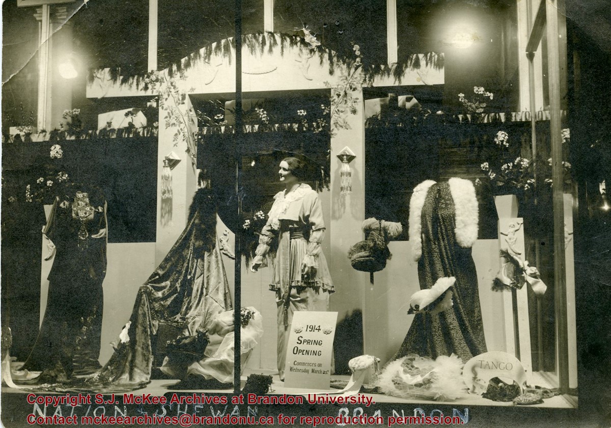
Scope and Content
Photograph shows a display of women's clothing and accessories in the window at Nation & Shewan. A sign reads: 1914 Spring Opening commences on Wednesday March 25th.
Notes
Writing on the back of the photograph reads: Mrs. E. Harden, 33-10th St., City. According to the Henderson's Brandon City Directories, Catharine "Kate" Harden (nee Chalmers) worked as a cashier at Nation & Shewan from 1913 to 1914.
Postcard is of buildings at Brandon University, including Clark Hall and the Original Building prior to the renovations, McMasater Hall, and the Q.E.II School of Music building.
Notes
Writing on the front of the postcard reads: Brandon University. Back of the postcard reads: (Top Left) Brandon University original building (Administration Center.), Bottom Left) Queen Elizabeth II Music Building, (Right) McMaster Hall Residence; Photo by Sandy Black; Printed in Brandon, Manitoba, Canada, by Leech Printing Ltd.
Photograph shows the Aboriginal camp site at the Brandon Fair. Pictured are wagon carts and canvas tents. Two children can be seen sitting in a wagon.
Notes
Writing on back of photograph reads: 6 prints [20-2009.145 to 20-2009.150]. Indians at the Brandon Fair. Camping off 18th St. back of fair grounds. 1923
Photograph shows a group of Aboriginal peoples sitting near a fair building. Several members are dressed in regalia.
Notes
Writing on back of photograph reads: 6 prints [20-2009.145 to 20-2009.150]. Indians at the Brandon Fair. Camping off 18th St. back of fair grounds. 1923
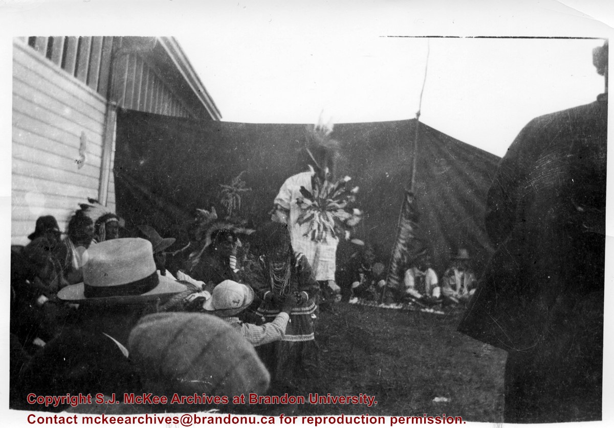
Photograph shows a group of Aboriginal peoples standing in a circle surrounding a group in traditional regalia. An American flag is visible in the foreground.
Notes
Writing on back of photograph reads: 6 prints [20-2009.145 to 20-2009.150]. Indians at the Brandon Fair. Camping off 18th St. back of fair grounds. 1923
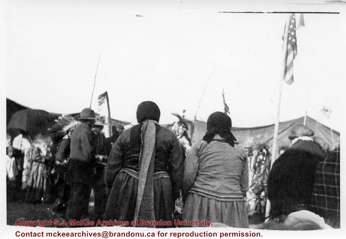
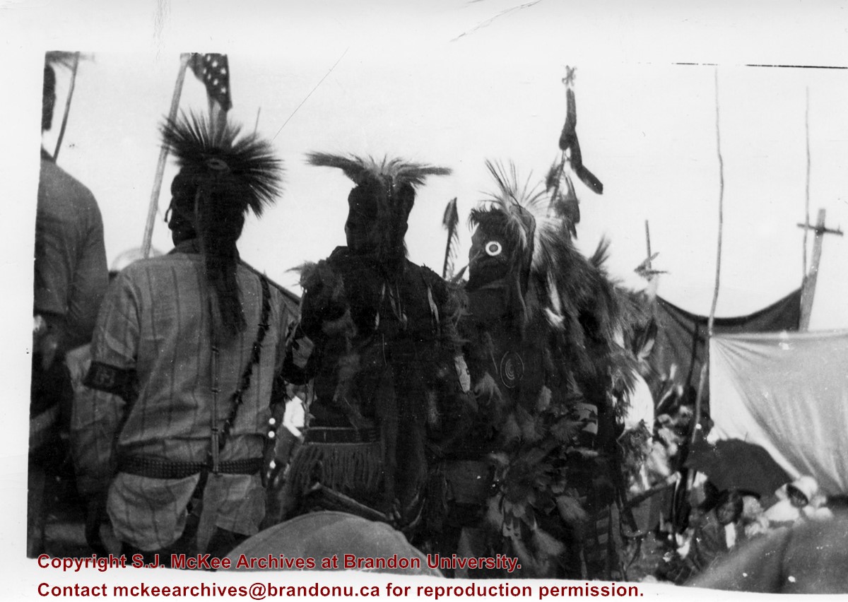
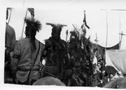
Photograph shows the backside of a group Aboriginal peoples dressed in traditional regalia. An American flag is visible in the background
Notes
Writing on back of photograph reads: 6 prints [20-2009.145 to 20-2009.150]. Indians at the Brandon Fair. Camping off 18th St. back of fair grounds. 1923
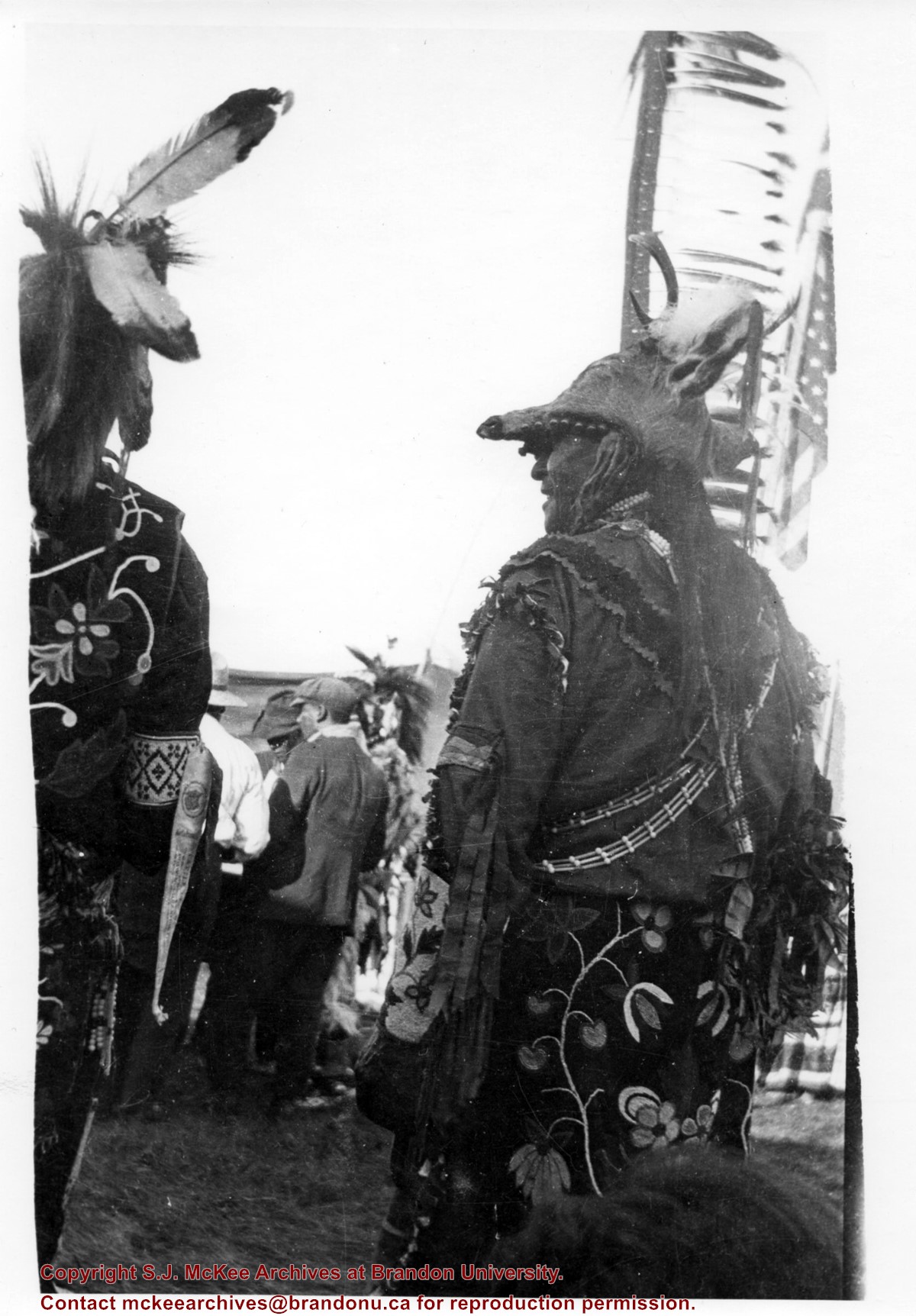
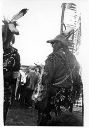
Photograph shows the backside of a pair of Aboriginal men dressed in traditional regalia. Both are wearing beaded clothing and one is wearing a deer head headdress. An American flag is visible in the background
Notes
Writing on back of photograph reads: 6 prints [20-2009.145 to 20-2009.150]. Indians at the Brandon Fair. Camping off 18th St. back of fair grounds. 1923
Photograph is stained and water damaged. A newspaper clipping about William (Billy) Muir is glued to the top left hand corner of the mat. The image is exfoliated in the right hand corner. The negative has been reverse printed.
History / Biographical
Coombs & Stewart opened the first general store in Brandon in 1881, which was located on 6th Street and Pacific Avenue. According to G.F. Barker (Brandon: A City, 1977, 291), William (Billy) Muir worked at the store until he opened his own grocery store in 1888.
Custodial History
Donated to Fred McGuinness by Allena Strath (nee Coombs).
Scope and Content
Photograph shows the Coombs & Stewart general store located on the corner of Pacific Avenue and 6th Street. A group of men pose in front of the wood-framed store.
Notes
Back of photograph reads: One of first stores in Brandon, Coombs...[?]
Photographs have been glued to a backing board that has warped over time
Scope and Content
Photograph shows street view of north side of Rosser Avenue, primarily the 700 block, along which sewer pipe is being laid. Visible buildings and businesses include: The Fleming Block with Lowes Brothers Clothing and Manitoba Farmers Hedge and Wire Fence Company, the Beaubier Block and its Empire Hotel, A.M. Percival (a grocer), the Brandon Hardware Company (600 block), and the Arlington Hotel (500 block) are visible along the north side of the avenue. The Bank of Hamilton Building is on the southeast corner of 8th Street and Rosser Avenue.
Notes
Writing on the front of the photograph matting reads: 290. Page appears to be from a photo album.
Photographs have been glued to a backing board that has warped over time
Scope and Content
Photograph shows street view of north side of Rosser Avenue, primarily the 700 block. Horse and buggies are travelling on the avenue and pedestrians fill the sidewalks. Union Jacks and English flags are mounted from the windows on the Fleming and Beaubier blocks. Flag banners are drapped across Rosser Avenue. Businesses visible in the Fleming Block include: Lowes Brothers Clothing and Spring Park Nurseries. Businesses visible in the Beaubier Block include the Empire Hotel. Businesses east of the Empire Hotel are grocer A.M. Percival and the Brandon Hardware Company. An advertisement for the Northern Bank is affixed to a telephone pole on the southside of the street.
Notes
Writing on the front of the photograph matting reads: July 1 1906, 314. One photograph (20-2009.8) is glued below and another, 20-2009.6, is glued on the reverse side. Page appears to be from a photo album.
Photographs have been glued to a backing board that has warped over time
Scope and Content
Photograph shows street view of north side of Rosser Avenue, primarily the 700 block. Horse and buggies are travelling on the avenue and pedestrians fill the sidewalks. Union Jacks and English flags are mounted from the windows on the Fleming and Beaubier blocks. Flag banners are drapped across Rosser Avenue. Businesses visible in the Fleming Block include: Lowes Brothers Clothing and Spring Park Nurseries. Businesses visible in the Beaubier Block include the Empire Hotel. Businesses east of the Empire Hotel are grocer A.M. Percival and the Brandon Hardware Company. An advertisement for the Northern Bank is affixed to a telephone pole on the southside of the street. The street is lined with litter and a number of dogs can be seen roaming the area.
Notes
Writing on the front of the photograph matting reads: 313 July 1906. One photograph (20-2009.8) is glued below and another, 20-2009.6, is glued on the reverse side. Page appears to be from a photo album.


)