The McKee Archives is the copyright holder for the Stuckey materials.
Storage Location
Lawrence Stuckey collection
Arrangement
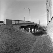
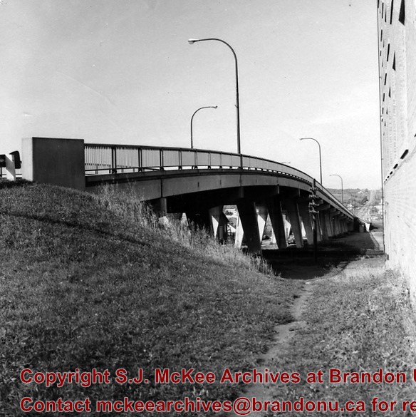
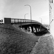
[Mr. Stuckey put 2 negatives and a print in the same envelope. He numbered the negatives BH2 and BH2a. We separated them and kept his original numbering. We numbered the print BH2aa and placed it in its own envelope.]
The McKee Archives is the copyright holder for the Stuckey materials.
Storage Location
Lawrence Stuckey collection
Arrangement
[Mr. Stuckey put 2 negatives and a print in the same envelope. He numbered the negatives BH2 and BH2a. We separated them and kept his original numbering. We numbered the print BH2aa and placed it in its own envelope.]
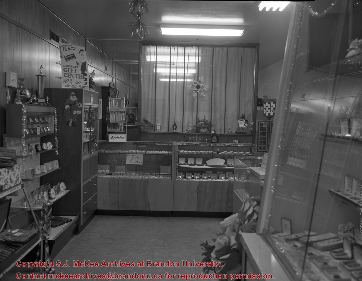
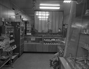
The Specialty Shop [to the right of the "OK Used Cars" sign] was opened by Ms. Helen Lamont in 1953.
Custodial History
For custodial history see the collection level description of the Lawrence Stuckey collection.
Scope and Content
This image shows commercial buildings located on the east side of the 100 block of 10th Street.
Businesses shown include Western Motors automobile dealership and a Specialty Shop
Notes
[Mr. Stuckey put three negatives and three prints in same envelope. We have separated them and numbered the negatives EA3(1), EA3(2) and EA3(3), and the prints EA3(1a), EA3(2a), EA3(3a).]
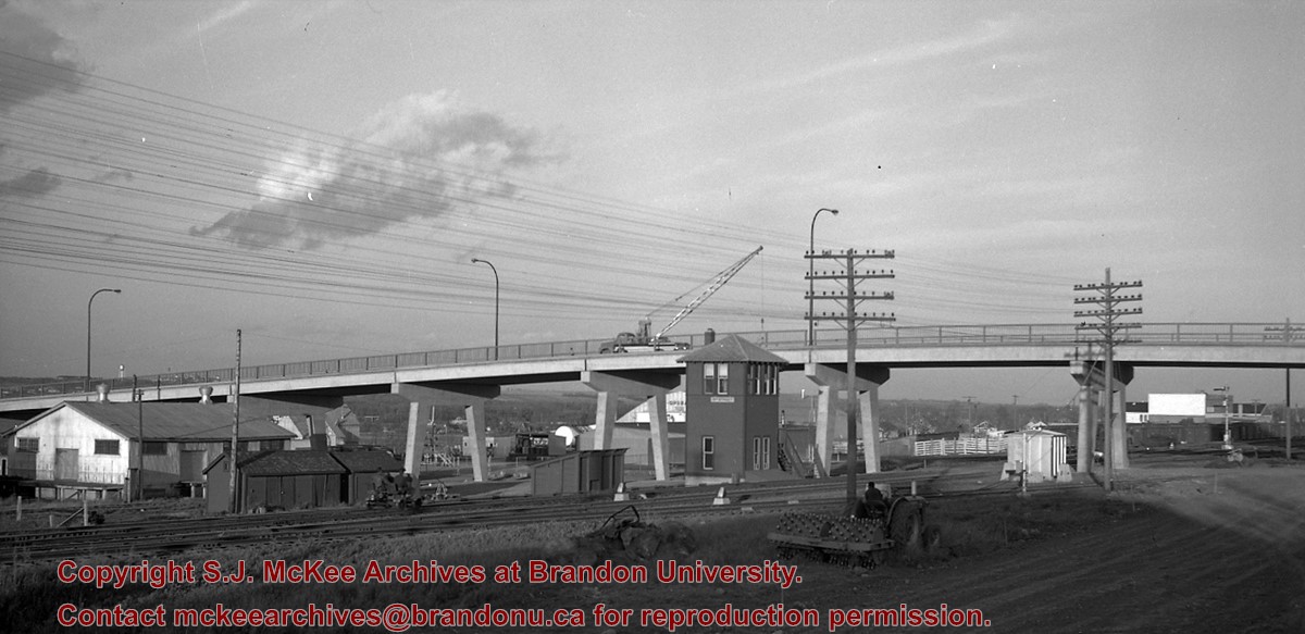
The first 18th Street Bridge was built in 1907 as the "King Edward Bridge." It was replaced the following year by the second 18th Street Bridge. The third 18th Street Bridge, called the David Thompson Bridge, was replaced by twin bridges; the first twin bridge opened in 2009, the second twin bridge opened c. 2010.
Custodial History
For custodial history see the collection level description of the Lawrence Stuckey collection.
3 m textual records; 100 photographs and drawings; 19 books and pamphlets
History / Biographical
John Tyman was born in Kent County, England. After briefly serving with the British Army, Tyman attended the University of Oxford. He came to Canada first in the summer of 1957 to work for a short time, before returning to England in the fall. In 1959, he returned to study at McGill University, and obtained an M.A. in 1961. In 1962, he moved to Brandon to establish a Geography department at Brandon College. Tyman served as a professor and, for a short time, as Dean of Science during his time at Brandon University. In 1970, he obtained a Ph.D. from the Oxford University. In 1976, Tyman left Brandon University and moved to Australia. In Australia he taught at Mount Gravatt College in Brisbane until his retirement in 1994. As of January 2006, John Tyman continues to reside in Australia.
Custodial History
The Tyman fonds remained in the possession of the Geography Department at Brandon University following Dr. Tyman's departure to Australia in 1976. With Dr. Tyman's approval the records were transferred to the McKee Archives in May 2001.
Scope and Content
This fonds contains a copy of "By Section, Township & Range: Studies in Prairie Settlement," by John Langston Tyman. This publication was based on Tyman's doctoral thesis, which is also included in the fonds. His doctoral thesis was completed in 1970 and titled, "The Disposition of Farm Lands in Western Manitoba, 1870 - 1930: Studies in Prairie Settlement."
Fonds also includes extensive research materials compiled by Dr. Tyman on prairie settlement. They include: copies of the Annual Report of the Department of the Interior; documents relating to C.P.R. land sales (c.1870-1900); personal accounts and local histories of municipalities in southern Manitoba such as Shoal Lake, Justice, and local C.P.R. lines; the Canadian Homestead Settlement Co.; The Free Land Homestead Co,; the Canadian Northwest Lands Co.; the N.W.H.B., C.N.R., Lake Manitoba Railway & Canal Co.; land grants given to Veterans; Wellams and Dominion Steamship Co.; maps of southern Manitoba RM's; Sowden and Co. (a land settlement company); correspondance to a Rev. L.O. Armstrong in Emerson (c. 1885); legislation; agricultural progress; history of school lands; correspondance to and from J. Tyman (c.1960); the settlement of Icelandic, Hungarian, and Scandinavian immigrants; a plethora of maps both relating to prairie settlement and to world geography; a manuscript by William Pearce (1925); a transcript titled "Patterns of Settlement"; 5 rolls of microfilm containing maps and copies of some publications acquired by Dr. Tyman; a number of books and c.1900 publications to do with prairie settlement; maps by township and range of the prairies; 100 photos and drawings all c.1880 to 1900; extensive township summaries; and extensive land disposal records as recorded by the Lands Department, including the names of settlers.
Notes
Fonds level description written by Mike White (2001).
Many documents in this collection were copied from originals at the Glenbow-Alberta Institute, Calgary, Alberta, Library and Archives Canada, the Archives of Manitoba, land titles and corporate offices.
Storage Location
MG 3 Brandon University Teaching and Administration
1.3 John Langston Tyman
Photograph shows the northwest corner of 10th Street and Princess Avenue. Traffic on the west side of Princess Avenue appears to travelling both ways. A taxi waits at the intersection.
Above the west entrance on the corner building is an electric sign that spells "Hughes Bldg." A second storey has been added to the portion of the Doig's shop that is adjacent to the Alexandra Block.
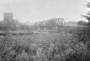
Built 1882 by Joseph E. Woodworth M.L.A. as a private enterprise toll bridge; See Barker pg. 3 [G. F. Barker, Brandon: City, 1881 - 1961. D.W. Friesen Printers: Altona, 1977 pp. 3 (P.E. 26/05/09).]
Custodial History
For custodial history see the collection level description of the Lawrence Stuckey collection.
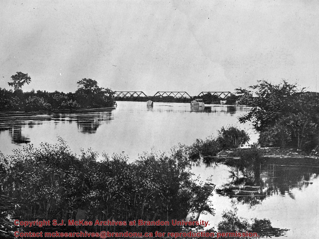
Built 1882 by Joseph E. Woodworth M.L.A. as a private enterprise toll bridge; See Barker pg. 3 (G. F. Barker, Brandon: City, 1881 - 1961. D.W. Friesen Printers: Altona, 1977 pp. 3 [P.E. 26/05/09])
Custodial History
For custodial history see the collection level description of the Lawrence Stuckey collection.
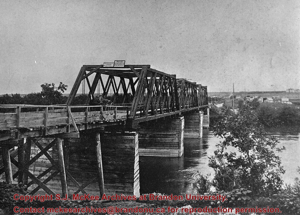
Scope and Content
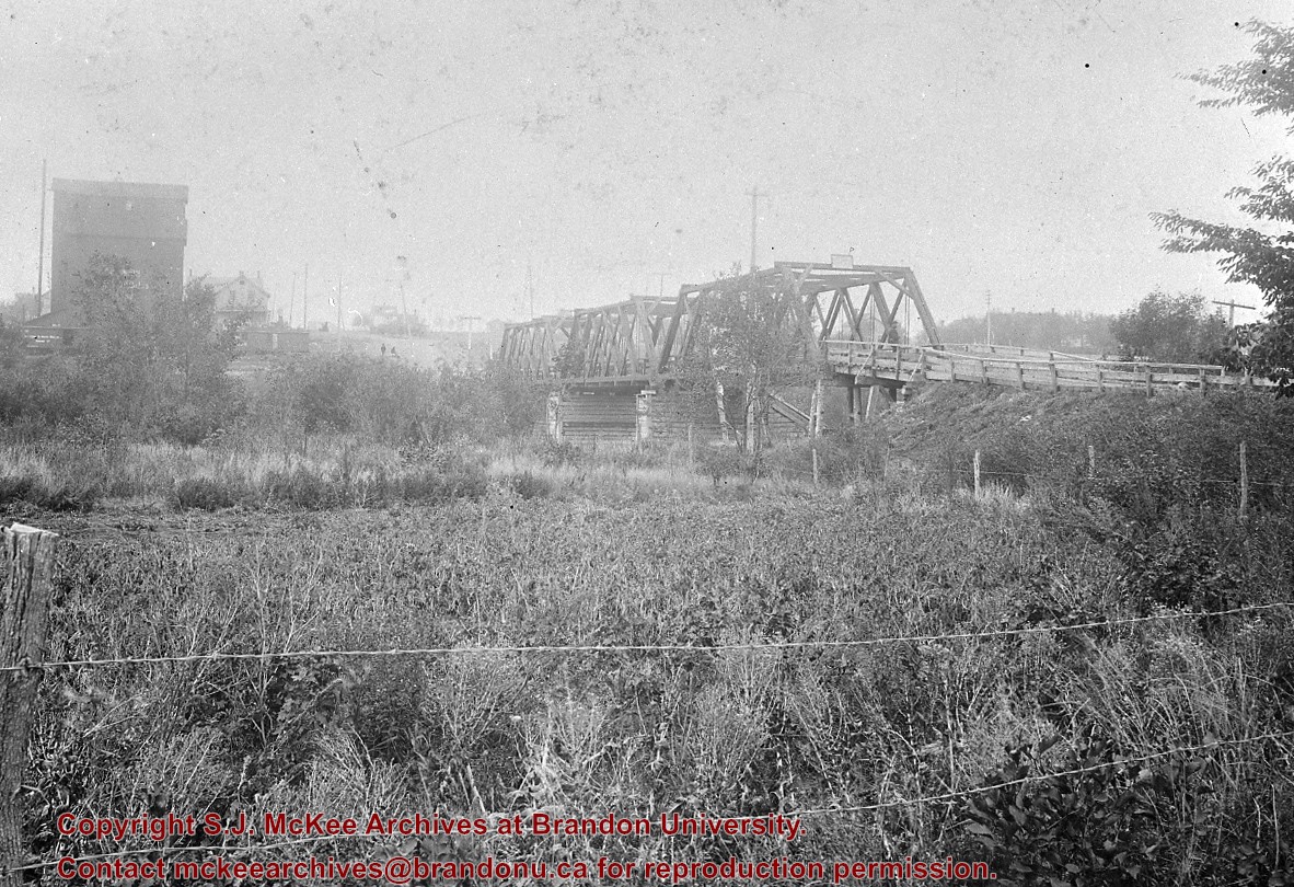
Original First Street Bridge
Notes
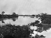
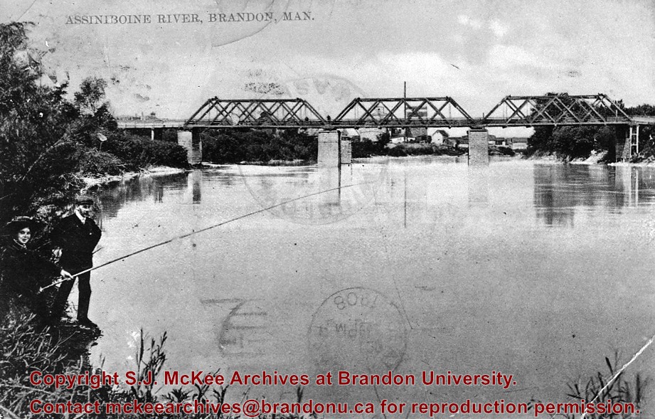
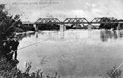
View from south bank about third street (about south end of the present dam); High water and leaves on trees indicate late May or early June.
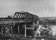
Built 1882 by Joseph E. Woodworth M.L.A. as a private enterprise toll bridge; See Barker pg. 3 [G. F. Barker, Brandon: City, 1881 - 1961. D.W. Friesen Printers: Altona, 1977 pp. 3 (P.E. 26/05/09).]
Custodial History
For custodial history see the collection level description of the Lawrence Stuckey collection.
Scope and Content
Original First Street Bridge
Notes
View from south bank, [east of bridge]; From postcard date-stamped 1908.

.jpg?width=1200&404=no-img.jpg&watermark=wmk)
.jpg?width=180&404=no-img.jpg)
.jpg?width=1200&404=no-img.jpg&watermark=wmk)
.jpg?width=180&404=no-img.jpg)


.jpg?width=1200&404=no-img.jpg&watermark=wmk)
.jpg?width=180&404=no-img.jpg)
.jpg?width=1200&404=no-img.jpg&watermark=wmk)
.jpg?width=180&404=no-img.jpg)


.jpg?width=1200&404=no-img.jpg&watermark=wmk)
.jpg?width=180&404=no-img.jpg)
.jpg?width=1200&404=no-img.jpg&watermark=wmk)
.jpg?width=180&404=no-img.jpg)
.jpg?width=1200&404=no-img.jpg&watermark=wmk)
.jpg?width=180&404=no-img.jpg)
.jpg?width=1200&404=no-img.jpg&watermark=wmk)
.jpg?width=180&404=no-img.jpg)
.jpg%3fmaxheight%3d1000%26maxwidth%3d1000%26watermark%3dwmk&description=10th+Street+Businesses+-+East+Side+of+100+Block)
.jpg%3fmaxheight%3d1000%26maxwidth%3d1000%26watermark%3dwmk&description=10th+Street+Businesses+-+East+Side+of+100+Block)
.jpg%3fmaxheight%3d1000%26maxwidth%3d1000%26watermark%3dwmk&description=Second+18th+Street+bridge)
.jpg%3fmaxheight%3d1000%26maxwidth%3d1000%26watermark%3dwmk&description=Second+18th+Street+bridge)
.jpg%3fmaxheight%3d1000%26maxwidth%3d1000%26watermark%3dwmk&description=Second+First+Street+bridge)
.jpg%3fmaxheight%3d1000%26maxwidth%3d1000%26watermark%3dwmk&description=Second+First+Street+bridge)
.jpg%3fmaxheight%3d1000%26maxwidth%3d1000%26watermark%3dwmk&description=Second+First+Street+bridge)
.jpg%3fmaxheight%3d1000%26maxwidth%3d1000%26watermark%3dwmk&description=Second+First+Street+bridge)