Box 1 and 2: Reston Co-operative Elevator Association Limited Minutes of Shareholders Annual meetings, 1928 - 1945, 1950 - 1951, 1953 1961 - 1963 Financial records and statistics Statement of surplus, 1938 - 1942 Final statements, 1935 - 1937, 1940 - 1942 (5 reports) Auditors' reports, 1929 - 1932, 1935 - 1942, 1947, 1954, 1962, 1963 (16 reports) Operating account, 1932 Balance sheet, 1951, 1960 - 1963 Analysis of Operating Result, 1961 - 1962 General expenses, 1961 - 1962 Surplus payment for year, 1938 - 1958 Final oats equalization payment, 1946 - 1947 Flax adjustment payment, 1947 - 1948 Barley adjustment payment, 1947 Grower's deliveries, 1958 - 1959, 1960 Deliveries and surplus, 1949 - 1959 Grower's ledgers, 1934 - 1947 Correspondence, 1944 - 1951 Membership list, 1945 - 1957, new Memberships Corporate Name: Rural Municipality of Pipestone
Box 3: Reston/Cromer Association Minutes Nov 5 1959 - Nov 1998; Correspondance July 19 1960 - May 25 1999; Documents 1960 - 1969; Membership and Board Members 1959 - 1999; Cromer Membership Roster 1968 - 1979; Attendance 1958 - 1969; Funding Requests; Financial 1957 - 1996; Miscellaneous
Box 4: Cromer Seed Co-operative August 1 1972 - June 5 1986; Reston Minute Book May 20 1983 - May 24 1994
Notes
File numbering is not congruous between sub-series arranged prior to 2009 and sub-series arranged or added to after 2009. This will be corrected in the future
View is southwest from the roof of the George T. Richardson Centre. Photograph shows the curved glass wall of the John E. Robbins Library, the walkway between the Library and the Dining Hall, the Dining Hall and Darrach Hall.
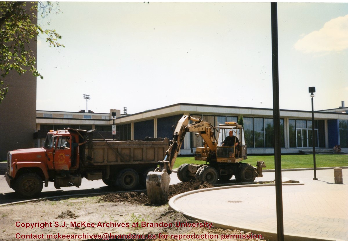
Photograph shows a backhoe and a dump truck on the north side of McMaster Hall during the landscaping of the flower bed on the southeast corner of the George T. Richardson Centre (John E. Robbins Library). The Dining Hall is in the background.
Photograph shows a backhoe digging a sewer hole near the sidewalk between the Brandon College Building and the Citizens' Science Building. The Knowles-Douglas Students' Union Centre, John R. Brodie Science Centre and a portion of the driveway are visible in the background.
View is northwest from the roof of the John R. Brodie Science Centre. Photograph shows the roof of the Knowles Douglas Students' Union Centre, the Citizens' Science Building, and the Brandon College Building and Clark Hall during renovation.
View is north probably from the roof of McMaster Hall. Photograph shows the construction of the new roof on Clark Hall and the Brandon College Building.
View is north probably from the roof of McMaster Hall. Photograph shows the construction of the extension to Clark Hall and the skywalk. Also visible are the A.E. McKenzie Building, the Brandon College Building, the Education Building, the original Music Building and the Western Manitoba Centennial Auditorium, as well as the walkway that runs north between the buildings and the courtyard.
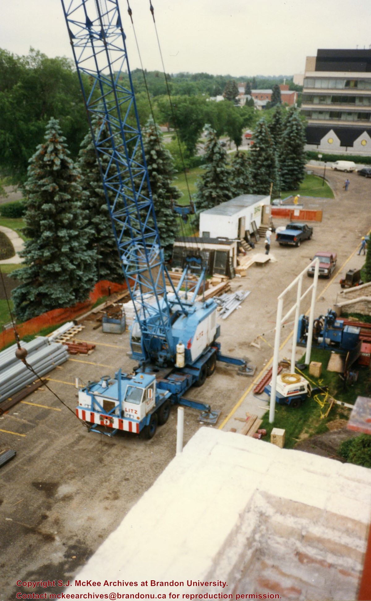
View is southeast from Clark Hall. Photograph shows a large crane, building materials and machines and the construction trailer (Bird Construction) on the driveway during the restoration of Clark Hall and the Brandon College Building. Portions of the front lawn, the John R. Brodie Science Centre and the Knowles Douglas Students' Union Centre are also visible. In the distance is Knox United Church.
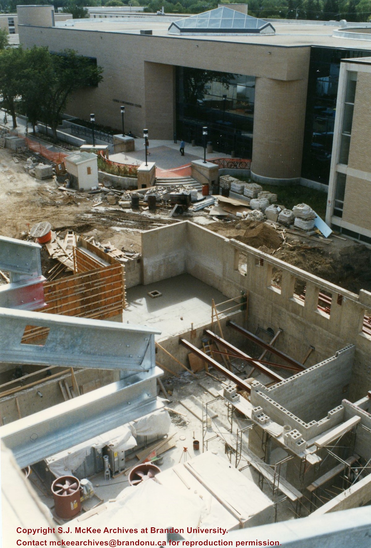
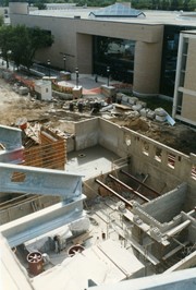
View is southwest from the roof of Clark Hall. Photograph shows the construction of the foundation and exterior walls of the Clark Hall extension. George T. Richardson Centre and construciton materials in the background.
View is north northwest from the roof of the John R. Brodie Science Centre. Photograph shows the Knowles Douglas Students' Union Building, and the Citizens' Science Building, the Brandon College Building and Clark Hall under restoration, as well as parts of the driveway and front lawn, including the flag pole.
View is northwest from Clark Hall. Photograph shows construction materials in the area between Clark Hall and the A.E. McKenzie Building during winter. The Western Manitoba Centennial Auditorium is visible in the upper right hand corner.
View is south southeast from the skywalk. Photograph shows the courtyard in winter full of vehicles, machines and building materials. Also visible are the Development and Physical Plant H-Huts, the Citizens' Science Building, the John R. Brodie Science Centre and McMaster Hall.
View is northwest from the roof of the Brandon College Building. Photograph was taken through wire fencing and shows construction on the roof of the Brandon College Building during winter. The original Clark Hall entrance to the roof is clearly visible. Portions of the A.E. McKenzie Building, Clark Hall and the Western Manitoba Centennial Auditorium are visible in the background.
Photograph was taken from the skywalk and shows students leaving the George T. Richardson Centre during winter. The courtyard contains construction materials. The Physical Plant H-Hut and McMaster Hall are partially visible in the background.
View is southwest from approximatley 16th Street between Princess and Rosser Avenues. Photograph shows the Brandon University campus, as well as surrounding residential blocks, including Flemming, J.R. Reid and Vincent Massey schools.
View is west southwest from approximatley 16th Street between Princess and Lorne Avenues. Photograph shows the Brandon University campus, as well as surrounding residential blocks between 16th and 23rd Streets, Princess and Louise Avenues..


