Series is divided into 13 sub-series, including: (1) Aerials; (2) Brandon College Building & Clark Hall; (3) Citizens' Science Centre & Knowles Douglas Building; (4) Richardson Centre & A.E. McKenzie Building; (5) Healthy Living Centre & Henry Champ Gymnasium; (6) Dining Hall & Residences; (7) Education Building; (8) Original Music Building & the Queen Elizabeth II Music Building; (9) J.R. Brodie Science Centre; (10) Dr. James and Mrs. Lucille Brown Health Studies Complex; (11) Jeff Umphrey Building & Glen P. Sutherland Art Gallery; (12) Physical Plant; (13) H-Huts.
Brandon College looking south from 19th Street. Photograph was taken after Flora Cowan Hall was built but before construction of the Education Building.
Image shows the Brandon College campus from 17th Street looking southwest. The photo was taken after the completion of the original Music Building in 1963, but construction of the Education Building. Also visible are a number of properties on the 200 block of 18th Street and the 200 block of 20th Street.
Image is looking east northeast from approximately the 300 block of 23rd Street between Lorne and Louise Avenues. Photograph shows the Brandon College campus after the opening of the original Music Building in 1963, but before the construction of the Education Building in 1966. A number of house on the 300 blocks of 22nd and 21st Streets are visible in the foreground, with the A.E. McKenzie Seed Co., the Prince Edward Hotel and various grain elevators on the horizon.
The Student Services H-Hut was located between the Brandon College Building and the Citzens' Science Building. It was placed there c. 1950 and it was removed sometime in the 1990s. Originally the H-Hut in this photograph was the Geology Depatment, housing offices, classrooms and the lab.
Scope and Content
Photograph is looking west and shows the entrance to the Student Services H-Hut.
Notes
History/Bio information from Tom Mitchell and Harvey Young.
Photograph is looking west southwest approximately from the driveway and shows one of the H-Huts. In this photograph the H-Hut was a science laboratory. It later became Student Services (c. 1980) and was removed from campus in the 1990s.
Notes
The H-Hut running north-south in the background beside the Citzens' Science Building was demolished c. 1987.
Photograph is looking west southwest approximately from the driveway and shows one of the H-Huts. In this photograph the H-Hut was a science laboratory. At one point it also housed the Geology Annex. It later became Student Services (c. 1980) and was removed from campus in the 1990s. McMaster Hall is in the background.
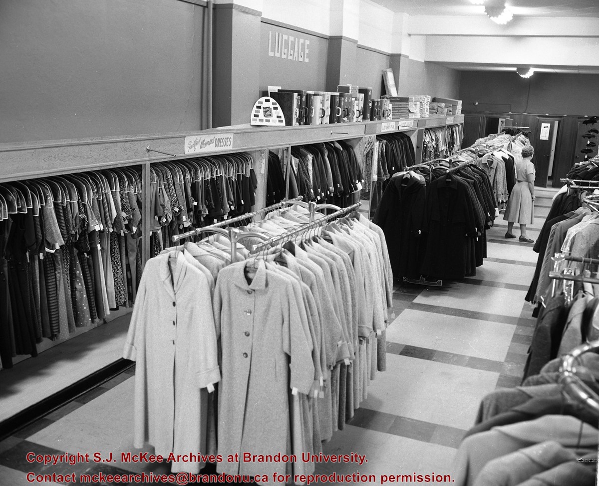
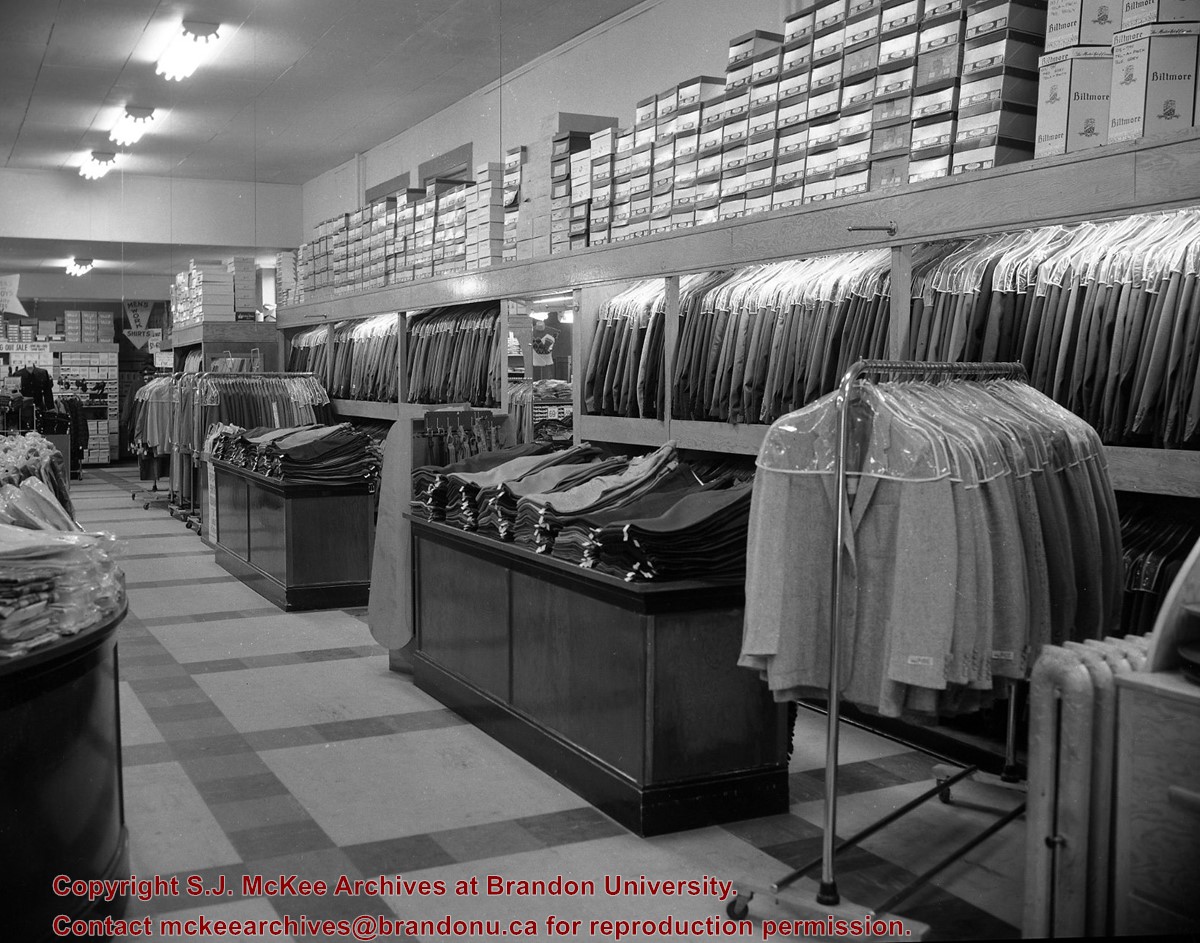
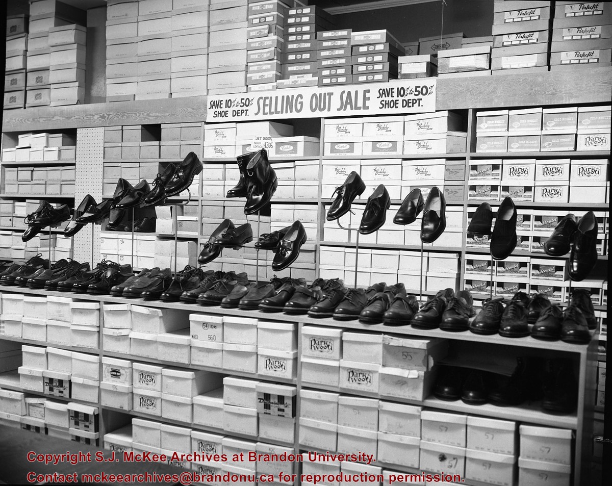
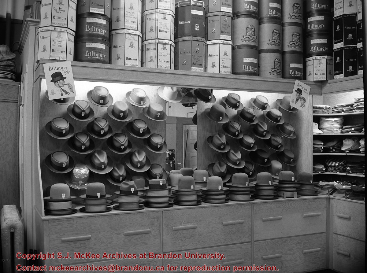
The building that housed Ashdown's Hardware was built in 1902 and was located at the corner of Princess Avenue and 7th Street on the north side of Princess Avenue. Strome and White Company General Store were the first occupants of the building. The building was destroyed by fire on March 27, 1983.
Custodial History
See fonds level of the CKX records for custodial history.
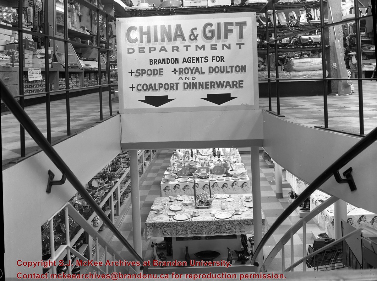
Scope and Content
Image of the staircase leading to the china and gift department at Ashdown's Hardware.
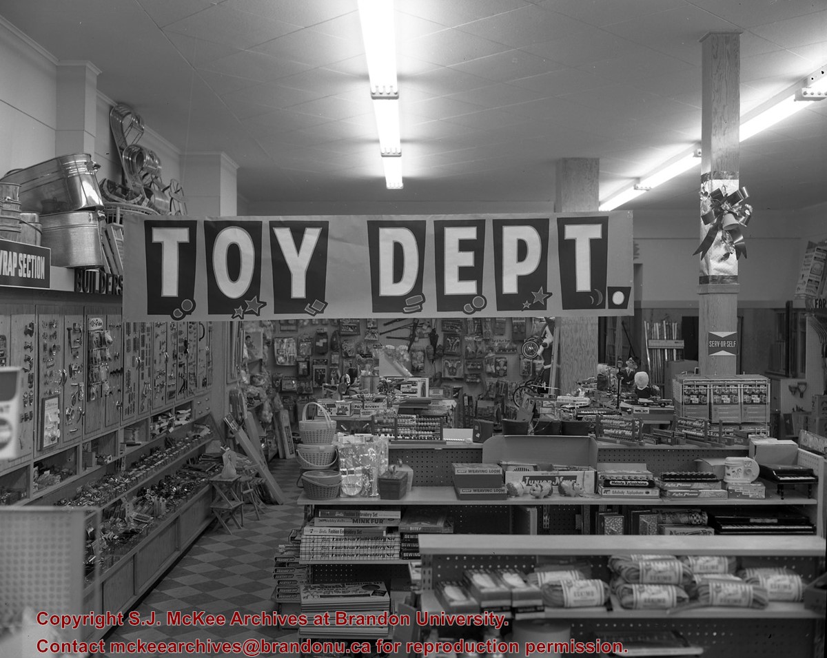
The building that housed Ashdown's Hardware was built in 1902 and was located at the corner of Princess Avenue and 7th Street on the north side of Princess Avenue. Strome and White Company General Store were the first occupants of the building. The building was destroyed by fire on March 27, 1983.
Custodial History
See fonds level of the CKX records for custodial history.
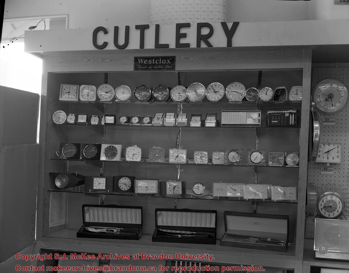
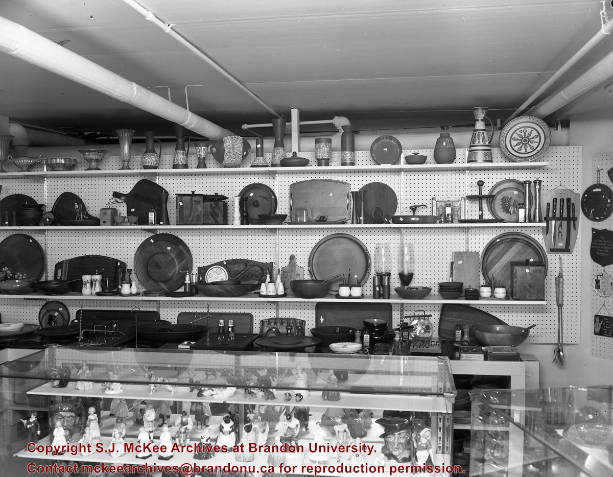
Scope and Content
Image of a display in the china and gift department of Ashdown's Hardware.
The building that housed Ashdown's Hardware was built in 1902 and was located at the corner of Princess Avenue and 7th Street on the north side of Princess Avenue. Strome and White Company General Store were the first occupants of the building. The building was destroyed by fire on March 27, 1983.
Custodial History
See fonds level of the CKX records for custodial history.
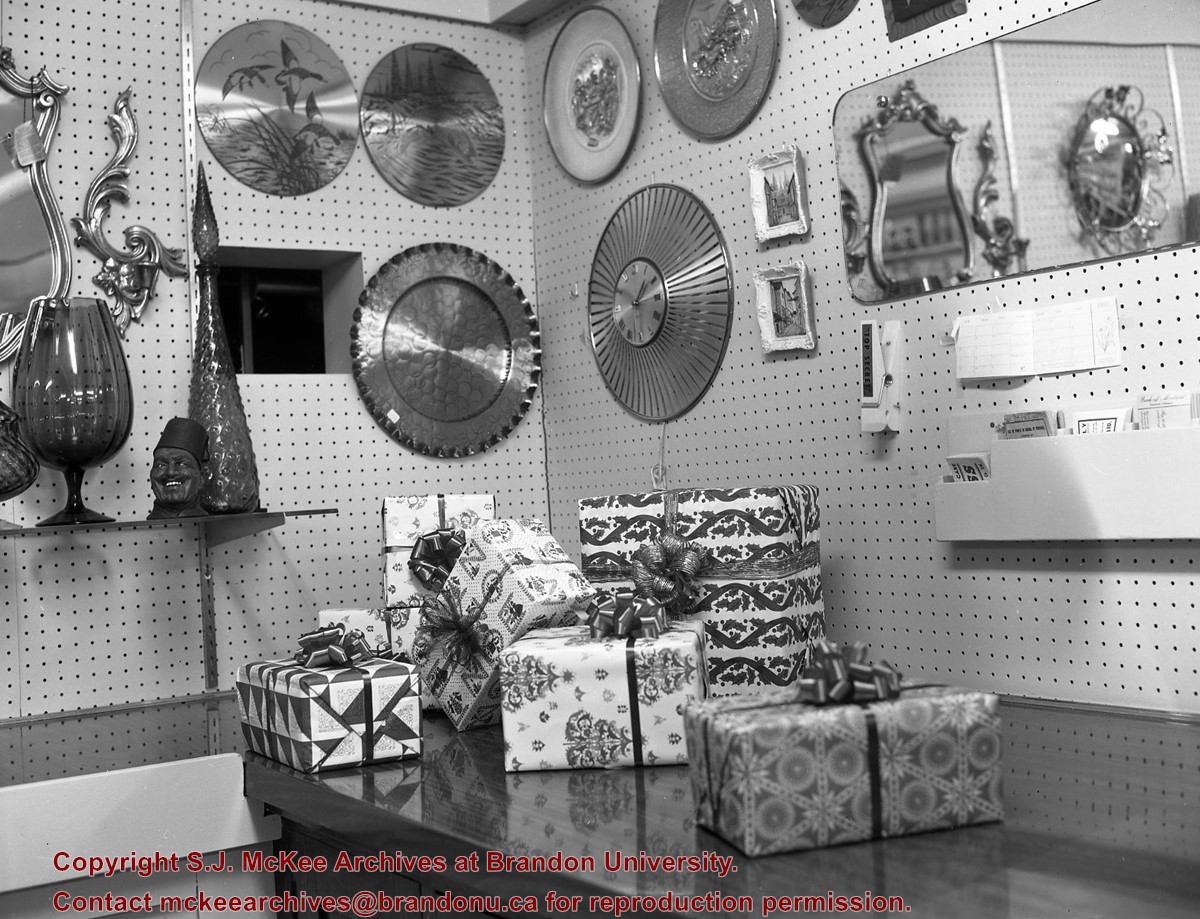
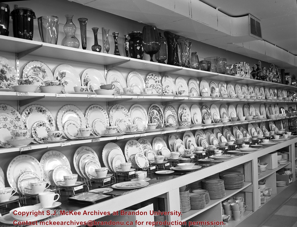
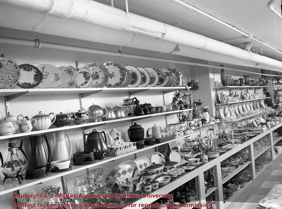
Scope and Content
Image of items in the china and gift department of Ashdown's Hardware.
The building that housed Ashdown's Hardware was built in 1902 and was located at the corner of Princess Avenue and 7th Street on the north side of Princess Avenue. Strome and White Company General Store were the first occupants of the building. The building was destroyed by fire on March 27, 1983.
Custodial History
See fonds level of the CKX records for custodial history.
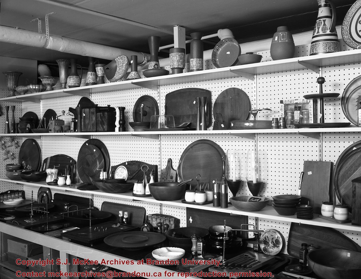
Scope and Content
Image of items in the china and gift department of Ashdown's Hardware.


