The United Grain Growers, a farmer controlled co-operative elevator association, was established in 1917, with the amalgamation of the Grain Growers Grain Company (1906), and the Alberta Farmer's Co-operative Elevator company (1913). Its original purpose was to provide a co-operative alternative to privately owned grain elevators.
Custodial History
This collection was accessioned by the McKee Archives in 1997. Prior custodial history is unknown.
Scope and Content
Collection includes copies of correspondence between T.A. Crerar, President of United Grain Growers and Colin Burnell, President, Manitoba Co-operative Wheat Producers (1925-26); correspondence directed to the Shareholders of United Grain Growers (1926-38); minutes of a meeting between representatives of the United Grain Growers and the provincial wheat pools (1937); as well as a variety of publications about the history and activities of the United Grain Growers (1917-18, 1927, 1929, 1951, 1956).
Photograph shows the west side of 10th Street between Rosser and Princess Avenues in the winter. Visible businesses include: Bottomley's, Simpsons-Sears, Lionel Electric, Allied Hardware Stores, Box Brothers Hardware, Doig's. Painted on the north face of the Strathcona Block are two advertisements, one for Sutherland and Robertson [Grocery] and the other for Boyd Electric Co. Ltd.
The Royal Bank moved to this location on 26 October 1929. An existing building was renovated to accomodate the bank. On 28 May 1976 fire destroyed the buildings from the lane west to the Royal Bank.
Scope and Content
Photograph shows the south side of Rosser Avenue between 7th and 8th Streets, west of the Eaton's building. Visible shops include: Vogue [Ladies Wear], Smith's Drugs, Sobie's Tailored Undergarnments, Household Finance Loans, and The Royal Bank of Canada.
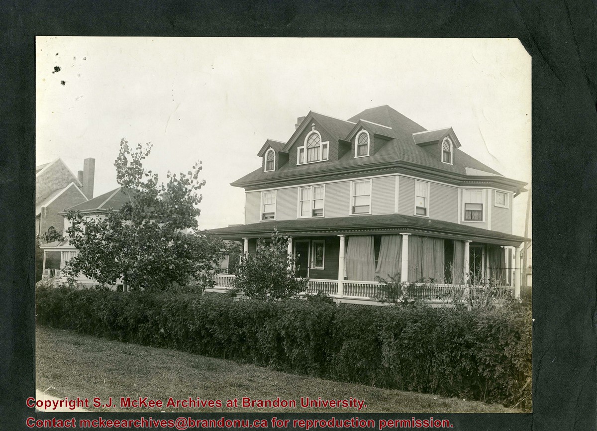
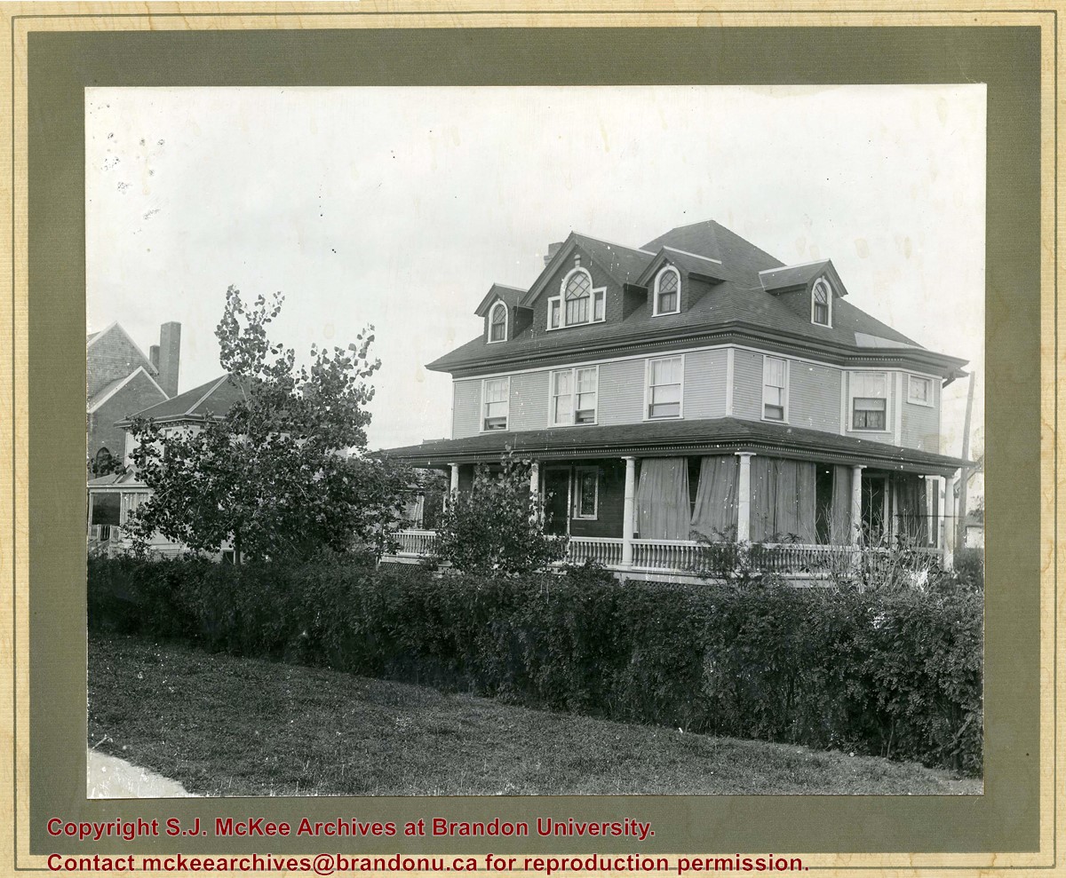
Photograph shows a three-storey wood framed house with a wrap-around porch, second storey bay window, and four gables.
Notes
Photograph is stamped on the back: Hughes & Co. Ltd., 1009 Princess Ave., Brandon, Man. Location has been identified as the southwest side of 10th Street.
Photograph shows Western Motors Ltd. on the southwest corner of 10th Street and Princess Avenue. To the west of the car dealership/garage is the Greyhound Bus Station and its Maxwell House Cafe as well as the court house.
The idea of the Keystone Centre was first mentioned in 1958, at a meeting of the board of directors of the Manitoba Winter Fair. The Manitoba Winter Fair wanted a new facility because the old Wheat City Arena had a leaking roof and a deteriorating west wall. The old facility also had limited space and the Winter Fair felt it needed more space for expansion. The Provincial Exhibition of Manitoba also had problems with their facilities, such as old barns and poor display areas. The idea of the Keystone Centre was put on hold until 1969, when the boards of the Provincial Exhibition and the Manitoba Winter Fair joined together as the Provincial Exhibition Association of Manitoba and the Wheat City Arena was sold and demolished. The original estimate for the cost of the Keystone Centre facilities was $4.5 million and funding would be proportioned so that the federal and provincial governments would each put in one-third of the money, with the rest coming from local donations. The financial campaign for the Keystone Centre began in 1970, and construction began in November 1970. The grand opening of the Centre was in March 1973, and coincided with the Royal Manitoba Winter Fair of that year.
Custodial History
This fonds was accessioned by the McKee Archives in 1998. Prior custodial history is unknown.
Scope and Content
Fonds contains many folders full of correspondence, financial statements, meeting minutes and other documents relating to the development and construction of the Keystone Centre from 1970-1974, including those from the Keystone Executive Committee, as well as the Building Committee. Fonds also contains one folder that pertains to the Brandon Area Agricultural Development Survey from 1959. This folder contains the names and locations of all farmers in the Brandon area in 1959. The Brandon Area Agricultural Development Survey was created in 1959, in order to make farming in the Brandon area more profitable. The survey was aided by Doane Agricultural Service from St. Louis, Missouri, who had success creating agricultural development programs in the United States. Fonds also contains folders from the Provincial Exhibition with correspondence, pamphlets, estimates, and studies from the 1960's. There is also one folder belonging to the Manitoba Winter Fair, which contains correspondence and financial statements relating to the Wheat City Arena. Fonds also contains information pertaining to the proposals made in the 1960's, for the building of the Keystone Centre, as well as one folder about the Keystone campaign from 1970-73. There is also one folder about the opening of the Keystone Centre, which contains newspaper clippings and guest lists. Finally, the fonds contains information about a court case involving Albert Bobyk and Robert Stewart. Stewart was the project manager for the Building Committee and Bobyk worked on the Keystone Center. The fonds includes a report about the trial of the two men who were charged with fraud involving their work on the Keystone Centre.
Photograph shows the west side of the 200-block on 10th Street. Visible businesses include: Chamber of Commerce Tourist Information, Dominion Tire & Radio Co., Bonnie's Bonnet Shop, Steve's Grill, Wally's Taxi, and Western Motors Ltd. The painted advertisement for Doig, Rankin and Robertson is visible on the Alexandra Block. Christmas ornaments are displayed from light standards and include Santa Claus and a Christmas elf.
Photograph shows the west side of the 200-block on 10th Street. Visible businesses include: Chamber of Commerce Tourist Information, Dominion Tire & Radio Co., Steve's Grill, Wally's Taxi, and the garage entrances to Western Motors Ltd. A Santa Claus Christmas ornament is displayed from a light standard.
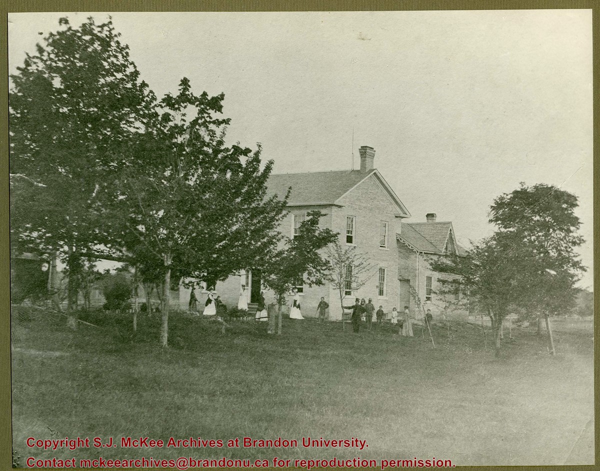
Photograph shows a group of 14 individuals scattered throughout a yard of a two-storey brick home with an extension. An elderly woman can be seen a wheelchair. Four women are wearing white gowns with long sleeves.
Notes
Writing on the front corner of the photograph reads: 1868
Photograph shows a two-storey wood-framed duplex. The building appears to be situated on a corner. The front verandas have wooden ornamentation and a lattice fence separates the front yards. Flowers and viriginia creeper appear in flower beds along the side of one house.
Notes
The location has been identified as the 7th Street Terrace between Lorne and Louise Avenues.
Photograph is scratche and scuffed. Top right corner is creased.
Scope and Content
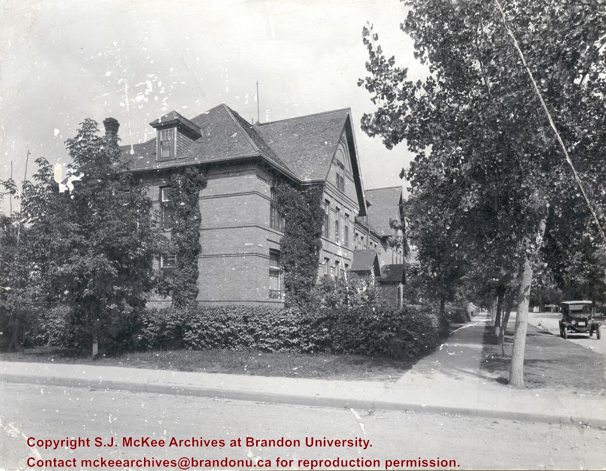
Photograph shows the three storey brick terraced property at 12th Street and Lorne Avenue. The entrance/stoop on the west side of the property appears to have been removed and the Lorne Street entrances have been modified (see 3-1997.72 for a comparison). Ivy is growing up the side of the house and the tree on the boulevard have grown and tower above the roof-line. A motor car is parked on Lorne Avenue in front the property.
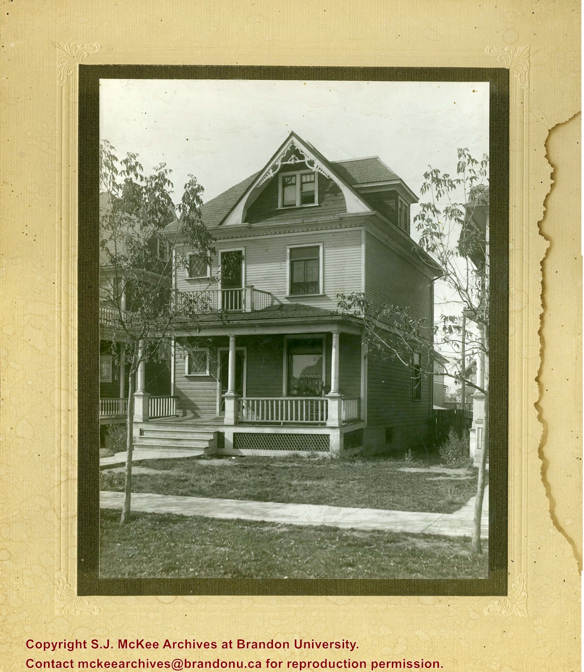
Photograph shows a three-storey wood framed house with a front porch, second storey balcony, and third-storey gable and dormer winder. Saplings have been planted on the boulevard.
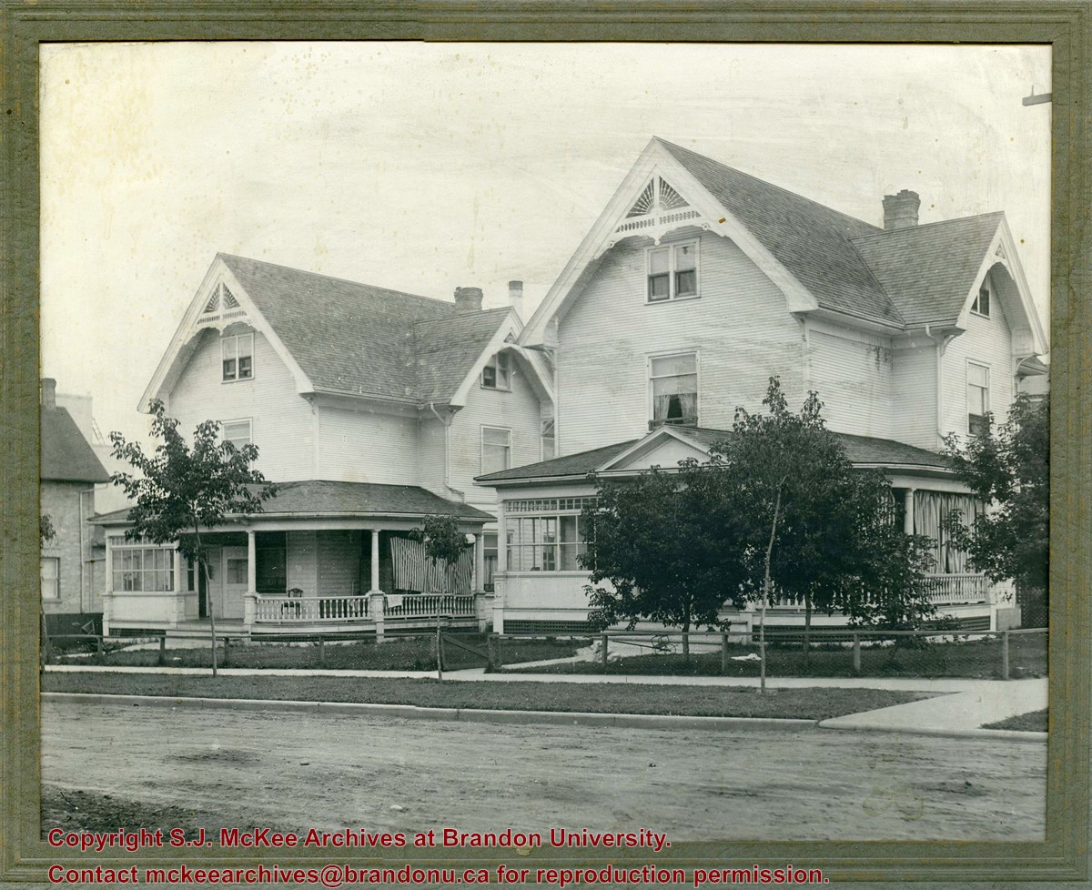
Photograph shows a two identical wood-framed homes. Both homes are three-stories, with wrap-around porches with a glassed-in sunroom and two gables with wooden sunburst ornamentation. The property on the right has curtains hanging in the porch, the other property has a striped blanket to block the sun. The properties are surrounded by a low chain-link/chicken wire-like fence with wooden posts. Saplings and grass have been planted on the boulevard in front of the properties. The road in front of the houses appears to be unpaved, while the curbs and sidewalks and appear to be concrete.
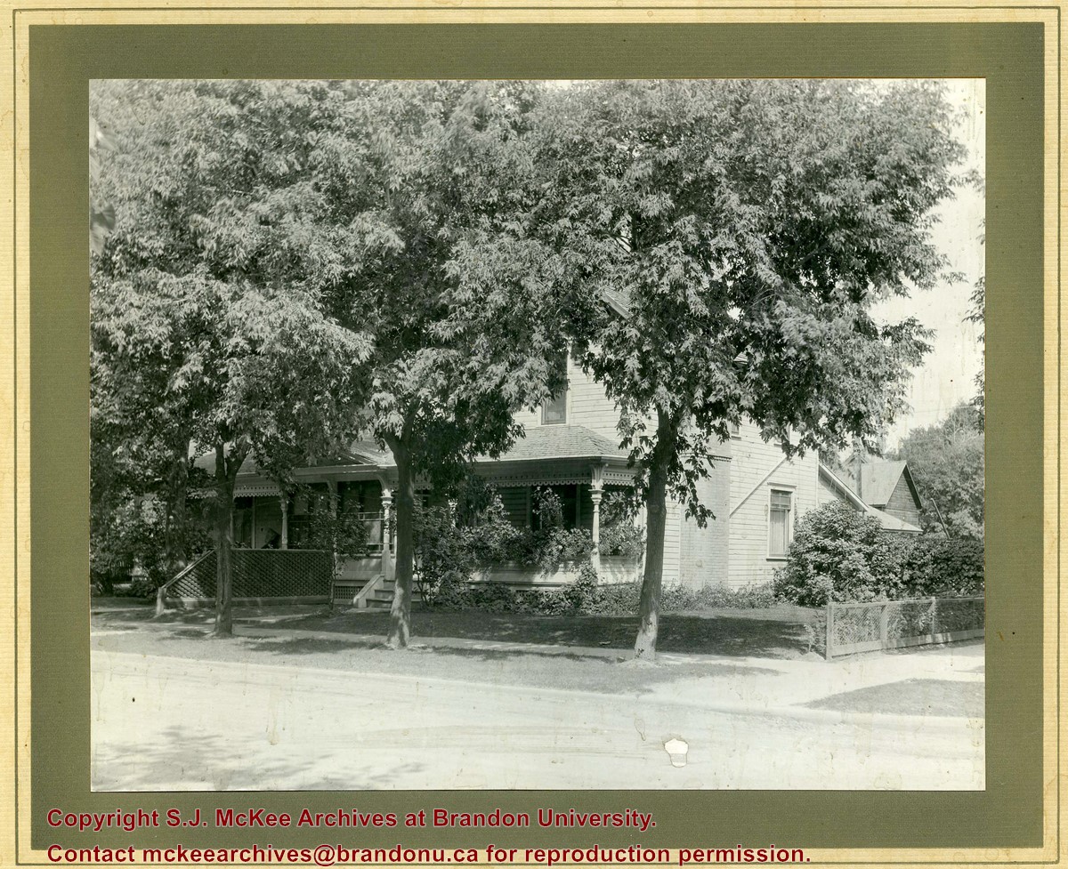
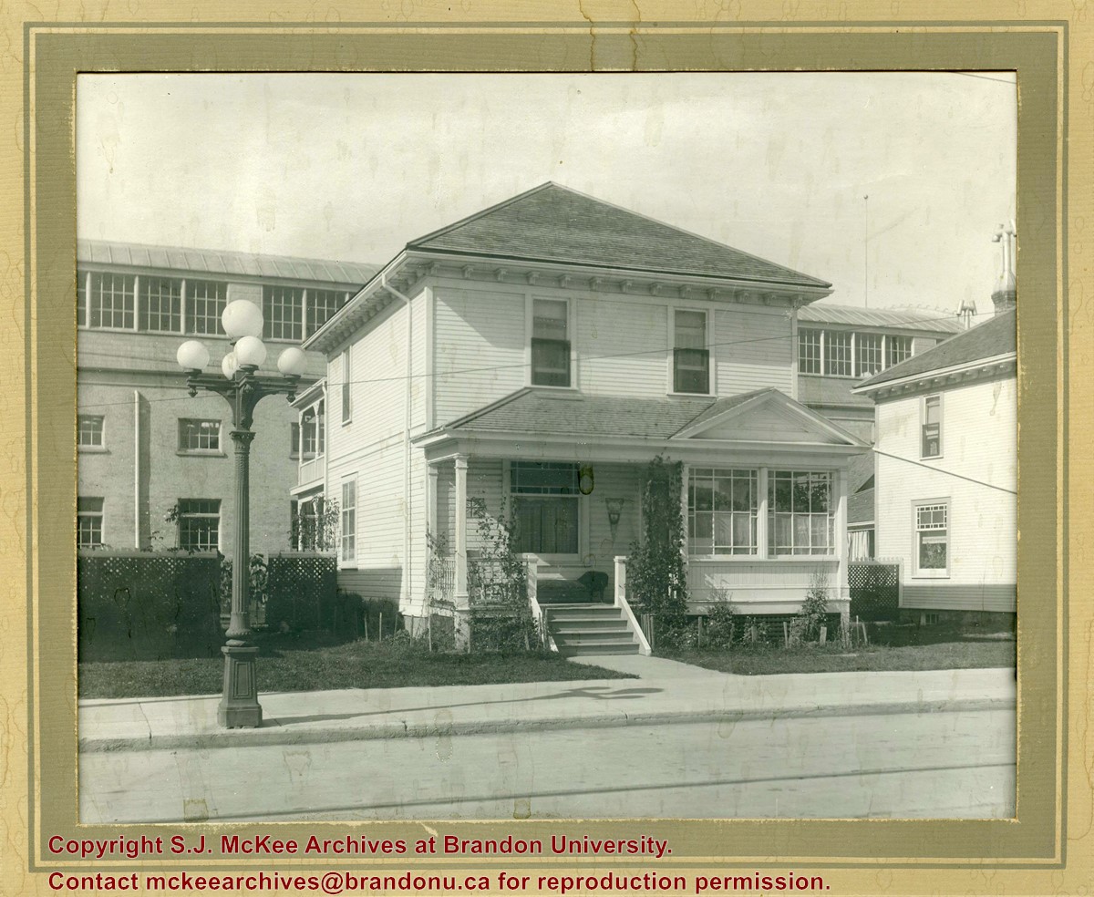
Photograph shows a two-storey wood-framed house with front porch and sunroom. Above a rocking chair and chez lounge, a Union Jack and pennant hang on the exterior wall on the porch. A five-globed black iron street lamp is on the sidewalk in front of the property. The Wheat City Arena can be seen behind the residence.
Notes
Based on the presence of the arena, the location has been identified as 10th Street near Victoria Avenue.
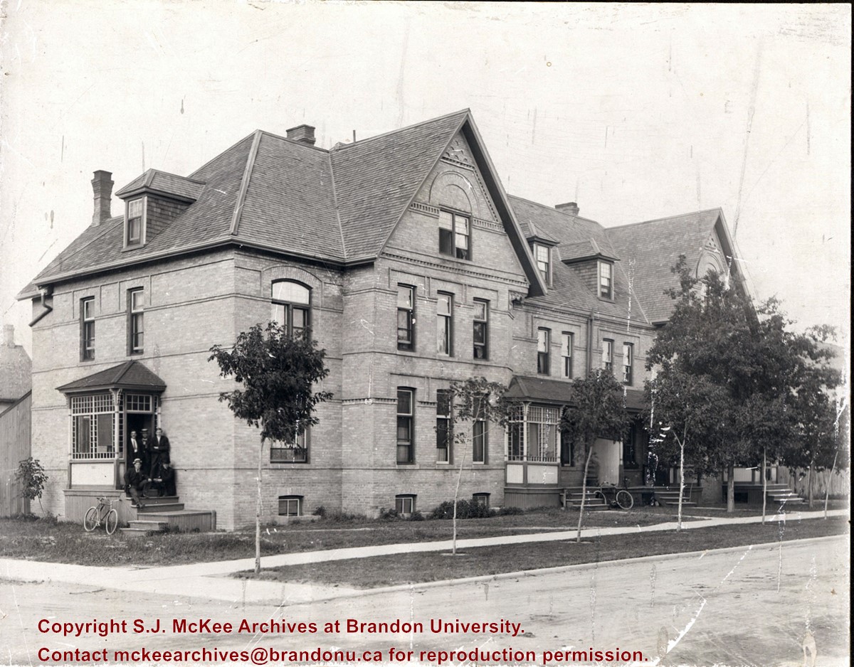
Photograph shows a three-storey multi-family brick house that appears to have at least four units. The structure also has a basement. A group of five men are posing on a stoop on the west side of the building. Sapplings have been planted on the boulevard in front the building.
Notes
Writing on the back of the photograph reads: Lorne Terrace, 12th and Lorne, always in the Hughes Family.
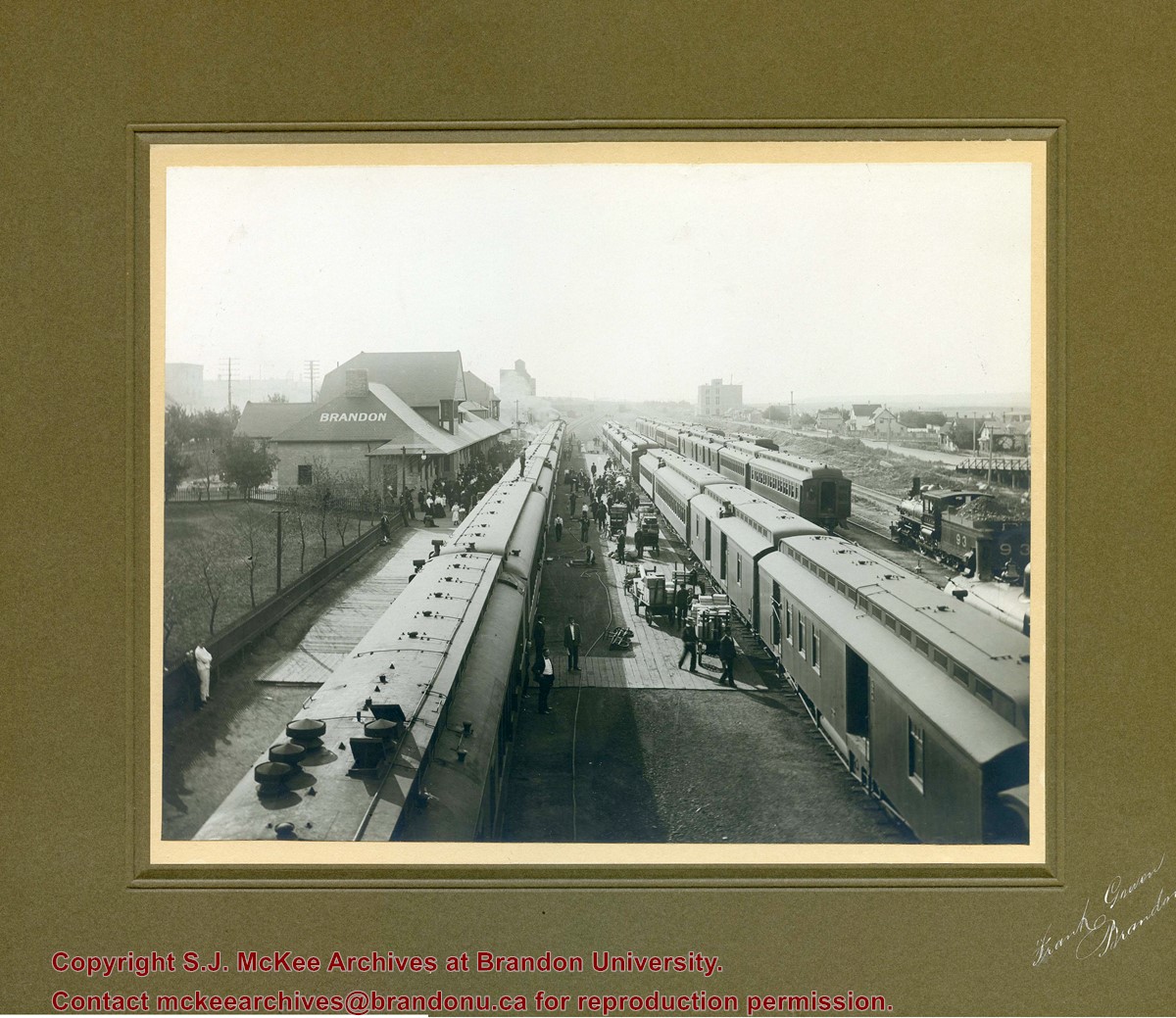
Photograph shows a CPR passenger trains at the old Brandon train station. Carts/trolleys appear to be loaded with wooden crates and metal milk containers. Photograph was likely taken from the 8th Street Bridge. The ramp to the 8th Street Bridge can be seen on the ride of the photograph, where residences line Assiniboine Avenue.
Item is a portrait of men from the Rivers area who attended a meeting or workshop facilitated by Reg Forbes, Principal of the Agricultural Extension Centre in Brandon, MB. Some of the men in the photo are John Dick, Tommy Seens, Roy Murrey, Reed Spearn and Reg Forbes.
Photograph shows Ted Heming Jewellers on the east side of 10th Street, Brandon, Manitoba, with the Strand Theatre to the south of the building complex. Other visible businesses in the Strand Block include: Hughes & Co. Ltd., Smart's Stationery, Waddell's, and Metropolitan Life.
Notes
Photograph dated from "Gidget," the movie playing at the Strand Theatre
Photograph shows the Strand Block on the east side of 10th Street, Brandon, Manitoba. Visible businesses in the Strand Block include: Hughes & Co. Ltd., Smart's Stationery, Waddell's, the Strand Theatre, and Metropolitan Life.
Notes
Back of the photograph is stamped: Clark Smith Studio, per July 27/59


)