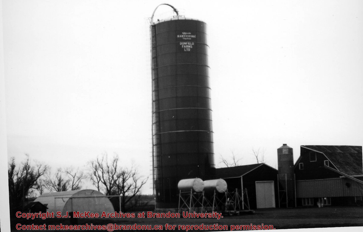
For custodial history see the collection level description of the Lawrence Stuckey collection.
Scope and Content
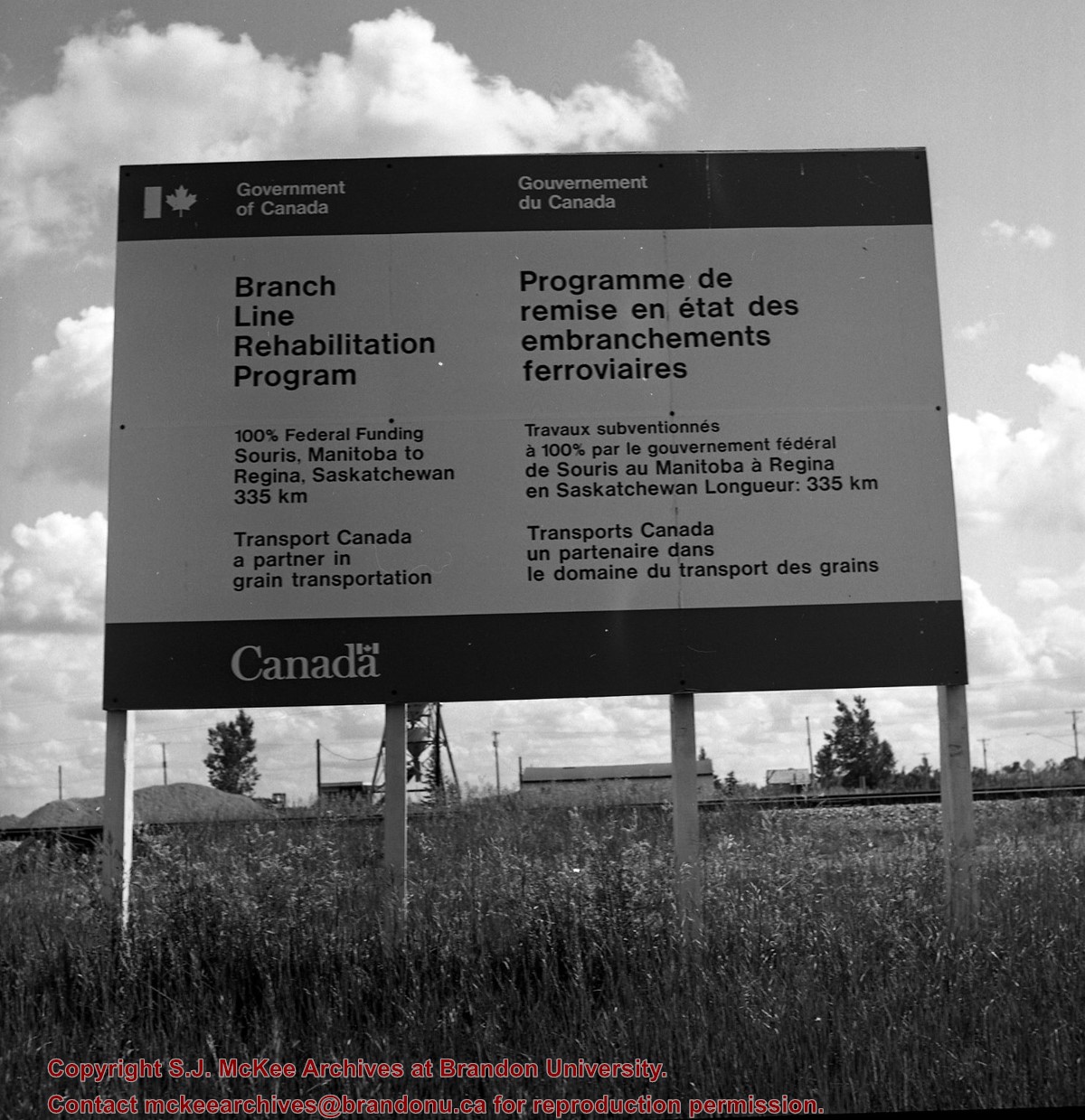
Image of a Prairie Branchline Rehabilitation Sign near Reston, Manitoba. Image was taken along the CPR lines south of the mainline.
Notes
[Image is of a Government of Canada sign which reads: Branch Line Rehabilitation Program. 100% federal funding. Souris, Manitoba to Regina Saskatchewan 335 km. Transport Canada, a partner in grain transportation].
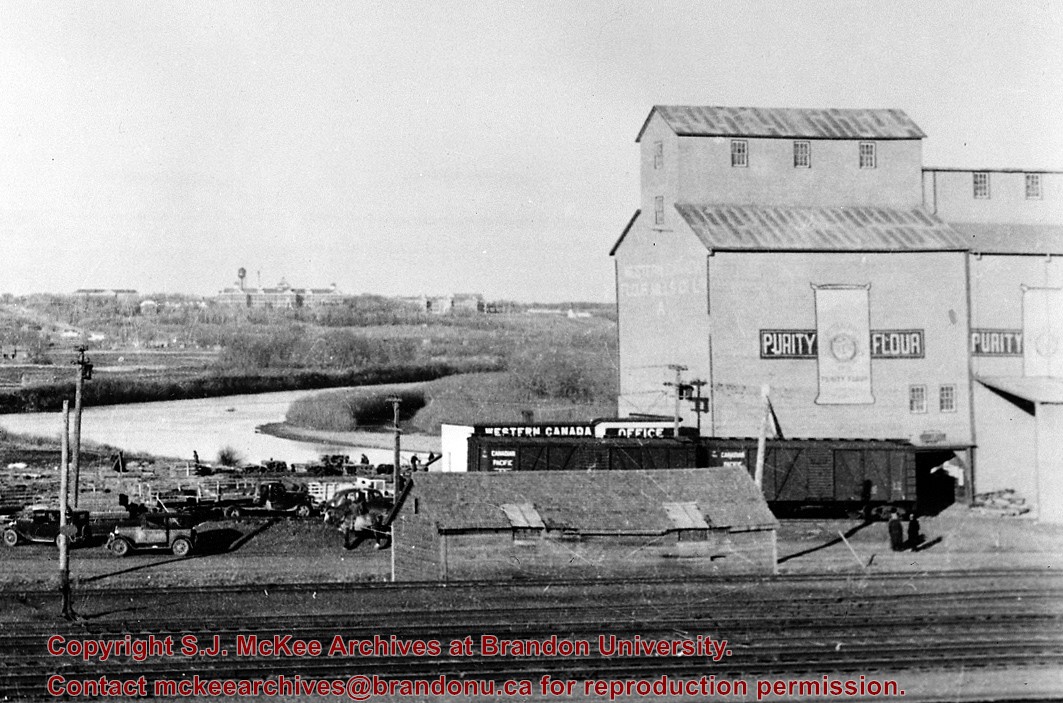
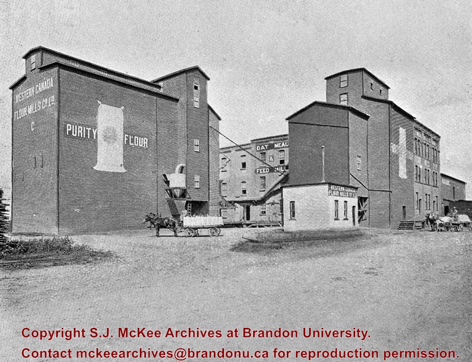
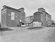
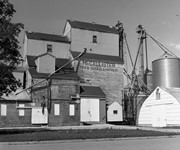
Photograph is looking northeast and shows the Western Canada Flour Mill Co. Ltd. complex (purity flour, oat meal, feed) and a couple of horse drawn carts.
Notes
Corresponds with negative 1-2002.3.9.H4.
Repro Restriction
The McKee Archives is the copyright holder for the Stuckey materials.
For custodial history see the collection level description of the Lawrence Stuckey collection.
Scope and Content
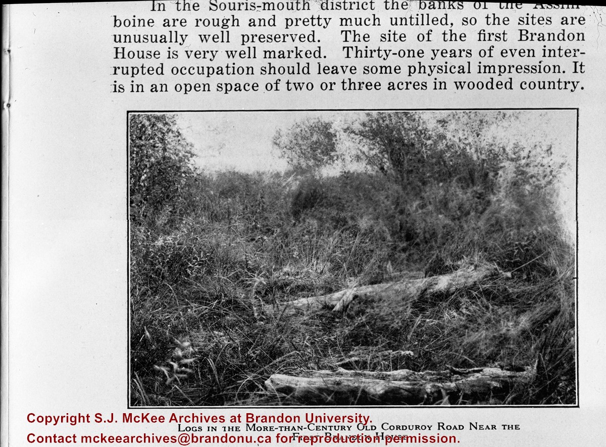
Image of corduroy road, Brandon House.
Notes
[Brandon SE includes communities south of Trans-Canada #1 highway and east of PTH #10.] [Caption on the image itself reads: "Logs in the more-than-century old corduroy road near the first Brandon House"]. [Additional information on the image itself reads: "In the Souris-mouth district the banks of the Assiniboine are rough and pretty much untilled, so the sites are unusually well preserved. The site of the first Brandon House is very well marked. Thirty-one years of even interrupted occupation should leave some physical impression. It is in an open space of two or three acres in wooded country."]


.jpg?width=1200&404=no-img.jpg&watermark=wmk)
.jpg?width=180&404=no-img.jpg)
.jpg?width=1200&404=no-img.jpg&watermark=wmk)
.jpg?width=180&404=no-img.jpg)
.jpg?width=1200&404=no-img.jpg&watermark=wmk)
.jpg?width=180&404=no-img.jpg)


.jpg%3fmaxheight%3d1000%26maxwidth%3d1000%26watermark%3dwmk&description=Simplot+Canada+Ltd.)
.jpg%3fmaxheight%3d1000%26maxwidth%3d1000%26watermark%3dwmk&description=Metev+Woolen+Mills+Ltd.)
.jpg%3fmaxheight%3d1000%26maxwidth%3d1000%26watermark%3dwmk&description=Metev+Woolen+Mills+Ltd.)