The high biodiversity and evidence of pre-Europeon contact prompted the decision to test the Crepeele locale. The survey was named in recognition of the Casselman family, the original landowners.
Archaeological testing began in the Crepeele locale in May 2003 on property now owned by the Crepeele family. The locale covers over 6 sections or approximately 3,800 acres of land in an area of stabilized sand dunes and wetlands covered with mixed forest and prairie grass. Given the terrain, the size of the crew and time constrains, an area of approximately 60 acres was chosen for the survey. The survey used the established archaeological methodology of walking the selected area and using a shovel test surveyed grid. The use of GIS technology to locate the exact test spot and record the information into a GIS database was a significant advance and was one of the advantages of the integration of multi-disciplinary techniques encouraged by the SCAPE project. Over one half of the test pits resulted in the recovery of cultural materials. The results of the Casselman survey indicated several areas for further examination including areas that became the Crepeele, Sarah and Graham sites.
Scope and Content
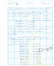
Sub sub series has been divided into five sub sub sub series including: (1) Summary information; (2) Field journals; (3) Site records; (4) Artifact catalogues; and (5) Photographs.
The Atkinson site was named for the landowners Ken and Karen Atkinson who were very helpful to the archaeology and geoarchaeology crews that worked at the site. Their support made the project possible.
The Atkinson site story begins with the discovery of a charcoal lens eroding from the north bank of the Souris River in the summer of 2002. Study of Cultural Adaptations on the Prairie Ecozone (SCAPE) project geoarchaeologist Dr. Garry Running was exploring the stratigraphic layering in the bank when he noted the lens and reported it to Dr. Bev Nicholson. Upon closer examination, a tiny pressure flake was observed on the lens exposure and it was decided to collect a charcoal sample for radiocarbon dating.
The resulting date of 5250B.P cal. 4225 B.C. placed the site in the early Archaic period. A second date on bone collagen of 5580B.P. cal. 4500 B.C. confirmed the earlier date and gave an averaged date of circa 4400 B.C or 6,500 years ago.
The Atkinson site is one of the oldest excavated sites in Manitoba. Based on the date of the site and the kind of lithics (stone tools) present it is considered a Gowen occupation. The Atkinson site is evidence that bison hunters were active on the northern plains at a very early date. Similar sites have also been found on the High Plains in the U.S. and are referred to as the Mummy Cave Complex.
The Atkinson Site is of great importance as it is the first undisturbed site of this type to be excavated in Manitoba and extends the range of these sites south and east from the type-sites in central Saskatchewan. Based on the date and sample evidence further excavations were conducted by Dr. Nicholson's team. in 2003, 2004 and 2006.
Scope and Content
Sub series has been divided into three sub sub series including: (1) Atkinson 2003, (2) Atkinson 2004; (3) Atkinson 2006