The Atkinson site was named for the landowners Ken and Karen Atkinson who were very helpful to the archaeology and geoarchaeology crews that worked at the site. Their support made the project possible.
The Atkinson site story begins with the discovery of a charcoal lens eroding from the north bank of the Souris River in the summer of 2002. Study of Cultural Adaptations on the Prairie Ecozone (SCAPE) project geoarchaeologist Dr. Garry Running was exploring the stratigraphic layering in the bank when he noted the lens and reported it to Dr. Bev Nicholson. Upon closer examination, a tiny pressure flake was observed on the lens exposure and it was decided to collect a charcoal sample for radiocarbon dating.
The resulting date of 5250B.P cal. 4225 B.C. placed the site in the early Archaic period. A second date on bone collagen of 5580B.P. cal. 4500 B.C. confirmed the earlier date and gave an averaged date of circa 4400 B.C or 6,500 years ago.
The Atkinson site is one of the oldest excavated sites in Manitoba. Based on the date of the site and the kind of lithics (stone tools) present it is considered a Gowen occupation. The Atkinson site is evidence that bison hunters were active on the northern plains at a very early date. Similar sites have also been found on the High Plains in the U.S. and are referred to as the Mummy Cave Complex.
The Atkinson Site is of great importance as it is the first undisturbed site of this type to be excavated in Manitoba and extends the range of these sites south and east from the type-sites in central Saskatchewan. Based on the date and sample evidence further excavations were conducted by Dr. Nicholson's team. in 2003, 2004 and 2006.
Scope and Content
Sub series has been divided into three sub sub series including: (1) Atkinson 2003, (2) Atkinson 2004; (3) Atkinson 2006
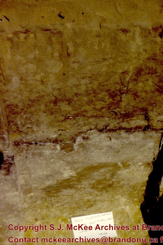
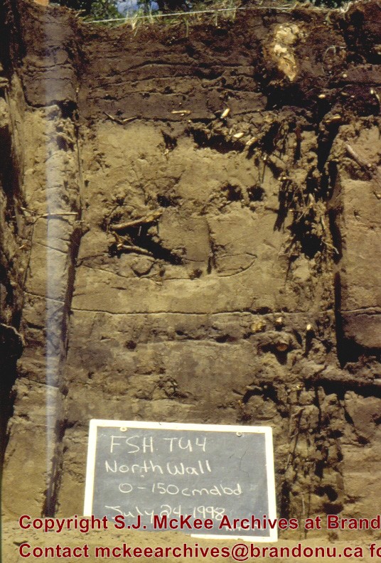
Flintstone Hill is located on the north bank of the Souris River. It is a deeply stratified lacustrine, fluvial and aeolian soil profile that has been exposed by the river through stream-bank erosion. This section is thought to be the most complete middle to late Holocene exposure on the northeastern plains. While the value of the site is primarily for paleo-environmental research and reconstruction, cultural deposits have been identified at the site. Local collectors have picked up lithic materials as they eroded out of the bank for the past several decades and it was they who had named the site. Mr. Bruce Timms from Lauder first drew the Flintstone Hill site to the attention of Dr. Nicholson of Brandon University.
During the mid 1990’s to the early 2000’s archaeological testing took place on Flintstone Hill. In 1998, an archaeological field crew dug a series of overlapping trenches down the slope of the profile and produced a schematic drawing. A peat layer at the bottom of this profile, dated from the top at 9,400 RCY and at the bottom to 10,400 RCY, has provided details of marsh plant and insect communities at this time.
Subsequent archaeological investigations at the site recovered several cultural deposits including: a hearth dating to 3250+/-70 R.C.Y. (BETA 109529); a butchered atlas bone 4090+/-70 R.C.Y. (BETA 109990); and bone fragments accompanied by Swan River Chert and Knife River Flint lithic flakes 5350+/-50 (BETA 109530). While no diagnostic tools were recovered, these dates suggest that this occupation, which is contemporary with the Atkinson site, may be a Gowen occupation.
Extensive paleo-environmental research has been conducted at the site. Dr. Running, a geomorphologist from the University of Wisconsin – Eau Claire, participated in the Study of Cultural Adaptations in the Prairie Ecozone (SCAPE) Project and he and his students tested the site for several years. He was joined in this effort by Dr. Havholm, Dr. Boyd, Dr. Wiseman, Dr. Beaudoin, and other SCAPE researchers in the interpretation of the paleo-environment of the Glacial Lake Hind basin. The following article is recommended reading.
Running, Garry L., Karen G. Havholm, Matt Boyd and Dion J. Wiseman
2002 Holocene Stratigraphy and Geomorphology of Flintstone Hill, Lauder Sandhills, Glacial Lake Hind Basin, Southwestern Manitoba. Geographie Physique et Quaternaire
56(2-3):291-303.
Scope and Content
Sub series has been divided into two sub sub series including: (1) Flintstone Hill 1997 (2) Flintstone Hill 1998-2000
Introduction
Information on archaeological materials in this locale first came to the attention of Dr. Nicholson through Doug Jackson, a local artifact collector from Souris. Doug had observed archaeological materials that included bone, ceramics and lithic material that had been exposed by municipal road building activity, northwest of Lauder Manitoba
Environment
The Makotchi-Ded Dontipi locale is located among stabilized sand dunes in the Lauder Sandhills in Southwestern Manitoba, northwest of the village of Lauder. The area is a mosaic of medium grass prairie and copses of aspen poplar and aspen-oak, together with intermittent sedge grass marshes and small ponds. These wetlands are bordered with balsam poplar, water birch, willows and red osier dogwood.
The well-drained upland forest also contains saskatoon, chokecherry, wild current, hazelnut bushes and occasional wild plums. Lowland areas have nannyberries and high-bush cranberry. Wild strawberries grow in lightly shaded areas along trail margins and in open patches in aspen forest.
History of Excavations
The Makotchi-Ded Dontipi locale is a virtual "island" of forest and marshlands in a vast expanse of mixed grass prairie. This archaeologically and environmentally rich area was given the Dakota name Makotchi-Ded Dontipi, meaning "the place where we live".
Summation
Prior to European settlement, the area was a rich environment for hunter-gatherer people. Archaeological investigations from 1992 to 2002 have revealed numerous sites within the locale. Some of these sites have been extensively excavated while others have been identified or tested.
Seven sites that have been identified in this locale range in age from the historic through protohistoric periods and extend into the middle precontact period. The major sites are the initial Middle Missouri Duthie site, the late precontact Jackson, Bradshaw sites and the protohistoric Twin Fawns, Schuddemat and Hollow B sites. The multi-component Vera site includes historic Métis, late precontact Vickers Focus, and middle precontact Besant, Pelican Lake, McKean Complex and Oxbow occupations. Over 230 units were excavated as well as numerous test pits and several extensive surveys.
Scope and Content
Scope and Content
The Series has been divided into seven sub-series, including (1) Duthie site (2) Jackson site (3) Twin Fawns site (4) Vera site (5) Schuddemat site (6) Bradshaw site (7) Hollow B site.
Field journals have been scanned in multi-page PDF files. Artifact catalogues are PDF files in spreadsheet format. Photographs are in jpeg format.
History / Biographical
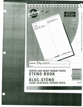
Based on the results of the testing in 2002 and the radiocarbon date of 6,500 years before present, further excavation was warranted at the Atkinson site. In 2003 Field Chief Holly Alston and crew Shayne Kolesar and Andrea Richards opened a 42m test excavation (units 1 - 4) that included the hearth area.
The site area was covered with a huge sand dune that was slowly sliding into the river as the supporting bank eroded away. As the dune was removed a late woodland camp was found at the dune interface and a large chunk of charcoal dated this occupation to 440+/-60 B.P. cal.1440A.D. This indicated that the dune was a relatively late incursion over the site. This occupation is likely connected to subsequent testing to the east in 2005 that came to be known as Atkinson II.
Methodology:
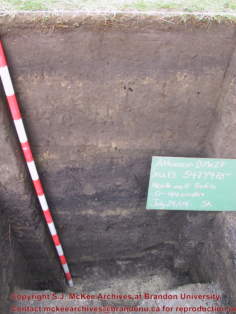
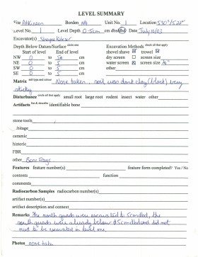
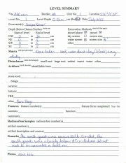
The crew began shovel shaving the upper strata with the intention of establishing an arbitrary datum when artifacts were encountered or when a level 25cm above the hearth was reached. At 25cm above the hearth an arbitrary surface datum was established and excavation in 5cm levels began. The overbank deposited matrix was a dense, compacted silt clay and it was necessary to soak the excavated materials in buckets and then water screen the material with a high pressure pump over ¼ inch hardware cloth.
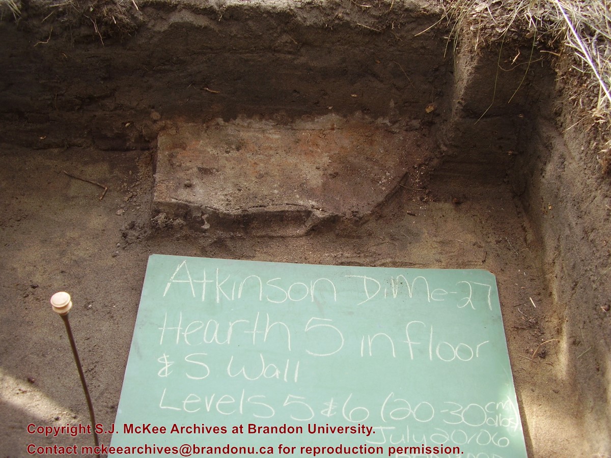
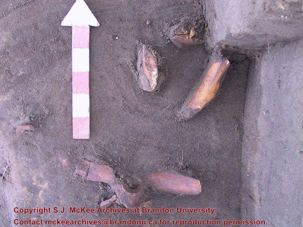
Lithic flakes were found at 10cm below datum, above the hearth level. In the next level, large bone, a broken projectile point and additional flakes were found. Increasing amounts of bone and lithic flakes were found as the excavation continued through levels 3 to 5. The top of the hearth was identified at 28cm below datum, below a 2cm layer of well-sorted sand. This sand layer was confined to a small area directly overlying the hearth. It was considered to be a deliberate quenching of the hearth.
After the conclusion of excavating level 6 the hearth was profiled and photographed. The charcoal and ash layer of the hearth was shown to be directly below the sand layer. Levels 6 and 7 revealed a bison bone bed that was consistent with primary and secondary butchering including elements from the vertebral column and appendicular skeleton. Two additional Gowen (Mummy Cave Series) projectile points were also recovered adjacent to the hearth. Level 8 continued to produce larger amounts of bone and many lithic flakes. Level 9 produced a few bone fragments and a small number of lithic flakes. At the conclusion of the excavations, the crew shoveled sand down from the dune to protect the site over winter and through any subsequent spring flooding.
Scope and Content
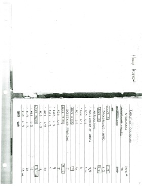
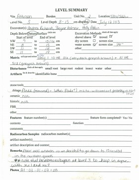
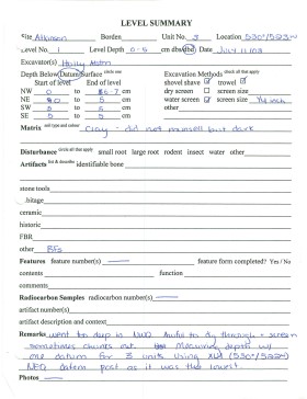
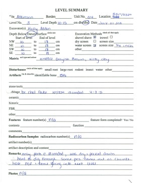
Sub-sub-sub series contains: Summary information of field methology, number and co-ordinates of excavations, personnel and their staff position; Field journals are daily records of recoveries, features and activities at the site; Site records include excavation level and unit summaries, feature sheets, profiles; sample records and maps; Artifact catalogues are lists and identifications of all artifacts recovered; Photographs are of excavation units, features, the landscape and personnel.
Record of excavation unit 1 at the Atkinson site 2003.
Scope and Content
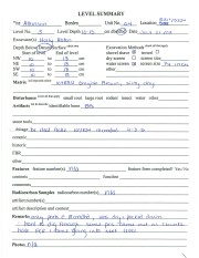
Site excavation records of excavation units may include: level summaries, floor plans, feature sheets, wall profiles, unit summaries and any other additional information relating to the unit.
Record of excavation unit 2 at the Atkinson site 2003.
Scope and Content
Site excavation records of excavation units may include: level summaries, floor plans, feature sheets, wall profiles, unit summaries and any other additional information relating to the unit.
Record of excavation unit 3 at the Atkinson site 2003.
Scope and Content
Site excavation records of excavation units may include: level summaries, floor plans, feature sheets, wall profiles, unit summaries and any other additional information relating to the unit.
Record of excavation unit 4 at the Atkinson site 2003.
Scope and Content
Site excavation records of excavation units may include: level summaries, floor plans, feature sheets, wall profiles, unit summaries and any other additional information relating to the unit.


.jpg?width=1200&404=no-img.jpg&watermark=wmk)
.jpg?width=180&404=no-img.jpg)


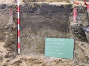
.jpg%3fmaxheight%3d1000%26maxwidth%3d1000%26watermark%3dwmk&description=Flintstone+Hill+1998-2000+-+Test+Unit+5+north+profile)