The John R. Brodie Science Centre was completed in 1971, with the official opening on May 7, 1972. It is located in the southeast corner of the campus and houses the Faculty of Science. The Brodie Building was named for John R. Brodie, a Brandon man who donated $250,000 to Brandon College in 1963 with the stipulation that the money be used for a Science Centre.
Scope and Content
Sub-series consists of photographs of the John R. Brodie Science Centre.
Notes
Additional biographical information on John R. Brodie is available in his bio file in the Reading Room.
View is southeast and was probably taken from the roof of McMaster Hall. Photograph shows the greenhouse situated on top of the John R. Brodie Science Centre.
See fonds level of the CKX records for custodial history.
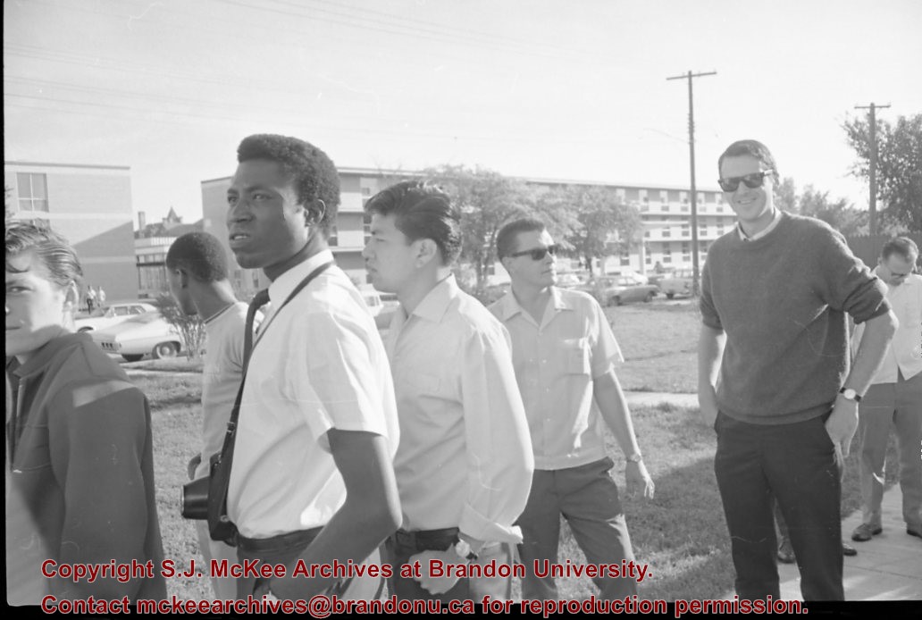
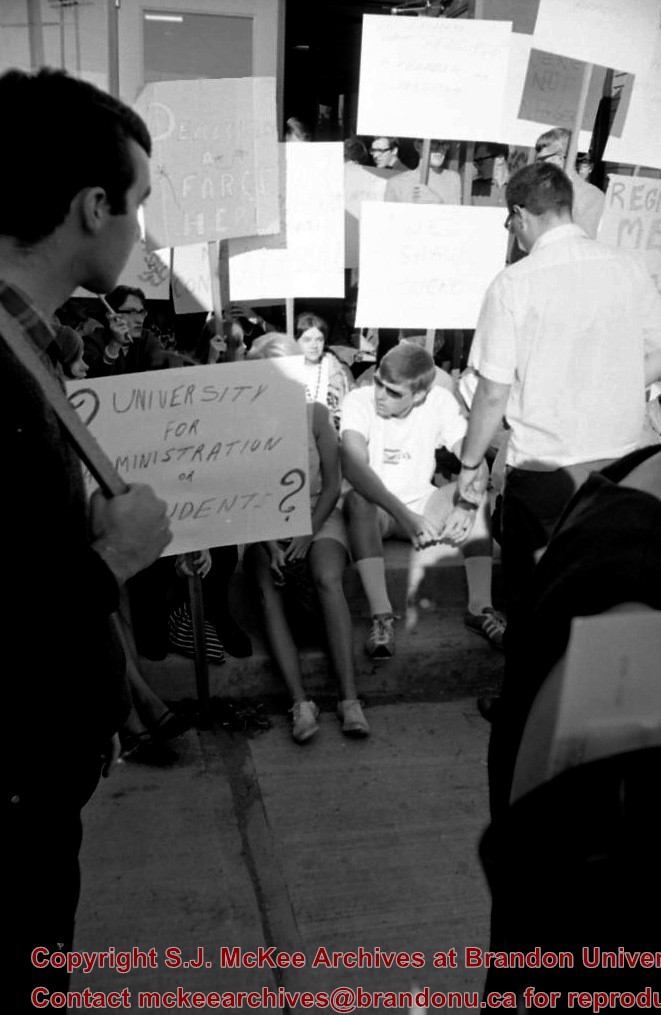
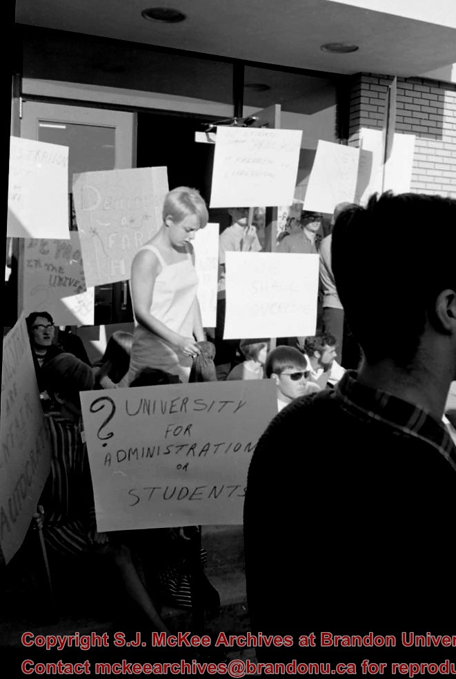
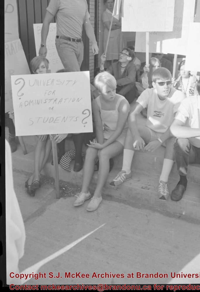
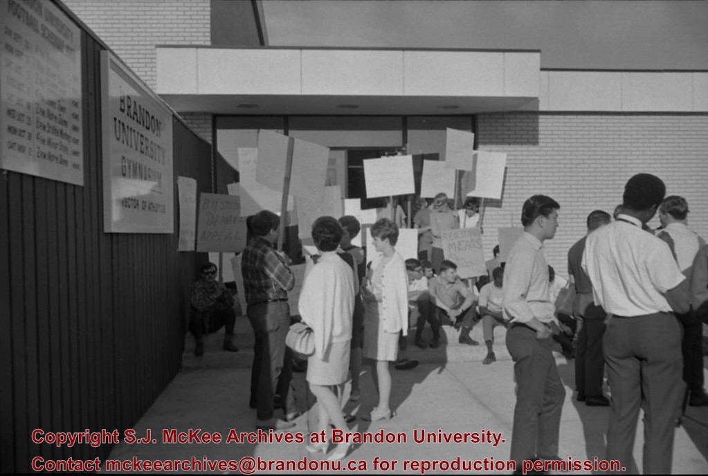
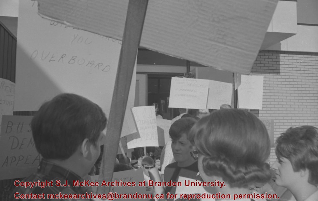
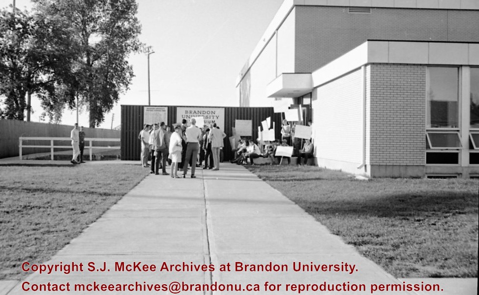
Scope and Content
Image of protesters outside the Gymnasium taken during the Brandon University rampage. Darrach Hall and Flora Cowan Hall are visible in the background.
The Jeff Umphrey Memorial Centre was completed in 1970 and is located on the north side of Victoria Avenue and 20th Street. Campus Books was located in the basement of the Umphrey Centre from 1970 to 1978. Once Campus Books moved to the lower McMaster Concourse, the University Archives occupied the basement from 1981 to 1997. A branch of the Bank of Montreal was located on the west side of the building until c. 2006 when the Department of Fine Arts moved into the Umphrey Centre and the Glen P. Sutherland Gallery was constructed on the main floor.
Scope and Content
Sub-series consists of photographs of the Jeff Umphrey Memorial Centre and the various University organizations that have operated out of the Centre.
View is southwest from approximately 18th Street and Lorne Avenue. Photograph shows the Brandon University campus in winter, including: the Brandon University sign, the John R. Brodie Science Centre, the Citizens' Science Building and McMaster Hall.
View is southwest from the north side of Princess Avenue. Photograph shows the original Music Building, the north driveway entrance and parts of Clark Hall and the Brandon College building.
View is southwest from the sidewalk on the west side of 18th Street. Photograph shows the Brandon University sign, the front lawn, the Citizens' Science Building, McMaster Hall and the John R. Brodie Science Centre.
View is south from the north side of Princess Avenue. Photograph shows the walkway leading south across campus, the original Music Building, the A.E. McKenzie Building, the J.R.C. Evans Lecture Theatre, Flora Cowan Hall and Darrach Hall.
View is southwest from Princess Avenue. Photograph shows the original Music Building, the A.E. McKenzie Building, the J.R.C. Evans Lecture Theatre and Darrach Hall. Also visible are the field where the Western Manitoba Centennial Auditorium now stands, as well as a number of houses on 20th Street.
View is northeast fron the west side of the Dining Hall. Photograph shows portions of the J.R.C. Evans Lecture Theatre and the A.E. McKenzie Building, as well as an H-Hut, Clark Hall, the Brandon College Building and the quadrangle.
View is north from approximately the Citizens' Science Building. Photograph shows the driveway running in front of the Brandon College Building and Clark Hall, a number of cars and students along the driveway and the Education Building in the background.
View is south from the lawn in front of the Education Building and shows a student exiting the building. The driveway and John R. Brodie Science Centre are visible in the background.


