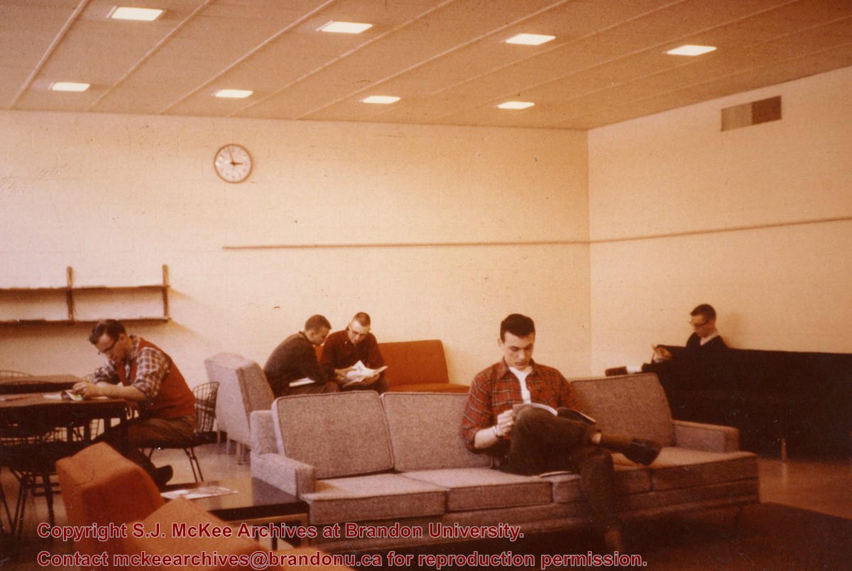
Photograph shows a number of students reading in the Men's Lounge in the A.E. McKenzie Building (Arts and Library Building). The lounge was located in the basement of the building.
Photograph is looking west southwest approximately from the driveway and shows one of the H-Huts. In this photograph the H-Hut was a science laboratory. It later became Student Services (c. 1980) and was removed from campus in the 1990s.
Notes
The H-Hut running north-south in the background beside the Citzens' Science Building was demolished c. 1987.
Photograph is looking west southwest approximately from the driveway and shows one of the H-Huts. In this photograph the H-Hut was a science laboratory. At one point it also housed the Geology Annex. It later became Student Services (c. 1980) and was removed from campus in the 1990s. McMaster Hall is in the background.
Brandon College looking south from 19th Street. Photograph was taken after Flora Cowan Hall was built but before construction of the Education Building.
Photograph is looking west from the east side of the driveway and shows the Continuing Education H-Hut, which was located between the Brandon College Building and the Citzens' Science Building.
The Student Services H-Hut was located between the Brandon College Building and the Citzens' Science Building. It was placed there c. 1950 and it was removed sometime in the 1990s. Originally the H-Hut in this photograph was the Geology Depatment, housing offices, classrooms and the lab.
Scope and Content
Photograph is looking west and shows the entrance to the Student Services H-Hut.
Notes
History/Bio information from Tom Mitchell and Harvey Young.
Image shows the Brandon College campus from 17th Street looking southwest. The photo was taken after the completion of the original Music Building in 1963, but construction of the Education Building. Also visible are a number of properties on the 200 block of 18th Street and the 200 block of 20th Street.
Image is looking east northeast from approximately the 300 block of 23rd Street between Lorne and Louise Avenues. Photograph shows the Brandon College campus after the opening of the original Music Building in 1963, but before the construction of the Education Building in 1966. A number of house on the 300 blocks of 22nd and 21st Streets are visible in the foreground, with the A.E. McKenzie Seed Co., the Prince Edward Hotel and various grain elevators on the horizon.
View is southwest from the roof of the George T. Richardson Centre. Photograph shows the curved glass wall of the John E. Robbins Library, the walkway between the Library and the Dining Hall, the Dining Hall and Darrach Hall.
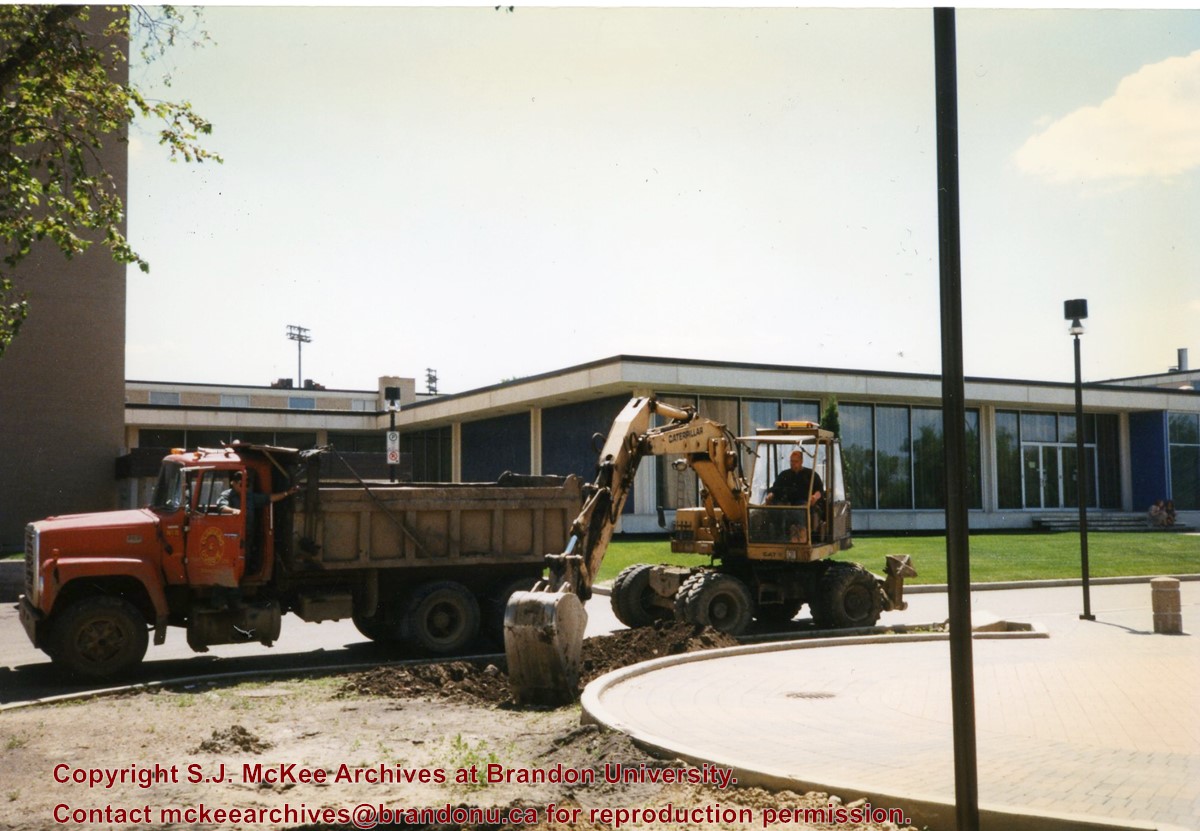
Photograph shows a backhoe and a dump truck on the north side of McMaster Hall during the landscaping of the flower bed on the southeast corner of the George T. Richardson Centre (John E. Robbins Library). The Dining Hall is in the background.
View is northwest from the roof of the John R. Brodie Science Centre. Photograph shows the roof of the Knowles Douglas Students' Union Centre, the Citizens' Science Building, and the Brandon College Building and Clark Hall during renovation.
View is north probably from the roof of McMaster Hall. Photograph shows the construction of the new roof on Clark Hall and the Brandon College Building.
View is north probably from the roof of McMaster Hall. Photograph shows the construction of the extension to Clark Hall and the skywalk. Also visible are the A.E. McKenzie Building, the Brandon College Building, the Education Building, the original Music Building and the Western Manitoba Centennial Auditorium, as well as the walkway that runs north between the buildings and the courtyard.
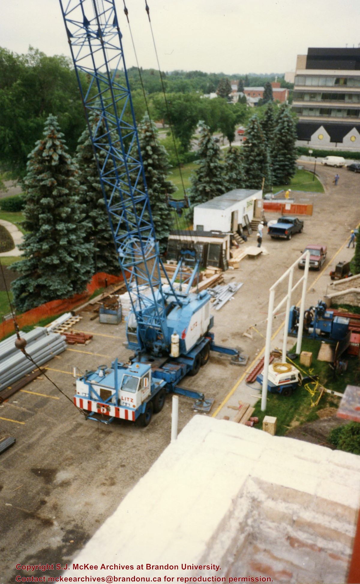
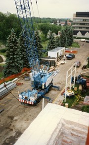
View is southeast from Clark Hall. Photograph shows a large crane, building materials and machines and the construction trailer (Bird Construction) on the driveway during the restoration of Clark Hall and the Brandon College Building. Portions of the front lawn, the John R. Brodie Science Centre and the Knowles Douglas Students' Union Centre are also visible. In the distance is Knox United Church.
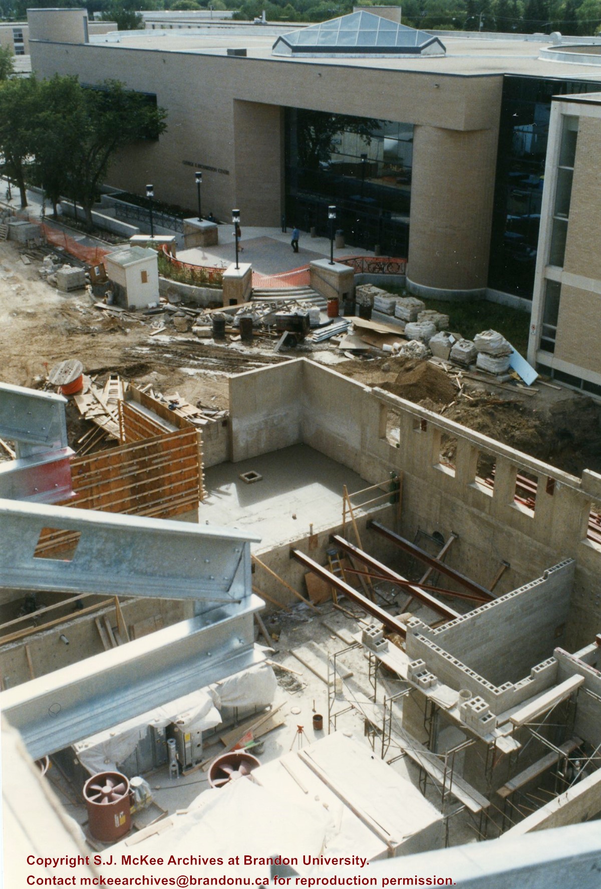
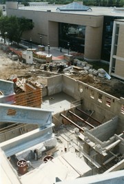
View is southwest from the roof of Clark Hall. Photograph shows the construction of the foundation and exterior walls of the Clark Hall extension. George T. Richardson Centre and construciton materials in the background.
View is north northwest from the roof of the John R. Brodie Science Centre. Photograph shows the Knowles Douglas Students' Union Building, and the Citizens' Science Building, the Brandon College Building and Clark Hall under restoration, as well as parts of the driveway and front lawn, including the flag pole.
View is northwest from Clark Hall. Photograph shows construction materials in the area between Clark Hall and the A.E. McKenzie Building during winter. The Western Manitoba Centennial Auditorium is visible in the upper right hand corner.


